Top 1 Lakes around Teror
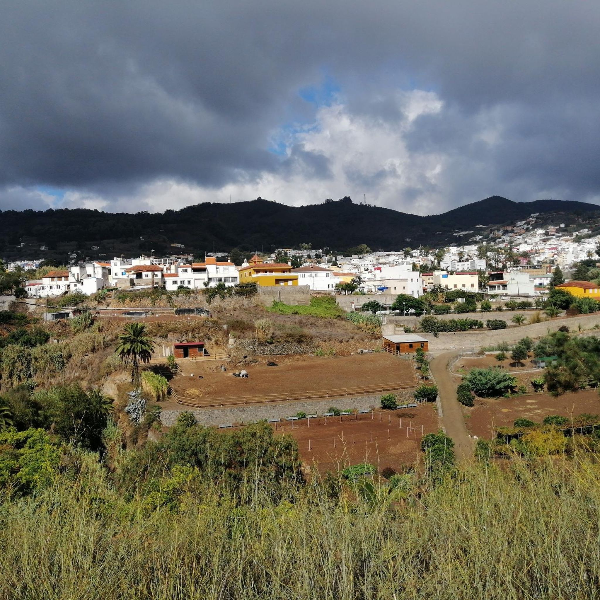
Best lakes around Teror, a municipality in Gran Canaria, are characterized by its lush landscapes and significant water sources rather than large natural lakes. The region's natural charm is deeply connected to its springs, ravines, and man-made water features that support its verdant environment. Teror is known as the "green heartland" of Gran Canaria, offering diverse ecosystems and tranquil settings. These water features provide essential resources and scenic spots for exploration.
Best lakes around Teror
- The most popular lakes is…
Last updated: October 4, 2026
Los Hornos Dam
Highlight • Lake
Translated by Google •
Tip by

Upper waterfall
Highlight • Climb
Translated by Google •
Tip by

Sign up now to discover places like this
Get recommendations on the best single tracks, peaks, & plenty of other exciting outdoor places.
El Charco de la Paloma
Highlight • Waterfall
Translated by Google •
Tip by

Presas del Pinto Dams
Highlight • Monument
Translated by Google •
Tip by

Start today with a free account
Your next adventure awaits.


Other adventures around Teror

Tips from the Community

After the recent rainfall, there is currently plenty of water for the small waterfall.
0
0

Unfortunately not very spectacular and not accessible due to the higher water
0
0

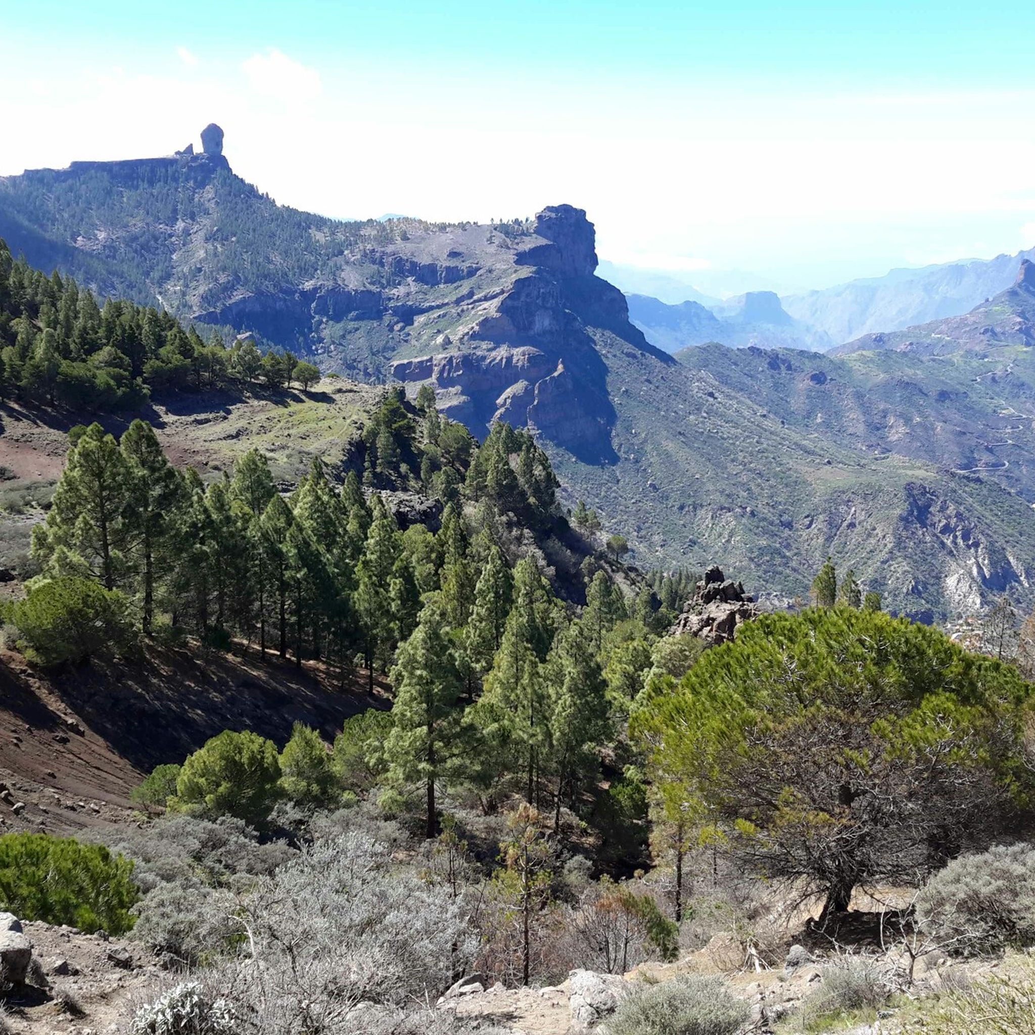
Los Hornos Dam Viewpoint The Los Hornos Dam or Cumbre Dam has a height of 1,565 meters above sea level. It dates from 1933, but was later enlarged. Made of ordinary masonry, it reached a height of 27 m and had a capacity of 697,000 m3 of water, which flows between ditches and tunnels towards the municipalities of Arucas and San Mateo.
3
1
The waterfall and the filled reservoir in front of it are probably best admired during the "rainy season" in autumn and winter. Since it doesn't rain often on the island, no water flows here from spring to autumn.
3
1
Los Hornos Dam Viewpoint The Los Hornos Dam or Cumbre Dam has a height of 1,565 meters above sea level. It dates from 1933, but was later enlarged. Made of ordinary masonry, it reached a height of 27 m and had a capacity of 697,000 m3 of water, which flows between ditches and tunnels towards the municipalities of Arucas and San Mateo.
6
0


One of the two dam walls Presa del Pinto - the oldest dams in the Canary Islands. They are now under monument protection. There is a circular path (total 2.1 km - approx. 1 hour), which partly runs along the bottom of the water community's grounds. There is an information board on this dam wall with the exact route of the path. Nice way!
0
0

The tour is really fun, provided you enjoy scrambling and looking for a path.
1
1
Frequently Asked Questions
What kind of 'lakes' can I expect to find around Teror?
Teror, known for its lush landscapes, features significant water sources rather than large natural lakes. You'll find impressive man-made reservoirs, often referred to as 'presas' or dams, which are crucial for the island's water supply. Additionally, there are natural water features like springs, ravines, and waterfalls that create verdant, water-fed environments. These include sites like the historic Los Hornos Dam and the scenic El Charco de la Paloma waterfall.
Are there any family-friendly water features or areas to visit near Teror?
Yes, several spots are suitable for families. The El Charco de la Paloma is a small lake with a beautiful waterfall, popular for excursions. The Presas del Pinto Dams also offer a family-friendly circular path that takes about an hour to complete, with an information board detailing the route.
What natural features are prominent around the water sources in Teror?
The region around Teror's water sources is rich in diverse natural features. The Osorio Estate, for example, boasts mountains, ravines, and forests, including remnants of ancient laurel forest, chestnut groves, and various European and South American tree species. Around Los Hornos Dam, you'll find recently reforested pine groves, broom, and sage, all set against a backdrop of unique volcanic rock formations.
Can I go hiking or walking near these water features?
Absolutely. The Osorio Estate is considered Teror's natural place par excellence, offering interesting routes for hikers and nature lovers amidst its diverse ecosystems. While the guide focuses on water features, there are also numerous cycling opportunities nearby. You can explore various routes for MTB Trails around Teror or enjoy Gravel biking around Teror.
Are there any historical water-related sites in the area?
Yes, Teror has a rich water-related history. The Presas del Pinto Dams are among the oldest dams in the Canary Islands and are now under monument protection. Additionally, La Fuente Agria (the Bitter Fountain) is an emblematic site where naturally carbonated mineral water has been bottled and distributed across the Canary Islands since 1916, reflecting Teror's vital quest for water and agricultural heritage.
What is the best time of year to visit the water features around Teror?
For natural water features like El Charco de la Paloma, the 'rainy season' in autumn and winter is often best to see the waterfall and reservoir at their fullest. However, Gran Canaria's generally mild climate means that the verdant landscapes and dam areas are pleasant to visit year-round, though water levels in natural springs can vary.
Are there any challenging routes or climbs near the water features?
Yes, for those seeking a challenge, the area around the Upper waterfall involves climbing rock walls and navigating slopes, with options to use ropes or walk through the water. This section is considered challenging and requires venturing off a clear path.
Can I swim in any of the water features?
While some natural pools and waterfalls like the Upper waterfall are described as 'great for swimming' by visitors, it's important to exercise caution and be aware of local regulations and safety conditions. The water at La Fuente Agria is for drinking, not swimming.
Where can I experience the famous mineral water of Teror?
You can experience the fresh, sparkling mineral water directly from its source at La Fuente Agria (the Bitter Fountain). This site features three distinct springs: El Principal, Agua Agria, and Molino de en Medio. Visitors are often welcomed to sample the water, which is naturally carbonated due to the volcanic soil.
What are some unique aspects of the Osorio Estate near Teror?
The Osorio Estate is a protected area spanning 207 hectares, known for its diverse ecosystems, including remnants of ancient laurel forest. It features numerous streams and springs, a 'Parque de la Fuente,' and serves as a nature classroom. It's also home to examples of the Canarian autochthonous black pig. Access typically requires prior permission.
Is there parking available near the dams or water features?
While specific parking details for all sites aren't always available, for Los Hornos Dam, the nearby Roque Nublo car park is mentioned as a convenient option. For other areas, it's advisable to check local signage or information for designated parking spots.
Most popular routes around Teror
Most popular attractions around Teror

Get inspired with the komoot mobile app


Explore more
Still not found your perfect lake around Teror? Check out the guides of these regions to see even more beautiful places.
