The best road cycling routes around Teror
4.4
(375)
11,420
riders
169
rides
Road cycling routes around Teror, nestled in the heart of Gran Canaria, traverse diverse volcanic landscapes and lush ravines. The region is characterized by mountainous terrain with significant elevation changes, offering challenging climbs and panoramic views. Roads are generally well-paved, winding through picturesque villages and unique geological formations. This topography provides varied road cycling experiences for different fitness levels.
Best road cycling routes around Teror
- The most popular road cycling route is View of Gran Canaria Mountains – Cruz de Tejeda Restaurant loop from Montesol, a 40.9 miles (65.9 km) trail that takes 3 hours 52 minutes to complete. This difficult route features substantial elevation gain through mountainous terrain.
- Another top favourite among local road cyclists is Tejeda – Artenara Village loop from Lomo Carbonero, a difficult 35.0 miles (56.4 km) path. It offers sustained climbing through the island's interior, showcasing volcanic landscapes and traditional villages.
- Local road cyclists also love the Las Alcaravaneras Beach – Las Canteras Beach loop from Montesol, a 17.2 miles (27.7 km) trail leading through coastal areas and urban landscapes, often completed in about 1 hour 27 minutes.
- Road cycling around Teror is defined by challenging mountainous terrain, deep ravines, and scenic viewpoints. The network offers options for different ability levels, from moderate coastal loops to difficult climbs into the island's interior.
- The routes in Teror are highly rated by the komoot community with an average score of 4.3 stars from more than 300 reviews. More than 9,500 road cyclists have used komoot to explore Teror's varied terrain.
Last updated: August 29, 2026
4.5
(2)
174
riders
66.2km
03:54
1,640m
1,640m
Hard road ride. Very good fitness required. Mostly well-paved surfaces and easy to ride.
5.0
(2)
116
riders
49.2km
03:09
1,440m
1,440m
Hard road ride. Very good fitness required. Mostly well-paved surfaces and easy to ride.

Sign up for free
4.3
(3)
103
riders
31.1km
01:41
620m
620m
Moderate road ride. Good fitness required. Mostly well-paved surfaces and easy to ride.
48
riders
43.4km
02:29
950m
950m
Hard road ride. Very good fitness required. Some segments of this route may be unpaved and difficult to ride.
19
riders
55.7km
03:08
1,230m
1,220m
Hard road ride. Very good fitness required. Mostly well-paved surfaces and easy to ride.
Get access to more routes and recommendations from other explorers.
Sign up for free
Already have an account?
Our route recommendations are based on thousands of hikes, rides, and runs completed by other people on komoot.
Start today with a free account
Your next adventure awaits.
Login or Signup


Other adventures around Teror

Tips from the Community

Little traffic, road between ravines without steep slopes, green
0
0

Very nice Sunday market. At forty-two degrees Celsius, not too crowded either.
0
0

Anyone wishing to visit the market on Sunday should arrive by 8:00 a.m.
0
0

goes downhill with a gradient of around 12% on super asphalt (2025, March)
0
0
Said to be the highest point on Gran Canaria. Great view.
1
0
great asphalt, very impressive scenery, little traffic (end of March)
0
0

Beautiful, quiet, it smells wonderful, moderate gradient
1
0

I already mentioned it on the cycling site. Seeing the photos, I wanted to go, but I was actually expecting something else. A more isolated area, or I don't know, remote and all that. It's nice, though. A little higher up, there's a little spot to sit on and all that. But it's dirt, so I brought a towel.
0
0
Frequently Asked Questions
How many road cycling routes are available around Teror?
Teror offers a wide selection of road cycling routes, with over 140 options available. These routes traverse diverse volcanic landscapes and lush ravines, catering to various fitness levels.
What is the best time of year for road cycling in Teror?
Teror benefits from a mild, year-round climate, making it suitable for road cycling throughout the year. Summers are warm and winters are gentle, providing comfortable conditions for outdoor activities.
What kind of terrain can I expect on road cycling routes in Teror?
Road cycling in Teror is characterized by challenging mountainous terrain and deep ravines. Routes often feature significant climbs, sometimes exceeding 1,000 meters in elevation gain, and offer panoramic views. The roads are generally well-paved, winding through picturesque villages and unique geological formations.
Are there circular road cycling routes in Teror?
Yes, many road cycling routes around Teror are designed as loops. For example, the View of Gran Canaria Mountains – Cruz de Tejeda Restaurant loop from Montesol is a popular circular route, as is the Tejeda – Artenara Village loop from Lomo Carbonero.
Are there road cycling routes suitable for beginners in Teror?
While many routes in Teror are challenging, there are options for less experienced cyclists. Approximately 14 routes are classified as easy, and 57 as moderate. For instance, the Las Alcaravaneras Beach – Las Canteras Beach loop from Montesol is a moderate route that leads through coastal and urban landscapes.
What natural landmarks or viewpoints can I see along the road cycling routes?
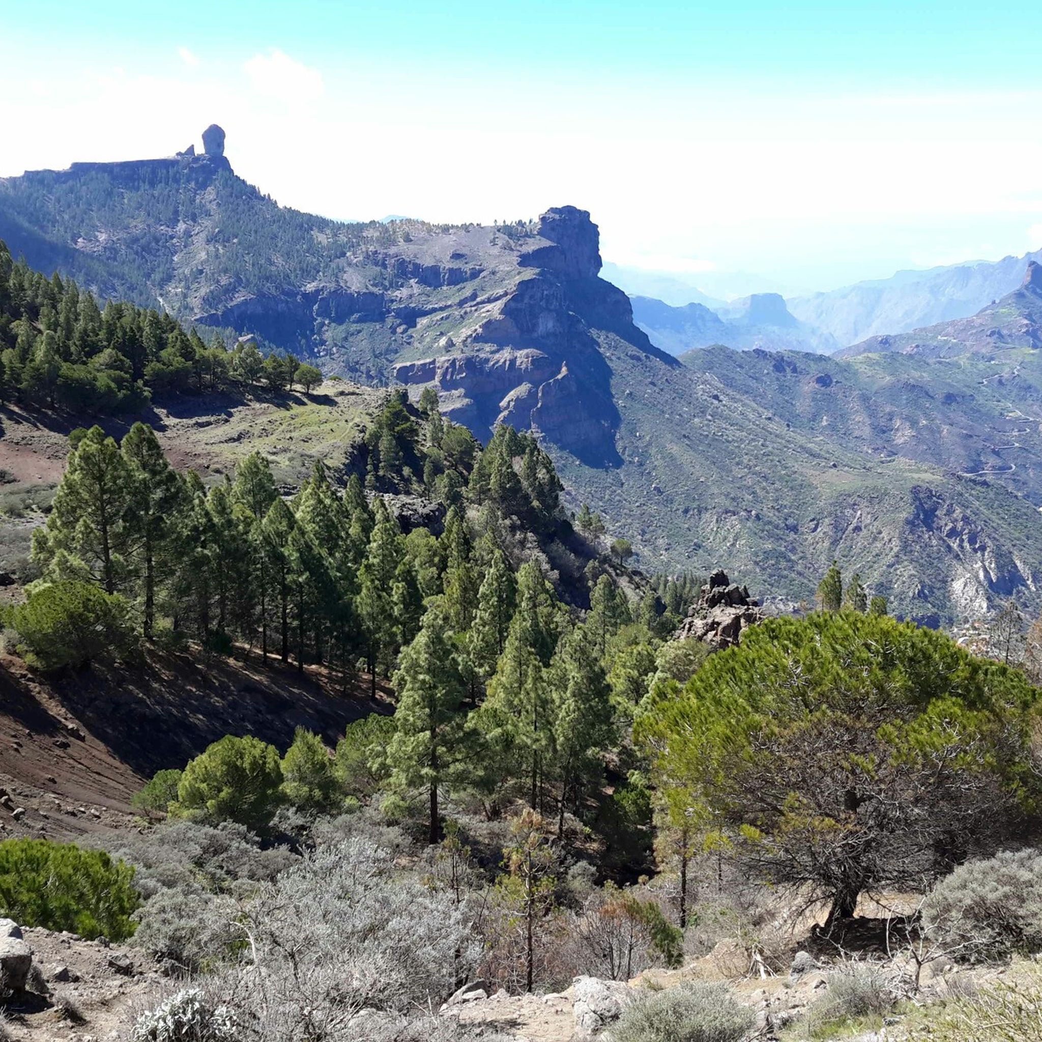
Teror's mountainous formation provides several natural lookouts offering stunning views. You can expect panoramic vistas of the island's unique geological formations. Notable attractions nearby include Roque Nublo, a symbol of Gran Canaria, and the Pico de las Nieves summit, the island's highest point.
Are there any waterfalls accessible near the road cycling routes?
Yes, the region around Teror features several waterfalls. You might encounter highlights such as the Small Waterfall, Large Waterfall, or Double Waterfall, which can be explored as part of a cycling trip or a short detour.
Is parking available for road cyclists in Teror?
Teror, as a town, offers various parking options, particularly in and around its historic center. Cyclists can typically find parking spaces suitable for starting their routes, though it's advisable to check local regulations or specific trailhead parking availability.
What do other road cyclists enjoy most about cycling in Teror?
The road cycling routes in Teror are highly rated by the komoot community, with an average score of 4.3 stars from over 300 reviews. Cyclists often praise the challenging mountainous terrain, the breathtaking panoramic views, and the well-paved roads that wind through picturesque villages.
Are there places to eat or drink along the road cycling routes in Teror?
Teror and the surrounding villages offer various cafes, restaurants, and local establishments where cyclists can refuel. The town of Teror itself has a charming historic center with dining options, and some routes, like the View of Teror – View of Gran Canaria Mountains loop from Teror, pass through areas with amenities.
What is the average difficulty of road cycling routes in Teror?
The majority of road cycling routes in Teror are classified as difficult, making up about 75 of the 146 available routes. However, there are also 57 moderate and 14 easy routes, providing options for different skill levels. The region is known for its significant elevation changes and demanding climbs.
Can I explore coastal areas on a road bike near Teror?
While Teror is nestled inland, some routes extend towards the coast. For example, the Las Alcaravaneras Beach – Las Canteras Beach loop from Montesol offers a moderate ride through coastal and urban landscapes, providing a different experience from the mountainous interior.
Most popular attractions around Teror

Get inspired with the komoot mobile app


Explore more
Browse the best Road cycling routes in other regions.
