Easy hikes and walks in the Sangre de Christo Mountains
4.7
(138)
2,582
hikers
276
hikes
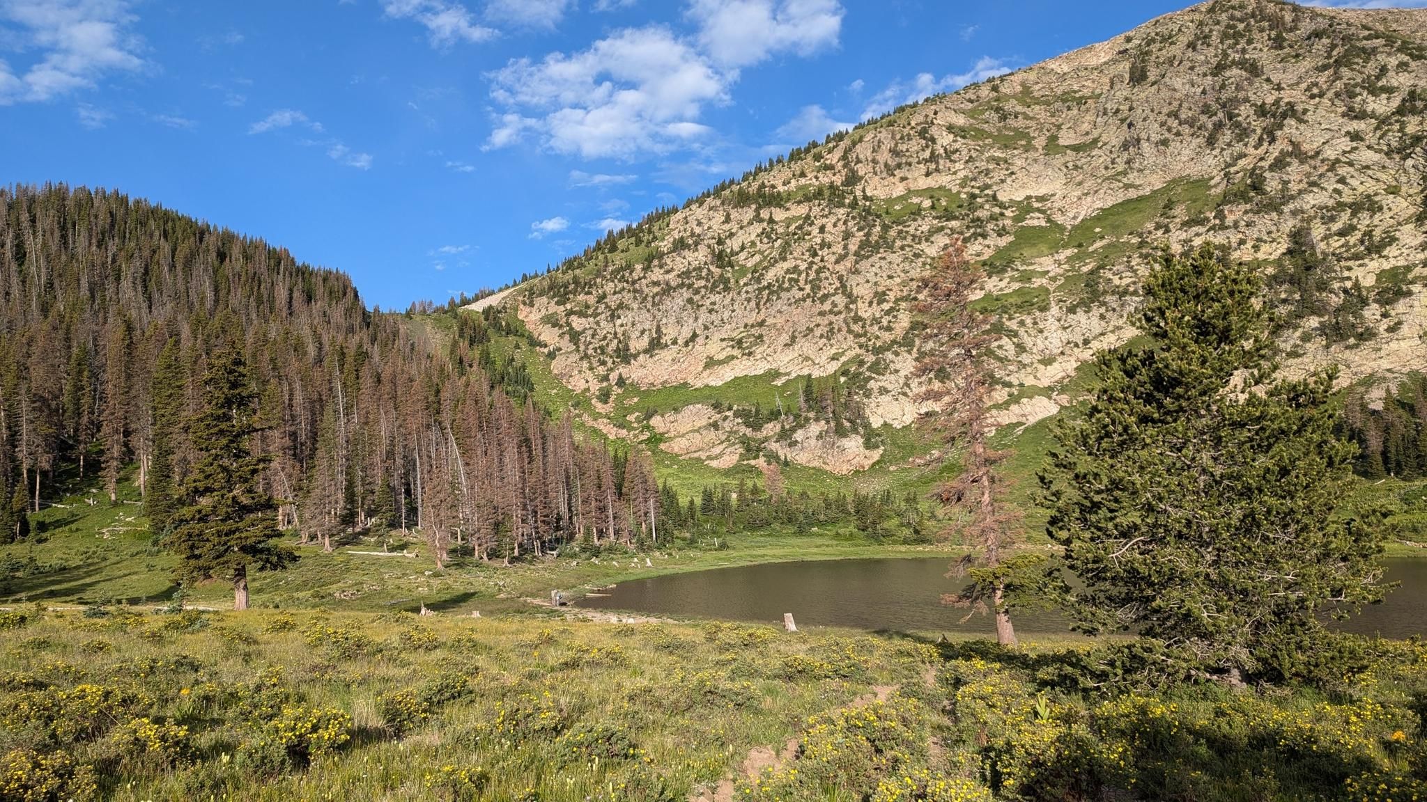
Easy hiking trails in the Sangre de Cristo Mountains traverse a landscape characterized by high-altitude peaks, alpine lakes, and dense forests. The region features dramatic geological formations and lush valleys, providing varied terrain for outdoor exploration. These mountains, part of the Rocky Mountains, offer extensive trail networks managed by national forests, catering to various hiking preferences.
Best easy hiking trails in the Sangre de Cristo Mountains
- The most popular easy hiking route is Borrego (150), Windsor (254) and Bear Wallow (182) Trail Loop, a 3.7 miles (5.9 km) trail that takes 1 hour 48 minutes to complete. This loop offers varied terrain through forested areas.
- Another top favourite among local hikers is North Bell Loop, an easy 2.7 miles (4.3 km) path. This route provides views of the surrounding mountain landscape with a gentle ascent.
- Local hikers also love the Ancestral Sites Trail, a 1.7 miles (2.7 km) trail leading through historical areas, often completed in about 42 minutes.
- Hiking in the Sangre de Cristo Mountains is defined by high-altitude peaks, pristine alpine lakes, and dense forests. The extensive network of easy hiking trails offers options for different ability levels.
- The routes in Sangre de Cristo Mountains are highly rated by the komoot community with an average score of 4.6 stars from over 100 reviews. More than 2,400 hikers have used komoot to explore Sangre de Cristo Mountains's varied terrain.
Last updated: October 11, 2026
5.0
(6)
78
hikers
5.91km
01:48
190m
240m
The Borrego (150), Windsor (254) and Bear Wallow (182) Trail Loop is an easy 3.7-mile (5.9 km) hike that takes you through the beautiful Santa Fe National Forest. You'll descend into shaded valleys, cross Tesuque Creek, and climb through lush forests of aspen, fir, and pine, often walking on soft pine needles. The varied terrain and picturesque aspen groves make for a constantly engaging experience, perfect for a 1 hour and 48 minute outing with 622 feet (190 metres) of elevation gain. It's a fantastic way to immerse yourself in the high-altitude forest environment.
This popular loop is easily accessed from Hyde Park Road near Santa Fe. Given the altitude, which ranges from 8,200 to 8,900 feet, staying hydrated is key, and you might find trekking poles helpful even on this easy route. The trail can get busy due to its accessibility and scenic beauty, so plan accordingly if you prefer a quieter experience. Dogs are welcome on the trail, making it a great option for a walk with your canine companion.
Historically, the Borrego Trail was used as a sheep drive trail, giving it a unique connection to the region's past. The Winsor Trail, part of this loop, is also recognized as a designated National Recreation Trail. Its higher elevation provides a welcome escape from the heat during warmer months, drawing both locals and visitors to its cool, forested paths. This loop offers a blend of natural beauty and historical context, making it a standout in the Santa Fe area.
4.0
(1)
58
hikers
4.28km
01:13
80m
110m
If you're seeking an easy hike that packs a scenic punch, the North Bell Loop is a great pick. This 2.7-mile (4.3 km) route, with its 277 feet (84 metres) of elevation gain, takes about 1 hour and 12 minutes to complete and winds through a classic high desert landscape. You'll encounter distinctive red and white rock formations, a mix of sandy and rocky sections, and enjoy rewarding views of Santa Fe city and the surrounding Sangre de Cristo and Jemez Mountains.
Planning your visit to the North Bell Loop is straightforward, as it's conveniently located close to downtown Santa Fe. The trail is part of the well-maintained Dale Ball Trails system and is clearly marked, so you won't have to worry about getting lost. While it's accessible year-round, consider hiking in the early morning or late afternoon during warmer months to avoid the midday sun.
This popular trail is an excellent choice for beginners or families looking for a quick outdoor escape. It offers a taste of the region's natural beauty without demanding a significant time commitment, making it a favorite among locals and visitors alike. Just be mindful of the altitude if you're not accustomed to Santa Fe's elevation.

29
hikers
2.66km
00:42
30m
20m
The Ancestral Sites Trail offers a unique journey through time, where the natural beauty of the Pecos River Valley meets profound historical significance. You'll wander along gravel and dirt paths, taking in views of Glorieta Mesa and the Sangre de Cristo Mountains, all while exploring ancient Pueblo ruins and the striking Mission Nuestra Señora de los Ángeles de Porciúncula. It's an easy 1.7-mile (2.7 km) loop with a gentle 92 feet (28 metres) of elevation gain, making it a perfect, family-friendly hike that takes around 42 minutes.
To plan your visit, head to the Pecos National Historical Park Visitor Center, which serves as the trailhead and offers trail guides to enhance your experience. The route is dog-friendly, allowing leashed pets to join. Always check the park's official website for the latest visitor information, including hours and any seasonal considerations, to ensure a smooth trip.
What truly sets this trail apart is its rich historical tapestry, allowing you to step directly into the past of the Pecos Pueblo people and the Spanish colonial era. You can even climb into a reconstructed kiva, offering a tangible connection to centuries-old ceremonial practices. This trail is a must-do for history buffs and anyone seeking an engaging, educational outdoor experience in New Mexico.
8
hikers
728m
00:13
20m
30m
Embark on an easy hike along the Montville Nature Trail, a peaceful singletrack path that winds through montane woodlands. You will find yourself surrounded by piñon and ponderosa pine, with subalpine aspen adding to the serene atmosphere. The trail frequently follows the babbling waters of Mosca Creek, where you might even spot small cascading waterfalls, especially after recent rain. This easy route covers just 0.5 miles (0.7 km) with a gentle elevation gain of 71 feet (22 metres), taking only about 13 minutes to complete. From its highest point, you can enjoy impressive panoramas of the Great Sand Dunes and the Sangre de Cristo Mountains, offering a refreshing change from the park's open dune fields.
The Montville Nature Trail is accessible throughout the year, though you should be prepared for small snowdrifts if you visit during winter months. To enhance your experience, consider picking up an interpretive brochure. This guide is available at the trailhead or visitor center and corresponds to numbered posts along the route, providing valuable insights as you walk.
This trail offers a unique opportunity to learn about the historic community of Montville and the surrounding natural environment within Great Sand Dunes National Park and Preserve. It provides a distinct contrast to the park's more famous open dune fields, immersing you in a different ecosystem. The route's focus on both natural beauty and local history makes it a notable and enriching experience in the region.
4
hikers
6.30km
01:41
70m
70m
The Rift Valley Loop Trails offer a captivating hiking experience through the unique landscape above the Rio Grande Gorge. You'll traverse a mix of gentle ascents and rolling hills, with sparse vegetation like piñon pines and junipers giving way to panoramic vistas of the Sangre de Cristo Mountains. Keep an eye out for the dramatic views into the gorge itself, a truly memorable sight on this easy 3.9-mile (6.3 km) route.
Planning your visit to these popular trails is straightforward, with parking available at trailheads such as The Upper Slide Trail. Since the 1 hour and 40 minute hike has little shade, it's wise to bring ample water and sun protection, especially if you're tackling the 220 feet (67 metres) of elevation gain during the warmer months. Spring and early summer are ideal for experiencing the vibrant wildflowers.
These trails are situated within the geologically significant Rio Grande Rift, offering a dramatic backdrop rarely seen elsewhere. Beyond the stunning Rift Valley Loop viewpoints, the area holds historical importance with evidence of ancient Puebloan presence and is home to diverse wildlife like mule deer and red-tailed hawks. It's a multi-use area, welcoming hikers, mountain bikers, and trail runners alike.
2.16km
00:44
160m
0m
Embark on an easy hike up the High Dune Trail, a unique experience on soft, sandy terrain. This route covers 1.3 miles (2.2 km) with an elevation gain of 531 feet (162 metres), taking about 44 minutes to complete. You will cross Medano Creek, which flows seasonally, before beginning your ascent. From the summit of High Dune, you are rewarded with expansive views of the entire dunefield, framed by the dramatic Sangre de Cristo Mountains. The feeling of hiking on shifting sand offers a distinct adventure.
Access the High Dune Trail from the Dunes Trailhead. If you plan to hike during summer, be aware that sand temperatures can reach over 140°F (60°C). To avoid extreme heat and potential thunderstorms, it is best to start your hike early in the morning or late in the evening. Always check local conditions before heading out.
This trail offers a distinctive opportunity to explore the unique geology of Great Sand Dunes National Park and Preserve. The dunefield is a dynamic environment, constantly shaped by wind and water. Hiking here provides a direct connection to this natural phenomenon, allowing you to experience the vastness and ever-changing landscape up close. It stands out as a prime example of the park's remarkable natural features.
1
hikers
2.91km
01:02
280m
0m
The South Boundary Trail to First Peak offers a quick, high-reward escape into the Sangre de Cristo Mountains, immersing you in the natural beauty of the Carson National Forest. You'll hike through serene conifer forests and impressive stands of aspen, with the terrain shifting between singletrack and some rocky, loose sections. The highlight is a memorable overlook near the El Nogal descent, providing sweeping views of the Taos area, making it a quintessential alpine experience for a relatively short outing. This easy hiking route is perfect for those seeking impressive vistas without a strenuous climb.
Access the trail from the El Nogal Trailhead, which is a popular starting point for this segment of the South Boundary Trail. While the route is generally accessible, be aware that it's a multi-use path, so you might share the trail with mountain bikers and horseback riders. For the most spectacular visual experience, consider visiting in autumn when the aspens ignite with vibrant yellow and gold foliage, though the trail is beautiful throughout the hiking season.
This specific 1.8-mile (2.9 km) segment to First Peak, with its 926 feet (282 metres) of elevation gain and estimated 1 hour and 1 minute duration, is considered easy, making it a great option for beginners or families. It's part of the much longer South Boundary Trail, which is renowned as an IMBA Epic mountain bike trail, highlighting its significance in the region. This particular section offers a taste of that grandeur in a manageable package.
1
hikers
4.41km
01:26
70m
410m
The Atalaya Trail (170) offers a delightful, easy hike right on Santa Fe's doorstep, perfect for a quick nature fix. This 2.7-mile (4.4 km) route, with a gentle 226 feet (69 metres) of elevation gain, guides you through serene piñon-juniper woodlands. You'll experience the peaceful atmosphere of the Santa Fe National Forest, making it an ideal choice for a relaxed outing that takes about 1 hour and 25 minutes.
Access to the trail is conveniently located near St. John's College, making it a popular and easily reachable spot for both locals and visitors. While it can get busy, especially on weekends, arriving earlier in the day usually helps secure parking. The trail is dog-friendly, so your canine companion can join you on this pleasant walk.
This segment of the Atalaya Trail showcases the diverse ecosystems of the region, transitioning from high desert flora to more established pine forests. It's a great way to experience the natural beauty surrounding Santa Fe without committing to a strenuous climb, offering a taste of the area's scenic trails.
2
hikers
4.63km
01:13
30m
50m
Embark on an easy hike along the South Pasture Loop Trail, a 2.9-mile (4.6 km) route that offers gentle exploration. You will experience open pasture lands with sweeping views of distant mesas and mountains. The trail also guides you through a shady cottonwood grove and along the bluffs overlooking the Pecos River. With only 97 feet (30 metres) of elevation gain, this loop is designed for a relaxed pace, taking about 1 hour and 12 minutes to complete.
Before you begin your hike, remember to check in at the E.E. Fogelson Visitor Center to get directions and a map. It is important to note the trail's operating hours, as it usually closes by 3:00 PM; plan to start your journey no later than 1:00 PM to ensure you have enough time. You should bring your own water, as there are no facilities available at the trailhead. Also, please be aware that pets are not permitted on this loop trail.
This trail is located within Pecos National Historical Park, offering a unique blend of natural beauty and historical significance. As you walk, you are traversing the historic Forked Lightning Ranch, providing a glimpse into the area's past. The diverse landscape, from open pastures to river bluffs, makes this an engaging route for those interested in both nature and history.
1
hikers
2.34km
00:44
150m
0m
The Saint John's Trail (174) offers a delightful, quick immersion into Santa Fe's high desert landscape, winding through aromatic piñon and juniper forests. You'll navigate the unique terrain, including descents into the Arroyo de los Chamisos, which the path crosses twice, and follow the drainage of Arroyo Cabezon. This easy 1.5-mile (2.3 km) hiking route, with 494 feet (151 metres) of elevation gain, is a fantastic way to experience the region's natural beauty in about 43 minutes.
Planning your visit to the Saint John's Trail (174) is straightforward, thanks to its large parking area, which can be a real bonus when other trailheads are full. The trail is generally accessible from spring through fall, offering a pleasant experience in the high desert climate. Be aware that the initial section traverses private land, so always stick to the marked path to respect property boundaries.
This trail is particularly notable as a popular and convenient gateway to the more extensive Trail 170, which leads to the summit of Atalaya Mountain for those seeking a longer adventure. Beyond hiking, the Saint John's Trail (174) is also a favorite among mountain bikers, adding to its diverse use. It's a great choice for beginners or anyone looking for a rewarding, shorter hike with the option to extend their journey.
Get access to more routes and recommendations from other explorers.
Already have an account?
Our route recommendations are based on thousands of hikes, rides, and runs completed by other people on komoot.
Start today with a free account
Your next adventure awaits.
Popular around Sangre de Christo Mountains
Santa Fe to Taos Thru-Hike — A journey across the Sangre de Cristo Mountains

Cowboy country & Route 66 – Wild West meets legend

Great Divide Mountain Bike Route — Cycling the spine of a continent

Mountain bike paradise around Salida in Colorado

Unforgettable MTB Adventures – IMBA Epic Trails in USA and Canada
Other adventures in the Sangre de Christo Mountains


Tips from the Community


The Great Sand Dunes cover an area of approximately 80 km² and, at a height of approximately 230 meters, are the highest dunes in North America. The sand dunes are approximately 12,000 years old and were formed by sand deposits from the Rio Grande and its tributaries. You should be in good physical shape to hike the dunes. The constant inclines in the loose sand can be very strenuous.
2
0

Just really beautiful! A tough hike through the loose sand.
2
0
The Creek was completely dried up now.
1
0

From the The Upper Slide Trail Trailhead, or Cascabel Trailhead, you can access the northeastern end of the popular Slide Trail, which links up to the Orilla Verde Campground and Taos Junction Bridge and Boat Launch. There are several parking spaces and vault toilets here for you to use, which are good to know about if hiking up from the Taos Overlook Trailhead that does not have any facilites.
0
0

Unfortunately dried out in summer. But you can see the riverbed from the greenery that is still there.
3
1
Frequently Asked Questions
How many easy hiking trails can I find in the Sangre de Cristo Mountains?
The Sangre de Cristo Mountains offer a wide variety of hiking experiences, with 88 easy trails specifically curated for those seeking a less strenuous adventure. Overall, there are over 270 hiking routes in the region, catering to all skill levels.
What kind of scenery can I expect on easy hikes in the Sangre de Cristo Mountains?
Even on easy trails, you'll experience the region's diverse beauty. Expect to traverse lush valleys and dense forests of pine and aspen, offering shade and a rich scenic backdrop. Some routes may provide glimpses of the dramatic geological formations and high-altitude peaks that define the Sangre de Cristo range.
Are there any easy loop trails in the Sangre de Cristo Mountains?
Yes, there are several easy loop trails perfect for a relaxed outing. A popular choice is the Borrego (150), Windsor (254) and Bear Wallow (182) Trail Loop, which offers varied terrain through forested areas. Another excellent option is the North Bell Loop, providing gentle ascents and views of the surrounding mountain landscape.
Are the easy hiking trails in the Sangre de Cristo Mountains suitable for families with children?
Many easy trails in the Sangre de Cristo Mountains are family-friendly, offering shorter distances and minimal elevation gain. The Ancestral Sites Trail is a great option, leading through historical areas and providing an engaging experience for all ages. The Montville Nature Trail is also a short and accessible option.
What are some interesting landmarks or points of interest I might see on an easy hike?
While many easy trails focus on natural beauty, some offer views of significant landmarks. For instance, the region is home to towering peaks like High Dune and Wheeler Peak Summit, which can often be seen from various viewpoints. The Ancestral Sites Trail specifically highlights historical areas.
What do other hikers say about the easy trails in the Sangre de Cristo Mountains?
The easy trails in the Sangre de Cristo Mountains are highly regarded by the komoot community, boasting an average rating of 4.6 out of 5 stars from over 100 reviews. Hikers frequently praise the well-maintained paths, the serene forest environments, and the accessibility of these routes for a relaxing outdoor experience.
Are there any easy trails that offer views of alpine lakes or waterfalls?
While many alpine lakes and waterfalls in the Sangre de Cristos are typically reached via more challenging routes, some easy trails might offer distant views or lead to smaller water features. The region is known for pristine alpine lakes like Willow Lake and Lake of the Clouds, and cascading waterfalls such as Venable Falls, though accessing them directly on an 'easy' trail might be limited.
What is the best time of year for easy hiking in the Sangre de Cristo Mountains?
The best time for easy hiking is generally from late spring through early fall (May to October). During these months, trails are typically free of snow, and the weather is milder. Fall offers spectacular views with changing aspen leaves. Always check local conditions, as higher elevations can retain snow later into the spring.
Are dogs allowed on the easy hiking trails?
Many trails within the Sangre de Cristo Mountains, particularly those managed by national forests, are dog-friendly. However, regulations can vary by specific trail or wilderness area. It's always best to check the local rules for the particular trail you plan to visit, and always keep your dog on a leash and practice Leave No Trace principles.
Do I need a permit for easy day hikes in the Sangre de Cristo Mountains?
For most easy day hikes on established trails in the Sangre de Cristo Mountains, especially within national forests, a specific hiking permit is generally not required. However, some designated wilderness areas or specific trailheads might have fees or require self-issued permits for overnight stays. It's advisable to check with the relevant forest service office (e.g., San Isabel National Forest, Carson National Forest, Santa Fe National Forest) for the most current information regarding your chosen trail.
Where can I find parking for easy hiking trails?
Most popular easy trailheads in the Sangre de Cristo Mountains, especially those near towns like Santa Fe or Taos, offer designated parking areas. These can range from small pull-offs to larger paved lots. For specific parking information, it's recommended to check the details for individual routes on komoot or consult local forest service maps.
What wildlife might I encounter on easy trails?
Even on easy trails, you have a chance to observe local wildlife. The Sangre de Cristo Mountains are home to diverse species, including elk, deer, and various bird species. Keep an eye out for smaller mammals like squirrels and chipmunks. Remember to maintain a respectful distance and never feed wild animals.
Are there any easy trails that are particularly good for beginners?
Absolutely. Trails like the Sand Sheet Loop or the Montville Nature Trail are excellent for beginners due to their short distances and minimal elevation changes. They provide a gentle introduction to hiking in the mountains without being overly strenuous.
Most popular routes in the Sangre de Christo Mountains
Most popular attractions in the Sangre de Christo Mountains

Get inspired with the komoot mobile app


Explore more
Browse the best Hikes in other regions.
