Santa Rosa And San Jacinto Mountains National Monument
Santa Rosa And San Jacinto Mountains National Monument
The best hikes from bus stations in Santa Rosa And San Jacinto Mountains National Monument
4.7
(232)
4,062
hikers
21
hikes
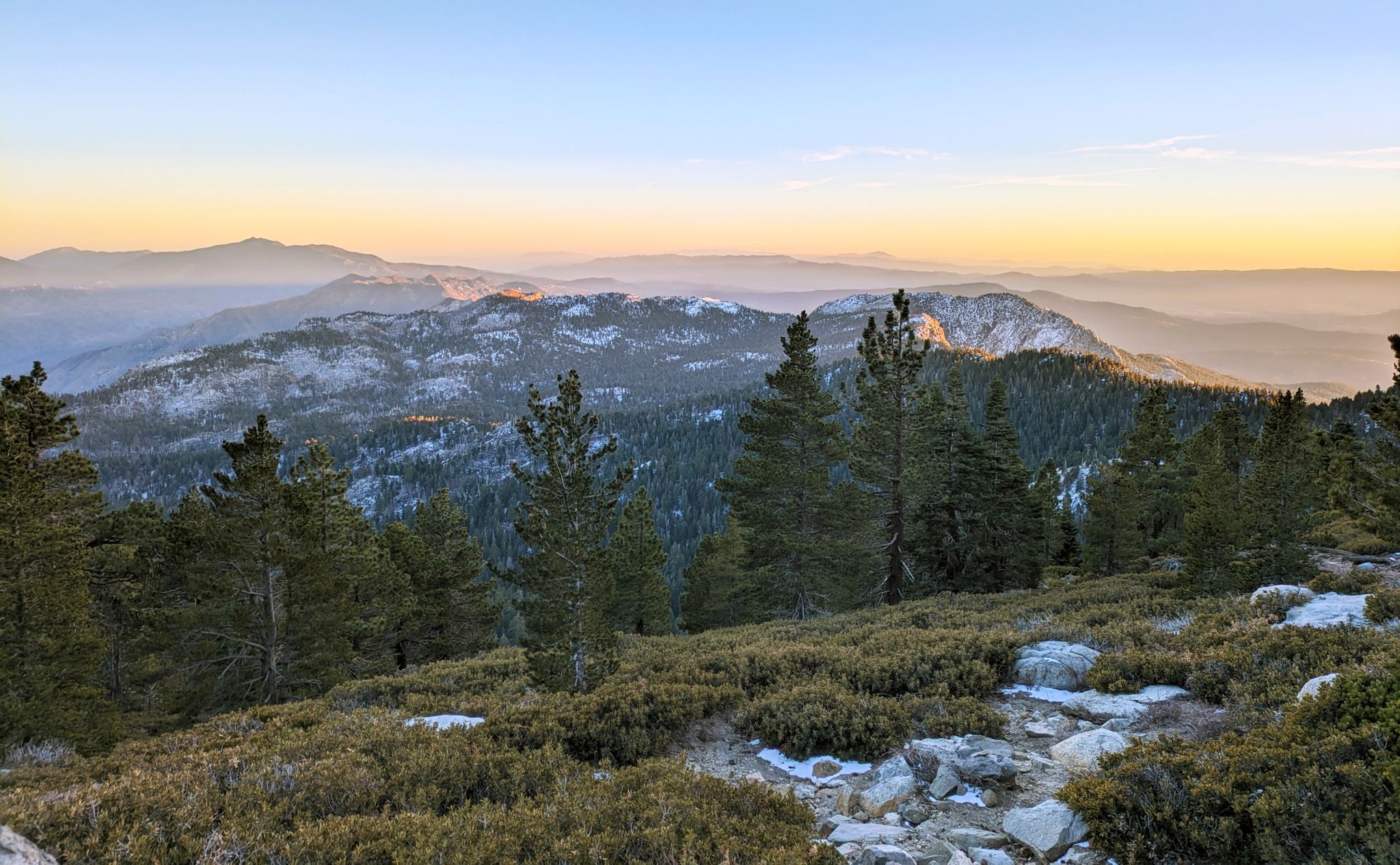
Bus station hiking trails in Santa Rosa And San Jacinto Mountains National Monument traverse a diverse landscape, ranging from arid desert floors to high-elevation forests. The region is characterized by rugged bare-rock ridges, granite boulders, and unique palm oases, with significant elevation changes. Hikers can experience varied terrain including chaparral and pinyon pines, leading to peaks over 10,000 feet. The monument is home to a variety of wildlife and distinct geological formations.
Best bus station hiking trails in Santa Rosa…
Last updated: July 8, 2026
50
hikers
5.78km
01:54
260m
260m
The Araby Trail loop offers a fantastic journey through diverse desert terrain, quickly leaving residential areas behind for natural landscapes filled with cacti and unique rock formations. As you climb,…
5.0
(1)
11
hikers
8.38km
02:35
300m
300m
Embark on the Palm Hills Hiking Trails loop from Palm Cyn at Gene Autry for a true taste of desert hiking. This moderate 5.2-mile (8.4 km) route climbs 1000 feet…

Sign up for free
3.0
(1)
10
hikers
7.59km
02:07
140m
140m
Moderate hike. Good fitness required. Easily-accessible paths. Suitable for all skill levels.
31
hikers
5.64km
01:27
30m
30m
Easy hike. Great for any fitness level. Easily-accessible paths. Suitable for all skill levels.
11
hikers
9.86km
03:02
330m
330m
Moderate hike. Good fitness required. Easily-accessible paths. Suitable for all skill levels.
Get access to more routes and recommendations from other explorers.
Sign up for free
Already have an account?
Our route recommendations are based on thousands of hikes, rides, and runs completed by other people on komoot.
Start today with a free account
Your next adventure awaits.
Login or Signup
Popular around Santa Rosa And San Jacinto Mountains National Monument


Other adventures in Santa Rosa And San Jacinto Mountains National Monument


Tips from the Community

Just a short spur off of the main trail, this viewpoint gives you a great view over the mountains surrounding Palm Springs.
0
0
Located along the South Lykken Trail, Josie Johnson Vista Park has wonderful views across Palm Springs, Santa Rosa, and the San Jacinto Mountains. Take a moment to catch your breath here and admire the desert scenery around you.
0
0

A work by Jeffrey Alden Fowler
1
0

Just 1 km from Rim Rd parking lot
0
0

This area has many trails to follow as much as small loops up high into the Palm Hills. This area was saved from development in 2004 from a massive development of houses, hotels and a golf course on the site. Its managed by the Owist Land Trust.
0
0

Catholic Church on the corner of Alejo and Belardo Road. It was built in 1929 in the California Mission style.
1
0
This stretch of the road (estimated 1km in length) could be considered the ‘Main Street’ in Palm Springs. It is lined with shops, cafes and restaurants, and is only one block away from the Palm Springs Art Museum.
2
0

Shopping street with many boutiques and restaurants.
2
0
Frequently Asked Questions
How many bus-accessible hiking trails are available in Santa Rosa And San Jacinto Mountains National Monument?
There are over 15 bus-accessible hiking trails in the Santa Rosa And San Jacinto Mountains National Monument, offering a variety of experiences for different skill levels. These routes are designed to start conveniently from public transport stops.
What kind of terrain can I expect on bus-accessible hikes in this region?
The Santa Rosa And San Jacinto Mountains National Monument offers incredibly diverse terrain, even on bus-accessible routes. You can expect to traverse arid desert floors, encounter unique palm oases, and navigate trails with rugged rock formations and granite boulders. The landscape transitions dramatically, providing varied scenery from one hike to the next.
Are there any easy, bus-accessible hikes suitable for beginners?
Yes, there are several easy bus-accessible hikes perfect for beginners. For example, the Palm Hills Hiking Trails loop from Palm Cyn at Gene Autry is an easy 5.4 km route with moderate elevation gain. Another gentle option is the Sculpture "Isabelle" – PS I Love You Sculpture loop from Palm Springs, which is a 4.5 km easy loop with minimal elevation change.
Can I find circular hiking routes that are accessible by bus?
Absolutely. Many of the bus-accessible routes in the Santa Rosa And San Jacinto Mountains National Monument are circular, allowing you to return to your starting point without retracing your steps. Examples include the Araby Trail loop from Horizon Mobile Village & RV Park and the Palm Hills Hiking Trails loop from Eisenhower Health Center.
What natural features or landmarks can I see on bus-accessible hikes?
Even on bus-accessible routes, you can encounter some of the region's most striking natural features. Keep an eye out for the dramatic palm oases, such as those found in the Indian Canyons area, which are fed by groundwater. You might also see rugged rock formations and enjoy views towards prominent peaks like San Jacinto Peak or Tahquitz Peak. The Palm Canyon is a significant highlight in the area.
Are there any viewpoints offering panoramic views along bus-accessible trails?
Yes, several bus-accessible trails offer excellent viewpoints. The diverse terrain means you can often gain elevation quickly, providing sweeping vistas of the desert landscape, the Coachella Valley, and the surrounding mountain ranges. While specific viewpoints vary by route, many trails provide opportunities for panoramic views, especially those climbing into the foothills.
What is the best time of year to hike these bus-accessible trails?
The best time to hike the bus-accessible trails in the Santa Rosa And San Jacinto Mountains National Monument is typically from fall through spring (October to May). During these months, temperatures are milder and more comfortable for hiking. Summer can be extremely hot, especially at lower elevations, making early morning or late afternoon hikes essential if visiting during that season. Always check weather forecasts before heading out.
Can I spot wildlife while hiking these trails?
The monument is home to diverse wildlife, and you have a good chance of spotting various species on bus-accessible trails. Keep an eye out for mule deer, coyotes, and a variety of birds, including golden eagles. More elusive creatures like bobcats and the endangered Peninsular bighorn sheep also inhabit the area. Remember to observe wildlife from a distance and never disturb their natural habitat.
Are there family-friendly hiking options accessible by bus?
Yes, many of the easier bus-accessible routes are suitable for families. These trails often feature less challenging terrain and shorter distances, making them enjoyable for children. Look for routes described as 'easy' in the guide, which typically have gentle ascents and well-maintained paths. The Sculpture "Isabelle" – PS I Love You Sculpture loop from Palm Springs is a good example of a shorter, easy route.
What do other hikers enjoy the most about hiking in Santa Rosa And San Jacinto Mountains National Monument?
The area is highly rated by the komoot community, with an average score of 4.77 stars. Reviewers often praise the stunning desert landscapes, the unique contrast of the palm oases against the arid environment, and the accessibility of trails from public transport. Many appreciate the well-marked paths and the opportunity to experience diverse ecosystems within a single region.
Are there any cafes or places to eat near the bus-accessible trailheads?
Given the proximity to urban areas like Palm Springs and Palm Desert, many bus-accessible trailheads are located within a short distance of cafes, restaurants, and other amenities. While specific options vary by bus stop, you'll generally find places to grab a coffee or a meal before or after your hike, especially in the more developed parts of the region.
Most popular routes in Santa Rosa And San Jacinto Mountains National Monument
Most popular attractions in Santa Rosa And San Jacinto Mountains National Monument

Get inspired with the komoot mobile app


Explore more
Browse the best Hikes in other regions.
