The best road cycling routes in Nerang National Park
4.4
(108)
1,638
riders
44
rides
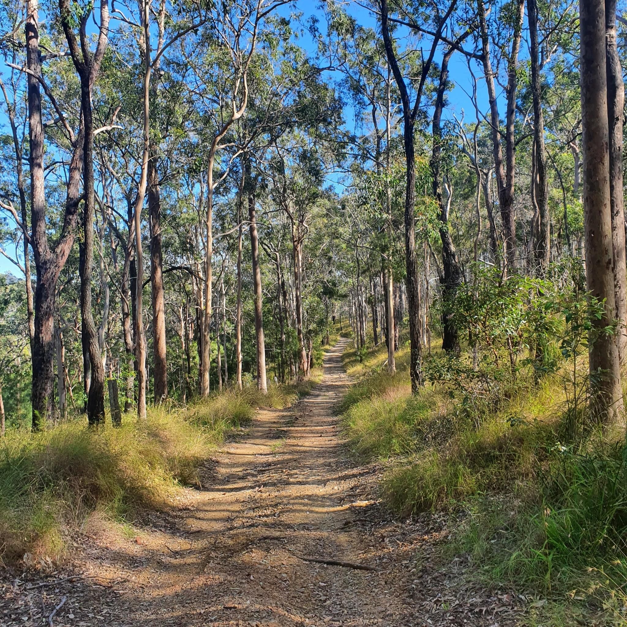
Road cycling in Nerang National Park and its surrounding areas features routes through varied landscapes, including open eucalypt forests, casuarina groves, and lush valleys. The terrain includes small to large hills, offering both gentle gradients and challenging ascents. Routes often follow paved surfaces alongside creeks and rivers, providing views of the surrounding natural environment. The region's topography includes hills and narrow wetlands, with trails often following creek lines.
Best road cycling routes in Nerang National Park
- The most popular road cycling route is Emerald Lakes Parklands loop from Dugandan St at Burra Street, an easy 27.2 miles (43.8 km) trail that takes 1 hour 52 minutes to complete. This route features gentle gradients and views of the local waterways.
- Another top favourite among local road cyclists is Lake Serenity – Eastern Grey Reserve loop from Parkwood, an easy 17.8 miles (28.6 km) path. This route leads through varied local scenery, including eucalypt forests and alongside creeks.
- Local road cyclists also love the Tallebudgera Creek – Burleigh Cove loop from Nerang, a 32.8 miles (52.8 km) trail leading through diverse landscapes, often completed in about 2 hours 27 minutes.
- Road cycling in Nerang National Park is defined by routes through eucalypt forests, alongside creeks, and over small hills. The network offers options for different ability levels, from easy rides to more moderate challenges.
- The routes in Nerang National Park are highly rated by the komoot community with an average score of 4.4 stars from over 70 reviews. More than 1600 road cyclists have used komoot to explore Nerang National Park's varied terrain.
Last updated: July 4, 2026
12
riders
43.1km
01:52
210m
210m
Easy road ride. Great for any fitness level. Mostly well-paved surfaces and easy to ride.
7
riders
28.6km
01:23
140m
150m
Easy road ride. Great for any fitness level. Mostly well-paved surfaces and easy to ride.

Sign up for free
7
riders
53.3km
02:31
280m
280m
Moderate road ride. Good fitness required. Mostly well-paved surfaces and easy to ride.
6
riders
64.7km
02:59
510m
510m
Moderate road ride. Good fitness required. Mostly well-paved surfaces and easy to ride.
19
riders
52.5km
02:27
220m
220m
Moderate road ride. Good fitness required. Some segments of this route may be unpaved and difficult to ride.
Get access to more routes and recommendations from other explorers.
Sign up for free
Already have an account?
Our route recommendations are based on thousands of hikes, rides, and runs completed by other people on komoot.
Start today with a free account
Your next adventure awaits.
Login or Signup
Popular around Nerang National Park


Tips from the Community

D'Arcy Doyle Park, also known as Warri Park, is home to a few little creeks, with three wooden bridges passing over them, a few large trees and a large mowed grass lawn. It's nestled in an urban area and just to the south, across from Swanton Drive, is a paved parking lot, public toilets and shaded picnic areas.
0
0
Mudgeeraba Creek flows about 20 kilometres through protected rainforests, rural farmland and suburban areas. The creek's headwaters are in Springbrook National Park and flows until merging with the Nerang River. Australian bass, Dewfish, and Surf bream all live in the waters and birds like the Golden-headed Cisticola live around the river as well.
0
0

This lovely path is a flat, easy loop that runs along the shoreline of Lake Orr and surrounding waterways. It is a family-friendly route with minimal elevation, popular for walking, running, cycling, and birdwatching. Along the way, the route passes through beautifully landscaped parklands with boardwalk sections, recreational facilities, and peaceful waterside views. It is a fantastic place for a scenic walk any time of the year.
0
0
Camp Creek flows into Lake Orr, contributing to the larger catchment that supplies this central waterway in Varsity Lakes. The surrounding paths and open spaces are a hub for everyday recreation, from walking and cycling to kayaking and stand-up paddleboarding on the lake. Together, they form a calm, natural pocket within Varsity Lakes, and if you are here in the evening, it's a lovely place to watch the sunset.
0
0
Damian Leeding Memorial Park is a large, multi-use lakeside park on the northern Gold Coast, centred around Regatta Waters Lake, and is a hub for recreation and water sports. There are open grassy areas, playgrounds, picnic shelters with barbecues, fitness equipment, and facilities for activities such as rowing, kayaking, and sailing. A nearly 4-kilometre shared-use path surrounds the lake, making it a popular spot for walking, cycling, and everyday exercise.
0
0
Emerald Lakes Parklands sits beside a calm lake with grassy areas, a playground, picnic spots, and a flat walking path that’s perfect for a peaceful stroll or family outing. The sealed trail circles the lake, offering views of the water, birdlife, and easy walking for all ages. It’s a scenic suburban green space ideal for picnics, light exercise, and enjoying the lakeside atmosphere.
0
0
This long sandy beach is a great pick on a summer day for sunbathing, swimming, and surfing, and it has lifeguards on duty with a nearby park. It is a well-patrolled area due to dangerous riptides and rough, open-ocean waves. Keep in mind that swimmers should always stay between the red and yellow flags for their safety. The sand is white, soft, and clean, making walks along the shore enjoyable.
0
0

The Gold Coast Oceanway is a paved coastal path that runs parallel to the beach, linking suburbs along the shoreline. This section near Surfers Paradise follows the edge of the sand, offering uninterrupted ocean views with the skyline rising behind you. The wide, sealed path is shared by walkers, runners and cyclists, so keep left and stay aware of faster traffic. Shade is limited along exposed stretches, making early morning or late afternoon a more comfortable time to walk.
0
0
Frequently Asked Questions
Are road cycling routes available directly within Nerang National Park?
No, the designated trails within Nerang National Park are primarily for mountain biking, hiking, and horse riding, and are not suitable for road bikes. However, the broader Nerang area and its surroundings offer numerous paved routes ideal for road cycling, often leading through natural areas adjacent to the park.
How many road cycling routes are available in the Nerang area?
There are over 50 road cycling routes available in the Nerang area and its surroundings, catering to various skill levels. You can find options ranging from easy, flat rides to more challenging routes with significant elevation changes.
What kind of terrain can I expect on road cycling routes near Nerang National Park?
Road cycling routes in the Nerang area feature varied terrain, including paved surfaces that wind through open eucalypt forests, casuarina groves, and lush valleys. You'll encounter both gentle gradients and some challenging ascents over small to large hills, often alongside creeks and rivers.
What are some popular easy road cycling routes in the Nerang area?
For an easy ride, consider the Burleigh Cove – Pelican Lake loop from Nerang, which is about 43.8 km with gentle gradients and views of local waterways. Another popular easy option is the Lake Lido loop from Dugandan St at Burra Street, a 42.5 km path that includes some hills and passes by Lake Lido.
Are there any moderate or difficult road cycling routes available?
Yes, the Nerang area offers routes for more experienced cyclists. For example, the Tallebudgera Creek – Burleigh Cove loop from Nerang is a moderate 52.8 km route. For a longer, more challenging ride, the Coomera River loop from Nerang covers nearly 65 km with significant elevation changes.
What natural features or wildlife might I see while road cycling in the Nerang area?
While cycling on paved roads outside the national park, you'll still be in a natural setting. The routes often pass through areas with diverse forests, including eucalypt and casuarina groves. Keep an eye out for local wildlife such as wallabies, kangaroos, and various bird species, especially in quieter sections near natural reserves.
What do other road cyclists think of the routes in the Nerang area?
The road cycling routes in the Nerang area are highly rated by the komoot community, with an average score of 4.5 stars from over 60 reviews. Cyclists often praise the varied scenery, well-maintained paved surfaces, and the mix of gentle and challenging sections.
Are there any family-friendly road cycling options?
Many of the easy-graded routes in the Nerang area are suitable for families, particularly those with gentle gradients and less traffic. The Lake Serenity – Eastern Grey Reserve loop from Parkwood, an easy 28.6 km trail, is a good example of a route that leads through varied local scenery and is often completed in about 1 hour 23 minutes.
Where can I find parking for road cycling near Nerang National Park?
Parking is generally available in the towns and suburbs surrounding Nerang National Park, such as Nerang, Parkwood, or areas near Burleigh Cove, where many of the road cycling routes begin. Look for public parking facilities in these areas to start your ride.
Is public transport available to access road cycling routes in the Nerang area?
Yes, the Nerang area is well-connected by public transport, particularly bus services, which can take you to starting points for many road cycling routes. Check local TransLink services for routes and schedules to plan your journey.
Are there any specific viewpoints or landmarks along the road cycling routes?
While the routes focus on natural beauty, many offer scenic views of local waterways, lakes like Lake Lido and Lake Serenity, and glimpses of the surrounding mountains and forests. The routes often follow rivers and creeks, providing picturesque natural backdrops.
What is the best time of year for road cycling in the Nerang area?
The Gold Coast region, including Nerang, generally offers pleasant cycling conditions year-round. However, the cooler, drier months from autumn to spring (March to November) are often preferred to avoid the peak heat and humidity of summer.
Most popular routes in Nerang National Park

Get inspired with the komoot mobile app


Explore more
Browse the best Road cycling routes in other regions.
