The best walks and hikes in Nerang National Park
4.7
(51)
995
hikers
28
hikes
Hiking in Nerang National Park offers diverse landscapes, including dry rainforest, open eucalypt forests, and casuarina groves. The terrain features small to large hills, crisscrossed by creeks and rivers, providing varied environments for exploration. Hikers can experience changing vegetation as they traverse from tall forests to areas with grey gum and tallowwood. The park also contains rainforest-covered mountains and lush valleys.
Best hiking trails in Nerang National Park
- The most popular hiking route is Nerang Yarrayne, Centre & North Street Break Circuit, a 4.6 miles (7.5 km) trail that takes 2 hours 11 minutes to complete. This moderate path winds through open eucalypt forest on a shared management trail.
- Another top favourite among local hikers is Terminator Summit loop from Nerang, a difficult 11.5 miles (18.4 km) path. This challenging route features significant elevation gain, leading to rewarding views.
- Local hikers also love the Freeman's Lookout Track, a 0.9 miles (1.5 km) trail leading through woodlands, often completed in about 27 minutes. This easy path provides panoramic views over the Nerang River valley and Gold Coast skyline.
- Hiking in Nerang National Park is defined by dry rainforest, open eucalypt forests, and varied hilly terrain. The network offers options for different ability levels, from easy walks to more challenging ascents.
- The routes in Nerang National Park are highly rated by the komoot community with an average score of 4.7 stars from over 50 reviews. More than 1200 hikers have used komoot to explore Nerang National Park's varied terrain.
Last updated: July 4, 2026
5.0
(3)
37
hikers
7.47km
02:12
210m
210m
Moderate hike. Good fitness required. Easily-accessible paths. Suitable for all skill levels.
15
hikers
17.3km
05:05
500m
500m
Hard hike. Very good fitness required. Easily-accessible paths. Suitable for all skill levels.

Sign up for free
13
hikers
Hard hike. Very good fitness required. Easily-accessible paths. Suitable for all skill levels.
5.0
(1)
10
hikers
7.51km
02:40
410m
410m
Moderate hike. Good fitness required. Easily-accessible paths. Suitable for all skill levels.
5.0
(1)
27
hikers
6.20km
01:33
0m
0m
Easy hike. Great for any fitness level. Easily-accessible paths. Suitable for all skill levels.
Get access to more routes and recommendations from other explorers.
Sign up for free
Already have an account?
Our route recommendations are based on thousands of hikes, rides, and runs completed by other people on komoot.
Start today with a free account
Your next adventure awaits.
Login or Signup


Tips from the Community

This access point to Hellfire Pass begins at the end of Hell Fire road in a residential area within Lower Beechmont Conservation Area. The trail starts from a turning circle, and there is no designated parking at the trailhead or along the street. Access is limited due to the residential setting, so it’s generally not recommended to start the hike from here if you are coming with a car.
0
0
Hellfire Pass is known for its steep climbs, rocky descents, and false peaks that make the trail feel longer than it looks on paper. Much of the route follows a fire trail through open forest and hinterland terrain, with rough, loose surfaces in sections. The climb is commonly used for endurance training, particularly for the Kokoda Challenge, due to the sustained elevation gain and demanding terrain. After rain, the rocky sections can become slippery underfoot.
0
0
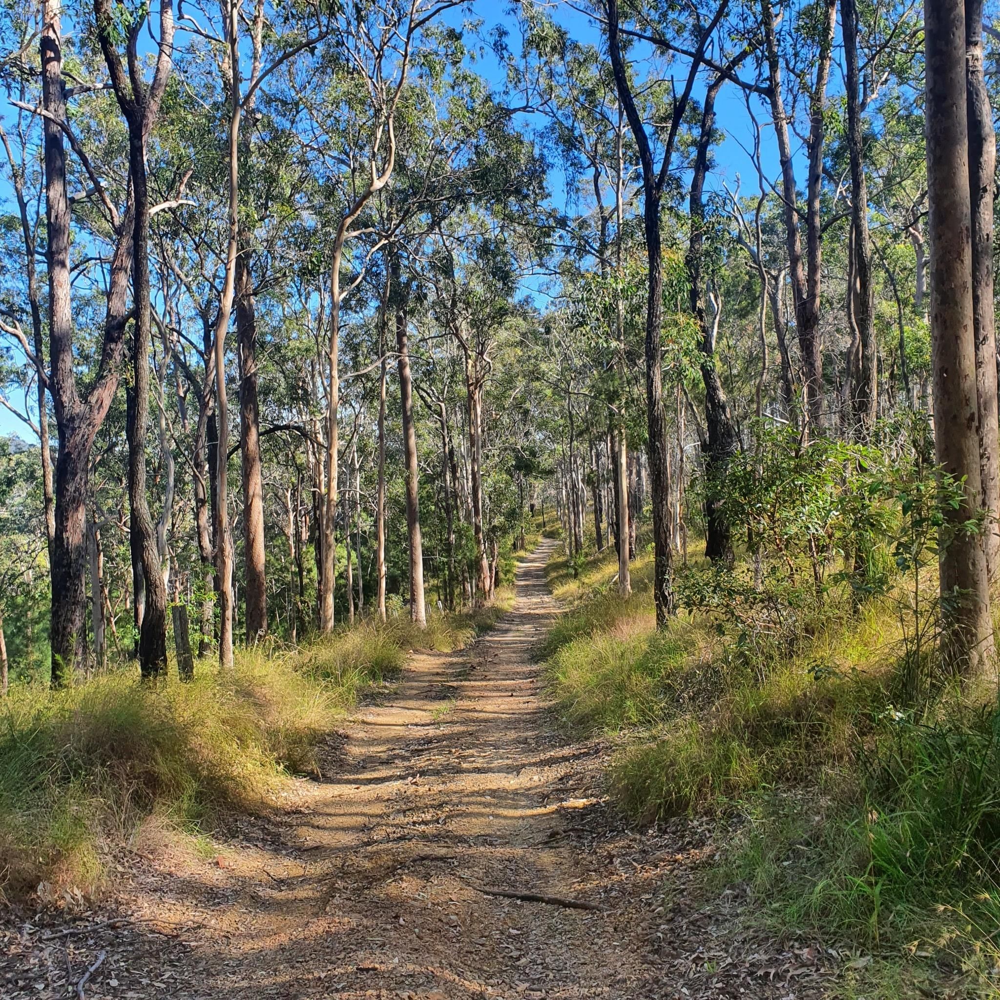
Centre Road Firetrail is a wide dirt and gravel route linking several sections of the park’s trail network. The firetrail moves through open eucalypt forest and rolling terrain, with a mix of gradual climbs and flatter stretches along the ridge lines. It’s shared by walkers, trail runners, mountain bikers, and horse riders, and is generally easy to follow due to its width and clear layout.
0
0
Located in the Gold Coast hinterland, Nerang National Park is made up of open eucalypt forest, dry bushland, and a large network of multi-use trails. The park is widely used for walking, trail running, and mountain biking, with routes ranging from wide fire trails to narrower singletrack. Compared to the nearby rainforest parks, the landscape here is drier and more exposed, with rolling terrain rather than steep climbs.
0
0
Located within Nerang National Park, this trail follows a network of forest tracks through open eucalypt bushland. The route is mostly wide and well-defined, with a mix of dirt and gravel surfaces underfoot. It’s a shared-use area, so walkers may encounter mountain bikers along parts of the track.
0
0

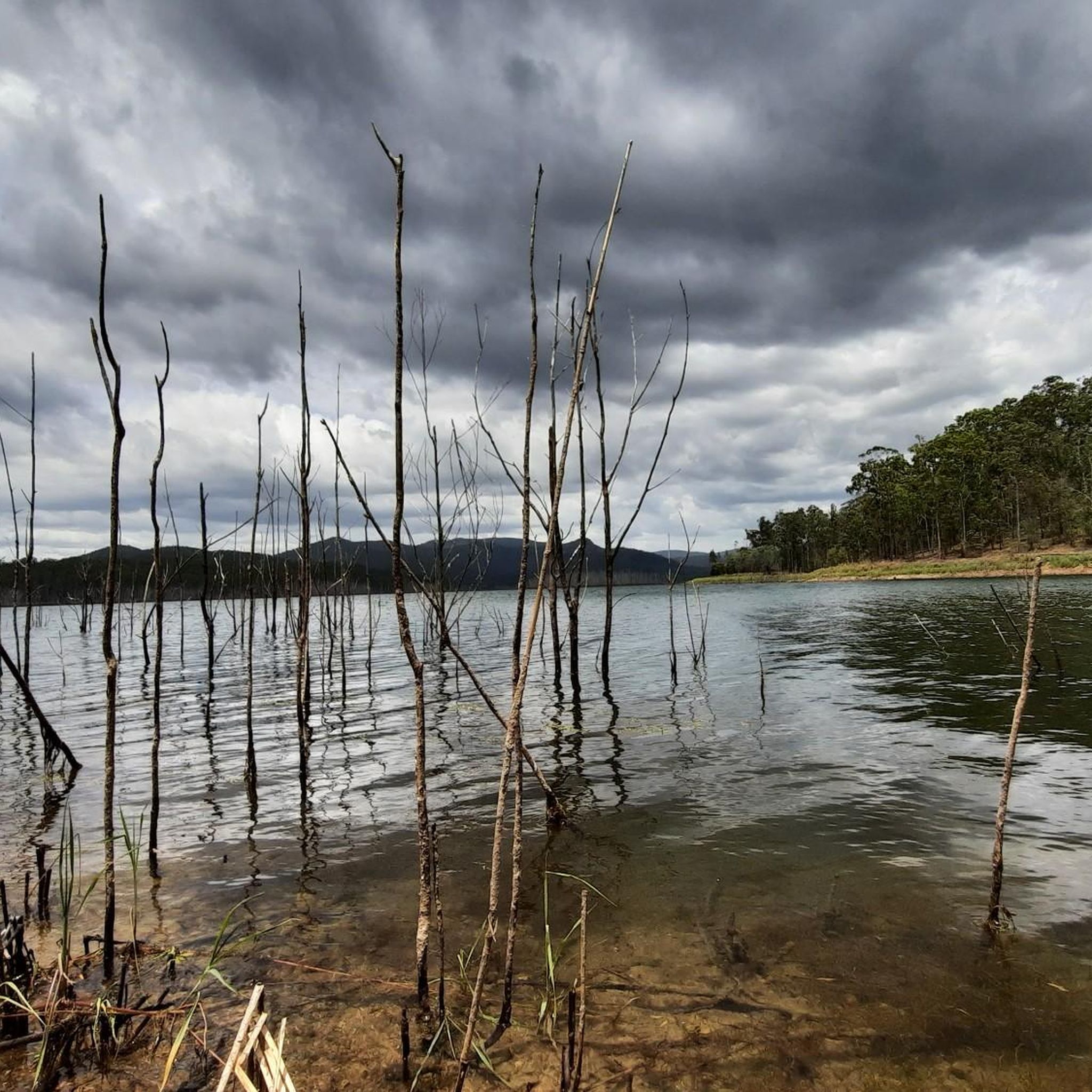
This pathway is a flat, landscaped walking route that loops around the lake and through the parklands, stretching a few kilometres with boardwalks and small bridges. Along the way, there are peaceful water views, open grassy areas, and plenty of spots to pause and enjoy the scenery. It’s an easy circuit ideal for walking, jogging, or birdwatching along the lake’s edge.
0
0
Emerald Lakes Parklands sits beside a calm lake with grassy areas, a playground, picnic spots, and a flat walking path that’s perfect for a peaceful stroll or family outing. The sealed trail circles the lake, offering views of the water, birdlife, and easy walking for all ages. It’s a scenic suburban green space ideal for picnics, light exercise, and enjoying the lakeside atmosphere.
0
0
North Street Break is a shared trail along the park boundary near the North Street access. It links to surrounding loops and connection roads, helping create longer continuous routes through the forest. Like the other breaks, it is primarily a management trail used by walkers, cyclists, and horse riders rather than a purpose-built technical track.
0
0
Frequently Asked Questions
What is the general difficulty level of hiking trails in Nerang National Park?
Nerang National Park offers a diverse range of trails catering to various fitness levels. You'll find everything from easy walks to more challenging ascents. For example, there are 19 easy routes, 9 moderate routes, and 2 difficult routes available.
Are there easy hiking trails suitable for beginners or families in Nerang National Park?
Yes, Nerang National Park has many easy trails perfect for beginners or families. An excellent option is the Freeman's Lookout Track, an easy 1.5 km path through woodlands that offers panoramic views. Another easy option is the Emerald Lakes Parklands circuit, which is 6.2 km with minimal elevation.
Are there challenging hikes for experienced trekkers in Nerang National Park?
For experienced hikers seeking a challenge, Nerang National Park offers routes with significant elevation gain. The Terminator Summit loop from Nerang is a difficult 18.4 km path that features substantial climbing and rewarding views.
What are some notable viewpoints or natural features to see while hiking?
A key attraction is Freeman's Lookout, which provides panoramic views over the Nerang River valley, rolling hinterland hills, and even the Gold Coast skyline on a clear day. The park itself features diverse landscapes including dry rainforest, open eucalypt forests, and casuarina groves, with terrain crisscrossed by creeks and rivers.
Is Nerang National Park dog-friendly?
Generally, dogs are not permitted in Queensland national parks to protect wildlife and natural environments. It's always best to check the official Queensland Parks and Wildlife Service website for the most current regulations regarding pets: parks.qld.gov.au/parks/nerang.
Can I find circular hiking routes in Nerang National Park?
Yes, there are several circular routes available. A popular moderate option is the Nerang Yarrayne, Centre & North Street Break Circuit, which is a 7.5 km loop. For a more challenging circular hike, consider the Terminator Summit loop from Nerang.
Where can I park when visiting Nerang National Park for a hike?
Nerang National Park has designated parking areas, often near trailheads. Specific parking information can usually be found on the official park website or by checking detailed komoot tour descriptions for starting points.
What kind of wildlife might I encounter on the trails?
Nerang National Park is rich in biodiversity. You might spot glossy black-cockatoos, koalas, short-beaked echidnas, wallabies, kangaroos, and possums. The park is also home to over 220 bird species, including threatened fauna like the powerful owl.
What do other hikers enjoy most about Nerang National Park?
The area is highly rated by the komoot community, with an average score of 4.7 stars from over 50 reviews. Hikers often praise the diverse landscapes, from dry rainforest to open eucalypt forests, and the varied terrain that offers options for all ability levels.
What is the best time of year to go hiking in Nerang National Park?
While hiking is possible year-round, the cooler, drier months (typically autumn and winter in Queensland, from March to August) are often preferred for more comfortable conditions and less humidity. Always check local weather forecasts before heading out.
Are hiking trails in Nerang National Park shared with other users?
Yes, many trails in Nerang National Park are shared with mountain bikers and horse riders. Walkers should be mindful and give way to others. Designated mountain bike trails are generally not recommended for walking due to the speed of cyclists.
Do I need a permit to hike in Nerang National Park?
For general day hiking in Nerang National Park, permits are typically not required. However, for specific activities like camping (if available) or commercial operations, permits may be necessary. It's always advisable to check the official Queensland Parks and Wildlife Service website for the latest information: parks.qld.gov.au/parks/nerang/things-to-do.
Most popular routes in Nerang National Park

Get inspired with the komoot mobile app


Explore more
Browse the best Hikes in other regions.
