Attractions and Places To See in San Gorgonio Wilderness - Top 6
Best attractions and places to see in San Gorgonio Wilderness include a vast protected area within the Sand to Snow National Monument, spanning nearly 97,000 acres. This wilderness features diverse elevations, from 4,400 feet to over 11,500 feet at San Gorgonio Mountain, the highest peak in Southern California. Notable landmarks include San Bernardino Peak, historically significant as the initial surveying point for Southern California. The landscape encompasses sub-alpine oases, forested areas, and unique natural features like Aspen Grove.
Best attractions and places to see in San Gorgonio Wilderness
- The most popular attractions is Mount San Gorgonio Summit, a summit that stands at 11,503 feet, making it the highest peak in Southern California. On clear days, hikers can experience expansive 360-degree views of the San Gorgonio Wilderness and the Pacific Ocean.
- Another must-see spot is San Bernardino East Peak, a summit located a mile east of San Bernardino Peak. This spot offers mountain views and solitude, with options for camping at Jackstraw Campground or Limber Pine Bench.
- Visitors also love Washington's Monument, a man-made monument marking the initial point from which all of Southern California was surveyed in 1852. Today, a pile of rocks and a metal plaque commemorate this historical site.
- San Gorgonio Wilderness is known for its challenging summits, historical sites, and scenic trails. The region offers a variety of attractions to see and explore, from high peaks to significant historical markers.
- The attractions in San Gorgonio Wilderness are appreciated by the komoot community, with 6 highlights featuring 7 photos and 2 upvotes.
Last updated: August 16, 2026
San Bernardino Peak Divide Trail
Highlight (Segment) • Trail
Tip by

Mount San Gorgonio Summit
Highlight • Summit
Tip by
Sign up now to discover places like this
Get recommendations on the best single tracks, peaks, & plenty of other exciting outdoor places.
Sign up for free
San Bernardino East Peak
Highlight • Summit
NOTE: Due to the 2020 El Dorado Fire the San Bernardino Peak is closed. The forest order is set to expire March 31, 2022.
Tip by

Vivian Creek Trail & High Creek Camp
Highlight • Trail
Since this is a quite popular trail up to San Gorgonio Mountain, you will need to obtain a free permit as soon as you plan your hike. Quotas fill up early!
Tip by
Washington's Monument
Highlight • Monument
NOTE: Due to the 2020 El Dorado Fire the San Bernardino Peak is closed. The forest order is set to expire March 31, 2022.
Tip by
Start today with a free account
Your next adventure awaits.
Login or Signup
Tips from the Community

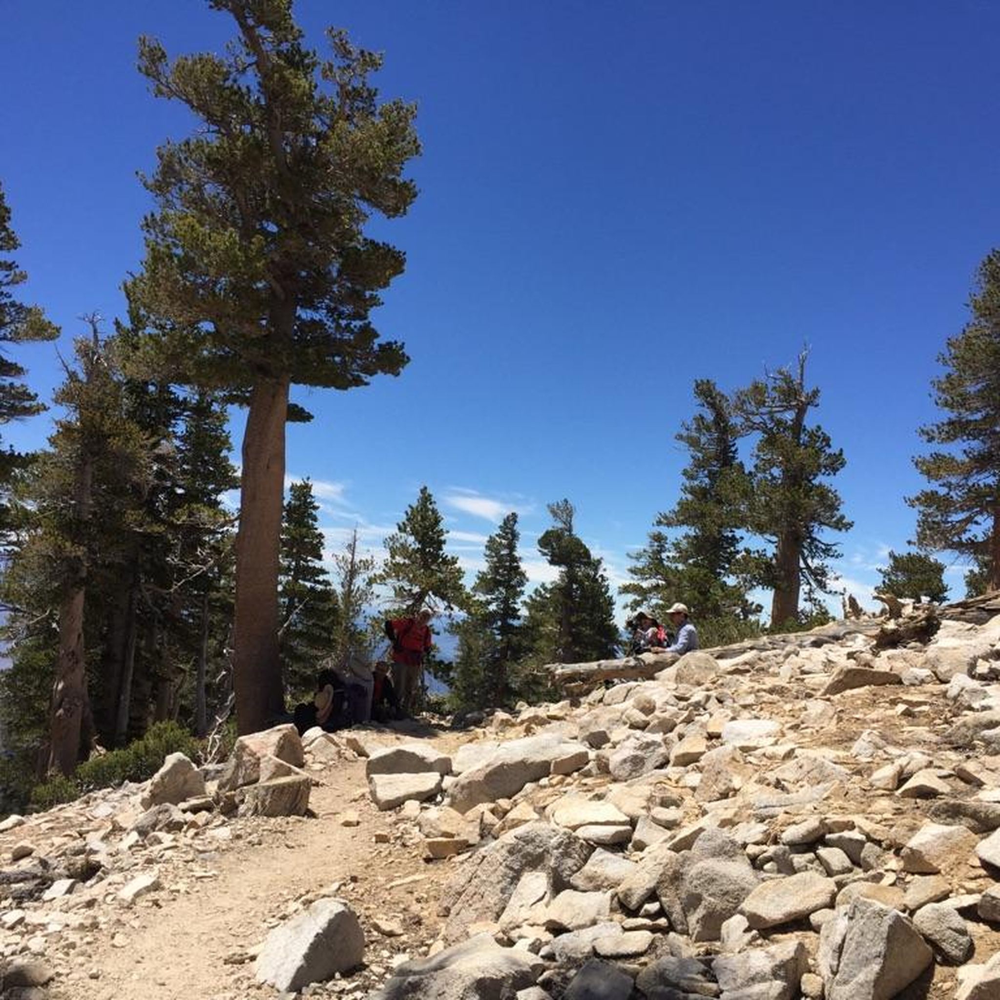
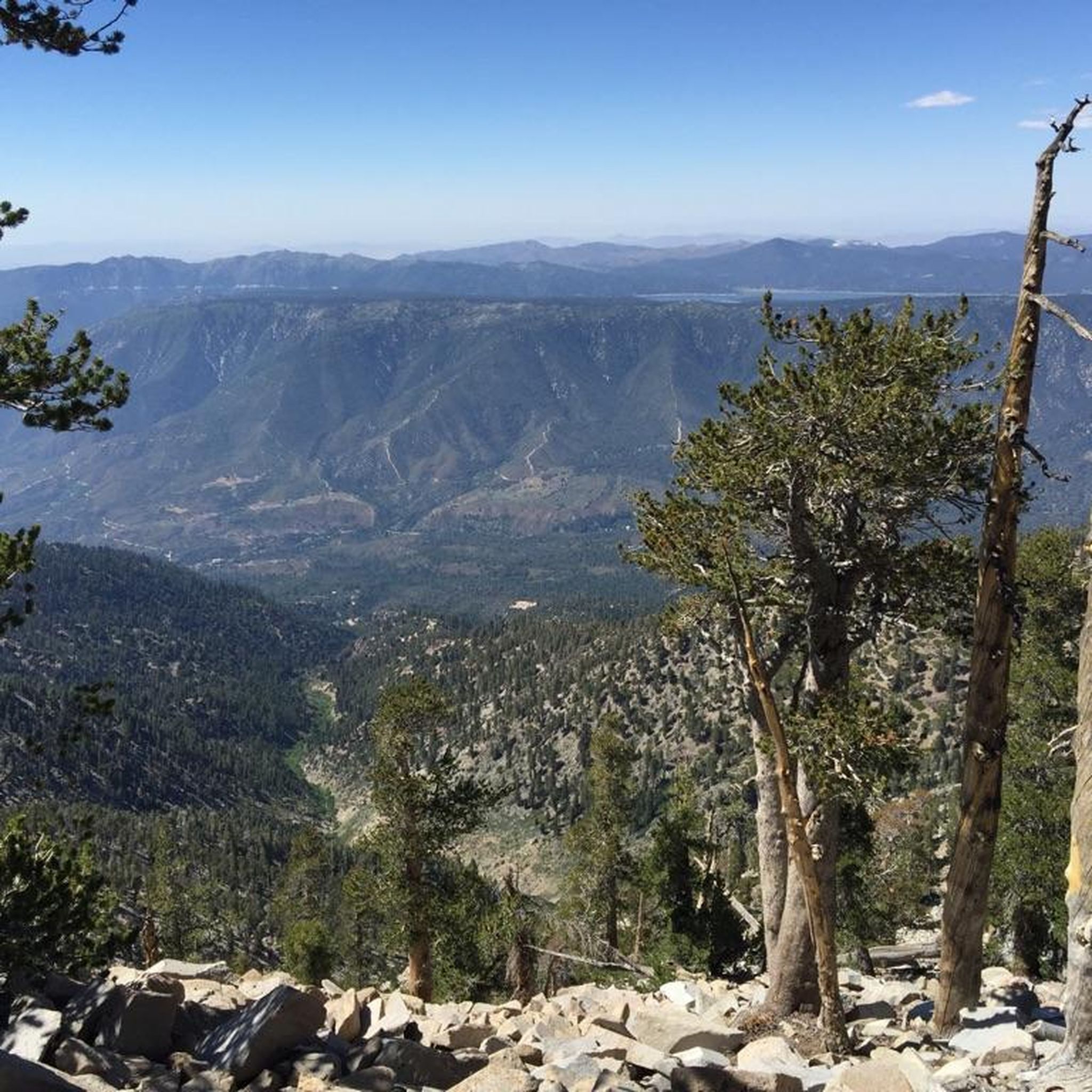
San Gorgonio Mountain, also called Mount San Gorgonio or Old Greyback, is the highest peak in Southern California, standing at 11,503 feet. The mountain has a pyramid-like shape, with a steep north face and a gentler south face. On clear days, hikers can enjoy expansive 360-degree views of San Gorgonio Wilderness and even the Pacific Ocean.
0
0
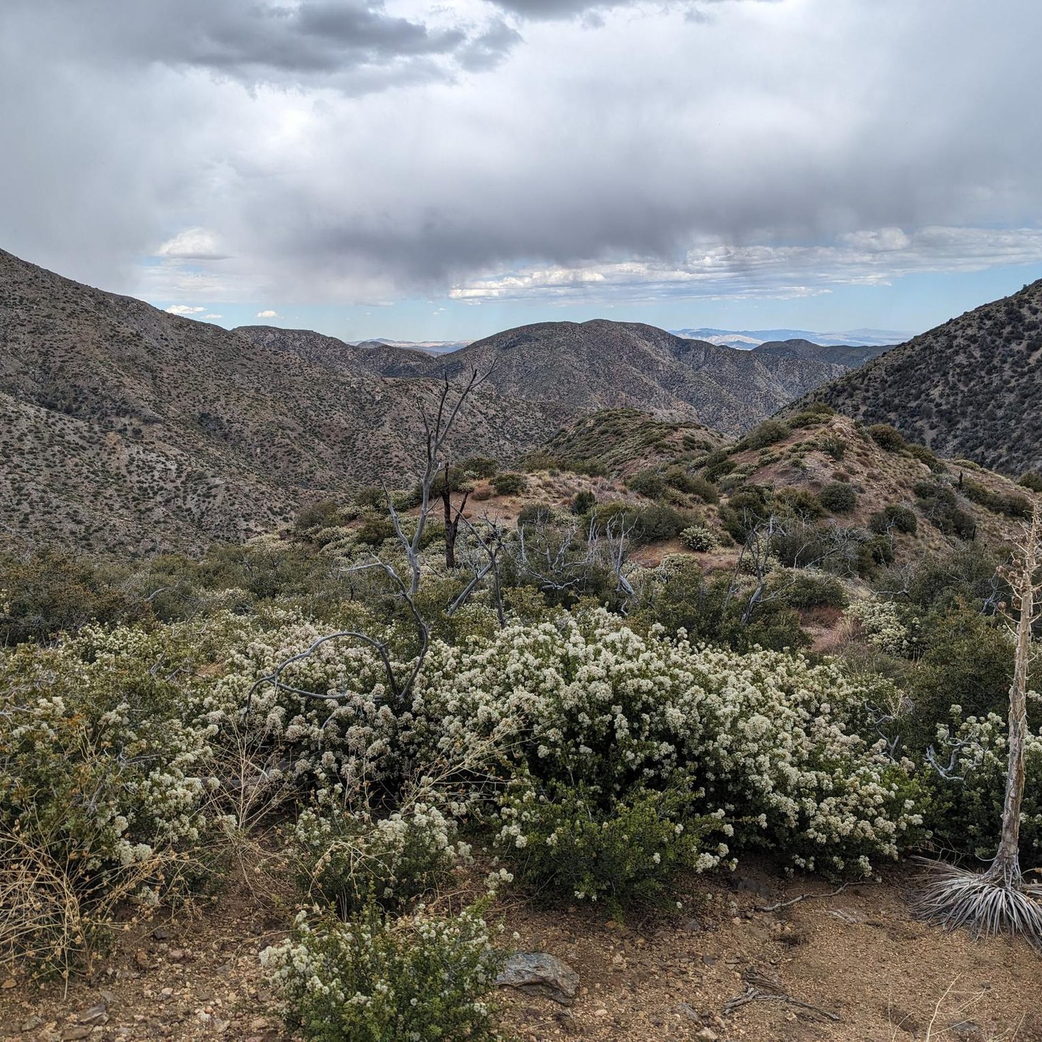
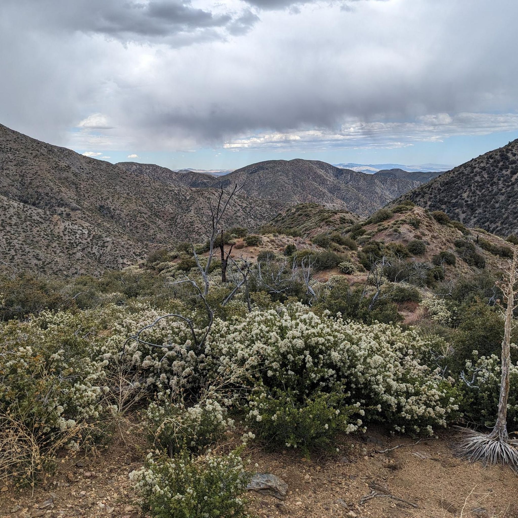
The San Bernardino Peak Divide Trail offers stunning views of the San Gorgonio Wilderness, but hikers must obtain a permit for day and overnight use. Although beautiful, the trail shows the effects of past wildfires, and hikers should prepare for a 13+ mile stretch with no water, depending on snowmelt. The trail can be dangerous in snowy conditions, so bring any necessary equipment or wait for the summer months when the snow melts.
0
0

Vivian Creek Trail is the steepest trail to summit San Gorgonio Mountain, but the scenery will compensate your effort and sweat. You hike along the burbling Vivian Creek and the treeline opens up for stunning vistas of Mount San Jacinto. There are two campsites along the trail: Halfway Camp and High Creek Camp if you want to split your hike into more than a day. Since this is a quite popular trail up to San Gorgonio Mountain, you will need to obtain a free permit as soon as you plan your hike. Quotas fill up early!
4
0
Stunning views over the San Gorgonio Wilderness are guaranteed on your hike along the San Bernardino Peak Divide Trail. You will need to obtain a permit to hike here: https://www.fs.usda.gov/detail/sbnf/news-events/?cid=FSEPRD779200 NOTE: The San Gorgonio Wilderness might be closed due to the Apple Fire in 2020.
3
0
San Bernardino Peak East is located a mile east of San Bernardino Peak and is a perfect spot to enjoy stunning mountain views and some solitude. If a day hike is too ambitious or you just want to experience the landscape a little longer, coming from east you can pitch you tent at Jackstraw Campground or Limber Pine Bench coming from the west. You will need to obtain a permit to hike here: https://www.fs.usda.gov/detail/sbnf/news-events/?cid=FSEPRD779200 NOTE: Due to the 2020 El Dorado Fire the San Bernardino Peak is closed. The forest order is set to expire March 31, 2022.
2
0
In 1852, the surveyor Henry Washington intended to establish the Initial Point (point from which all of Southern California was surveyed and mapped) at San Bernardino Peak. Since the peak was not visible from the valley, he decided to establish the point right here with a 25-foot tall pole rising from a pile of rocks. Today, all there is left is the pile of rocks and a metal plaque in this honor. You will need to obtain a permit to hike here: https://www.fs.usda.gov/detail/sbnf/news-events/?cid=FSEPRD779200 NOTE: Due to the 2020 El Dorado Fire the San Bernardino Peak is closed. The forest order is set to expire March 31, 2022.
3
0

This is a tough hike, but a nice one to check off your bucket list. Incredible views from this point.
1
0
Frequently Asked Questions
Do I need a permit to hike in the San Gorgonio Wilderness?
Yes, a free wilderness permit is required for both day hikes and overnight trips within the San Bernardino National Forest portion of the wilderness. You can request permits up to 90 days in advance through the San Gorgonio Wilderness Association. Additionally, an Adventure Pass or Interagency Pass is needed for parking at some trailheads, such as Vivian Creek Trailhead and South Fork Trailhead.
What is the highest peak in the San Gorgonio Wilderness?
The highest peak in the San Gorgonio Wilderness, and indeed in Southern California, is Mount San Gorgonio Summit, standing at 11,503 feet. It's also known as "Old Grayback" and offers expansive 360-degree views on clear days.
Are there any historical sites to visit in the San Gorgonio Wilderness?
Yes, the wilderness holds significant historical markers. Washington's Monument marks the initial point from which all of Southern California was surveyed in 1852. San Bernardino Peak itself is historically important as the original intended surveying point.
What unique natural features can I find in the San Gorgonio Wilderness?
The San Gorgonio Wilderness is home to several unique natural features. You can find a rare Aspen Grove, one of only two locations in California outside the Sierra Nevada where these trees are found, particularly vibrant in the fall. The Whitewater River Crossing offers a refreshing desert oasis, and the prominent Red Dome rises above the desert floor nearby.
What are some challenging hiking trails in the San Gorgonio Wilderness?
For expert hikers, the Vivian Creek Trail is an intense 19-mile out-and-back route to the summit of San Gorgonio Mountain. The San Bernardino Peak Trail is another challenging 16-mile roundtrip offering solitude and fantastic views. Hikers should be prepared for significant elevation changes and potentially dangerous conditions with snow and ice in winter.
When is the best time of year to visit the San Gorgonio Wilderness?
The best time to visit largely depends on your activity. Summer months are ideal for reaching higher elevations like Mount San Gorgonio Summit when snow has melted. Fall offers vibrant colors, especially at the Aspen Grove. Spring can be beautiful with wildflowers, but some trails may still have snow. Winter brings dangerous conditions with snow and ice, requiring proper gear and experience, and some roads may close.
Are there family-friendly trails or activities in the San Gorgonio Wilderness?
While many trails are recommended for intermediate to expert hikers due to significant elevation changes, some areas might offer shorter, less strenuous options. For specific family-friendly routes, it's best to consult the San Bernardino National Forest visitor centers for current conditions and recommendations, as trail difficulty can vary greatly.
Does the Pacific Crest Trail pass through the San Gorgonio Wilderness?
Yes, a significant portion of the famed Pacific Crest Trail (PCT) traverses the San Gorgonio Wilderness. It offers scenic views and connects to other trails and natural features like the Whitewater Preserve and the San Gorgonio Overlook.
What road cycling routes are available near the San Gorgonio Wilderness attractions?
While the wilderness itself is primarily for hiking, there are road cycling opportunities in the surrounding area. You can find routes like the 'Mill Creek Visitors Center to Onyx Summit' (difficult, 100 km) or the 'Baldwin Lake – Big Bear Lake loop from Bear Mountain' (easy, 33 km). Explore more options in the Road Cycling Routes in San Gorgonio Wilderness guide.
Are there running trails near the San Gorgonio Wilderness attractions?
Yes, the region offers several running trails. Options include the 'Vivian Creek Trail loop from Restrooms' (difficult, 18 km) or the 'Whitewater River & Red Dome via PCT – San Bernardino National Forest' (moderate, 7 km). For a comprehensive list, check out the Running Trails in San Gorgonio Wilderness guide.
What mountain biking trails can I explore in the San Gorgonio Wilderness?
Mountain biking trails are available in the broader San Gorgonio Wilderness area. You can find routes such as 'Clark's Grade to Big Bear' (difficult, 29 km) or 'Santa Ana River Trail – San Bernardino National Forest' (moderate, 21 km). Discover more trails in the MTB Trails in San Gorgonio Wilderness guide.
Are there camping opportunities within the San Gorgonio Wilderness?
Yes, the wilderness offers various camping opportunities. Areas like Dry Lake and Dollar Lake have designated camping spots, with Dollar Lake Forks Trail Camp located near Dollar Lake (note: camping is prohibited within a quarter-mile of Dollar Lake). Many campsites throughout the wilderness also provide picturesque views of the nearby San Jacinto mountains. Remember, a wilderness permit is required for overnight stays.
What are the parking regulations and fees for trailheads in the San Gorgonio Wilderness?
An Adventure Pass or Interagency Pass is required for parking at some trailheads, including the Vivian Creek Trailhead and South Fork Trailhead. It's advisable to check the specific requirements for your chosen trailhead before your visit to ensure compliance and avoid any issues.
Most popular routes in San Gorgonio Wilderness
Most popular attractions in San Gorgonio Wilderness

Get inspired with the komoot mobile app


