San Gorgonio Wilderness
San Gorgonio Wilderness
The best walks and hikes in San Gorgonio Wilderness
4.5
(56)
717
hikers
53
hikes
Hiking trails in San Gorgonio Wilderness traverse a sub-alpine environment characterized by a significant elevation gradient, ranging from 4,400 feet to over 11,500 feet. The terrain transitions from rolling foothills and canyons to rugged mountains, including the highest peak in Southern California. This region features diverse vegetation zones and offers panoramic views from its prominent summits.
Best hiking trails in San Gorgonio Wilderness
- The most popular hiking route is San Gorgonio Peak via Vivian Creek Trail — San Bernardino National Forest, a 17.8 miles (28.7 km) difficult trail that takes 9 hours 57 minutes to complete. This route ascends to the highest point in Southern California, offering extensive views.
- Another top favourite among local hikers is San Bernardino East Peak – San Bernardino National Forest, a difficult 14.4 miles (23.1 km) path. This trail leads to a peak with historical significance and provides views across the wilderness.
- Local hikers also love the Vivian Creek Trail loop from Joshua Tree Highlands, an 11.3 miles (18.2 km) difficult trail leading through rugged mountain terrain, often completed in about 6 hours 13 minutes.
- Hiking in San Gorgonio Wilderness is defined by rugged mountains, sub-alpine environments, and deep canyons. The network offers options for easy, moderate, and difficult ability levels.
- The routes in San Gorgonio Wilderness are highly rated by the komoot community with an average score of 4.6 stars from over 40 reviews. More than 600 hikers have used komoot to explore San Gorgonio Wilderness's varied terrain.
Last updated: July 8, 2026
3
hikers
16.1km
05:09
1,080m
60m
Hike the challenging San Gorgonio Mountain via Fish Creek Trail, a 10-mile route to Southern California's highest peak with 3,553 feet of ga
1
hikers
27.7km
09:05
1,320m
1,280m
Hike the difficult 17.2-mile San Bernardino Peak Loop via Forsee Creek Trail for panoramic views and challenging ascents.

Sign up for free
3.21km
01:00
190m
20m
Hike the easy 2.0-mile Aspen Grove Trail in San Gorgonio Wilderness to see rare Quaking Aspen trees and enjoy a serene woodland setting.
4.2
(5)
57
hikers
28.7km
09:57
1,630m
1,630m
The Vivian Creek Trail to San Gorgonio Mountain is a demanding ascent that rewards your effort with incredibly diverse scenery. You'll start in a wooded canyon, transition to lush sections alongside Vivian Creek with its babbling waters, and then climb through changing forest types. As you gain elevation, the landscape opens up to exposed alpine slopes and boulders, culminating in the broad, rocky expanse of the Mount San Gorgonio Summit. This difficult 17.9 miles (28.7 km) route involves a substantial 5358 feet (1633 metres) of elevation gain, typically requiring around 9 hours and 57 minutes to complete.
Planning your trip requires a free wilderness permit, which you can obtain online. This is the shortest and steepest path to the summit, so be prepared for a relentless uphill climb and ensure you carry plenty of water, especially for the exposed upper sections. Parking is available at the trailhead, but it's a popular spot, so an early start is recommended to secure a space and beat the crowds.
San Gorgonio Mountain, affectionately known as "Old Grayback," stands as Southern California's highest peak, making this hike a significant achievement for any enthusiast. The trail serves as an excellent high-altitude training ground for those preparing for other major climbs like Mt. Whitney. From the summit, you're treated to expansive 360-degree panoramic views that can stretch from the Pacific Ocean to the Mojave Desert on clear days, showcasing the dramatic escarpment of the mountain's north face.
3
hikers
23.1km
07:46
1,200m
1,200m
Hard hike. Very good fitness required. Easily-accessible paths. Suitable for all skill levels.
Get access to more routes and recommendations from other explorers.
Sign up for free
Already have an account?
Our route recommendations are based on thousands of hikes, rides, and runs completed by other people on komoot.
Start today with a free account
Your next adventure awaits.
Login or Signup
Tips from the Community

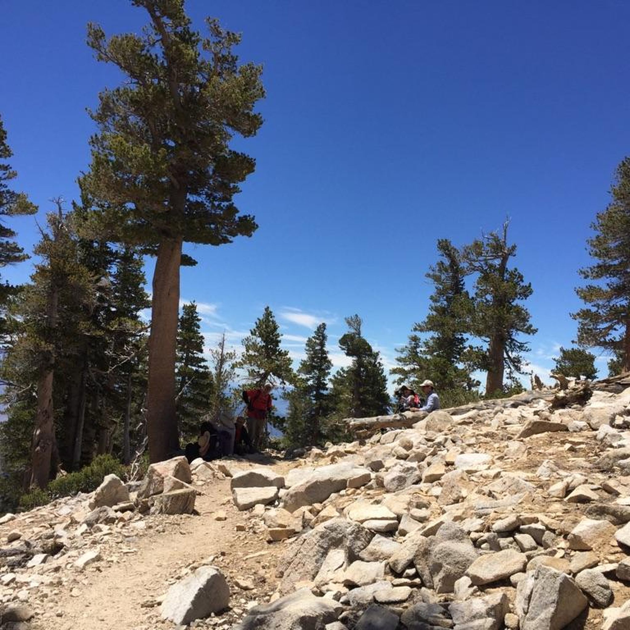
San Gorgonio Mountain, also called Mount San Gorgonio or Old Greyback, is the highest peak in Southern California, standing at 11,503 feet. The mountain has a pyramid-like shape, with a steep north face and a gentler south face. On clear days, hikers can enjoy expansive 360-degree views of San Gorgonio Wilderness and even the Pacific Ocean.
0
0
The San Bernardino Peak Divide Trail offers stunning views of the San Gorgonio Wilderness, but hikers must obtain a permit for day and overnight use. Although beautiful, the trail shows the effects of past wildfires, and hikers should prepare for a 13+ mile stretch with no water, depending on snowmelt. The trail can be dangerous in snowy conditions, so bring any necessary equipment or wait for the summer months when the snow melts.
0
0

Vivian Creek Trail is the steepest trail to summit San Gorgonio Mountain, but the scenery will compensate your effort and sweat. You hike along the burbling Vivian Creek and the treeline opens up for stunning vistas of Mount San Jacinto. There are two campsites along the trail: Halfway Camp and High Creek Camp if you want to split your hike into more than a day. Since this is a quite popular trail up to San Gorgonio Mountain, you will need to obtain a free permit as soon as you plan your hike. Quotas fill up early!
4
0
Stunning views over the San Gorgonio Wilderness are guaranteed on your hike along the San Bernardino Peak Divide Trail. You will need to obtain a permit to hike here: https://www.fs.usda.gov/detail/sbnf/news-events/?cid=FSEPRD779200 NOTE: The San Gorgonio Wilderness might be closed due to the Apple Fire in 2020.
3
0
San Bernardino Peak East is located a mile east of San Bernardino Peak and is a perfect spot to enjoy stunning mountain views and some solitude. If a day hike is too ambitious or you just want to experience the landscape a little longer, coming from east you can pitch you tent at Jackstraw Campground or Limber Pine Bench coming from the west. You will need to obtain a permit to hike here: https://www.fs.usda.gov/detail/sbnf/news-events/?cid=FSEPRD779200 NOTE: Due to the 2020 El Dorado Fire the San Bernardino Peak is closed. The forest order is set to expire March 31, 2022.
2
0
In 1852, the surveyor Henry Washington intended to establish the Initial Point (point from which all of Southern California was surveyed and mapped) at San Bernardino Peak. Since the peak was not visible from the valley, he decided to establish the point right here with a 25-foot tall pole rising from a pile of rocks. Today, all there is left is the pile of rocks and a metal plaque in this honor. You will need to obtain a permit to hike here: https://www.fs.usda.gov/detail/sbnf/news-events/?cid=FSEPRD779200 NOTE: Due to the 2020 El Dorado Fire the San Bernardino Peak is closed. The forest order is set to expire March 31, 2022.
3
0
Deep within the San Gorgonio Wilderness, San Bernardino Peak is still a well kept secret to enjoy stunning mountain views and some solitude. If a day hike is too ambitious or you just want to experience the landscape a little longer, you can pitch you tent at some established campsites along the trails leading up to the peak. You will need to obtain a permit to hike here: https://www.fs.usda.gov/detail/sbnf/news-events/?cid=FSEPRD779200 NOTE: Due to the 2020 El Dorado Fire the San Bernardino Peak is closed. The forest order is set to expire March 31, 2022.
3
1

This is a tough hike, but a nice one to check off your bucket list. Incredible views from this point.
1
0
Frequently Asked Questions
How many hiking trails are available in San Gorgonio Wilderness?
The San Gorgonio Wilderness offers nearly 30 hiking trails, catering to various skill levels. You'll find options ranging from easy strolls to challenging multi-day expeditions, with 9 easy, 12 moderate, and 8 difficult routes recorded on komoot.
What are the typical difficulty levels for hiking in San Gorgonio Wilderness?
Hiking in the San Gorgonio Wilderness ranges from intermediate to expert levels due to its significant elevation changes and rugged terrain. While there are some easier paths, many routes, especially those to the prominent peaks, are considered difficult, involving substantial elevation gain and distance.
Are there any trails suitable for families with children?
The San Gorgonio Wilderness primarily features trails for intermediate to expert hikers, often involving significant elevation and distance. While specific 'family-friendly' trails aren't explicitly highlighted, some of the easier, shorter routes might be suitable for older, more experienced children. Always check the route details for distance and elevation before heading out with family.
What kind of natural features and landmarks can I expect to see?
The wilderness boasts diverse landscapes, from canyons to sub-alpine environments. You can explore prominent peaks like Mount San Gorgonio Summit, the highest point in Southern California, and San Bernardino Peak, which offers historical significance. Notable natural features include Dry Lake and Dollar Lake, and viewpoints like 'Poop-Out Hill' along the South Fork Trail. You might also encounter Washington's Monument.
Are there any circular hiking routes in the area?
Yes, there are circular routes available. For example, the Vivian Creek Trail loop from Joshua Tree Highlands is an 11.3-mile difficult trail, and the Forsee Creek Trail loop from Joshua Cove is a 13.4-mile difficult option.
What is the best time of year to hike in San Gorgonio Wilderness?
The best time to hike is generally from late spring through fall. Winter conditions can be challenging with snow and ice, especially at higher elevations, requiring proper gear and experience. Always check current weather and trail conditions before planning your trip.
Are permits required for hiking in San Gorgonio Wilderness?
Yes, a free wilderness permit is required for both day hikes and overnight trips within the San Bernardino National Forest portions of the wilderness. It's essential to obtain this permit in advance to ensure compliance with regulations.
What wildlife might I encounter while hiking?
The San Gorgonio Wilderness is home to a variety of wildlife. Hikers might spot deer, bear, mountain lions, and bighorn sheep. The area also supports many threatened and endangered plant species, adding to its ecological richness.
What do other hikers enjoy most about San Gorgonio Wilderness?
The area is highly rated by the komoot community, with an average score of 4.6 stars from over 40 reviews. Hikers frequently praise the challenging ascents, the extensive panoramic views from the peaks, and the unique sub-alpine environment.
Are there options for multi-day backpacking trips?
Yes, the San Gorgonio Wilderness is well-suited for multi-day backpacking. Numerous established camps along the trails, such as Vivian Creek Camp, Halfway Camp, High Creek Camp, and Alger Creek Camp, provide opportunities for overnight stays and extended adventures.
What are some of the highest peaks I can hike to?
You can hike to several prominent peaks, including Mount San Gorgonio Summit, which is the highest point in Southern California at 11,502 feet. Another significant peak is San Bernardino Peak, standing at 10,624 feet, offering outstanding views in all directions.
How long do hikes typically take in San Gorgonio Wilderness?
Hike durations vary significantly based on the trail's length and difficulty. For instance, the challenging San Gorgonio Peak via Vivian Creek Trail, at 17.8 miles, typically takes around 9 hours and 57 minutes. Shorter, easier routes will naturally take less time, while multi-day backpacking trips can extend over several days.
Most popular attractions in San Gorgonio Wilderness

Get inspired with the komoot mobile app


