The best walks and hikes around Rottachsee
4.6
(17087)
83,219
hikers
19
hikes
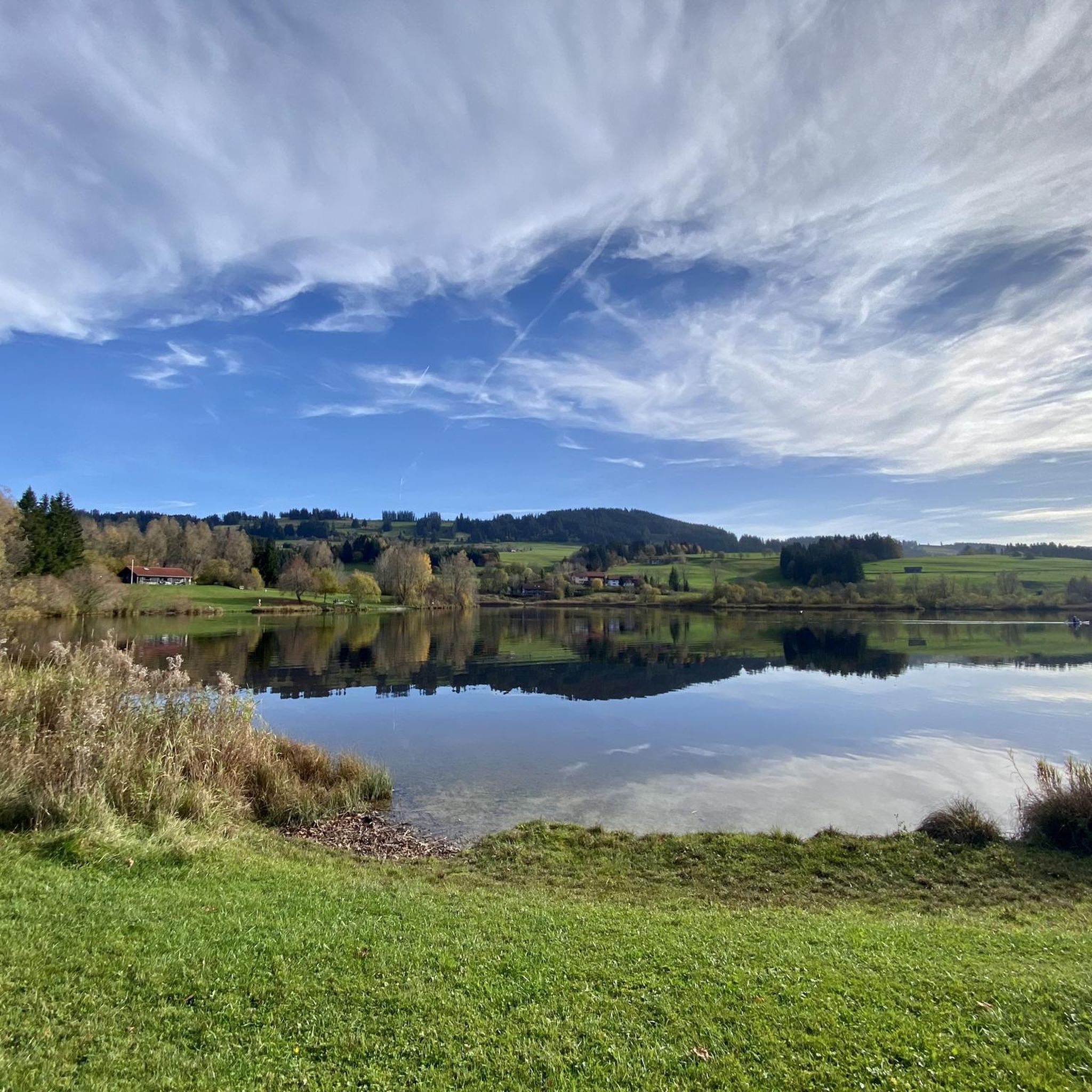
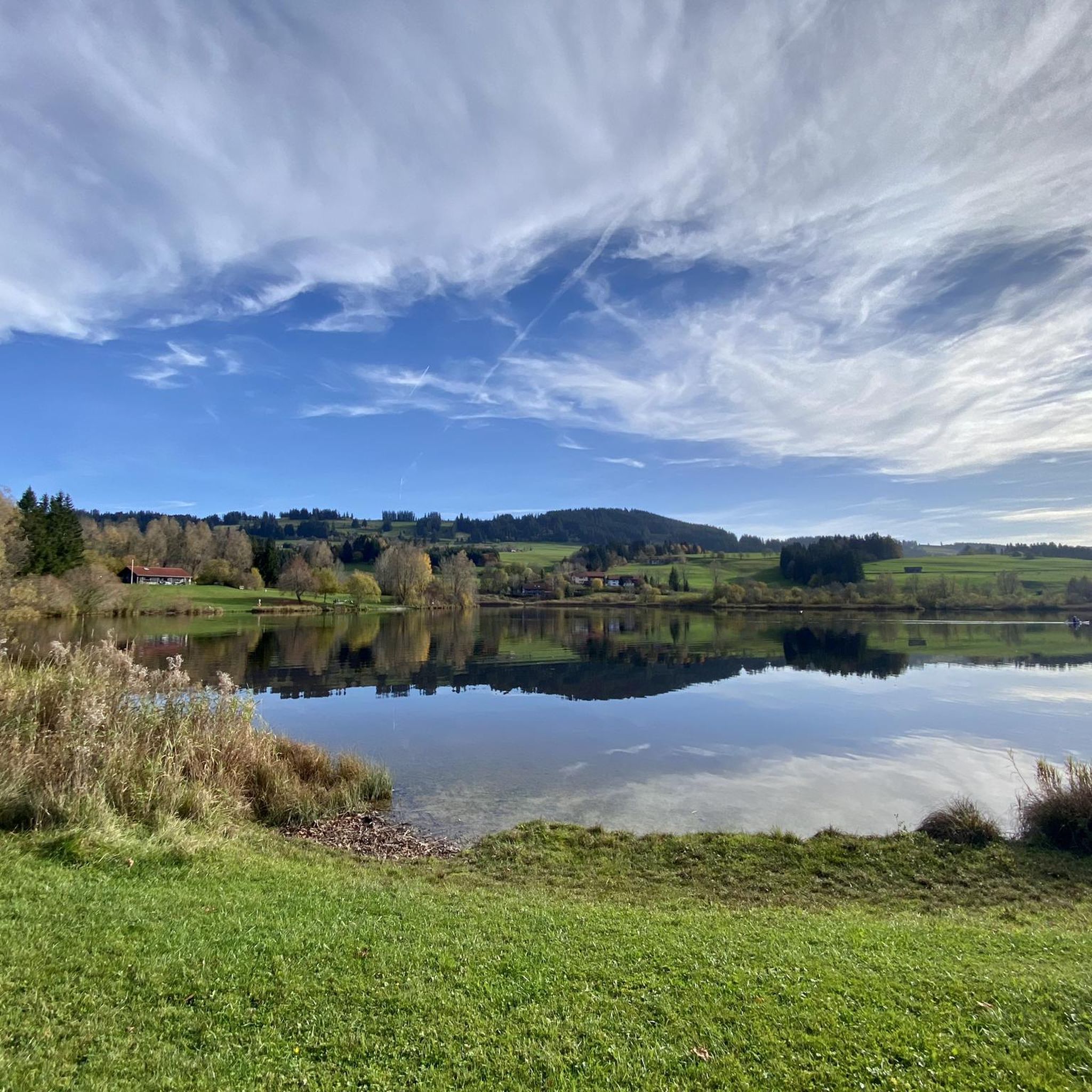
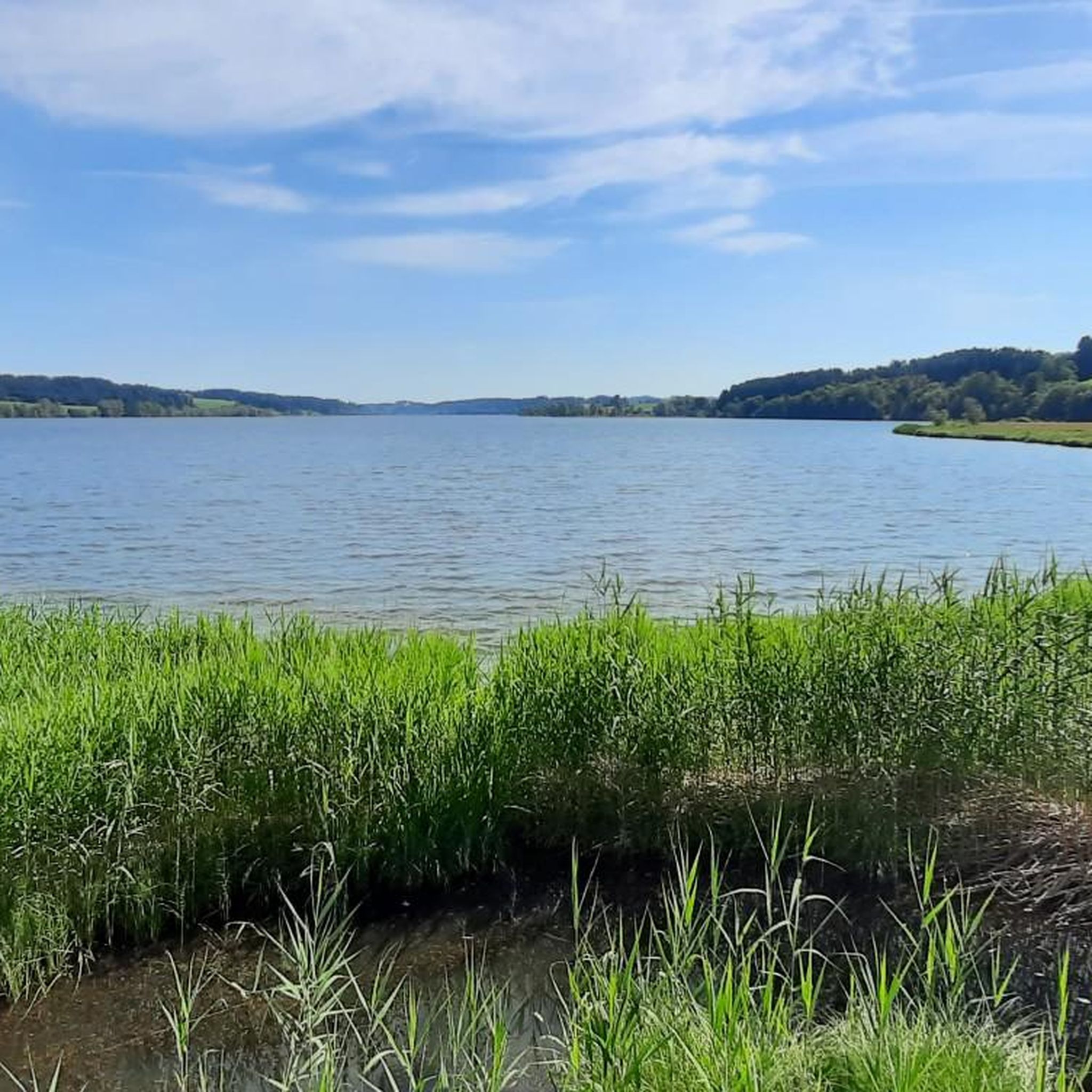
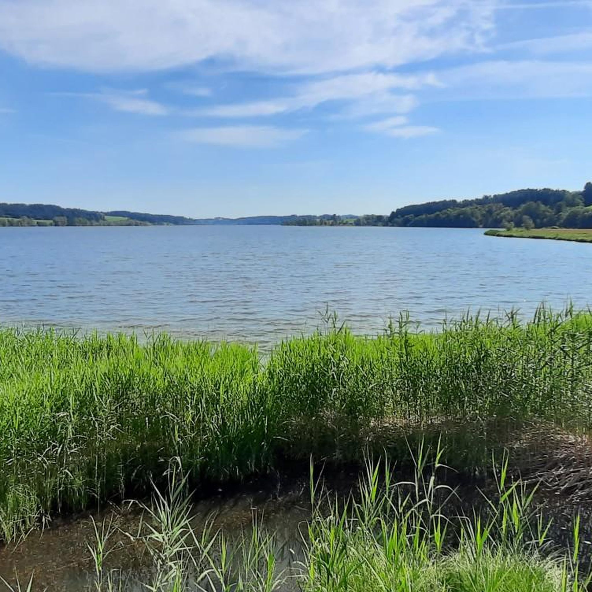
Hiking around Rottachsee offers diverse trails within the pre-Alpine region of Allgäu, Germany. The area features a tranquil artificial lake, rolling pre-Alpine hills, and distant views of the Allgäu Alps, including the prominent Grünten peak. Hikers encounter varied terrain, from soft forest floors and wide meadows to gravel paths around the lake, with ecologically protected areas fostering diverse flora and fauna.
Best hiking trails around Rottachsee
- The most popular hiking route is View of Rottachsee – Geratser Waterfall loop from…
Last updated: July 1, 2026
4.8
(359)
1,733
hikers
Moderate hike. Good fitness required. Easily-accessible paths. Suitable for all skill levels.
3.8
(37)
125
hikers
8.34km
02:14
100m
100m
Moderate hike. Good fitness required. Easily-accessible paths. Suitable for all skill levels.

Sign up for free
4.5
(17)
92
hikers
16.0km
04:44
470m
460m
Moderate hike. Good fitness required. Easily-accessible paths. Suitable for all skill levels.
4.6
(13)
85
hikers
Easy hike. Great for any fitness level. Easily-accessible paths. Suitable for all skill levels.
4.5
(8)
34
hikers
3.72km
01:00
40m
40m
Easy hike. Great for any fitness level. Easily-accessible paths. Suitable for all skill levels.
Get access to more routes and recommendations from other explorers.
Sign up for free
Already have an account?
Our route recommendations are based on thousands of hikes, rides, and runs completed by other people on komoot.
Start today with a free account
Your next adventure awaits.
Login or Signup
Tips from the Community

Rustic section through the forest directly along the stream. very idyllic
0
0

Small wooden bridge over the Geratser Ach, right at the entrance to the forest.
0
0
Very small waterfalls on the Geratser Ach shortly before its confluence with the Kranzegger Bach
0
0

Beautiful circular route around the long lake with idyllic spots.
1
0

Beautifully situated with great viewpoints
1
0
Beautifully situated with great viewpoints
1
0
Beautifully situated with great viewpoints
1
0
Beautifully situated with great viewpoints
1
0
Frequently Asked Questions
What kind of terrain can I expect on hiking trails around Rottachsee?
The Rottachsee area offers a diverse range of terrain. You'll find soft forest floors, wide, well-kept meadows, and gravel paths, particularly around the lake. The landscape includes rolling pre-Alpine hills and offers expansive views of the Allgäu Alps.
Are there any easy hiking trails suitable for beginners or families with young children?
Yes, Rottachsee has several easy trails. For a shorter, family-friendly option, consider the Playground at Rottachsee – View of Lake Rottach loop from Petersthal, which is just over 4.6 km and features minimal elevation gain. Many sections of the main circular path around the lake are also suitable for strollers.
Can I find circular hiking routes around Rottachsee?
Absolutely. The most prominent circular route is the Rottachsee Circular Path, which is approximately 13-15 kilometers long and encircles the entire lake. Other popular circular options include the Viewing Platform at Rottachsee – Eastern shore of the Rottachsee loop from Petersthal, offering continuous lake perspectives.
Are there any trails that feature waterfalls near Rottachsee?
Yes, you can experience waterfalls on some routes. The View of Rottachsee – Geratser Waterfall loop from Petersthal is a moderate 16 km trail that includes views of the lake and the Geratser Waterfall, located in the nearby municipality of Rettenberg.
What are some notable viewpoints or landmarks to look out for while hiking?
Hikers can enjoy various scenic spots. The Eastern shore of the Rottachsee offers beautiful views, and there's a dedicated Viewing Platform on the eastern side of the lake for excellent photography opportunities. You'll also frequently see the prominent Grünten peak, known as the 'Guardian of the Allgäu,' providing a dramatic backdrop.
Is Rottachsee a dog-friendly hiking destination?
Rottachsee is generally welcoming for dogs, with many trails suitable for walks with your canine companion. The wide paths around the lake and through meadows provide ample space. However, always ensure your dog is on a leash, especially in ecologically protected areas and near wildlife habitats, and be mindful of local regulations.
What is the best time of year to go hiking around Rottachsee?
The pre-Alpine region around Rottachsee is beautiful throughout much of the year. Spring, summer, and early autumn offer pleasant temperatures for hiking, with the lake's clear waters inviting for breaks. The distant mountain vistas are particularly stunning on clear days. While specific winter hiking information isn't detailed, the area's natural beauty makes it appealing across seasons.
Are there places to eat or get refreshments along the hiking trails?
Yes, you'll find convenient spots for refreshments. The Petersthal Kiosk at Rottachsee and the Kiosk at Bisseroysee are good options. The lake's shores, especially in villages like Petersthal and Moosbach, also feature recreational areas with facilities.
How many hiking routes are available in the Rottachsee area?
There are over 19 hiking routes available around Rottachsee, catering to various skill levels. These include easy strolls and moderate trails, ensuring there's something for everyone to explore.
What do other hikers enjoy most about hiking in Rottachsee?
The hiking trails around Rottachsee are highly rated by the komoot community, with an average score of 4.5 stars from over 3400 reviews. Hikers often praise the tranquil lake scenery, the diverse terrain ranging from forest paths to open meadows, and the stunning views of the Allgäu Alps, including the prominent Grünten peak.
Is there parking available near the trailheads?
Yes, parking is generally available at various points around Rottachsee, particularly in the villages and at popular recreational areas. Specific parking information for individual trailheads can often be found on detailed route descriptions or local signage.
What kind of wildlife can I expect to see around Rottachsee?
Rottachsee's natural banks and ecologically protected areas, with their mosaic of islands and varied water depths, foster new habitats for diverse flora and fauna. This rich environment makes it a great spot for wildlife observation, particularly birds and other small creatures that thrive in lakeside ecosystems.
Most popular routes around Rottachsee
Most popular attractions around Rottachsee

Get inspired with the komoot mobile app


Explore more
Browse the best Hikes in other regions.
