The best walks and hikes in Cheatham County
4.5
(11)
194
hikers
17
hikes
Hiking in Cheatham County, Tennessee, offers diverse landscapes characterized by rolling hills, lush forests, and winding river valleys. The region is shaped by the Cumberland and Harpeth Rivers, providing scenic routes and natural features. Much of the area is covered by the Cheatham Wildlife Management Area, featuring upland hardwood forests and open fields. This Middle Tennessee county provides varied terrain for outdoor exploration.
Best hiking trails in Cheatham County
- The most popular hiking route is Beaman Park loop — Nashville, a 3.1 miles (5.1 km) trail that takes 1 hour 25 minutes to complete. This easy loop explores the natural beauty of Beaman Park.
- Another top favourite among local hikers is Cumberland River Bicentennial Trail, a difficult 13.3 miles (21.4 km) path. This trail follows the Cumberland River, offering extensive riverside views.
- Local hikers also love the Laurel Woods Trail loop — Beaman Park, a 12.3 miles (19.8 km) trail leading through dense woodlands, often completed in about 5 hours 30 minutes.
- Hiking in Cheatham County is defined by rolling hills, lush forests, and winding river valleys, with routes offering options for various ability levels.
- The routes in Cheatham County are highly rated by the komoot community with an average score of 4.5 stars from over 10 reviews. More than 190 hikers have used komoot to explore Cheatham County's varied terrain.
Last updated: June 23, 2026
1
hikers
4.77km
01:18
50m
110m
The North Fork Laurel Woods Trail offers a delightful journey through varied forest scenery, perfect for a relaxed outing. You'll wander through dense hardwood and pine trees, with the path gently descending into valleys to cross streams before climbing back to ridges. The area around Long Hollow Creek is especially picturesque, featuring beautiful switchbacks that add to the trail's charm. Keep an eye out for wildflowers and local wildlife, particularly if you visit during spring or summer. This route provides a refreshing escape into nature without demanding too much effort.
Starting at the Highland Trailhead, you'll find convenient parking, a picnic area, and trail maps to help you get oriented. The trail is generally accessible throughout the year, and there are no permits or fees required, making it an easy choice for a spontaneous adventure. It's a great option for families or anyone looking for a straightforward hike, and you can complete it in either direction. Consider visiting in the morning for cooler temperatures and a quieter experience.
This segment is part of the larger Laurel Woods Trail system within Beaman Park, known for its lush forest environment. While the broader system includes longer, more moderate sections, the North Fork portion is specifically designed to be easy and family-friendly. The trail's gentle 154 feet (47 metres) of elevation gain over 3.0 miles (4.8 km) makes it suitable for beginners, typically taking about 1 hour and 17 minutes. It's a fantastic way to experience the natural beauty of Davidson County.
1.36km
00:21
0m
0m
Wander along the Cumberland River Bicentennial Trail and discover a peaceful escape just outside Nashville. This easy 0.8-mile (1.4 km) hiking route, with only 7 feet (2 metres) of elevation gain, guides you past impressive limestone bluffs and offers beautiful views of the river, especially in spring and fall. You'll find yourself on a mostly flat path, a mix of paved and hard-packed gravel sections, making it a pleasant 20-minute stroll for nearly everyone.
Planning your visit is straightforward, as the trail is well-maintained and features comfort stations and shaded picnic areas. It's a popular spot, so you might share the path with other walkers, cyclists, and dog owners. The trail is dog friendly, provided your furry friend stays on a leash, making it a great option for a family outing.
This trail is a segment of the historic Tennessee Central Railway, transformed into a "rails-to-trails" path, blending natural beauty with a touch of history. Keep an eye out for plant identification signs and, if you're lucky, you might spot eagles or pelicans, especially during winter. It's a fantastic example of how old infrastructure can be repurposed for accessible outdoor recreation.

Sign up for free
4.36km
01:06
10m
0m
The Eagle Pass section of the Cumberland River Bicentennial Trail offers a delightful, easygoing journey along a converted rail bed, providing continuous views of the Cumberland River. You'll wander past impressive limestone bluffs, picturesque wetlands, and lively streams, with the chance to see vibrant wildflowers and dogwood blooms in spring. Keep an eye out for historic railroad trestle bridges, like the large one spanning Sycamore Creek, which offers expansive vistas, and you might even spot eagles or winter pelicans.
This 2.7-mile (4.4 km) hiking route is rated easy, with a minimal 20 feet (6 metres) of elevation gain, and typically takes just over 1 hour and 5 minutes to complete. It's an ideal choice for a relaxed outing or a family-friendly adventure. For optimal river viewing and wildlife spotting, consider visiting in the spring or fall when the tree canopy is less dense.
This trail is a segment of the broader Cumberland River Bicentennial Trail, repurposing old Tennessee Central Railroad beds for recreational use. Its historical significance, combined with the ecological importance of the Cumberland River and its diverse wildlife, makes it a unique natural feature in the Cheatham County area. It's a perfect spot for beginner hiking in Tennessee.
602m
00:10
10m
0m
Hike the easy 0.4-mile Bluff Trail in Harpeth River State Park, offering scenic views and a gentle 48-foot elevation gain.
22
hikers
4.01km
01:03
30m
30m
Embark on the Hidden Lake and Ridge Loop, an easy hiking route that promises pleasant natural surroundings for a relaxing outing. This trail guides you past the serene Hidden Lake, a perfect spot to pause and enjoy the water's calm. You will also follow sections along the Harpeth River, where you can take in scenic views and watch for local wildlife. The entire loop covers 2.5 miles (4.0 km) with a gentle elevation gain of just 101 feet (31 metres), making it accessible for most. You can comfortably complete this hike in about 1 hour and 2 minutes, offering a quick escape into nature.
Planning your visit to the Hidden Lake and Ridge Loop is straightforward. The trailhead is conveniently located within Harpeth River State Park, where parking is typically available for visitors. This trail is generally accessible year-round, so you can enjoy it in any season. Before heading out, it is always a good idea to check the park's official website for any specific alerts or seasonal information that might affect your trip.
This loop is a family-friendly option, suitable for all ages, making it an excellent choice for a leisurely day outdoors. The route's gentle terrain and clear path ensure a comfortable experience for everyone. Its location within Harpeth River State Park means you are also close to other natural attractions and trails if you wish to extend your adventure. Consider this trail for a peaceful escape into the natural beauty of the area.
5.0
(2)
15
hikers
19.8km
05:27
340m
340m
The Laurel Woods Trail offers a deep dive into Beaman Park's backcountry, winding through lush hardwood and pine forests that burst with wildflowers and vibrant fall foliage. You'll experience a recurring pattern of descending to cross streams, like the scenic Creek in Beaman Park, before climbing back up to ridges, providing a dynamic and engaging journey through varied terrain.
Planning your visit to this challenging route is straightforward, as it's just 25 minutes from downtown Nashville. The trail is dog-friendly, welcoming your furry friends to join the adventure. While the full 12.3-mile (19.8 km) loop is a difficult undertaking with 1119 feet (341 metres) of elevation gain and an estimated duration of 5 hours and 27 minutes, shorter options are available, including a 6-mile loop utilizing the Shortcut Trail.
Opened in October 2020, the Laurel Woods Trail is a relatively new addition to Beaman Park, providing access to previously inaccessible areas and expanding the park's hiking offerings. Its design, with repeating ascents and descents, makes it a notable option for those seeking a substantial workout and a true immersion in nature, distinguishing it from other trails in the Nashville-Davidson area.
1
hikers
21.4km
05:23
20m
20m
Hike the 13.3-mile Cumberland River Bicentennial Trail near Ashland City, Tennessee, offering river views, historic bridges, and wildlife.
5.0
(4)
39
hikers
11.8km
03:15
210m
210m
The Creek in Beaman Park loop offers a refreshing escape into nature, winding through the diverse ecosystems of the Western Highland Rim. You'll traverse thick hardwood forests, follow the meandering Henry Creek, and encounter unique limestone outcroppings. The trail provides a sense of solitude and a chance to spot local wildlife, especially vibrant wildflowers if you visit in spring.
This moderate 7.3-mile (11.8 km) hike involves 680 feet (207 metres) of elevation gain, typically taking about 3 hours and 15 minutes. Parking is available at Beaman Park, which serves as the trailhead. The park is accessible year-round, but spring is particularly beautiful for the blooming wildflowers; consider an early start to beat any crowds.
Beaman Park is a significant natural sanctuary near Nashville, known for its diverse plant communities, including rare hillside barrens and post oak woodlands. It's home to a rare shortleaf pine population and the state-listed Eggert's sunflower. This trail is a popular choice for those seeking a substantial yet manageable outdoor adventure with rich natural features.
7
hikers
1.72km
00:27
10m
10m
Easy hike. Great for any fitness level. Easily-accessible paths. Suitable for all skill levels.
Get access to more routes and recommendations from other explorers.
Sign up for free
Already have an account?
Our route recommendations are based on thousands of hikes, rides, and runs completed by other people on komoot.
Start today with a free account
Your next adventure awaits.
Login or Signup



Tips from the Community

The trailhead at Marks Creek includes parking, restrooms, and trail signage. The route passes through varied landscapes, including forests, wetlands, and river views.
0
0
This bridge spans a tributary of the Cumberland River, offering a scenic vantage point on the trail. Its sturdy construction ensures safe passage for visitors while providing a striking visual element to the overall trail experience.
1
0
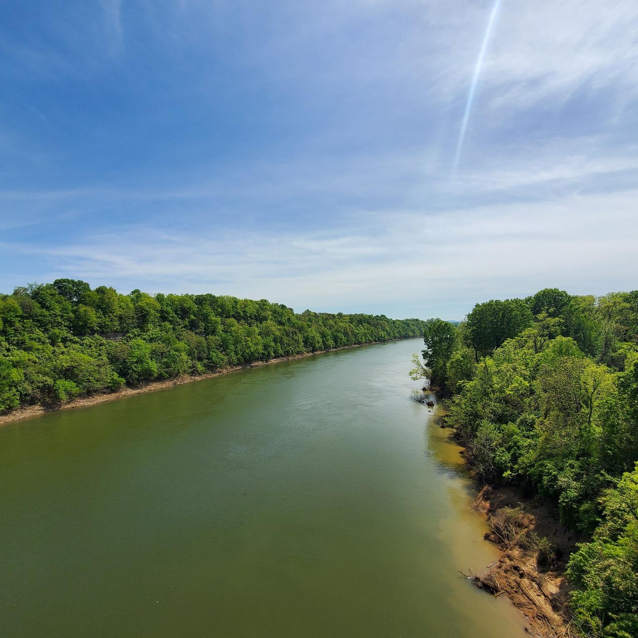
The river winds through a beautiful valley, offering scenic views of rolling hills, limestone bluffs, and lush forests. Keep your eyes peeled for wildlife sightings along the way!
0
0
Hidden Lake wasn't always a lake. In the 1800s, it was a limestone quarry, and the excavation is what created the lake bed we see today. During Prohibition (1920s), whispers swirled about hidden speakeasies and illegal moonshine operations happening around the secluded lake.
0
0
The trail winds through a lush forest with a mix of hardwood and pine trees, providing a refreshing escape into nature. With a moderate difficulty level, it's a perfect choice for hikers of most experience levels, including families with children.
0
0


Beaman Park is a small nature park outside of Nashville with diverse wildlife, lush woods, and offers a great break from the city.
0
0
Frequently Asked Questions
What kind of terrain can I expect on hiking trails in Cheatham County?
Cheatham County offers a diverse landscape characterized by rolling hills, lush forests, and winding river valleys. You'll find trails along the Cumberland and Harpeth Rivers, as well as within the extensive Cheatham Wildlife Management Area, which features upland hardwood forests and open fields. The terrain varies from easy, flat paths to more challenging routes with moderate elevation changes.
Are there easy hiking trails suitable for beginners or families in Cheatham County?
Yes, Cheatham County has several easy trails perfect for beginners and families. For instance, the Beaman Park loop — Nashville is an easy 3.1-mile (5.1 km) trail. Another great option is the Hidden Lake Trails loop — Harpeth River State Park, which is also considered easy. The county offers 9 easy routes out of 12 total, providing plenty of accessible options.
What are some notable natural features or landmarks to see while hiking in Cheatham County?
Cheatham County is rich in natural beauty. You can explore the scenic Cumberland River and Harpeth River, which define much of the landscape. The Narrows of the Harpeth River, now a state park, features dramatic rock formations and waterways. Additionally, the Cheatham Wildlife Management Area offers extensive forests and opportunities for wildlife observation. The historical Mound Bottom site along the Harpeth River also provides a cultural dimension to the natural landscape.
Are there any loop hikes available in Cheatham County?
Yes, several trails in Cheatham County are designed as loops, offering a convenient way to explore without retracing your steps. Popular loop options include the Beaman Park loop — Nashville and the Hidden Lake Trails loop — Harpeth River State Park. For a longer challenge, consider the Laurel Woods Trail loop — Beaman Park.
What is the average length and duration of hikes in Cheatham County?
The hiking trails in Cheatham County vary in length and duration. You can find shorter, easy walks like the Montgomery Bell tunnel loop from Narrows Of The Harpeth, which is about 1.1 miles (1.7 km) and takes around 25 minutes. Longer, more challenging routes, such as the Cumberland River Bicentennial Trail — Ashland City, can extend over 13 miles (21.4 km) and take several hours to complete.
What do other hikers say about the trails in Cheatham County?
The trails in Cheatham County are highly regarded by the komoot community, with an average rating of 4.5 stars from over 10 reviews. Hikers often praise the diverse terrain, from rolling hills to riverside paths, and the natural beauty of the forests and waterways. Many appreciate the variety of routes available for different skill levels.
Are there opportunities for wildlife viewing while hiking in Cheatham County?
Yes, Cheatham County is an excellent area for wildlife observation. The Cheatham Wildlife Management Area, covering over 20,000 acres, is home to diverse species and is a recognized spot for birdwatching. Hikers often encounter various birds and other local wildlife within the lush forests and along the riverbanks, especially in quieter areas away from main roads.
Is Cheatham County suitable for winter hiking?
While specific winter conditions can vary, Cheatham County's trails, particularly those in the Cheatham Wildlife Management Area or along the Cumberland River Bicentennial Trail, can be explored during winter. The rolling hills and forests offer a different kind of beauty in the colder months. Always check local weather conditions and trail accessibility before heading out, and dress in appropriate layers.
What should I wear or bring for a hike in Cheatham County?
For hiking in Cheatham County, it's advisable to wear comfortable, layered clothing suitable for the season, sturdy hiking shoes, and bring plenty of water. Depending on the trail and time of year, insect repellent can be useful. For longer hikes, consider packing snacks and a map or GPS device, as some areas, particularly within the Cheatham Wildlife Management Area, can be extensive.
Are there any trails that follow the Cumberland River?
Absolutely. The Cumberland River Bicentennial Trail — Ashland City is a prime example. This difficult 13.3-mile (21.4 km) path is a rail-to-trail project that follows the Cumberland River, offering extensive riverside views and a unique perspective of the waterway and surrounding landscape.
Are there any trails near Bells Bend Park?
Yes, Bells Bend Park offers several hiking opportunities. You can explore the Dove Farm & River Loop — Bells Bend Park, an easy 4.7-mile (7.6 km) trail. Another option is the Cumberland River loop from Bells Bend Park, which is about 3.4 miles (5.4 km) long.
Most popular routes in Cheatham County

Get inspired with the komoot mobile app


Didn’t find what you were looking for?
Check out more Hikes throughout Cheatham County below and find the perfect route in your destination.
Explore more
Browse the best Hikes in other regions.
