The best walks and hikes around Loisieux
4.5
(1153)
11,253
hikers
184
hikes
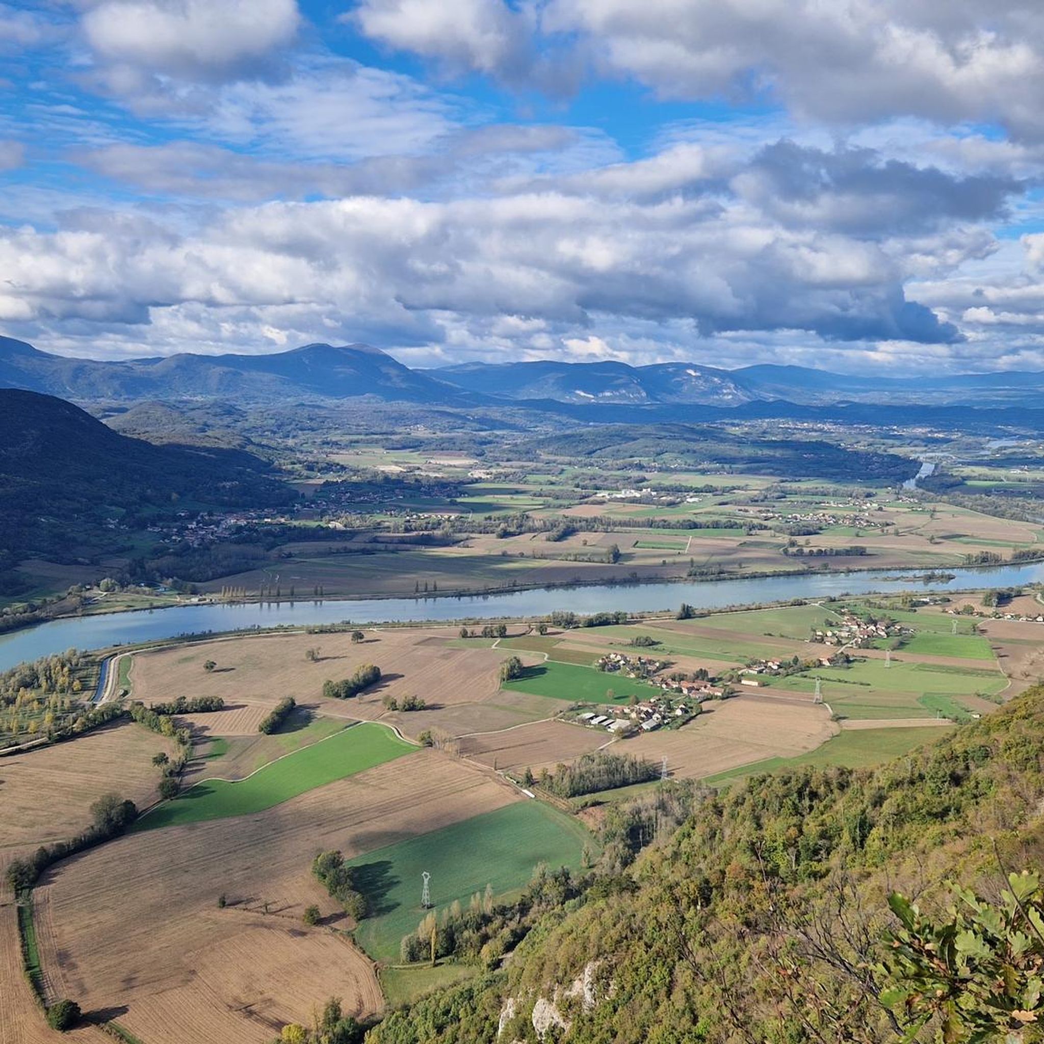
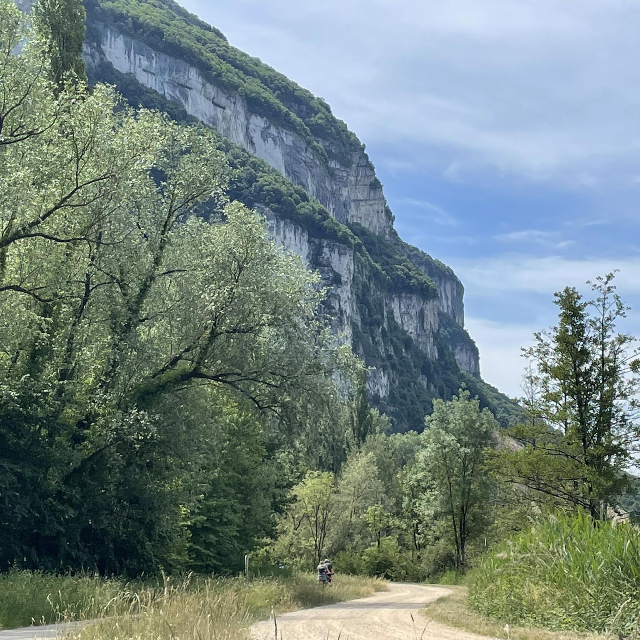
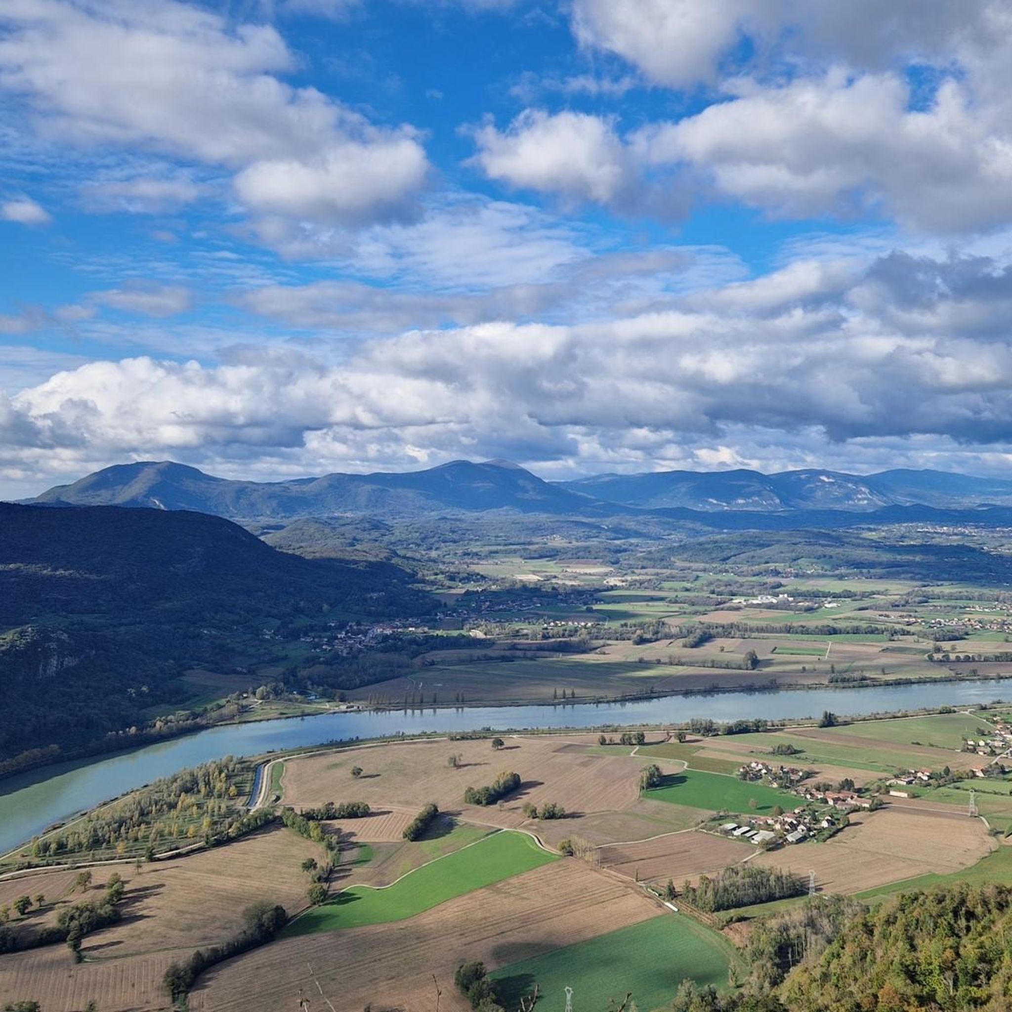
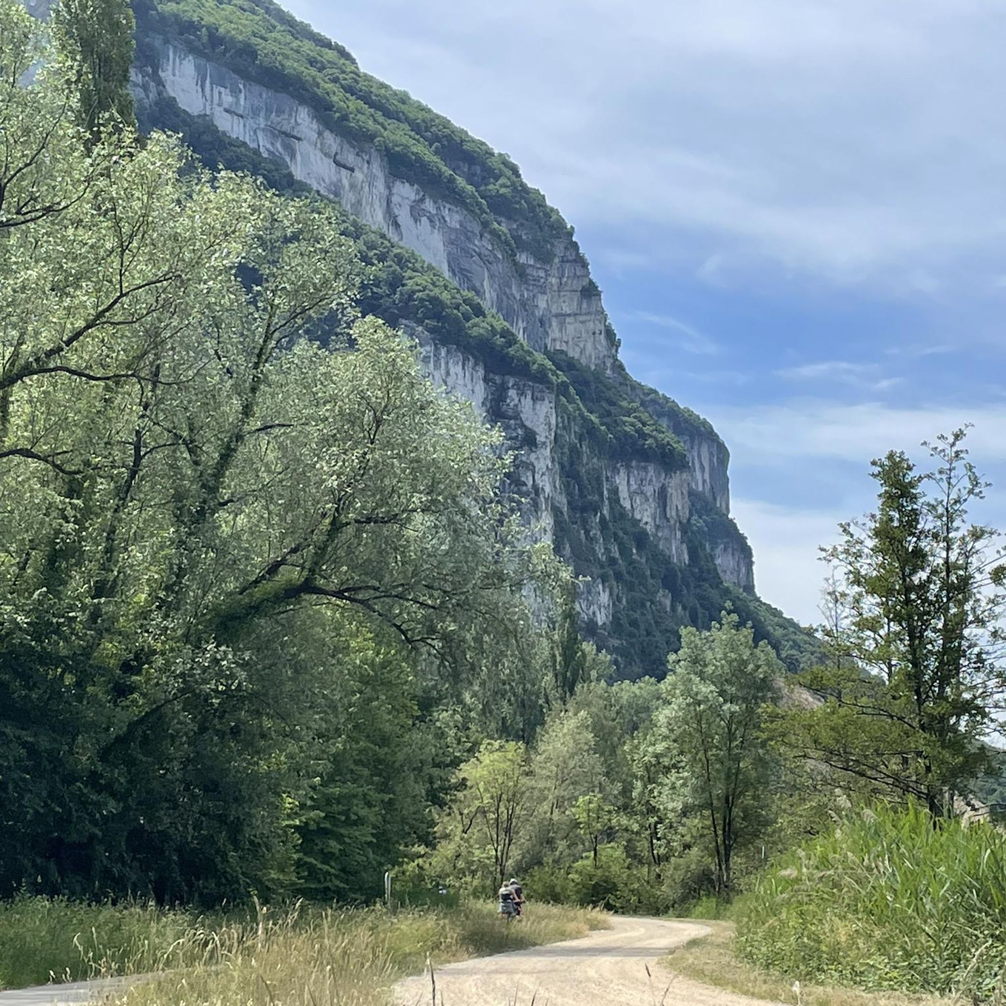
Hiking around Loisieux offers varied landscapes, including panoramic views of the Rhône river and the Jura mountains from elevated points. The terrain features a mix of hills and low mountains, with significant forest cover and agricultural areas. This blend provides routes through wooded paths and open countryside, catering to diverse hiking experiences.
Best hiking trails around Loisieux
- The most popular hiking route is Sons' Lookout – Mount Tournier loop from Saint-Maurice-de-Rotherens, a 7.1 miles (11.4 km) trail that takes…
Last updated: June 28, 2026
4.6
(12)
70
hikers
11.4km
03:21
330m
320m
Moderate hike. Good fitness required. Easily-accessible paths. Suitable for all skill levels.
4.8
(10)
19
hikers
8.10km
02:32
300m
300m
Moderate hike. Good fitness required. Easily-accessible paths. Suitable for all skill levels.

Sign up for free
4.5
(6)
12
hikers
6.18km
01:50
190m
190m
Easy hike. Great for any fitness level. Easily-accessible paths. Suitable for all skill levels.
10
hikers
8.35km
02:35
280m
280m
Moderate hike. Good fitness required. Easily-accessible paths. Suitable for all skill levels.
5.0
(3)
16
hikers
6.79km
01:57
170m
160m
Easy hike. Great for any fitness level. Easily-accessible paths. Suitable for all skill levels.
Get access to more routes and recommendations from other explorers.
Sign up for free
Already have an account?
Our route recommendations are based on thousands of hikes, rides, and runs completed by other people on komoot.
Start today with a free account
Your next adventure awaits.
Login or Signup


Tips from the Community

Dizzying belvedere from the top of Mont Tournier, view of the Grand Thur, the Grand Colombier and of course the Rhône.
1
0


Very nice rest area with a magnificent view over the Rohne valley.
4
0

Wonderful viewpoint high above the Rhone
2
0

Great view of the Rhone and the valley. Perfect for a little break.
3
0

Superb view that deserves the climb to Mont Tournier and a short stretch of path in a meadow!
3
0
The Fils site offers a breathtaking panorama! It is from a 500m cliff that the visitor discovers at 180 ° the meanders of the Rhône, wild and canalized. The reading table gives the names of the charming villages bordering the Fleuve-Roi. From the Son Site, the gaze focuses on the last links of the Jura and the departments of Savoie and Ain. In summer, this blue river that stands out from the landscape is a real gem of nature. In the fall and winter, photographers will also appreciate the sea of clouds forming just below their feet. The fauna and flora of the place are also part of the beauty of the site with the presence of certain rare and preserved flowers. Open your eyes ! The site takes its name from the harp antenna built in 1912 by the engineer Galletti, the wires leaving from the station located in Champagneux to climb to the top of the cliff. This wireless telegraph station was the most powerful in the world at the time. Today, it is a well-known take-off site for paragliders. Source: https://www.savoie-mont-blanc.com/offre/fiche/belvedere-du-site-des-fils/117238
3
0
Frequently Asked Questions
How many hiking trails are there around Loisieux?
Loisieux offers a wide variety of hiking experiences, with over 170 trails available. These routes cater to different preferences, ranging from easy strolls to more challenging treks.
What are the different difficulty levels for hiking in Loisieux?
The trails around Loisieux are diverse, with options for all abilities. You'll find approximately 60 easy routes, 86 moderate trails, and 25 more difficult hikes, ensuring there's something suitable whether you're looking for a gentle walk or a strenuous adventure.
What kind of landscapes can I expect to see while hiking in Loisieux?
Hiking in Loisieux offers stunning panoramic views, especially over the Rhône river and the Jura mountains from elevated points like the Recorba Viewpoint and Sons' Lookout. The terrain is a beautiful mix of hills, low mountains, extensive forests, and agricultural lands, providing varied scenery through wooded paths and open countryside.
Are there any notable viewpoints or landmarks along the trails?
Absolutely. Many trails lead to breathtaking viewpoints. The Sons' Lookout – Mount Tournier loop from Saint-Maurice-de-Rotherens offers incredible vistas of the Rhône river and Jura mountains. Another highlight is Pierre Vire, a unique rock formation with a wonderful view, which you can experience on the Mount Tournier – Pierre Vire loop from Saint-Maurice-de-Rotherens.
Are there any family-friendly hiking options in Loisieux?
Yes, Loisieux has several easy trails perfect for families. The Cave with Creek – Recorba Viewpoint loop from Loisieux is an easy 6.2 km route that takes about 1 hour 50 minutes, leading through forests and open countryside. The Sons' Lookout loop from Saint-Maurice-de-Rotherens is another accessible option, offering great views on an easy 6.9 km path.
Can I find circular walks in Loisieux?
Yes, many of the popular hiking routes in Loisieux are circular, allowing you to start and end at the same point without retracing your steps. Examples include the Sons' Lookout – Mount Tournier loop and the Cave with Creek – Recorba Viewpoint loop.
What do other hikers say about the trails in Loisieux?
The hiking routes in Loisieux are highly rated by the komoot community, with an impressive average score of 4.4 stars from nearly 1000 reviews. Hikers often praise the stunning panoramic viewpoints over the Rhône Valley, the varied terrain, and the well-maintained paths through forests and open countryside.
Are there any lakes or water features near the hiking trails?
While Loisieux itself is known for its river views, the broader region offers beautiful lakes. Lake Bourget, one of France's largest natural lakes, is located approximately 9.8 km to the east. Other nearby lakes include Lac d'Aiguebelette and Lac de Barterand, offering additional natural beauty to explore.
What is the best time of year to hike in Loisieux?
The Rhône Valley landscape around Loisieux is particularly beautiful in summer with its blue river. In autumn and winter, the area can present a 'sea of clouds' phenomenon, which is especially appealing to photographers. The varied terrain and forest cover make it enjoyable across multiple seasons, but always check local weather conditions before heading out.
Are there any other attractions or points of interest to visit near Loisieux?
Beyond the hiking trails, the area around Loisieux boasts several points of interest. You can explore mountain passes like Col du Chat and Épine Pass. For cyclists, the ViaRhôna Cycle Path runs along the Rhône nearby. Additionally, viewpoints like Mont du Chat lookout offer expansive views of the region.
Are the trails around Loisieux suitable for dog walking?
While many trails in France are dog-friendly, it's always recommended to keep dogs on a leash, especially in agricultural areas or near wildlife. There are no specific restrictions mentioned for Loisieux, but always be mindful of local signage and other hikers. The varied terrain and forest paths generally offer good conditions for walks with your dog.
Most popular routes around Loisieux
Most popular attractions around Loisieux

Get inspired with the komoot mobile app


Explore more
Browse the best Hikes in other regions.
