Top 8 Mountain Passes around Meyrieux-Trouet
Mountain passes near Meyrieux-Trouet offer diverse terrain and scenic routes within the Savoie department of France. This region is characterized by its mountainous landscape, providing opportunities for various outdoor activities. The area features passes with varying elevations, from lower routes offering lake views to higher alpine challenges. Meyrieux-Trouet serves as a starting point for exploring these natural features and the surrounding French Alps.
Best mountain passes around Meyrieux-Trouet
- The most popular mountain passes is Col du Chat (638 m),…
Last updated: July 10, 2026
Col du Chat (638 m)
Highlight • Mountain Pass
Translated by Google •
Tip by

Épine Pass
Highlight • Summit
The pass is closed in winter
Translated by Google •
Tip by

Sign up now to discover places like this
Get recommendations on the best single tracks, peaks, & plenty of other exciting outdoor places.
Sign up for free
Crucifix Pass
Highlight • Mountain Pass
Translated by Google •
Tip by

Col du Banchet
Highlight • Mountain Pass
Translated by Google •
Tip by

Col de la Lattaz (754 m)
Highlight • Mountain Pass
Translated by Google •
Tip by

Sign up for free to discover even more mountain passes around Meyrieux-Trouet.
Sign up for free
Already have an account?
Start today with a free account
Your next adventure awaits.
Login or Signup


Tips from the Community

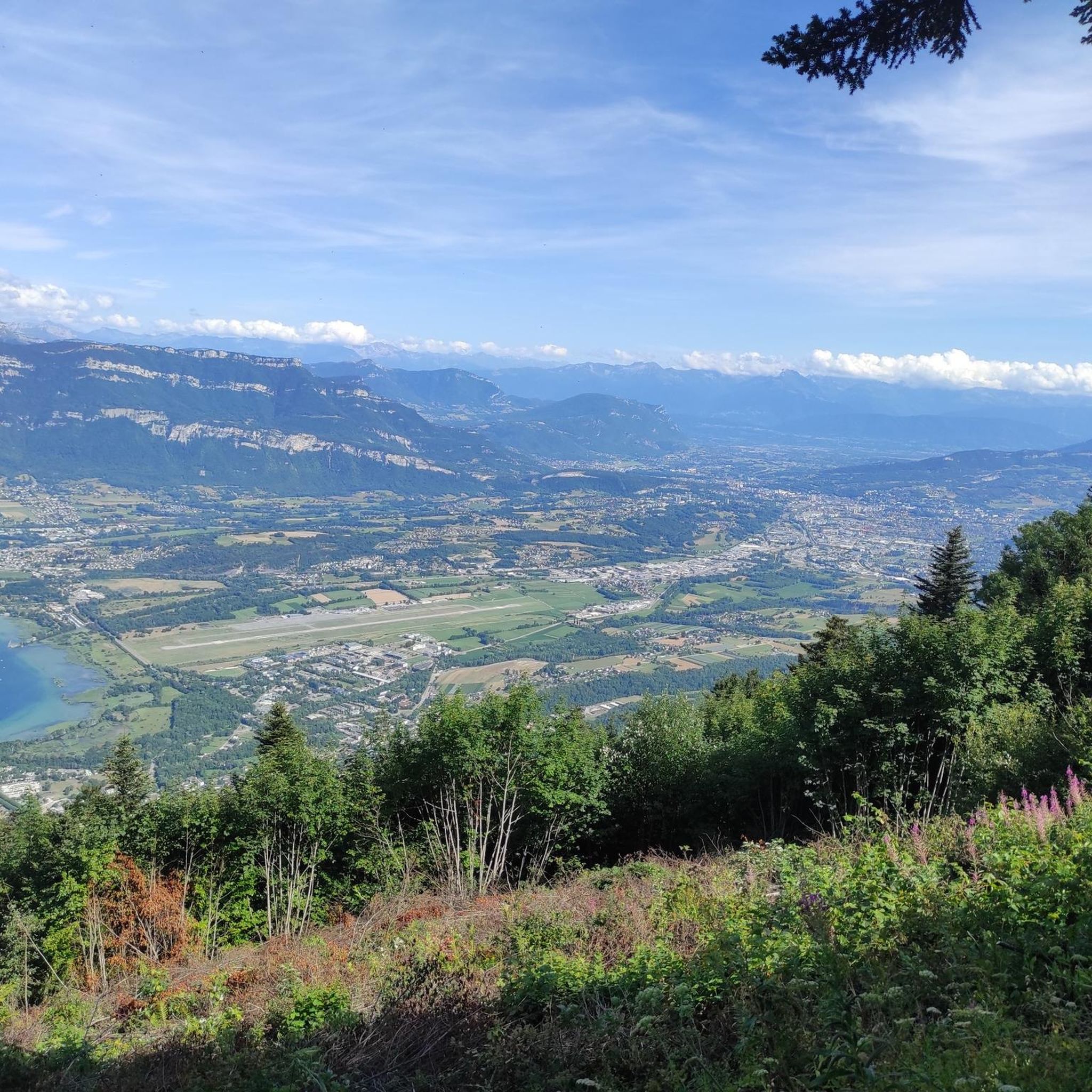
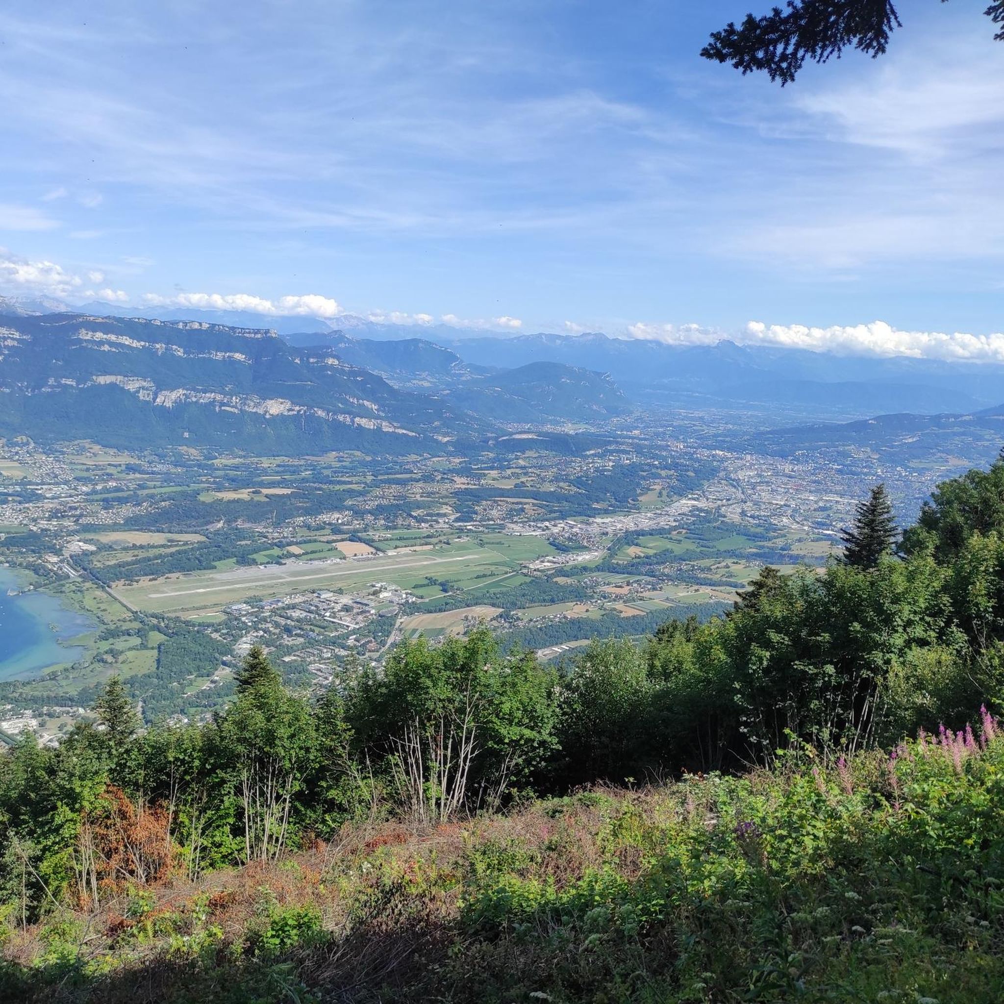
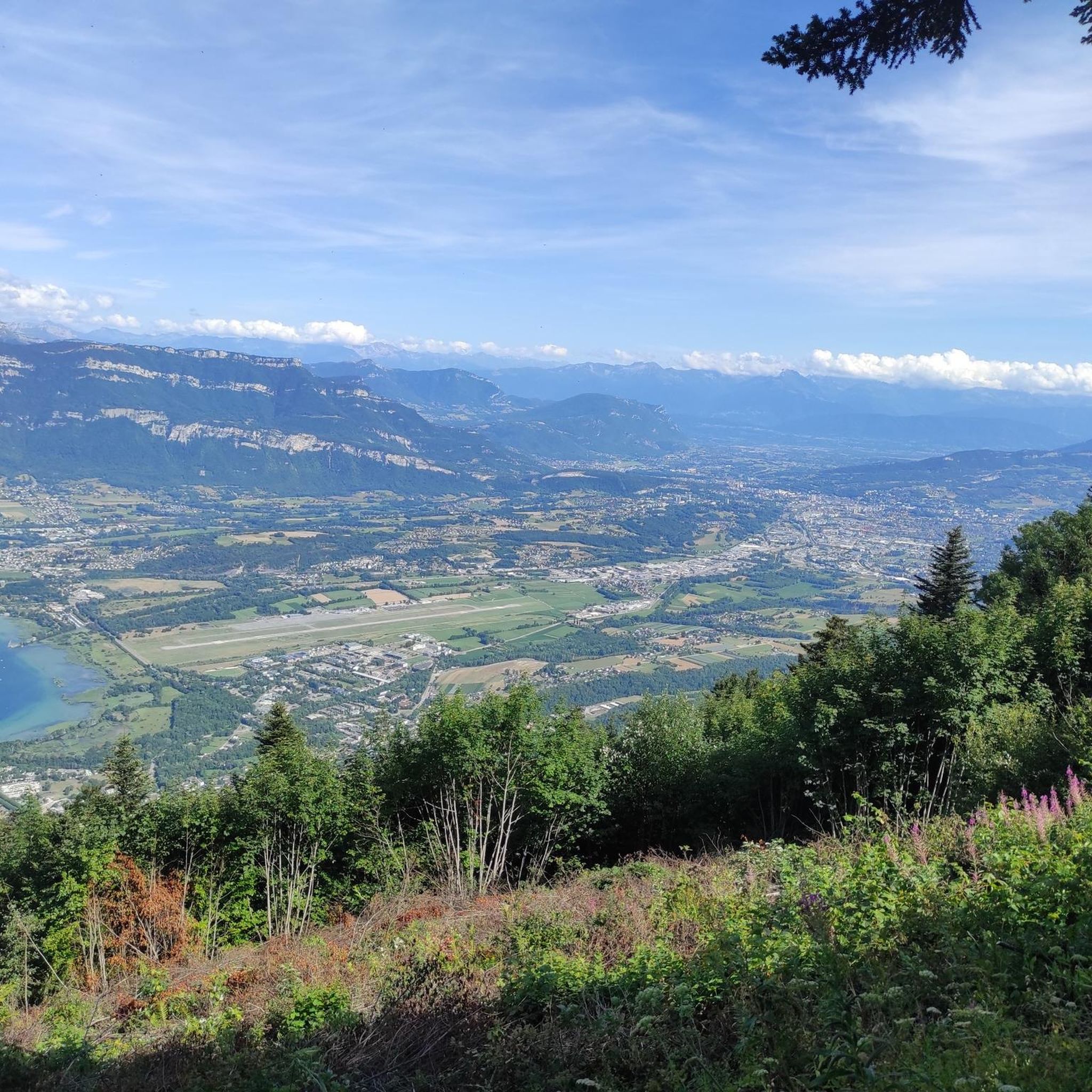
It's a must-see place with a magnificent view of Lake Bourget.
1
0


A very quiet and pleasant road. On the Chambéry side, a good part is in the shade, the slope of the main road is rather constant around 7-8%. On the Novalaise side, the mineral aspect with the cliff is more present in the middle of the climb. This side is quite steep with kilometers at 8-9%. On each side, 1 belvedere offers a breathtaking view of Lake Aiguebelette (approx. 2 km from the summit) and on the other side of Chambéry, the Bauges, Belledonne, the Chartreuse (500 m from the summit). The summit is in the forest.
1
0

Leaving from Chambery, the beginning hurts a little, but the rest is quite good
0
1

There is a mistake about the valleys!
2
0

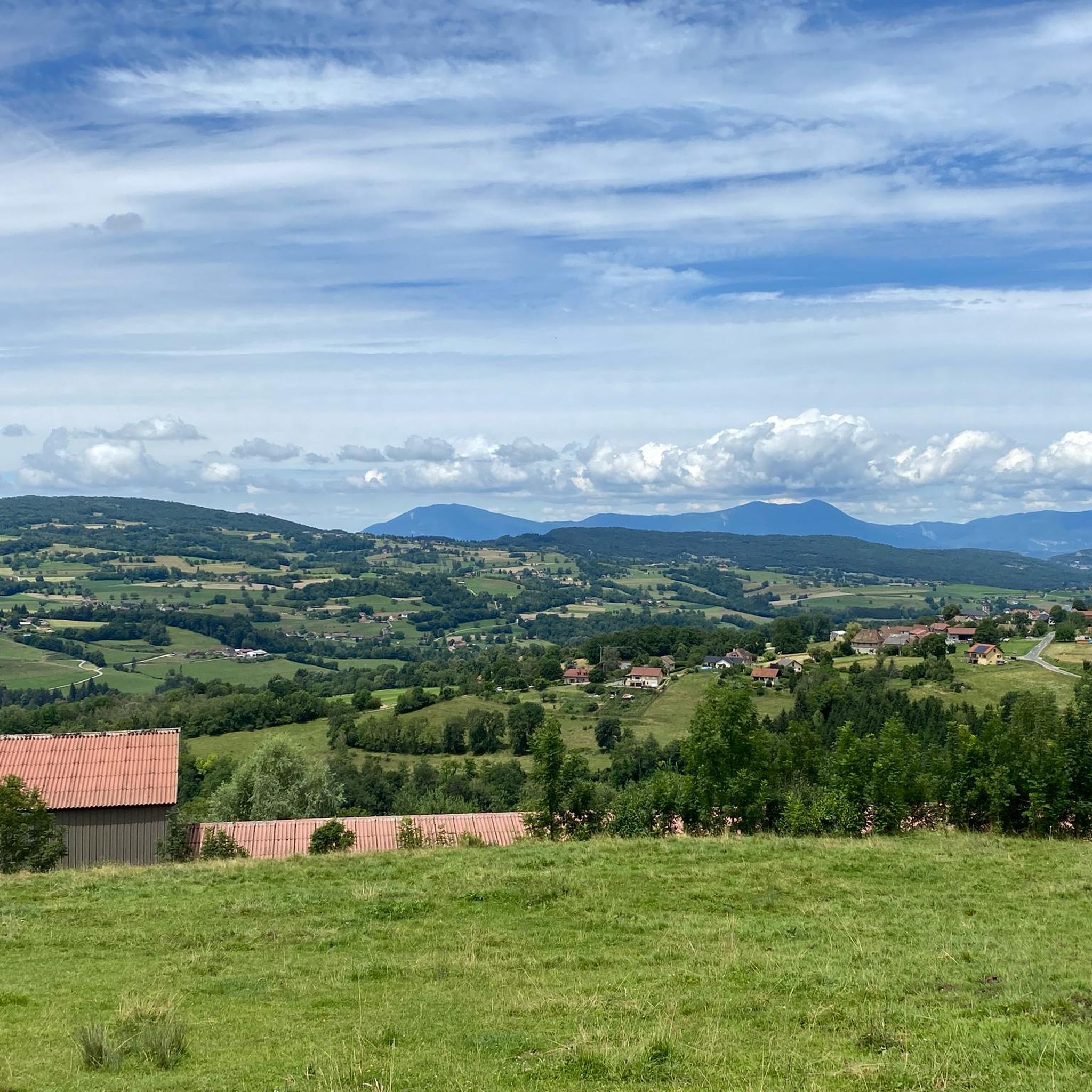
Pass without too much traffic. Quite steep start to reach Saint Sulpice, the rest is rather regular. The pass is closed in winter
2
0

Unmissable “road cycling” of the Col de l'Épine located at an altitude of 990 m.
1
0

The Col d'Épine connects the Thônes and Faverges valleys. At the summit, which rises to an altitude of 987 m, to the west you have a breathtaking view of Chambéry, the south of Lake Bourget and the Bauges massif. On the eastern slope, you can enjoy a superb panoramic view of Lake Aiguebelette.
1
0
Frequently Asked Questions
What are the most popular mountain passes to visit near Meyrieux-Trouet?
Among the most popular passes are Col du Chat (638 m), known for its fantastic lake views during the eastern ascent, and Épine Pass, which offers breathtaking views of Chambéry, Lake Bourget, and Lake Aiguebelette from its 987-meter summit. Another appreciated pass is Col du Banchet, a shaded route where the view rewards the effort.
What kind of views can I expect from the mountain passes in the Savoie region?
The passes in the Savoie region offer diverse and stunning views. From Col du Chat (638 m), you'll see beautiful lake vistas during the climb. Épine Pass provides panoramic views of Chambéry, Lake Bourget, and the Bauges massif to the west, and Lake Aiguebelette to the east. Higher passes like Col du Galibier offer expansive views across the Barre des Écrins and the peaks of Savoie and Queyras, while Col de l'Iseran boasts breathtaking views of the Vanoise massif.
Are there any historically significant mountain passes in the area?
Yes, the region has passes with historical importance. The Crucifix Pass is noted as a former place of passage on the Sardinian way, with wayside crosses that symbolize local piety and history. Further afield, Col du Mont Cenis, on the border with Italy, historically served as a crucial passageway through the Alps, linking the Maurienne and Susa valleys.
What is the best time of year to visit the mountain passes around Meyrieux-Trouet?
The best time to visit depends on the pass's elevation. Lower passes like Col du Chat (638 m) are generally accessible year-round, though conditions can vary. Higher alpine passes, such as Col du Galibier and Col de l'Iseran, are typically open during summer months, usually from June to October, due to heavy snow in winter. Épine Pass is closed during winter months.
Are there family-friendly mountain passes or activities near Meyrieux-Trouet?
While specific family-friendly designations for passes aren't always explicit, many passes offer scenic drives and opportunities for gentle walks with children. The Col du Chat (638 m) offers accessible views, and the surrounding areas often have picnic spots. For more structured family activities, consider exploring the lower sections of passes or nearby towns that cater to tourists.
What outdoor activities can I do near these mountain passes?
The region around Meyrieux-Trouet is excellent for various outdoor activities. You can find numerous routes for cycling, gravel biking, and running. For cycling, explore routes like the 'Col de l'Épine viewpoint – Épine Pass loop' or the 'Mont du Chat lookout 🐱 – Mont du chat relay antenna loop'. Gravel biking options include the 'Jongieux Vineyards Crossing'. Running enthusiasts can enjoy trails such as the 'Molard Noir loop'. You can find more details on these activities in the Gravel biking around Meyrieux-Trouet, Running Trails around Meyrieux-Trouet, and Cycling around Meyrieux-Trouet guides.
Are there challenging mountain passes for experienced cyclists?
Absolutely. The Savoie region is renowned for its challenging passes, many of which are legendary for their inclusion in the Tour de France. The Épine Pass has a quite steep start. Further afield, Col du Galibier, Col de l'Iseran, Col de la Madeleine, and Col du Glandon are considered highly demanding for cyclists, featuring significant climbs and steep sections.
Where can I find accommodation or places to eat near the mountain passes?
Near passes like Col du Chat (638 m) and Épine Pass, you'll find various options in nearby towns and villages. The areas around Lac du Bourget and Lac d'Aiguebelette, which are visible from these passes, offer a range of cafes, restaurants, and accommodation choices. For specific recommendations, it's best to check local listings in towns like Yenne or those closer to the pass access points.
What are the typical conditions for winter hiking or visiting mountain passes in winter?
Winter conditions on mountain passes in the Savoie region can be severe. Many higher passes, such as Col du Galibier, Col de l'Iseran, and Épine Pass, are closed due to heavy snow and ice. Lower passes might remain accessible, but trails can be slippery or covered in snow. It's crucial to check local weather forecasts and road conditions before planning any winter visit and to be equipped for cold weather and potentially icy terrain.
How accessible are the mountain passes by public transport or car?
Access largely depends on the specific pass. Many passes are accessible by car, with parking available at or near the summit or trailheads. For example, parking is generally available for Col du Chat (638 m) and Épine Pass. Public transport options directly to the passes can be limited, especially for higher or more remote ones. It's often necessary to use a combination of public transport to a nearby town and then drive or cycle to the pass itself.
What makes Cormet de Roselend a unique mountain pass?
Cormet de Roselend is particularly cherished for its picturesque location amidst mountain pastures, where you can often hear the bells of Tarine cows. It's known as the 'land of Beaufort' cheese, offering a chance to discover the region's culinary heritage alongside its natural beauty. It's also a legendary pass that has been featured in the Tour de France, making it a favorite for cyclists and those seeking scenic drives.
Can I find shaded routes among the mountain passes near Meyrieux-Trouet?
Yes, some passes offer shaded sections, which can be particularly pleasant during warmer months. Col du Banchet is specifically described as a 'small shaded pass and without any difficulty,' making it a good option if you prefer routes with natural cover.
Most popular routes around Meyrieux-Trouet
Most popular attractions around Meyrieux-Trouet

Get inspired with the komoot mobile app


Explore more
See even more epic mountain passes by checking out these guides around Meyrieux-Trouet:
