The best running trails around Charbonnières-Les-Sapins
4.2
(43)
1,491
runners
89
runs
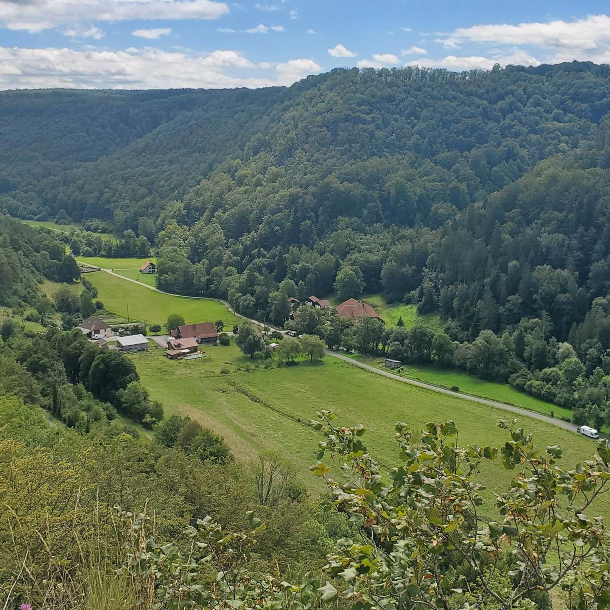
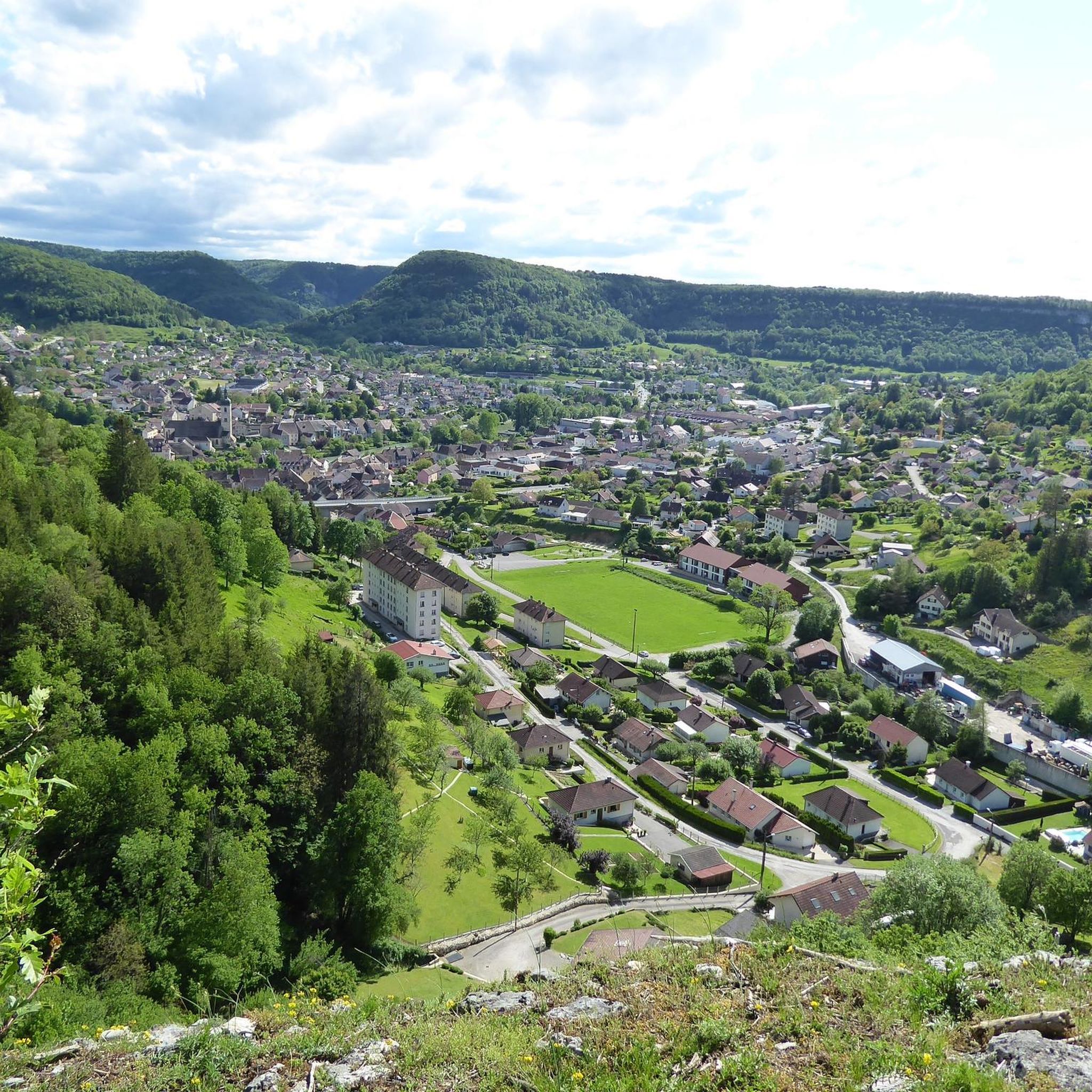
Jogging around Charbonnières-Les-Sapins offers diverse landscapes and extensive trail networks. The region features dense forests, picturesque valleys like the Loue, and the small gorges of the Brême stream, providing varied terrain for runners. Panoramic viewpoints such as Roche Lahier and Rocher du Tourbillon offer expansive views of the Comtoise hills. With altitudes ranging from 400 to 583 meters, the area provides options from gentle inclines to more challenging ascents.
Best jogging routes around Charbonnières-Les-Sapins
- The most popular jogging route is…
Last updated: July 1, 2026
5.0
(1)
22
runners
14.5km
01:52
450m
450m
Hard run. Very good fitness required. Sure-footedness, sturdy shoes and alpine experience required.
11
runners
13.9km
01:45
390m
390m
Hard run. Very good fitness required. Mostly paved surfaces. Suitable for all skill levels.

Sign up for free
6
runners
7.39km
00:55
140m
130m
Moderate run. Good fitness required. Mostly paved surfaces. Suitable for all skill levels.
8
runners
7.94km
00:51
60m
60m
Moderate run. Good fitness required. Mostly paved surfaces. Suitable for all skill levels.
12
runners
22.9km
02:43
250m
250m
Hard run. Very good fitness required. Mostly paved surfaces. Suitable for all skill levels.
Get access to more routes and recommendations from other explorers.
Sign up for free
Already have an account?
Our route recommendations are based on thousands of hikes, rides, and runs completed by other people on komoot.
Start today with a free account
Your next adventure awaits.
Login or Signup

Tips from the Community

Old railway line
0
0

Plot of fir trees cut down, so bike park destroyed 😞
0
0

Hut in the picture is not a shelter
0
0

very beautiful view
0
0

The Viaduc de la Brème (also known as the Viaduc de Bois Joli) is an impressive viaduct in the Bourgogne-Franche-Comte region. ie: The Viaduc de la Brème is located near the Château de la Malcôte and the Chapelle Notre-Dame-du-Chêne. It offers magnificent views of the surrounding landscape. This viaduct spans the Brême River and is part of a historic railway line. It is an architectural masterpiece that is both functional and aesthetic. It offers panoramic views of the natural beauty of the area.
7
0

Beautiful place on the river Loue
5
0
Ornans is located on the banks of the River Loue, surrounded by hills and forests. It is located in a picturesque area and is known for its attractive scenery. Ornans has a rich history dating back to the Middle Ages. It was the birthplace of Gustave Courbet, an influential French painter of the 19th century. Courbet is considered an important figure in the art movement of realism.
9
0
The Viaduc de la Brème (also known as Viaduc de Bois Joli) is an impressive viaduct in the Bourgogne-Franche-Comte region. The Viaduc de la Brème is located near the Château de la Malcôte and the Chapelle Notre-Dame-du-Chêne. It offers beautiful views of the surrounding landscape. This viaduct spans the Brême River and is part of a historic railway line. It is an architectural masterpiece that is both functional and aesthetic. It offers panoramic views of the natural beauty of the area.
0
0
Frequently Asked Questions
How many running routes are available around Charbonnières-Les-Sapins?
There are over 85 diverse running routes in the Charbonnières-Les-Sapins area, catering to various fitness levels and preferences. These routes have been explored by more than 1300 runners using komoot.
What kind of terrain can I expect on the jogging trails in this region?
The region offers a varied topography, with altitudes ranging from 400 to 583 meters. You'll find extensive trail networks through dense forests, picturesque valleys like the Loue, and the small, wild gorges of the Brême stream. Some paths even follow converted railway lines, providing relatively flat or gently sloping terrain.
Are there any easy or beginner-friendly running routes?
Yes, while many routes are moderate or difficult, there are 4 easy running routes available. These are perfect for beginners or those looking for a more relaxed jog through the scenic landscape.
What are some notable viewpoints or landmarks I can see while running?
The area is rich with panoramic viewpoints. You can enjoy stunning vistas from belvederes like Roche Lahier and Roche Bottine over the Loue Valley, or the Rocher du Tourbillon overlooking the Brême Valley. The Old railway bridge is another interesting landmark along some routes. For a challenging run with rewarding views, consider the Roche de Lahier – Le Saut du Chevalier loop from Saules.
Are there any long-distance running options in Charbonnières-Les-Sapins?
Yes, for those seeking longer runs, routes like the Old railway bridge loop from L'Hôpital-du-Grosbois offer a substantial distance of over 23 km, providing an extended experience through the region's diverse landscapes.
What do other runners say about the trails in Charbonnières-Les-Sapins?
The running routes in Charbonnières-Les-Sapins are highly rated by the komoot community, with an average score of 4.2 stars from over 30 reviews. Runners often praise the varied terrain, the serene atmosphere of the dense woodlands, and the rewarding panoramic views.
Are there any circular running routes available?
Many of the routes in the area are designed as loops, offering convenient circular options. For example, the Bike Park Ornans loop from Saules and the Bois d'Onchaud loop from Saules are popular circular trails that allow you to start and finish in the same location.
Can I find routes that pass by interesting towns or historical sites?
Absolutely. Some routes may lead you near charming settlements like Ornans or Vuillafans. You might also encounter historical points of interest such as the Former tile factory of Combes Punay, adding a cultural dimension to your run.
Are there any running trails that follow old railway lines?
Yes, the region is known for its converted railway lines. The old railway line along the Brême stream, now a promenade, offers smooth and accessible paths. The impressive Viaduc de la Brème (Viaduc de Bois Joli) is also part of a historical railway and provides scenic routes with beautiful views, such as those found on the Old railway bridge loop from L'Hôpital-du-Grosbois.
What are the best natural features to look out for on a run?
Runners can enjoy the serene beauty of dense forests, the dramatic scenery of the Loue Valley with its rugged rock formations, and the unique pathways through the small, wild gorges of the Brême stream. The region's diverse natural environment makes every run an exploration.
Is there a route suitable for a quick, moderate run?
For a moderate run that can be completed in under an hour, the Bois d'Onchaud loop from Saules is an excellent choice. It's a 7.4 km trail through dense woodlands, typically taking about 55 minutes.
Are there any routes that offer a mix of forest and open views?
Many routes combine the tranquility of dense forests with expansive views. Trails on the plateaus often provide stunning panoramas of the Comtoise hills and the Hautepierre rock, while also winding through shaded woodlands, offering a balanced running experience.
Most popular routes around Charbonnières-Les-Sapins
Most popular attractions around Charbonnières-Les-Sapins

Get inspired with the komoot mobile app


Explore more
Browse the best Running Trails & Routes in other regions.
