The best cycling routes around Río Guadamatilla Y Arroyo Del Tamujar
34
riders
10
rides
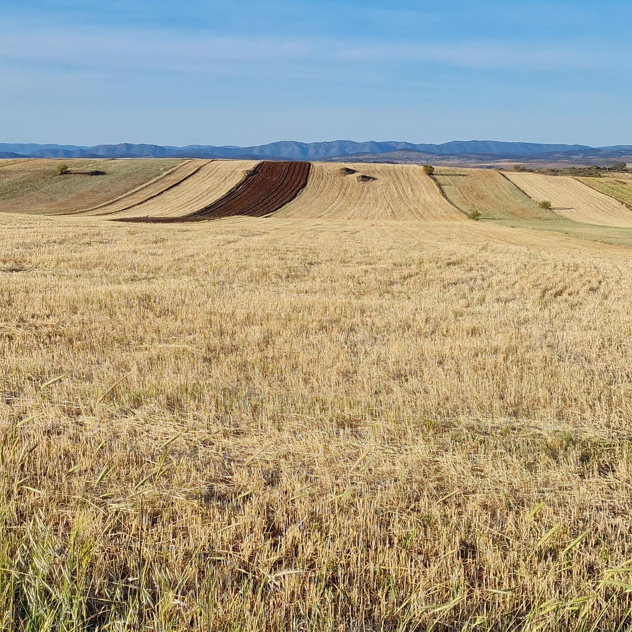
Touring cycling around Río Guadamatilla Y Arroyo Del Tamujar traverses a protected natural space in the northern part of Córdoba, Spain, characterized by its siliceous rivers and rich riparian ecosystems. The landscape features the Río Guadamatilla and Arroyo del Tamujar, which form ecological corridors, with riverbanks often lined by dense canopies of ash trees and abundant brambles. While much of the Comarca de Los Pedroches is typically flat, the Sierra de Santa Eufemia presents more rugged terrain with some northern…
Last updated: July 10, 2026
9
riders
49.2km
04:38
1,030m
1,030m
Hard bike ride. Very good fitness required. Mostly paved surfaces. Suitable for all skill levels.
8
riders
48.8km
04:24
620m
620m
Hard bike ride. Very good fitness required. Mostly paved surfaces. Suitable for all skill levels.

Sign up for free
1
riders
16.3km
01:27
230m
230m
Moderate bike ride. Good fitness required. Mostly paved surfaces. Suitable for all skill levels.
2
riders
38.4km
03:28
330m
330m
Moderate bike ride. Good fitness required. Mostly paved surfaces. Suitable for all skill levels.
1
riders
35.7km
02:37
220m
220m
Moderate bike ride. Good fitness required. Mostly paved surfaces. Suitable for all skill levels.
Get access to more routes and recommendations from other explorers.
Sign up for free
Already have an account?
Our route recommendations are based on thousands of hikes, rides, and runs completed by other people on komoot.
Start today with a free account
Your next adventure awaits.
Login or Signup
Popular around Río Guadamatilla Y Arroyo Del Tamujar


Tips from the Community

La Puerta de la Villa de Santa Eufemia is one of the most notable remains of the municipality's old walled enclosure. This stone arch, of medieval origin, gave access to the interior of the villa and today is integrated into the urban area, preserving its historical and heritage value.
0
0

This is one of the stage destinations where pilgrims on the Camino Mozarabe can find accommodation for the night.
0
0

A town with history and cobblestones where you can stop to learn a little more about it and the neighbors are delighted to tell you
0
0
Once in the town of Santa Eufemia, go up to the castle with a good supply of water and calmly since it is very uneven
0
0

The name of this town comes from the fennel that is abundant in this area. Its monuments include the church of San Juan Bautista, known as the cathedral of the mountains, the parish of San Isidro Labrador, the convent of the Conceptionist mothers and several hermitages.
2
0
One of the monumental towns of the Sierra de Córdoba, which has several examples of architecture of great importance. Among them, the Castillo de los Sotomayor y Zúñiga stands out in the Gothic-military style, built in the 15th century. Thanks to its impressive Renaissance-style keep, it is the highest castle in the entire Iberian Peninsula.
3
0
A small town where there is no shortage of things to see: the Nuestra Señora de la Encarnación Parish Church from the 14th century and the Puerta de Córdoba, popularly known as "Arco or Puerta de la Villa", with its lowered horseshoe arch are the obligatory points of interest. the visit.
2
0

Sebastián de Belalcázar, founder of the colonial city of Quito, in Ecuador, was from this city. Its landscape is dominated by its imposing castle, but the old town houses other architectural jewels that are also worth visiting.
2
0
Frequently Asked Questions
What is the general difficulty level for touring cycling routes in Río Guadamatilla Y Arroyo Del Tamujar?
The touring cycling routes in this region range from moderate to difficult. You'll find options like the Belalcázar – Hinojosa del Duque loop from Belalcázar, which is moderate, alongside more challenging routes such as the Belalcázar – Castillo de Belalcázar loop from Belalcázar, which is rated difficult due to its elevation changes.
Are there any circular touring cycling routes available?
Yes, many of the touring cycling routes in Río Guadamatilla Y Arroyo Del Tamujar are designed as loops. For instance, you can enjoy the Belalcázar – Castillo de Belalcázar loop from Belalcázar, which is a 48.8 km circular route, or the Santa Eufemia – Puerta de la Villa loop from Santa Eufemia, covering 49.2 km.
What kind of natural features can I expect to see along the cycling routes?
The region is characterized by its siliceous rivers, Río Guadamatilla and Arroyo del Tamujar, which form vital ecological corridors. Cyclists will encounter vibrant riparian ecosystems with dense canopies of ash trees and abundant brambles along the riverbanks, creating shaded pathways. The area is also home to unique flora like the four-leaf clover and white water lily.
What is the typical distance and duration for touring cycling routes here?
The touring cycling routes in Río Guadamatilla Y Arroyo Del Tamujar vary in length and time. Routes typically range from approximately 30 km to 50 km. For example, the Belalcázar – Churrería loop from Belalcázar is 41.5 km and can be completed in about 2 hours 29 minutes, while the Santa Eufemia – Puerta de la Villa loop from Santa Eufemia is 49.2 km and takes around 4 hours 37 minutes.
Are there any historical landmarks or points of interest along the touring cycling routes?
Yes, some routes incorporate historical landmarks. The Belalcázar – Castillo de Belalcázar loop from Belalcázar, for instance, features the historic Castillo de Belalcázar. Another route, the Santa Eufemia – Puerta de la Villa loop from Santa Eufemia, offers views of the Puerta de la Villa.
What kind of wildlife might I encounter while cycling in the area?
The diverse ecosystems along the rivers support typical riverside fauna. You might spot otters, Iberian painted frogs, and various fish species like the boga del Guadiana. Birdwatchers can look out for kingfishers and several raptor species, making for interesting wildlife observation during your tour.
What is the best time of year for touring cycling in Río Guadamatilla Y Arroyo Del Tamujar?
Given the region's natural characteristics, spring and autumn are generally ideal for touring cycling. The riparian ecosystems offer shaded pathways, which can be particularly pleasant during warmer months. However, the varied hydrological regimes of the rivers mean different sections offer unique scenery throughout the year.
Are the touring cycling routes suitable for families?
While the guide features routes rated moderate to difficult, the tranquil nature of some river sections and the picturesque landscapes could be enjoyable for families with older children or those accustomed to longer rides. It's advisable to check the specific route details, including distance and elevation, to ensure it matches your family's ability.
What do other touring cyclists enjoy most about cycling in Río Guadamatilla Y Arroyo Del Tamujar?
Touring cyclists often praise the region for its beautiful riverine landscapes, the ecological richness of the protected natural spaces, and the peaceful, shaded pathways created by dense ash tree canopies. The variety of routes, from moderate to difficult, also allows for different levels of challenge amidst stunning natural beauty.
Are there options for parking near the cycling routes?
While specific parking details for each trailhead are not provided, routes often start and end in towns like Belalcázar and Santa Eufemia. These towns typically offer public parking facilities, making it convenient to access the cycling routes.
Can I find cafes or places to eat along the touring cycling routes?
Routes often originate or pass through towns such as Belalcázar, Santa Eufemia, and Hinojosa del Duque. These towns provide opportunities to find local cafes and restaurants where you can refuel during or after your ride. For example, the Belalcázar – Churrería loop from Belalcázar suggests starting from a town where such amenities would be available.
Most popular routes around Río Guadamatilla Y Arroyo Del Tamujar

Get inspired with the komoot mobile app


Explore more
Browse the best Cycling routes in other regions.
