The best city hikes and walks around Oberalpsee
4.6
(1245)
9,777
hikers
3
hikes
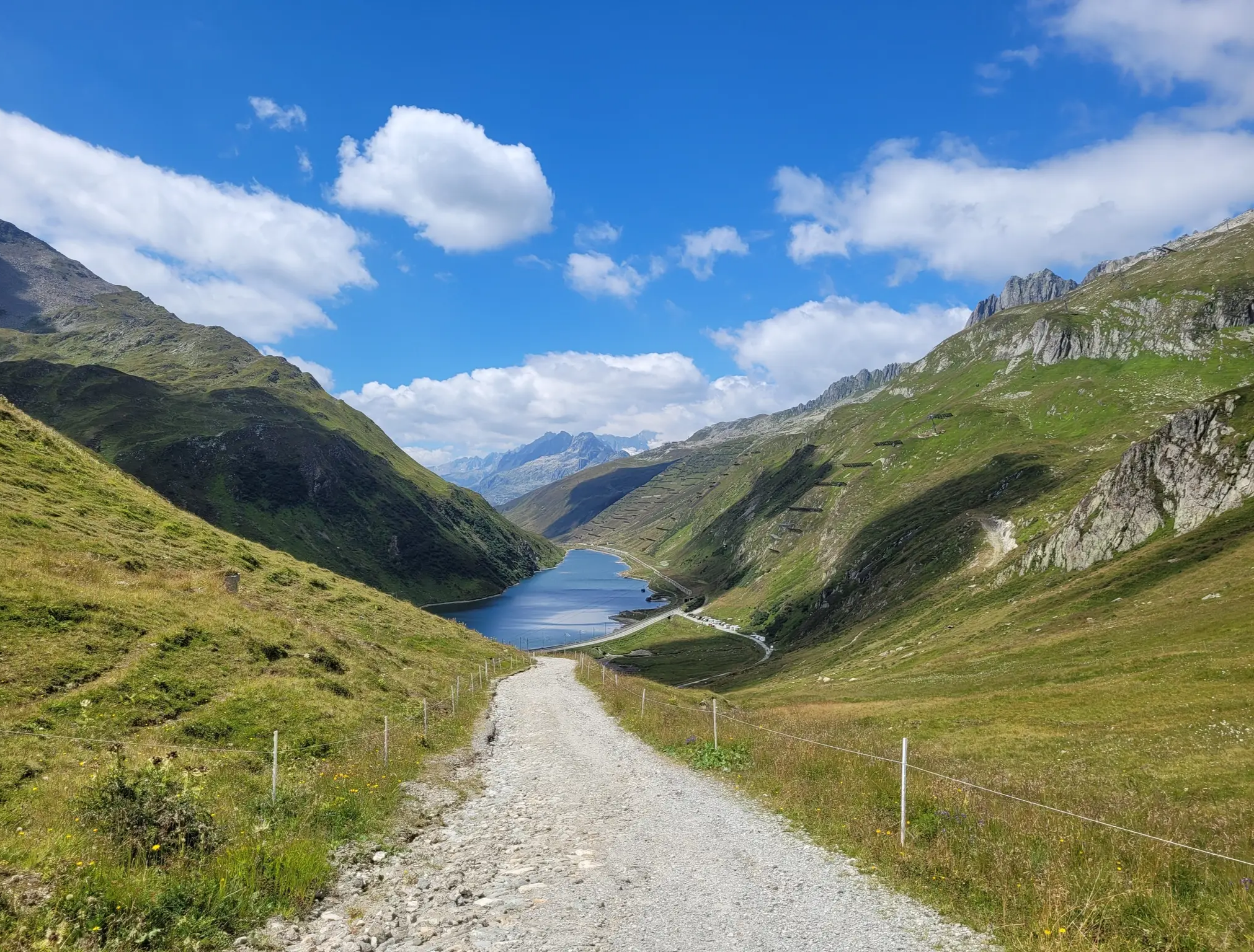
Urban hiking trails around Oberalpsee are primarily found in the nearby town of Andermatt, offering accessible paths within a high alpine setting. The region is characterized by its location within the Gotthard Massif, providing views of rugged mountains and the Ursern Valley. While the immediate trails are urban, the broader landscape features the serene Oberalpsee and numerous mountain streams. These routes offer a way to explore the town's surroundings with the backdrop of the Swiss Alps.
Best urban hiking trails around Oberalpsee
- The most popular urban hiking route is Andermatt train station – Dorfstrasse Andermatt loop from Andermatt, a 1.9 miles (3.1 km) trail that takes 50 minutes to complete. This easy route explores the village center and its immediate surroundings.
- Another top favourite among local hikers is Vinothek 1620 – Andermatt train station loop from Andermatt, an easy 1.1 miles (1.8 km) path. This trail offers a short loop through the town, showcasing local architecture and views.
- Local hikers also love the Andermatt train station loop from Andermatt, a 0.6 miles (1.0 km) trail leading through the village center, often completed in about 15 minutes.
- Hiking around Oberalpsee is defined by accessible village paths, views of the surrounding alpine scenery, and proximity to the Gotthard Massif. The network offers options for different ability levels, focusing on easy urban exploration.
- The routes in Oberalpsee are highly rated by the komoot community with an average score of 4.6 stars from over 1200 reviews. More than 9000 hikers have used komoot to explore Oberalpsee's varied terrain.
Last updated: July 8, 2026
3.0
(2)
33
hikers
Easy hike. Great for any fitness level. Easily-accessible paths. Suitable for all skill levels.
11
hikers
1.79km
00:28
20m
20m
Easy hike. Great for any fitness level. Easily-accessible paths. Suitable for all skill levels.

Sign up for free
3
hikers
1.05km
00:17
10m
10m
Easy hike. Great for any fitness level. Easily-accessible paths. Suitable for all skill levels.
Our route recommendations are based on thousands of hikes, rides, and runs completed by other people on komoot.
Start today with a free account
Your next adventure awaits.
Login or Signup
Popular around Oberalpsee
Other adventures around Oberalpsee


Tips from the Community

Starting point for cycling and hiking tours with seating, bicycle service station and sculpture "Ursern - The Valley of the Three Passes".
0
0

The train journey between Disentis and Andermatt should definitely be included in any trip.
0
0

Very nice, modern center. Opportunities for breaks or shopping are available.
0
0
Beautiful little place, a must see
0
0
Beautiful how the red cars move through the landscape
0
0

Andermatt train station is also the starting point for hikes to the Devil's Bridge and Schöllen Gorge, among others. But other destinations are also accessible from here.
0
0

The cable car to Gemstock starts nearby, from where you have a very nice view and in winter there are great ski slopes.
1
0

If you are there at the right time, you can see the legendary Gotthard stagecoach passing through.
1
0
Frequently Asked Questions
How many urban hiking trails are available around Oberalpsee?
This guide features three easy urban hiking trails, all located in the charming village of Andermatt, which is a short distance from Oberalpsee. These routes are perfect for exploring the village and its immediate surroundings.
Are the urban hiking trails around Oberalpsee suitable for families?
Yes, all the urban hiking trails listed in this guide are rated as easy, making them ideal for families with children. They are relatively short and have minimal elevation gain, allowing for a relaxed stroll through Andermatt. For example, the Andermatt train station loop from Andermatt is just over 1 km long.
Can I bring my dog on the urban hikes near Oberalpsee?
Generally, dogs are welcome on most hiking trails in the region, including the urban walks around Andermatt. However, it's always recommended to keep your dog on a leash, especially in populated areas or near livestock. Please be mindful of local regulations and other hikers.
What is the best time of year for urban hiking around Oberalpsee?
Urban hiking in Andermatt can be enjoyed year-round. While the high alpine trails around Oberalpsee are best in summer and early autumn, the village walks offer pleasant experiences even in spring and late autumn. Winter transforms Andermatt into a snowy wonderland, and these easy loops can still be accessible, though conditions might require appropriate footwear.
Are there any circular urban trails in this guide?
Yes, all three urban trails featured in this guide are circular routes, starting and ending in Andermatt. This makes them convenient for exploring the village without needing to retrace your steps. You can choose from routes like the Andermatt train station – Dorfstrasse Andermatt loop or the shorter Vinothek 1620 – Andermatt train station loop.
What are the typical distances and durations for these urban hikes?
The urban hikes in this guide are relatively short and easy. Distances range from approximately 1 km to just over 3 km, with durations from about 15 minutes to an hour. This makes them perfect for a leisurely stroll or a quick exploration of Andermatt.
Where can I find parking for urban trails in Andermatt?
Andermatt offers several parking options within the village. You can often find public parking near the train station or in designated parking garages. It's advisable to check local signage for current parking regulations and fees.
What kind of views or landmarks can I expect on these urban trails?
While these are urban trails, Andermatt is nestled in the Ursern Valley, offering charming village scenery with traditional Swiss architecture and glimpses of the surrounding alpine peaks. You'll experience the local atmosphere and might spot landmarks like the historic Gotthard railway line or the village church.
What do other hikers enjoy most about hiking in this region?
The area is highly rated by the komoot community, with an average score of 4.6 stars from over 1,200 ratings. Reviewers often praise the stunning alpine scenery, the well-maintained trails, and the accessibility of the region by train, which also applies to the charming village of Andermatt.
Are there cafes or restaurants along the urban hiking routes in Andermatt?
Yes, as these trails are located within the village of Andermatt, you'll find numerous cafes, restaurants, and shops where you can stop for refreshments, a meal, or to pick up local delicacies. The village center is well-equipped with amenities for visitors.
What should I wear for urban hiking in Andermatt?
Even for urban hikes, comfortable walking shoes are recommended. Depending on the season, layers are always a good idea in the mountains. In summer, light clothing is suitable, while in cooler months, a warm jacket, hat, and gloves might be necessary. Always check the local weather forecast before heading out.
Most popular routes around Oberalpsee

Get inspired with the komoot mobile app


Explore more
Browse the best Hikes in other regions.
