The best traffic-free bike rides in Calares De Sierra De Los Filabres
42
riders
5
rides
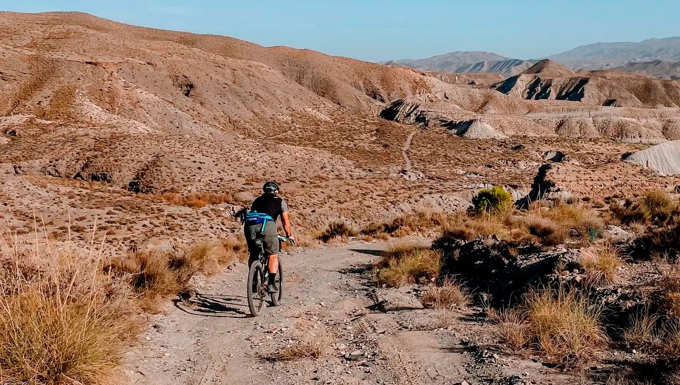
Gravel biking in Calares De Sierra De Los Filabres offers diverse terrain within the largest mountain range of Almería Province. The region features a rugged topography of dramatic hills and valleys, with elevations often exceeding 2,000 meters. Unique karstic formations and diverse woodlands characterize the landscape, transitioning from arid conditions to higher altitude forests. This area provides varied surfaces, including gravel sections, suitable for challenging climbs and moderate loops.
Best no traffic gravel bike trails in Calares De Sierra De…
Last updated: October 12, 2026
18
riders
107km
09:40
2,170m
2,170m
Hard gravel ride. Very good fitness required. Mostly paved surfaces. Suitable for all skill levels.
6
riders
46.8km
04:32
1,220m
1,220m
Hard gravel ride. Very good fitness required. Mostly paved surfaces. Suitable for all skill levels.

5
riders
85.0km
07:49
1,730m
1,730m
Hard gravel ride. Very good fitness required. Mostly paved surfaces. Suitable for all skill levels.
1
riders
29.7km
02:17
330m
330m
Moderate gravel ride. Good fitness required. Mostly paved surfaces. Suitable for all skill levels.
12
riders
90.9km
08:23
1,610m
1,610m
Hard gravel ride. Very good fitness required. Mostly paved surfaces. Suitable for all skill levels.
Our route recommendations are based on thousands of hikes, rides, and runs completed by other people on komoot.
Start today with a free account
Your next adventure awaits.
Popular around Calares De Sierra De Los Filabres


Other adventures in Calares De Sierra De Los Filabres

Tips from the Community

If you are passing through the Sierra de los Filabres near the summit of Calar Alto, the Fuente La Merendera is an almost mandatory stop at 1882 meters above sea level. This spring is famous for its fresh water that gushes from the metamorphic rocks of the mountains. Officially, there is a sign warning that it is not drinkable, but that does not stop locals and many passers-by from queuing with jugs, attracted by its water. Although, it is a good idea to filter the water before drinking it. If you need a long break, just across the road you will find a recreational area complete with tables, barbecues, and a viewpoint with spectacular views.
1
0
At 1,870 meters above sea level, the Collado de Conde marks a total change in the Almería landscape, moving from the arid environment, known for Western films, to a much cooler setting of mountains and pine forests. This point also functions as a crossroads, with roads, trails, and gravel tracks opening up in various directions.
0
0


Highest point of the Sierra de Los Filabres
0
0
Recreation area with drinking water fountain
0
0
Both mountain ranges ensure that it hardly rains in this semi-desert area.
1
0
Nice shady spots, benches and beautiful views.
1
0
A spectacular route through the southeast of the peninsula between the highlands of Granada in the Baza area towards the Almendricos district, already in the Murcia region, and passes through the Almanzora Valley in Almería. A route that for decades crossed a railway line that transported tons of iron and other merchandise
1
0
Frequently Asked Questions
How many no-traffic gravel bike trails are available in Calares De Sierra De Los Filabres?
There are 5 dedicated no-traffic gravel bike trails in Calares De Sierra De Los Filabres, offering a range of experiences from moderate to difficult. These routes are designed to keep you away from vehicular traffic, allowing for a more serene cycling experience.
What kind of terrain can I expect on these gravel bike trails?
The terrain in Calares De Sierra De Los Filabres is diverse, featuring rugged hills and valleys with significant elevation changes. You'll encounter a mix of unpaved gravel surfaces, tracks, and some winding mountain roads with excellent tarmac. The region's 'Calares' formations mean you'll be riding through unique limestone and dolomite landscapes, often with dramatic views.
Are there any challenging no-traffic gravel routes for experienced riders?
Yes, the region offers several challenging routes. For instance, the Venta Luisa Pass – Velefique climb loop from Centro Astronómico Hispano en Andalucía is a difficult 87 km ride with over 1500 meters of elevation gain, providing a demanding experience for advanced gravel bikers.
What natural features or landmarks can I see along the trails?
You'll find a wealth of natural beauty and historical sites. The region is known for its dramatic hills, valleys, and unique 'Calares' karstic formations. Keep an eye out for diverse woodlands, especially ancient black pine specimens at higher altitudes. You might also pass by historical sites like the Las Menas Mining Village or the Los Cortijillos, offering glimpses into the area's rich past.
Are there any moderate gravel bike trails suitable for a less intense ride?
Absolutely. For a moderate challenge, consider the Serón Railway Station – Aljibe de Serón loop from Serón. This route covers nearly 30 km with around 327 meters of elevation gain, making it a great option for those looking for a less strenuous but still rewarding gravel experience.
What is the best time of year for gravel biking in Calares De Sierra De Los Filabres?
The Sierra de los Filabres experiences a transition from arid conditions to snow-capped peaks in winter. For gravel biking, spring and autumn generally offer the most pleasant temperatures. Summers can be very hot, while winters can bring snow to higher elevations, especially around peaks like Calar Alto. Always check local weather conditions before heading out.
Are there any loop trails available for gravel biking?
Yes, all the no-traffic gravel bike trails listed are loop routes, allowing you to start and end your ride at the same point. For example, the Velefique climb – Alto de Velefique Pass loop from Sierro offers a substantial 50 km circular ride.
Can I expect to see any wildlife while gravel biking in the region?
The area is home to diverse wildlife. You might spot various species of bats in caves, and there are significant populations of birds of prey, including golden eagles and peregrine falcons. Deer sightings are also common, especially in areas like the El Chortal Hunting Reserve. The contrast of arid and green landscapes supports a rich ecosystem.
Are there any trails that offer panoramic viewpoints?
Many routes in Calares De Sierra De Los Filabres provide stunning panoramic views. The high altitude of the region, with peaks exceeding 2,000 meters, means you'll often be treated to expansive vistas of the Sierra Nevada and the Mediterranean Sea. The Trail with views highlight is specifically noted for its scenic outlooks.
What should I bring for a gravel bike ride in this area?
Given the varied terrain and potential for significant elevation, it's advisable to bring plenty of water, especially during warmer months. Essential bike repair tools, a first-aid kit, and appropriate layers of clothing are also recommended. Navigation tools are crucial, as some areas can be remote. Don't forget snacks to fuel your ride through the challenging sections.
Are there any routes that pass by the Calar Alto Astronomical Observatory?
Yes, the Venta Luisa Pass – Calar Alto (2,168 m) loop from Centro Astronómico Hispano en Andalucía is a moderate 11 km route that takes you towards the prominent Calar Alto observatory. This offers a unique opportunity to cycle near this scientific landmark, which provides striking visual contrasts against the mountainous backdrop.
What are the typical elevation gains on these no-traffic gravel routes?
The elevation gains vary significantly depending on the route's difficulty. Moderate trails like the Venta Luisa Pass – Calar Alto (2,168 m) loop have around 330 meters of ascent. More difficult routes, such as the Velefique climb – Alto de Velefique Pass loop from Sierro, can feature over 1450 meters of climbing, offering substantial challenges for riders.
Most popular routes in Calares De Sierra De Los Filabres
Most popular attractions in Calares De Sierra De Los Filabres

Get inspired with the komoot mobile app


Explore more
Browse the best Gravel rides in other regions.
