The best family-friendly hikes and walks in Calares De Sierra De Los Filabres
4.5
(16)
82
hikers
8
hikes
Family friendly hiking trails in Calares De Sierra De Los Filabres traverse a landscape characterized by its unique "calares," which are high-mountain limestone and dolomitic enclaves. These geological features contribute to karstic phenomena and diverse terrain. The region features extensive pine and holm oak woodlands, particularly in areas that have undergone reforestation. Mountain peaks, some exceeding 2,000 meters, offer panoramic views across the varied environment.
Best family friendly hiking trails in Calares De Sierra De Los Filabres
- The most popular…
Last updated: July 13, 2026
4.7
(6)
24
hikers
6.57km
01:53
160m
160m
Easy hike. Great for any fitness level. Easily-accessible paths. Suitable for all skill levels.
3.5
(2)
10
hikers
14.4km
04:09
370m
370m
Moderate hike. Good fitness required. Easily-accessible paths. Suitable for all skill levels.

Sign up for free
5
hikers
9.73km
02:44
190m
190m
Moderate hike. Good fitness required. Easily-accessible paths. Suitable for all skill levels.
5.0
(1)
4
hikers
12.3km
03:39
370m
370m
Moderate hike. Good fitness required. Easily-accessible paths. Suitable for all skill levels.
5.0
(1)
5
hikers
22.8km
06:59
790m
790m
Hard hike. Very good fitness required. Easily-accessible paths. Suitable for all skill levels.
Get access to more routes and recommendations from other explorers.
Sign up for free
Already have an account?
Our route recommendations are based on thousands of hikes, rides, and runs completed by other people on komoot.
Start today with a free account
Your next adventure awaits.
Login or Signup
Popular around Calares De Sierra De Los Filabres
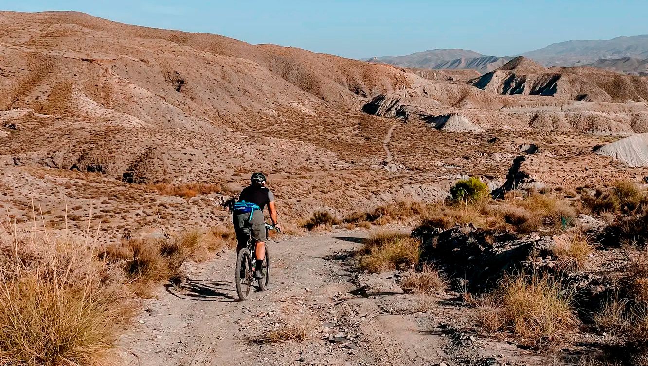
Other adventures in Calares De Sierra De Los Filabres

Tips from the Community

If you are passing through the Sierra de los Filabres near the summit of Calar Alto, the Fuente La Merendera is an almost mandatory stop at 1882 meters above sea level. This spring is famous for its fresh water that gushes from the metamorphic rocks of the mountains. Officially, there is a sign warning that it is not drinkable, but that does not stop locals and many passers-by from queuing with jugs, attracted by its water. Although, it is a good idea to filter the water before drinking it. If you need a long break, just across the road you will find a recreational area complete with tables, barbecues, and a viewpoint with spectacular views.
1
0
If you are passing through the Sierra de los Filabres near the summit of Calar Alto, the Fuente La Merendera is an almost mandatory stop at 1882 meters altitude. This spring is famous for its fresh water that gushes from the metamorphic rocks of the sierra. Officially there is a sign warning that it is not potable, but that does not stop locals and many passers-by from queuing with canisters, attracted by its water. However, it is a good idea to filter the water before drinking it. If you need a long break, just across the road you will find a recreational area complete with tables, barbecues, and a viewpoint with spectacular views.
0
0

Recreation area with drinking water fountain
0
0

Both mountain ranges ensure that it hardly rains in this semi-desert area.
1
0
Nice shady spots, benches and beautiful views.
1
0
The Las Menas iron ore mines remained active until 1968, providing an income for 2,900 people, including miners and their families.
0
0
Challenging gorge, very quiet and unknown in the middle of nature with beautiful views, intended for the real biker and hiker.
0
0
A spectacular route through the southeast of the peninsula between the highlands of Granada in the Baza area towards the Almendricos district, already in the Murcia region, and passes through the Almanzora Valley in Almería. A route that for decades crossed a railway line that transported tons of iron and other merchandise
1
0
Frequently Asked Questions
How many family-friendly hiking trails are available in Calares De Sierra De Los Filabres?
You'll find a selection of 8 family-friendly hiking trails in Calares De Sierra De Los Filabres, offering various experiences suitable for different ages and abilities. These include 1 easy route, 4 moderate routes, and 3 more challenging options.
What kind of landscapes can we expect on family hikes in Calares De Sierra De Los Filabres?
The region offers diverse and striking landscapes. You'll encounter unique 'calares' – high-mountain limestone enclaves – alongside extensive woodlands of pine and holm oaks. Many trails provide panoramic views, and in winter, you might even see snow-capped peaks. The scenery transitions from almond and olive groves in lower valleys to these higher-altitude forests.
Are there any easy circular routes suitable for families?
Yes, for an easy circular option, consider the Camping Las Menas de Serón – Los Cortijillos loop from Las Menas. This route is just over 6.5 km long with minimal elevation gain, making it a pleasant walk for families looking for a gentle introduction to the area's beauty.
What interesting sights or landmarks can we see along the family-friendly trails?
Many trails offer glimpses into the region's rich history and natural beauty. You might pass ancient cortijadas (farmhouses) or remnants of 19th and 20th-century mining operations, such as the abandoned mining village of Las Menas. For specific points of interest, the Los Cortijillos highlight is a historical site you can explore. You can also find trails with stunning views.
Are there any moderate family hikes that offer a bit more challenge?
Absolutely. For a moderate challenge, the El Cantaril Gorge – Serón Railway Station loop from Estación de Serón is a great choice. It covers about 9.7 km with around 190 meters of elevation, offering a rewarding experience without being overly strenuous for active families.
What is the best time of year to go hiking with family in Calares De Sierra De Los Filabres?
The region experiences seasonal climate variations. Spring and autumn are generally ideal for family hikes, offering pleasant temperatures and vibrant scenery. While summer can be warm, the higher-altitude woodlands provide shade. Winter brings a different charm, with snow often gracing the mountain roads and peaks, though some routes might be more challenging.
Are there any longer family-friendly routes for more experienced hiking families?
For families seeking a longer adventure, the Camping Las Menas de Serón – Las Menas Mining Village loop from Las Menas is a moderate option spanning nearly 14.3 km. It allows for a more extended exploration of the area's natural and historical features, including the mining village.
What do other hikers enjoy most about the family-friendly trails here?
The area is highly rated by the komoot community, with an average score of 4.6 stars. Reviewers often praise the tranquility, stunning views, and the opportunity to reconnect with nature. Many appreciate the varied flora and fauna, and the sense of discovery found in the winding mountain paths.
Are there any trails that pass through picturesque villages?
Yes, some routes offer the chance to experience the charm of local villages. The Bayarque Village loop from Tíjola is a moderate 12.3 km route that takes you through the area, allowing you to discover these picturesque, labyrinthine villages that are often described as 'anchored in time'.
What kind of wildlife might we spot on a family hike?
The extensive woodlands of pine and holm oaks provide a rich habitat for various bird species. While not guaranteed, you might also have the chance to spot deer, adding to the natural appeal of your family's outdoor adventure.
Is there parking available near the trailheads for family hikes?
While specific parking details vary by trailhead, many routes in Calares De Sierra De Los Filabres, especially those starting from villages or recreation areas, typically have designated or informal parking spots. For example, routes like the Camping Las Menas de Serón – Los Cortijillos loop start near facilities where parking is usually accessible.
Most popular routes in Calares De Sierra De Los Filabres
Most popular attractions in Calares De Sierra De Los Filabres

Get inspired with the komoot mobile app


