The best dog-friendly hikes and walks in Ouachita National Forest
4.7
(27)
626
hikers
10
hikes
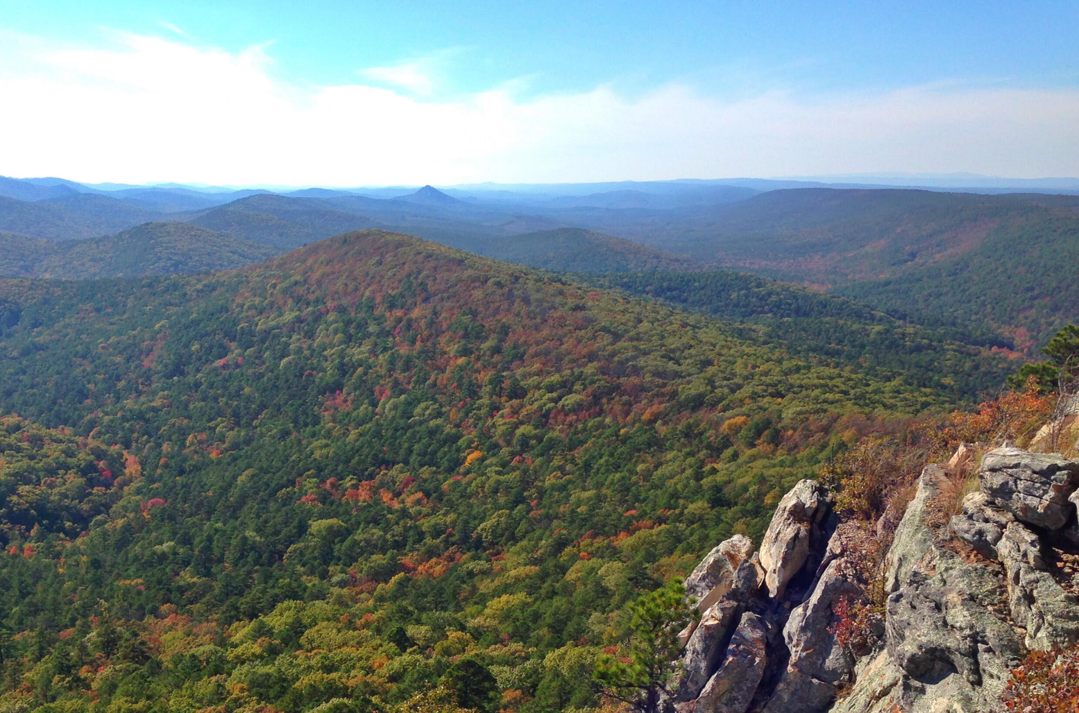
Dog friendly hiking trails in Ouachita National Forest traverse 1.8 million acres of diverse landscapes across central Arkansas and southeastern Oklahoma. The region is characterized by rolling hills, dense pine and hardwood forests, and east-to-west running mountain ridges. Hikers will find numerous clear lakes and rivers, along with notable quartz outcroppings. This oldest and largest national forest in the Southern United States offers varied terrain for all skill levels.
Best dog friendly hiking trails in Ouachita National Forest
- The most…
Last updated: July 8, 2026
13.5km
04:43
400m
430m
Embark on the Ouachita Bohannon Trail for a moderate hiking experience through the rugged Ouachita National Forest. This 8.4-mile (13.5 km) route challenges you with 1300 feet (396 metres) of…
1
hikers
604m
00:11
30m
0m
The Flatside Pinnacle Spur Trail delivers massive views for minimal effort, making it a standout in the Ouachita Mountains. You'll wind through pine and hardwood forests before the terrain gets…

Sign up for free
7.16km
02:13
230m
330m
The Rough Mountain via Ouachita Trail offers a rugged and rewarding experience, winding through dense pine-oak forests and over rocky terrain. You'll navigate continuous ascents and descents, with the trail…
400km
116:17
8,970m
8,850m
The Ouachita National Recreation Trail offers a rugged, diverse hiking experience through the unique east-west running Ouachita Mountains. You'll traverse pine and oak forests, sweeping valleys, and clear streams, with…
854m
00:15
0m
60m
The Queen Wilhelmina Reservoir Trail offers a delightful, easy stroll through peaceful woodlands, leading you to a historic stone reservoir. This short 0.5-mile (0.9 km) route, with no elevation gain,…
Get access to more routes and recommendations from other explorers.
Sign up for free
Already have an account?
Our route recommendations are based on thousands of hikes, rides, and runs completed by other people on komoot.
Start today with a free account
Your next adventure awaits.
Login or Signup
Popular around Ouachita National Forest
Other adventures in Ouachita National Forest

Tips from the Community

This trailhead sits right along Highway 298 and is one of several access points for the Ouachita National Recreation Trail (ONRT). While there are no restrooms or drinking water here, there is a short spur trail leading to the Upper Fork Ouachita River—it is an excellent water source and a great spot to pitch a tent if you are thru-hiking the 223-mile trail.
0
0
The Ouachita National Forest, established by President Theodore Roosevelt in 1907 and initially named the Arkansas National Forest, covers an impressive 1.8 million acres in central Arkansas and southeastern Oklahoma. It is the oldest and largest National Forest in the Southern Region. The forest features a diverse mix of pine and hickory trees with over 700 miles of trails for hiking, mountain biking, and horseback riding. There are multiple developed recreation areas, scenic vistas, shooting ranges, historical sites, wilderness areas, and one national recreation area within the forest. Most of the developed recreation areas are open from April to September, although some sites remain accessible year-round. The Ouachita National Forest is breathtaking in every season, providing expansive views of mountains that stretch for miles.
0
0
Flatside Pinnacle stands at 1,550 feet and offers stunning panoramic views. The short 0.2-mile trail from the gravel road to the summit is clearly marked and relatively easy, though it does get rocky and a little steep at the end. At the top are some of the best views in the state, including Pinnacle Mountain and Rattlesnake Ridge to the east. On clear days, you may even spot Mt. Nebo, Petit Jean, and Mt. Magazine. It's a perfect spot to hang a hammock, have lunch, or simply enjoy some solitude. Dispersed camping is allowed here, making it an ideal spot for thru-hikers to unwind and soak in the scenery.
0
0
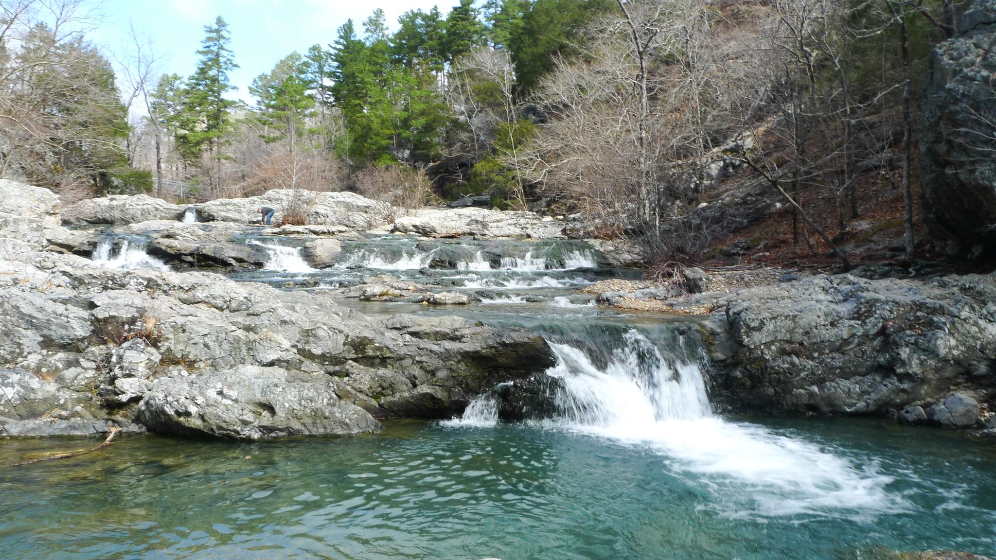
The Brushy Trail Complex combines Brushy Mountain, Mountain Top, Rockhouse, and Brushy Creek Trails, which, along with the Ouachita National Recreation Trail, offer a variety of fantastic loop-trail hiking options spanning from 3 to 12 miles. This area is picturesque, with flowing streams, waterfalls, unique geological formations, and peaceful woodlands. Entrance to the day use area and dispersed camping is free—just be sure you camp at least 100 feet away from any trail. Brushy Creek is a reliable water source for thru hikers exploring the ONRT, making it an excellent spot to spend the night during a long journey.
0
0
This trailhead sits right along Highway 7 with a relatively large parking area and trail registration box. There is no water or restroom here. It is an access point of Ouachita Trail that leads to Wolf Pinnacle, a popular destination for day hikers for its scenic views, and is commonly used as a supply drop for thru-hikers.
0
0
Queen Wilhelmina State Park offers some of the most breathtaking views in the state from its fully renovated lodge. Known as the original “Castle in the Sky,” originally built in 1898, the lodge is situated on the 2,681-foot Rich Mountain—Arkansas' second highest peak. The original lodge was built in the late 1800s as a Victorian resort named Wilhelmina Inn to honor the young Queen of the Netherlands, after Dutch investors helped fund the construction of the railroad system. The park includes 41 campsites, including five tent sites with water, one hike-in tent site, picnic areas, and several short hiking trails, and the lodge features 40 rooms, a restaurant featuring Southern cuisine, and a gift shop. Dogs are welcome except in the restaurant and the large hearth room.
0
0
The Kiamichi River is a beautiful tributary of the Red River, stretching for 177 miles as it winds through Pushmataha County and the Kiamichi Mountains. The river is mostly untouched, with limited access, and is known for its excellent bass and catfish fishing opportunities. It's a favorite destination for organized canoe float trips (Class I-II), so you may encounter others enjoying this scenic river while you're here.
0
0
The Upper Kiamichi River Wilderness spans 10,372 acres within the Ouachita National Forest. This beautiful area is protected by the long ridges of Pine Mountain and Rich Mountain and features picturesque groves of beech trees as well as dense forests of pine and hardwoods. It offers excellent hiking and fishing opportunities along the Kiamichi River and is home to a variety of wildlife, including black bears, white-tailed deer, bobcats, skunks, and pheasants.
0
0
Frequently Asked Questions
How many dog-friendly hiking trails are available in Ouachita National Forest?
There are 10 dog-friendly hiking trails featured in this guide for Ouachita National Forest. These routes offer a variety of experiences, ranging from easy strolls to more challenging treks, ensuring there's something suitable for every dog and owner.
Are there easy dog-friendly hikes suitable for beginners or older dogs?
Yes, Ouachita National Forest offers several easy dog-friendly options. For a short, scenic walk, consider the Flatside Pinnacle Spur Trail, which is just over half a kilometer. Another gentle option is the Queen Wilhelmina Reservoir Trail, an easy 0.8 km path. These trails are perfect for a leisurely outing with your canine companion.
What are the rules for dogs on trails in Ouachita National Forest?
Dogs are generally welcome on trails throughout Ouachita National Forest, but they must be kept on a leash at all times. Always practice Leave No Trace principles, which includes picking up after your dog and carrying out all waste. It's also advisable to carry enough water for both yourself and your dog, especially on longer hikes.
Are there any dog-friendly trails with water features like lakes or rivers?
Yes, many trails in the Ouachita National Forest offer access to beautiful water features. The region is known for its clear lakes and rivers. For consistent lake views, the Caddo Bend Trail near Lake Ouachita is a popular choice. The Little Missouri River, a designated wild and scenic river, also features cascading waterfalls and ancient pine stands, offering refreshing spots for you and your dog.
What kind of terrain and elevation can I expect on dog-friendly trails?
The Ouachita National Forest features diverse terrain, from rolling hills and dense forests to mountain ridges. Trails can vary from relatively flat paths, like the Flatside Pinnacle Spur Trail with minimal elevation gain, to more challenging routes. For example, the Ouachita Bohannon Trail involves nearly 400 meters of ascent over its 13.5 km length, offering a good workout for active dogs and owners.
What do other hikers enjoy most about dog-friendly hiking in Ouachita National Forest?
The komoot community highly rates the dog-friendly trails in Ouachita National Forest, with an average score of 4.8 out of 5 stars. Reviewers often praise the serene natural beauty, the well-maintained paths, and the opportunity to explore diverse landscapes with their canine companions. The sense of solitude and the varied terrain are frequently highlighted as key attractions.
Are there any notable landmarks or viewpoints along the dog-friendly trails?
Absolutely! The forest is rich with natural and historical landmarks. You can find stunning panoramic vistas from various points, especially in areas like the Flatside Wilderness Area, which includes Flatside Pinnacle. The Lake Sylvia Recreation Area offers picturesque lake views, and the Camp Ouachita Historic District provides a glimpse into the region's past.
Are there any longer, more challenging dog-friendly hikes for experienced hikers?
For those seeking a more demanding adventure with their dog, the Ouachita National Forest delivers. The Ouachita Bohannon Trail is a moderate 13.5 km hike with significant elevation changes. For an even more extensive challenge, sections of the Ouachita National Recreation Trail, which spans over 400 km in its entirety, offer difficult, multi-day options for well-prepared hikers and their dogs.
What is the best time of year to go dog-friendly hiking in Ouachita National Forest?
Spring and fall are generally considered the best times for dog-friendly hiking in Ouachita National Forest. The weather is milder, and the natural scenery is vibrant, with wildflowers in spring and colorful foliage in autumn. Summers can be hot and humid, while winters are typically mild but can bring occasional ice or snow, especially at higher elevations. Always check local weather conditions before heading out.
Are there any dog-friendly loop trails in the Ouachita National Forest?
While many trails offer out-and-back options, the region does feature some excellent loop opportunities. The Caddo Bend Trail is an easy 4.0-mile loop that provides consistent lake views and interesting quartz outcroppings, making it a great choice for a circular walk with your dog.
Most popular routes in Ouachita National Forest
Most popular attractions in Ouachita National Forest

Get inspired with the komoot mobile app


Explore more
Browse the best Hikes in other regions.
