The best traffic-free bike rides around Groslée-Saint-Benoît
4.6
(940)
7,603
riders
75
rides
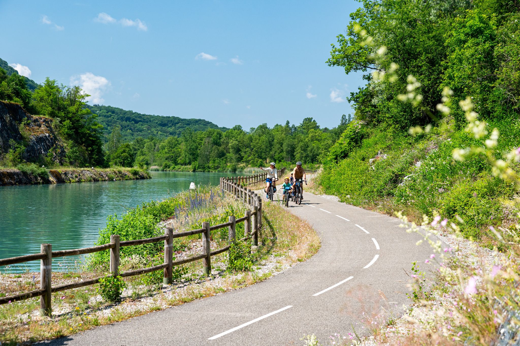
Touring cycling around Groslée-Saint-Benoît offers a diverse landscape shaped by the Rhône River and the varied terrain of the Bugey region. The area features well-maintained cycling paths along the ViaRhôna, providing riverside routes through preserved natural environments and greenways. Topography ranges from gentle plains to ascents within the Bugey mountains, including vineyards and forests. This region provides options for various cycling abilities, with many routes specifically designed for no traffic touring.
Best no traffic touring cycling routes around Groslée-Saint-Benoît
- The…
Last updated: July 7, 2026
4.3
(9)
55
riders
27.4km
02:04
130m
130m
Moderate bike ride. Good fitness required. Mostly paved surfaces. Suitable for all skill levels.
5.0
(3)
25
riders
Easy bike ride. Great for any fitness level. Mostly paved surfaces. Suitable for all skill levels.

Sign up for free
12
riders
13.7km
00:48
50m
50m
Easy bike ride. Great for any fitness level. Mostly paved surfaces. Suitable for all skill levels.
9
riders
57.2km
04:05
1,070m
1,070m
Hard bike ride. Very good fitness required. Mostly paved surfaces. Suitable for all skill levels.
3.0
(2)
3
riders
Easy bike ride. Great for any fitness level. Mostly paved surfaces. Suitable for all skill levels.
Get access to more routes and recommendations from other explorers.
Sign up for free
Already have an account?
Our route recommendations are based on thousands of hikes, rides, and runs completed by other people on komoot.
Start today with a free account
Your next adventure awaits.
Login or Signup




Tips from the Community

Beautiful view of the Rhône and the Jura mountains
0
0

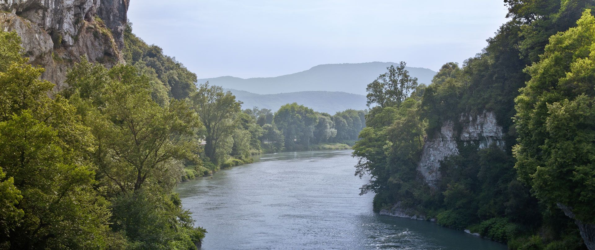
As you head back up to La Bruyère, you'll have a breathtaking view of the Rhone stretching out below. The river meanders through the landscape, lined with lush vegetation and dotted with small islands.
1
0

The Groslée bridge is a suspension bridge crossing the Rhône between the municipalities of Groslée-Saint-Benoit (Ain) and Brangues (Isère). Designed by Ferdinand Arnodin and completed in 1912, it has a main span of 177.21 m in length. Source: Wikipedia
0
0

The Col du Mont Tournier – 851 m – is located in the Savoyard Avant-Pays but belongs, from a geological point of view, to the Jura Massif.
2
0
Very beautiful water point to pass after the Glan Dieu waterfall.
0
0
Very pretty spot with these water currents.
0
0

The Col de la Lattaz offers beautiful views. Located at an altitude of 754 meters, the climb from the Mont Tournier pass is rather gradual. The road continues around the summit of Mount Chaffaron.
1
0
Frequently Asked Questions
How many traffic-free touring cycling routes are available in Groslée-Saint-Benoît?
There are over 75 dedicated traffic-free touring cycling routes in Groslée-Saint-Benoît, offering a wide variety of distances and difficulty levels for exploration.
What do other touring cyclists enjoy most about cycling in Groslée-Saint-Benoît?
The komoot community highly rates the touring cycling experience in Groslée-Saint-Benoît, with an average score of 4.5 stars from over 600 reviews. Cyclists particularly appreciate the peaceful riverside paths along the ViaRhôna, the varied landscapes of the Bugey region, and the numerous scenic viewpoints.
Are there any easy, family-friendly traffic-free routes suitable for beginners?
Yes, Groslée-Saint-Benoît offers over 30 easy touring cycling routes that are perfect for families and beginners. Many sections of the ViaRhôna provide flat, well-maintained paths ideal for a relaxed ride. An example of an easy route is the Groslée Bridge loop from Groslée, which is just under 14 km.
Can I bring my dog on the traffic-free cycling routes, especially the ViaRhôna?
Yes, dogs are generally permitted on the ViaRhôna and other traffic-free paths in Groslée-Saint-Benoît, provided they are kept on a leash. It's always a good idea to bring water for your pet and be mindful of other users on the path.
What natural attractions can I see along the traffic-free touring cycling routes?
The region is rich in natural beauty. You can cycle past the impressive Glandieu Waterfall, explore the tranquil Lac d'Ambléon, or discover the picturesque Brive Waterfall. The Cascade des Dards is another beautiful waterfall nestled in a forest, offering a refreshing stop.
Are there any circular traffic-free touring routes available?
Many of the routes in Groslée-Saint-Benoît are circular, allowing you to start and finish in the same location. For example, the Groslée Bridge – Château de Brangues loop from Brégnier-Cordon offers a moderate 47 km ride, while the Groslée Bridge loop from Réserve naturelle nationale du Haut-Rhône français is an easier 14.6 km option.
Where can I find parking for these traffic-free cycling routes?
Parking is generally available in the villages and towns along the routes, such as Groslée-Saint-Benoît and Brégnier-Cordon. Look for designated parking areas near trailheads or public spaces. The ViaRhôna often has specific parking facilities at key access points.
What is the best time of year to enjoy traffic-free touring cycling in Groslée-Saint-Benoît?
Spring (April-June) and autumn (September-October) are ideal for touring cycling in Groslée-Saint-Benoît. The weather is typically mild, and the natural scenery, from blooming flowers to vibrant autumn foliage, is at its most beautiful. Summer can also be pleasant, especially along the shaded riverside paths, but be prepared for warmer temperatures.
Are there any historical or cultural points of interest along the routes?
While cycling, you can discover historical sites such as the Château de Groslée or the ruins of the 13th-century Château des Marches in Saint-Benoît. The region's heritage is also showcased at the Musée Escale Haut Rhône in Brégnier-Cordon, which is easily accessible from some of the ViaRhôna sections.
Can I find places to eat or drink along the traffic-free cycling routes?
Yes, the villages and towns along the routes, including Groslée-Saint-Benoît, offer various options for refreshments. You'll find cafes, restaurants, and local shops where you can stop for a break and refuel during your ride.
Are there any routes with particularly scenic views of the Rhône River?
Absolutely. The ViaRhôna is central to the region's cycling, offering continuous views of the majestic Rhône River. Routes like the Beautiful view over the Rhône – Lac de Barterand loop from Brégnier provide stunning panoramas over the river and its surrounding landscapes.
Most popular routes around Groslée-Saint-Benoît
Most popular attractions around Groslée-Saint-Benoît

Get inspired with the komoot mobile app


Explore more
Browse the best Cycling routes in other regions.
