The best hikes from bus stations around Parco Regionale Naturale dei Monti Lucretili
4.4
(2352)
8,748
hikers
33
hikes
Bus station hiking trails around Parco Regionale Naturale dei Monti Lucretili traverse a landscape characterized by pre-Apennine formations, including mountains, karst plateaus, and pastoral valleys. The region features significant peaks like Monte Pellecchia (1370 m) and Monte Gennaro (1271 m), alongside dense beech forests and unique geological features from ancient marine sedimentary formations. Hikers can explore a variety of environments, from open plateaus to shaded woodlands and serene lakes such as the Laghetti di Percile. The park offers an extensive…
Last updated: July 13, 2026
4.2
(12)
40
hikers
Moderate hike. Good fitness required. Easily-accessible paths. Suitable for all skill levels.
4.8
(4)
22
hikers
22.6km
08:20
1,090m
1,090m
Hard hike. Very good fitness required. Sure-footedness, sturdy shoes and alpine experience required.

Sign up for free
4.0
(5)
19
hikers
17.3km
06:10
980m
980m
Hard hike. Very good fitness required. Sure-footedness, sturdy shoes and alpine experience required.
4.5
(2)
13
hikers
Hard hike. Very good fitness required. Mostly accessible paths. Sure-footedness required.
1.5
(2)
7
hikers
8.75km
02:30
210m
210m
Moderate hike. Good fitness required. Easily-accessible paths. Suitable for all skill levels.
Get access to more routes and recommendations from other explorers.
Sign up for free
Already have an account?
Our route recommendations are based on thousands of hikes, rides, and runs completed by other people on komoot.
Start today with a free account
Your next adventure awaits.
Login or Signup
Popular around Parco Regionale Naturale dei Monti Lucretili
Other adventures around Parco Regionale Naturale dei Monti Lucretili

Tips from the Community

View of Lake Marraone, not reachable because the path is closed due to dangerous banks.
0
0

A wonderful clearing where we can find wild cattle grazing. There are many varieties of beautiful flowers to admire (and please do not pick!) From here we begin the climb to the wonderful peak of Monte Gennaro
0
0

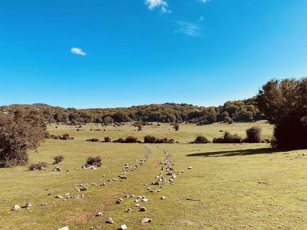
over time a short stretch of flat path has been marked out with stones, suggestive
0
0

Suggestive to say the least, very low grass and populated by cows and horses. An excellent refreshment point before the summit!
0
1
Visible from miles away, and far from ancient, it represents one of the symbols of the mountain. For the more athletic and risk-takers there is also an iron staircase planted inside which would allow you to climb to the top of the tower. It is strongly not recommended judging by the stability of the structure.
0
0
There is the possibility to choose how to reach the top of Gennaro either via the path or the dirt road. The first is more impervious but with a beautiful view of the Roman plain; the second, very well groomed but with a greater difference in altitude. The two roads meet in front of the Monte Gennaro refuge and then continue towards the top.
0
0
Challenging path in the first part, but despite what appears on the map the climb is not so steep and impervious. The path is very well trodden and sheltered from the sun. After 25 hairpin bends and another hundred meters you will be able to enjoy a breathtaking view over the entire Roman plain, from the summit of Monte Gennaro or from the nearby tower.
0
0
Frequently Asked Questions
How many hiking trails accessible by bus are available in Parco Regionale Naturale dei Monti Lucretili?
There are 27 hiking routes in Parco Regionale Naturale dei Monti Lucretili that are accessible from bus stations. These trails offer a variety of experiences, with 7 easy, 13 moderate, and 7 difficult options to choose from.
Are there any easy, family-friendly hikes accessible by bus?
Yes, the park offers several easy routes suitable for families. While specific family-friendly routes are not detailed here, you can find 7 easy trails that are generally shorter and have less elevation gain, making them suitable for a relaxed outing. The region's diverse landscapes, from forests to karst plateaus, provide engaging scenery for all ages.
Can I find circular hiking routes that start and end at a bus station?
Yes, many of the bus-accessible routes are circular, allowing you to return to your starting point without needing additional transport. An example is the moderate route From Poggio Moiano to the Roman amphitheater - Circular walk, which offers a pleasant loop exploring local history.
Are there any trails with waterfalls or lakes accessible from bus stops?
Absolutely. You can explore trails that lead to beautiful natural water features. For instance, the moderate route Cineto Romano – Rioscuro Stream Waterfalls loop from Cineto Romano will take you to the Rioscuro Stream Waterfalls. Another option is the Fontanile of the Monti Lucretili – Lagustelli di Percile loop from Percile, which visits the serene Lagustelli di Percile.
What kind of natural features or landmarks can I expect to see on these bus-accessible hikes?
The bus-accessible trails in Parco Regionale Naturale dei Monti Lucretili offer a variety of natural and historical sights. You might encounter significant peaks like Pizzo Pellecchia or the expansive Monte Gennaro Meadow. The park is characterized by pre-Apennine landscapes, dense forests, and karst plateaus. You can also find historical elements like the Roman amphitheater near Poggio Moiano.
Are there any challenging or advanced hikes reachable by bus?
Yes, for experienced hikers, there are 7 difficult routes accessible by bus. An example is the demanding Monte Gennaro Saddle – Monte Gennaro Summit loop from Palombara Sabina, which involves significant elevation gain and offers panoramic views from Monte Gennaro, one of the park's highest peaks.
What do other hikers say about the bus station trails in Parco Regionale Naturale dei Monti Lucretili?
The komoot community highly rates the hiking experience in Parco Regionale Naturale dei Monti Lucretili, with an average score of 4.4 out of 5 stars from over 1970 ratings. Hikers often praise the diverse landscapes, well-marked trails, and the opportunity to explore both natural beauty and historical sites, even when relying on public transport.
Are dogs allowed on the hiking trails accessible by bus?
Generally, dogs are permitted on trails within Parco Regionale Naturale dei Monti Lucretili, but it's always recommended to keep them on a leash, especially in areas with wildlife or livestock. Specific regulations may vary, so check local signage or park authority guidelines for any restrictions on particular routes or during certain seasons.
What is the best time of year to hike these bus-accessible trails?
The park offers enjoyable hiking experiences throughout much of the year. Spring and autumn are particularly popular due to milder temperatures and vibrant foliage or blooming wildflowers. Summer can be hot, especially at lower elevations, so early morning starts are advisable. Winter hiking is possible, but some higher-altitude trails might require appropriate gear due to snow or ice.
Are there any amenities like cafes or shops near the bus stations or trailheads?
The villages and towns where bus stations are located, such as Percile, Palombara Sabina, Poggio Moiano, and Cineto Romano, typically offer basic amenities like small shops, cafes, or restaurants. It's advisable to check opening hours, especially in smaller villages, and to carry sufficient water and snacks for your hike as amenities might not be directly at every trailhead.
Can I find less crowded hiking options accessible by bus?
While popular routes can see more visitors, the extensive network of trails in Parco Regionale Naturale dei Monti Lucretili means you can often find quieter paths. Exploring some of the moderate or difficult routes, or visiting during off-peak times (weekdays, outside of major holidays), can help you discover more secluded sections of the park and enjoy its natural tranquility.
Most popular routes around Parco Regionale Naturale dei Monti Lucretili
Most popular attractions around Parco Regionale Naturale dei Monti Lucretili

Get inspired with the komoot mobile app


Explore more
Browse the best Hikes in other regions.
