The best waterfall hikes and walks around Parco Regionale Naturale dei Monti Lucretili
4.4
(2330)
8,718
hikers
46
hikes
Waterfall hiking trails around Parco Regionale Naturale dei Monti Lucretili traverse a landscape characterized by rolling hills, dense woodlands, and numerous streams that feed into cascades. The region, part of the Apennine mountain range, features varied elevations and natural water features. These trails offer opportunities to explore the park's natural beauty, including its distinctive rock formations and lush vegetation. The area provides a diverse environment for outdoor activities, with trails ranging from gentle walks to more challenging ascents.
Best waterfall…
Last updated: July 7, 2026
3.9
(7)
12
hikers
19.5km
06:35
790m
780m
Hard hike. Very good fitness required. Sure-footedness, sturdy shoes and alpine experience required.
3.8
(6)
26
hikers
9.21km
02:49
300m
300m
Moderate hike. Good fitness required. Easily-accessible paths. Suitable for all skill levels.

Sign up for free
5.0
(4)
24
hikers
29.4km
09:40
1,240m
1,240m
Hard hike. Very good fitness required. Mostly accessible paths. Sure-footedness required.
4.0
(5)
13
hikers
5.04km
01:40
240m
240m
Easy hike. Great for any fitness level. Easily-accessible paths. Suitable for all skill levels.
3.0
(3)
11
hikers
13.4km
04:58
550m
550m
Moderate hike. Good fitness required. Mostly accessible paths. Sure-footedness required.
Get access to more routes and recommendations from other explorers.
Sign up for free
Already have an account?
Our route recommendations are based on thousands of hikes, rides, and runs completed by other people on komoot.
Start today with a free account
Your next adventure awaits.
Login or Signup
Popular around Parco Regionale Naturale dei Monti Lucretili
Other adventures around Parco Regionale Naturale dei Monti Lucretili

Tips from the Community


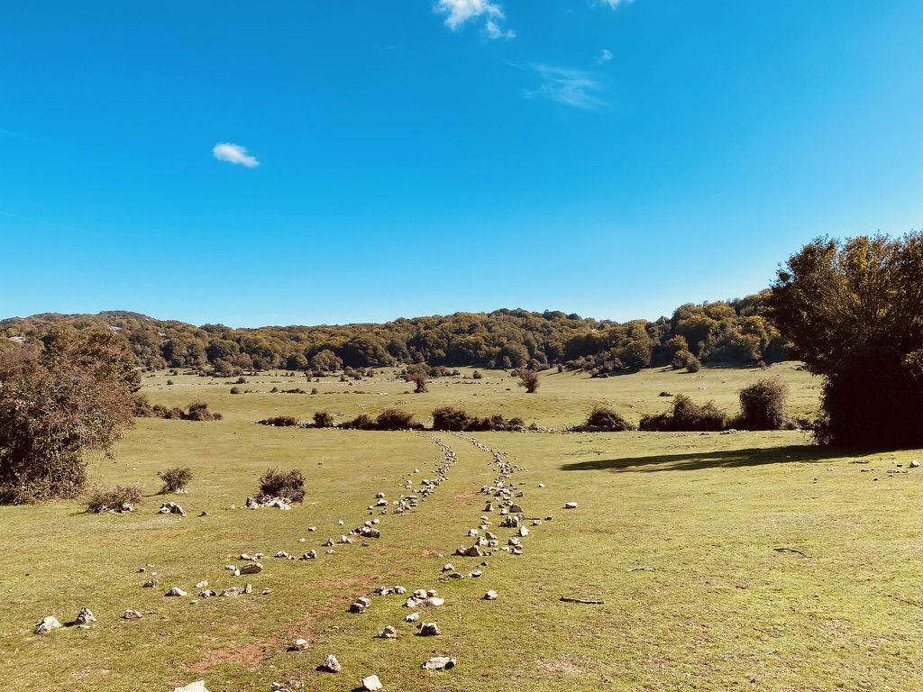
Flat spot before the ascent of Monte Gennaro
0
0

Suggestive to say the least, very low grass and populated by cows and horses. An excellent refreshment point before the summit!
0
1
Pratone landmark. Unfortunately for the conditions in which it concerns, full of manure and plastic.
0
0
Path to Pratone and Monte Gennaro, very well laid out and easy to follow. The path to Mount Morra is currently closed by a gate so conditions are uncertain. In the woods, pay attention to the path called "L Uva Spina" which connects the meadow to the Falicchio meadow. It is very well marked with BLUE CIRCLES rather than the classic white and red trail markers.
0
1

"This farmhouse may have been a typical agricultural residence and it seems to have undergone various vicissitudes over the centuries. During the period of the agrarian reform, part of its land was redistributed, while in more recent times it has seen progressive abandonment and degradation. The name "Burned" could derive from war events or fires that damaged its structure in the past. Today the site represents an example of rural architecture and offers ideas for the historical and tourist valorization of the area." (to check)!
0
0

Centuries-old elephant-shaped tree
0
0
Frequently Asked Questions
How many waterfall hiking trails are available in Parco Regionale Naturale dei Monti Lucretili?
There are over 40 waterfall hiking trails in Parco Regionale Naturale dei Monti Lucretili, offering a wide range of options for different skill levels and preferences.
Are there easy waterfall hikes suitable for beginners or families?
Yes, the park offers several easy waterfall hikes. A great option for beginners or families is the Pisciarello Stream – Maricella Stream Waterfall loop from Licenza, which is an easy 3.1-mile (5.0 km) trail that takes about 1 hour 40 minutes to complete and features two distinct waterfalls.
What is the typical duration for waterfall hikes in the park?
The duration of waterfall hikes varies significantly. Easy trails, like the Pisciarello Stream – Maricella Stream Waterfall loop from Licenza, can be completed in under two hours. More challenging routes, such as the Pizzo Pellecchia – Maricella Stream Waterfall loop from Licenza, can take around 6 hours due to their length and elevation gain.
When is the best time of year to visit the waterfalls in Parco Monti Lucretili?
The best time to experience the waterfalls is typically in spring, when snowmelt and seasonal rains ensure the cascades are at their most powerful and voluminous. Autumn also offers beautiful scenery with vibrant foliage, though water levels might be lower. Winter can be picturesque but some trails may be less accessible due to weather conditions.
What kind of gear should I bring for waterfall hikes in this region?
For waterfall hikes in Parco Monti Lucretili, it's recommended to wear sturdy hiking boots with good grip, as trails can be wet or slippery near waterfalls. Layered clothing is advisable, along with waterproof outerwear, especially during spring. Don't forget water, snacks, and a camera to capture the scenic views.
Are there any circular routes that include waterfalls?
Yes, many of the waterfall trails in Parco Monti Lucretili are designed as circular routes, allowing you to start and end at the same point. Examples include the popular Santa Maria del Piano – Cascata del Petescia loop from Orvinio and the Pisciarello Stream – Maricella Stream Waterfall loop from Licenza.
What can I see along the waterfall hiking trails besides the waterfalls themselves?
Beyond the beautiful waterfalls, the trails often lead through dense woodlands and offer views of the park's distinctive rock formations. You might also encounter natural monuments like Pizzo Pellecchia or the serene Lagustelli di Percile, depending on your chosen route.
What do other hikers enjoy most about hiking in Parco Regionale Naturale dei Monti Lucretili?
The area is highly rated by the komoot community, with an average score of 4.4 stars from over 1200 reviews. Hikers often praise the diverse terrain, the tranquility of the dense woodlands, and the refreshing experience of discovering the numerous streams and waterfalls.
Are there any challenging waterfall hikes for experienced hikers?
Absolutely. For experienced hikers seeking a challenge, routes like the Pizzo Pellecchia – Maricella Stream Waterfall loop from Licenza offer significant elevation gain and longer distances, leading through mountainous terrain to impressive waterfalls.
Are there any specific highlights or landmarks near the waterfall trails?
Yes, depending on the trail, you might find yourself near interesting landmarks. For instance, some routes offer views of Monte Guardia or pass by the Monte Gennaro Meadow. The region is rich in natural and historical points of interest.
How well-maintained are the waterfall hiking trails?
The trails in Parco Regionale Naturale dei Monti Lucretili are generally well-regarded by the komoot community. While conditions can vary with weather, many routes are frequently used and maintained, offering a pleasant hiking experience through the park's natural beauty.
Most popular routes around Parco Regionale Naturale dei Monti Lucretili
Most popular attractions around Parco Regionale Naturale dei Monti Lucretili

Get inspired with the komoot mobile app


Explore more
Browse the best Hikes in other regions.
