The best family-friendly hikes and walks around Parco Regionale Naturale dei Monti Lucretili
4.4
(2352)
8,748
hikers
53
hikes
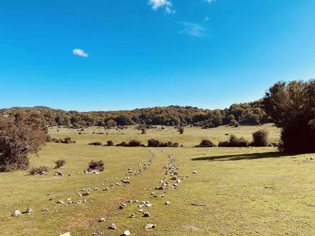
Family friendly hiking trails around Parco Regionale Naturale dei Monti Lucretili traverse a diverse landscape characterized by mountain peaks, karst plateaus, and extensive woodlands. The park features a unique ecological blend due to its transition zone between different marine environments. Hikers can explore a variety of forest types, from cultivated orchards at lower elevations to mixed deciduous and beech forests higher up, alongside meadows rich in botanical species. This region offers a network of well-signposted footpaths, providing varied terrain for outdoor exploration.
Best family friendly hiking trails around Parco Regionale Naturale dei Monti Lucretili
- The most popular family friendly hiking route is From Percile to Lagustelli – Regional Natural Park of Monti Lucretili, a 7.5 miles (12.1 km) trail that takes 3 hours 30 minutes to complete. This route leads to the tranquil Laghetti di Percile, nestled in wild nature.
- Another top favourite among local hikers is Monte Gennaro Loop from Prato Favale, a difficult 6.2 miles (10.0 km) path. This trail offers views of Monte Gennaro and the surrounding karst plateaus.
- Local hikers also love the Prato Favale to the Monte Gennaro, a 5.8 miles (9.4 km) trail leading through varied mountain terrain, often completed in about 3 hours 10 minutes.
- Hiking around Parco Regionale Naturale dei Monti Lucretili is defined by mountain peaks, karst plateaus, and diverse forests. The network offers options for different ability levels, including easy family friendly hiking trails and more challenging routes.
- The routes in Parco Regionale Naturale dei Monti Lucretili are highly rated by the komoot community with an average score of 4.4 stars from over 1900 reviews. More than 7600 hikers have used komoot to explore Parco Regionale Naturale dei Monti Lucretili's varied terrain.
Last updated: July 13, 2026
4.4
(107)
335
hikers
12.1km
03:32
310m
310m
Embark on a moderate hike from the charming village of Percile to the unique Lagustelli, covering 7.5 miles (12.1 km) with an elevation gain of 1026 feet (313 metres). This route typically takes around 3 hours and 31 minutes to complete, leading you through diverse woodlands of oak and hornbeam, open meadows, and areas of marsh vegetation. You will encounter varied terrain, including paved, unpaved, gravel, and natural surfaces, all while enjoying panoramic views of the Lazio Apennines and potentially spotting grazing cows and horses.
Planning your visit is straightforward, as the paths within the Monti Lucretili Regional Natural Park are generally well-signposted. Look for clear white and red markings and arrows that often include estimated times to various destinations, helping you navigate with ease. Starting your journey from Percile offers a convenient access point to this picturesque natural area.
The highlight of this trail is undoubtedly the Lagustelli themselves: two distinctive karst lakes, Fraturno and Marraone, formed by natural sinkholes. These lakes are known for their clear, sometimes turquoise waters and are surrounded by trees, creating a serene atmosphere. The area boasts a rich biodiversity, with opportunities for birdwatching and the presence of indicator species like crayfish and spectacled salamanders in the clear lake waters, showcasing a healthy ecosystem. Furthermore, Percile, your starting point, is recognized as one of "Italy's Most Beautiful Villages," adding a cultural dimension to your outdoor adventure.
4.6
(78)
212
hikers
9.97km
03:35
440m
440m
Embark on the Monte Gennaro Loop from Prato Favale, a challenging hike spanning 6.2 miles (10.0 km) with a significant elevation gain of 1434 feet (437 metres). This route takes approximately 3 hours and 35 minutes to complete, offering a diverse landscape. You will traverse dense forests, including an ancient beech forest in the Valle Cavalera, before reaching expansive grassy clearings like the Pratone del Monte Gennaro. The trail culminates at the Monte Gennaro Summit, where you can enjoy exceptional 360-degree panoramic views, often stretching from Rome to the distant Apennine mountains on clear days. Expect varied terrain, with some stony and uneven sections.
Before you set out, be aware that this is a difficult trail requiring good fitness and sure-footedness. You should wear sturdy hiking shoes to handle the varied terrain, which can be stony and potentially muddy, especially after rain. Good orientation skills are also essential for navigating the route effectively. Plan your visit during favorable weather conditions to fully appreciate the views and ensure a safer experience.
This loop is a rewarding experience for well-prepared hikers seeking a substantial challenge in the Parco Naturale Regionale dei Monti Lucretili. The opportunity to spot wild horses and cows in the Pratone del Monte Gennaro adds a unique wildlife element to your journey. The trail's demanding nature and the stunning vistas from the summit make it a notable adventure for those looking to explore the natural beauty and rugged landscapes of the region.

Sign up for free
3.8
(46)
111
hikers
9.35km
03:12
410m
410m
Moderate hike. Good fitness required. Mostly accessible paths. Sure-footedness required.
4.5
(6)
19
hikers
Hard hike. Very good fitness required. Mostly accessible paths. Sure-footedness required.
3.9
(7)
12
hikers
19.5km
06:35
790m
780m
Hard hike. Very good fitness required. Sure-footedness, sturdy shoes and alpine experience required.
Get access to more routes and recommendations from other explorers.
Sign up for free
Already have an account?
Our route recommendations are based on thousands of hikes, rides, and runs completed by other people on komoot.
Start today with a free account
Your next adventure awaits.
Login or Signup
Popular around Parco Regionale Naturale dei Monti Lucretili
Other adventures around Parco Regionale Naturale dei Monti Lucretili

Tips from the Community

Beautiful meadow on the slopes of Mount Follettoso
0
0

Suggestive to say the least, very low grass and populated by cows and horses. An excellent refreshment point before the summit!
0
1
Beautiful source of drinking water
1
0

wonderful place, the trail is very easy
1
0

Mount Guardia, or La Guardia, is the least known peak of the Lucretili mountains, perhaps due to its more secluded position compared to the nearby Pellecchia and Gennaro. The routes to reach this peak are longer than those to other areas of the park, but the view from here is worth all the effort.
3
0

This natural pool is formed by the clear waters of the Pisciarello stream. The flow of water can vary according to the season and a series of small waterfalls often form, all easily reachable by following the dirt path that goes up the moat. On hot, sultry summer days it is a pleasure to bathe in the icy, clear water.
2
0
These splendid lakes are a testimony of the karst phenomenon on the Lucretili mountains. The largest, the Fraturno lake, exposed to the sun, the smallest enclosed in a deep sinkhole. Immersing yourself in the Fraturno waters is a unique experience if you overcome the initial skepticism of the muddy bottom!
5
0
Frequently Asked Questions
How many family-friendly hiking trails are available in Parco Regionale Naturale dei Monti Lucretili?
Our guide features over 50 hiking trails suitable for families in the Parco Regionale Naturale dei Monti Lucretili. Among these, you'll find 6 easy routes perfect for a relaxed outing with children, alongside many moderate options for families seeking a bit more adventure.
What are some easy, shorter routes suitable for families with young children?
For families with young children looking for an easier, shorter walk, consider trails that explore the lower elevations and charming villages. While specific short, easy routes are not detailed in the provided data, many of the park's 6 easy trails offer gentle terrain. Look for routes around villages like Percile or Licenza for accessible starting points.
Are there any circular family walks in the Monti Lucretili Park?
Yes, the park offers several circular routes that are great for families. For example, the From Roccagiovine to Monte Guardia - ring tour provides a scenic loop, though it is rated difficult and might be better suited for families with older, more experienced hikers. Always check the difficulty and length to ensure it's right for your family.
What natural features or landmarks can we see along family-friendly trails?
The Monti Lucretili Park is rich in natural beauty. Families can explore the enchanting Lagustelli di Percile, two serene lakes nestled in wild nature. The Monte Gennaro Meadow offers expansive views and is a great spot for a picnic. You might also encounter diverse forests and meadows, home to a variety of flora and fauna.
Are there any historical or cultural points of interest suitable for families?
Absolutely! The park is dotted with charming medieval villages and historical sites. You can explore towns like Orvinio with its Malvezzi-Campeggi Castle, or visit Licenza, known as the ancient retreat of the Roman poet Horace. Palombara Sabina is dominated by the majestic Savelli Castle, offering a glimpse into the region's rich past.
What is the best time of year to visit Parco Regionale Naturale dei Monti Lucretili with family?
The Monti Lucretili Park is beautiful year-round, but spring and autumn are particularly pleasant for family hikes. In spring, the meadows burst with wildflowers, including around 60 different kinds of flowering orchids. Autumn offers comfortable temperatures and stunning fall foliage. Summer can be warm, so early morning or late afternoon hikes are recommended, while winter can bring snow to higher elevations, offering a different kind of adventure.
Are dogs allowed on the family-friendly hiking trails?
The Parco Regionale Naturale dei Monti Lucretili is generally dog-friendly, but it's always best to keep your dog on a leash, especially in areas with wildlife or near grazing animals. Please ensure you clean up after your pet to help preserve the park's natural environment for everyone.
Where can we find parking for family hikes in the park?
Parking is typically available near the starting points of many trails, especially in or near the villages that serve as trailheads. For example, if you plan to hike to the Lagustelli, you can often find parking in Percile. For routes around Monte Gennaro, Prato Favale is a common starting point with parking options. Always check specific route details for recommended parking locations.
What do other hikers enjoy most about hiking in Parco Regionale Naturale dei Monti Lucretili?
The area is highly rated by the komoot community, with an average score of 4.4 stars from over 1970 ratings. Reviewers often praise the park's diverse and unspoiled landscapes, the tranquility of its forests, and the stunning vistas from its peaks. The well-signposted paths and the blend of natural beauty with historical charm are also frequently highlighted.
Are there any trails that lead to water features like lakes or waterfalls?
Yes, the park is home to the beautiful Laghetti di Percile, which are two enchanting lakes, Fraturno and Marraone. The trail From Percile to Lagustelli is a moderate route that takes you directly to these tranquil water features, offering a lovely destination for a family outing.
What should we pack for a family day hike in Monti Lucretili?
For a family day hike, it's essential to pack plenty of water, snacks, and a picnic if you plan to eat on the trail. Comfortable hiking shoes, sun protection (hats, sunscreen), and layers of clothing are advisable, as mountain weather can change. A first-aid kit, a map or GPS device, and binoculars for wildlife spotting will also enhance your experience.
Most popular routes around Parco Regionale Naturale dei Monti Lucretili
Most popular attractions around Parco Regionale Naturale dei Monti Lucretili

Get inspired with the komoot mobile app


Explore more
Browse the best Hikes in other regions.
