The best hikes from bus stations around Forêt de Rothonne
4.5
(653)
3,572
hikers
29
hikes
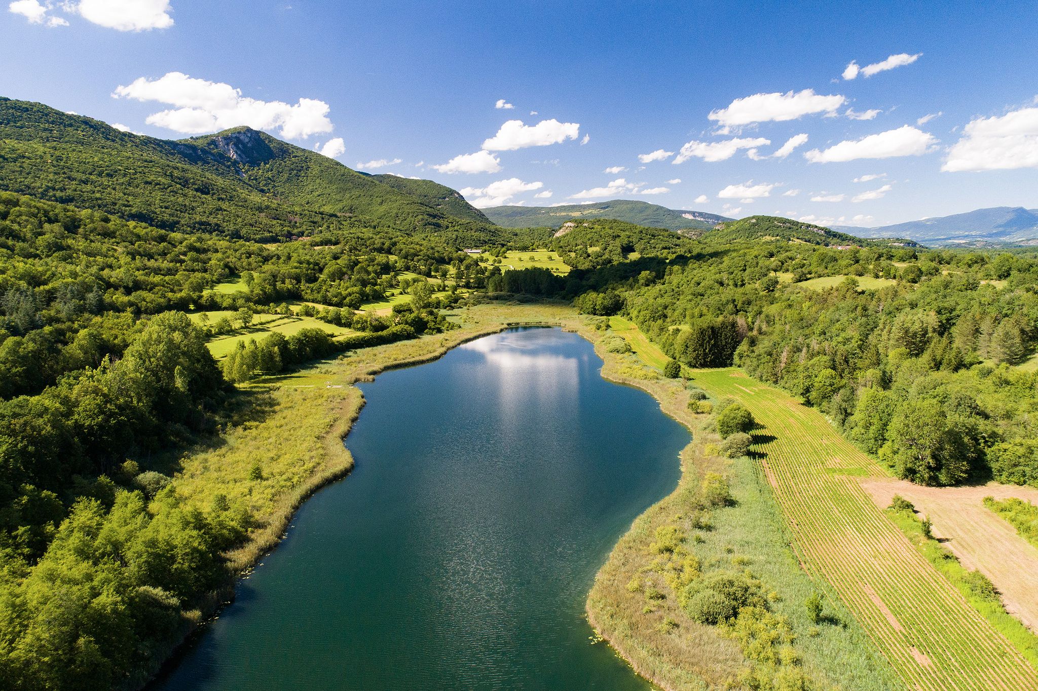
Bus station hiking trails around Forêt de Rothonne offer access to a diverse natural landscape in the Ain department of France. The region is characterized by dense, shaded woodlands, gentle hills, and tranquil ponds. Trails often feature modest elevation gains, making them accessible for various fitness levels. From certain points, views of "la Dent du Chat" are visible, adding to the scenic appeal of the area.
Best bus station hiking trails around Forêt de Rothonne
- The most popular bus station hiking route is Sublime Forets loop from Belley, a 9.2 miles (14.8 km) moderate trail that takes 4 hours 1 minute to complete. This route features a gentle ascent of approximately 656 feet (200 m) through the forest.
- Another top favourite among local hikers is What a bulwark! loop from Virignin, a moderate 5.3 miles (8.5 km) path. This trail includes varied terrain with an elevation gain of 1,053 feet (321 m), offering views and a mix of forest and open sections.
- Local hikers also love the The ViaRhôna Lodges – Virignin la Balme footbridge loop from Virignin, a 3.7 miles (6.0 km) trail leading through riverside landscapes, often completed in about 1 hour 32 minutes.
- Hiking around Forêt de Rothonne is defined by shaded forest paths, accessible arboretums, and historical trails. The network offers options for different ability levels, from easy riverside walks to moderate forest ascents.
- The routes in Forêt de Rothonne are highly rated by the komoot community with an average score of 4.5 stars from over 500 reviews. More than 2,900 hikers have used komoot to explore Forêt de Rothonne's varied terrain.
Last updated: June 29, 2026
11
hikers
5.90km
01:34
50m
60m
Easy hike. Great for any fitness level. Easily-accessible paths. Suitable for all skill levels.
3.0
(1)
9
hikers
14.8km
04:01
200m
200m
Moderate hike. Good fitness required. Easily-accessible paths. Suitable for all skill levels.

Sign up for free
4.3
(4)
12
hikers
9.49km
03:04
400m
400m
Moderate hike. Good fitness required. Easily-accessible paths. Suitable for all skill levels.
5.0
(1)
3
hikers
Easy hike. Great for any fitness level. Easily-accessible paths. Suitable for all skill levels.
10
hikers
5.09km
01:18
10m
10m
Easy hike. Great for any fitness level. Easily-accessible paths. Suitable for all skill levels.
Get access to more routes and recommendations from other explorers.
Sign up for free
Already have an account?
Our route recommendations are based on thousands of hikes, rides, and runs completed by other people on komoot.
Start today with a free account
Your next adventure awaits.
Login or Signup
Popular around Forêt de Rothonne
Other adventures around Forêt de Rothonne

Tips from the Community

Very nice cyclist bridge over the Rhône. It could become slippery in icy and wet conditions.
0
0
If camping were possible, it would be a great idea on the bike path.
0
0

Public toilets are located behind the lodges in the parking lot for cars and campers. We find far fewer public toilets on the Via Rhona than on the Atlantic coast (Normandy, Brittany, Velodyssee).
0
0

A 19th century fortress that was never seriously used. Incredible walls/ditches. Considering that this fortress was built to protect the nearby monastery from raids and attacks by the Austrians, one has to wonder how rich this monastery was. Unfortunately, both the fortress and the monastery cannot be visited. No matter, the fortress is also an adventure playground. If it hadn't been well over 31 degrees, we would have explored even more.
0
0

A beautiful footbridge to avoid the departmental road
1
0

In the Natura 2000 zone, this metal footbridge between the departments of Ain and Savoie is 170 meters long and offers superb views of the Rhône.
3
0

Allows you to connect the cycle route without making a detour. beautiful area
1
0

Rolling course, undergrowth, forest, valley, a true concentrate of nature.
0
0
Frequently Asked Questions
How many bus-accessible hiking trails are available around Forêt de Rothonne?
There are over 25 hiking routes accessible from bus stations in the Forêt de Rothonne area. These trails cater to various fitness levels, offering a diverse range of experiences from easy strolls to more challenging treks.
What types of landscapes can I expect on bus-accessible hikes in Forêt de Rothonne?
Hikes accessible by bus in Forêt de Rothonne primarily feature serene, shaded forest environments. You can expect tranquil paths, an arboretum with diverse tree species, and opportunities to observe local flora and fauna. Some elevated points, particularly along routes like the 'Parcours Chevreuil', offer views of la Dent du Chat. The area also includes ponds where deer and roe deer may be spotted.
Are there easy hiking options accessible from bus stations in the Forêt de Rothonne area?
Yes, there are several easy hiking options accessible from bus stations. For instance, the The ViaRhôna Lodges – Virignin la Balme footbridge loop from Virignin is an easy 6 km route, and the Virignin la Balme footbridge loop from Virignin is an even shorter 4.6 km easy walk. These routes are generally flat with minimal elevation gain, making them suitable for a relaxed outing.
Can I find circular hiking routes that start and end near bus stops?
Many of the trails in the Forêt de Rothonne area are designed as loops, making them ideal for circular walks from bus stops. For example, the Sublime Forets loop from Belley offers a moderate 14.8 km circular hike, and the What a bulwark! loop from Virignin is an 8.5 km moderate option, both starting and ending conveniently for public transport users.
Are the bus-accessible trails in Forêt de Rothonne suitable for families with children?
Absolutely. Forêt de Rothonne is very family-friendly. Beyond the easy hiking trails, the forest offers engaging activities like a 'nature challenge' discovery course and a puzzle trail for children. The arboretum is also designed to be accessible, and there are picnic areas available, some with facilities for barbecues, making it a great destination for a family day out.
Are dogs allowed on the hiking trails around Forêt de Rothonne?
While the region research does not explicitly state dog policies, generally, dogs are welcome on leash in French public forests like Forêt de Rothonne. It's always recommended to keep your dog under control and clean up after them to ensure a pleasant experience for all visitors and protect local wildlife.
What natural attractions or landmarks can I see on hikes accessible by bus?
On hikes accessible by bus, you can explore the diverse natural features of Forêt de Rothonne. Key attractions include the accessible arboretum, bird observation stations, and interpretive botanical panels. From certain viewpoints, you can enjoy vistas of la Dent du Chat. For a more dramatic natural sight, the Glandieu Waterfall – View of the Rhône Valley loop from Brégnier offers a challenging hike that includes the impressive Glandieu Waterfall.
Are there any historical points of interest along the bus-accessible routes?
Yes, Forêt de Rothonne has a rich history. You can explore the '133rd Infantry Trail,' which commemorates soldiers and features remnants of exercise trenches and a firing mound used before World War I. This trail includes explanatory panels, metal silhouettes, and artistic works, offering a unique blend of nature and history.
What is the best time of year to hike in Forêt de Rothonne from a bus station?
Forêt de Rothonne is enjoyable year-round due to its predominantly shaded trails. Spring and autumn offer pleasant temperatures and beautiful foliage. Summer provides a cool escape from the heat under the dense canopy. Even in winter, the forest can be beautiful, though some paths might be muddy or require appropriate footwear.
Are there amenities like picnic areas or accessible facilities along the trails?
Yes, Forêt de Rothonne is well-equipped with amenities. You'll find numerous picnic tables, some specifically designed for wheelchair users. There's also a barbecue area and covered shelters available. The forest is committed to accessibility, featuring dedicated parking for people with disabilities and a 1 km main path with educational and sporting equipment accessible to individuals with reduced mobility.
What do other hikers enjoy the most about hiking in Forêt de Rothonne?
The area is highly rated by the komoot community, with an average score of 4.5 stars. Reviewers often praise the tranquil, shaded forest environment, the well-maintained and clearly marked trails, and the diverse range of activities available for all ages. The accessibility features and family-friendly attractions are also frequently highlighted.
Most popular routes around Forêt de Rothonne

Get inspired with the komoot mobile app


Explore more
Browse the best Hikes in other regions.
