The best traffic-free bike rides around Muldestausee
4.8
(13)
43
riders
5
rides
Gravel biking around Muldestausee offers routes through a landscape transformed from a former lignite mining area into a region of lakes and forests. The terrain features a mix of rolling hills, dense woodlands, and lakeside paths, providing varied surfaces for gravel cyclists. The Muldestausee reservoir, a significant body of water, is central to the area, with routes often bordering the Dübener Heide Nature Park. This post-industrial environment has created a diverse biotope with numerous cycling opportunities.
Best no traffic gravel bike trails around Muldestausee
- The most popular no traffic gravel bike trail is Ferropolis Entrance – Großer Goitzschesee Gauge Tower loop from Mühlbeck, a 36.7 miles (59.1 km) trail that takes 3 hours 7 minutes to complete. This moderate route explores the transformed landscape around the Großer Goitzschesee.
- Another top favourite among local gravel bikers is Oranienbaumer Heide – Lake in Wörlitzer Park loop from Burgkemnitz, a moderate 50.2 miles (80.8 km) path. This route guides riders through the Oranienbaumer Heide and past the Wörlitzer Park lake.
- Local gravel bikers also love the Salegaster Forst Forest Path – View of the Mulde River loop from Burgkemnitz, a 25.5 miles (41.0 km) trail leading through the Salegaster Forst, often completed in about 2 hours 22 minutes.
- Gravel biking around Muldestausee is defined by transformed industrial landscapes, extensive lake systems, and dense forests. The network offers options for different ability levels, from easy loops to more challenging moderate routes.
- The routes in Muldestausee are highly rated by the komoot community with an average score of 4.7 stars from over 15 reviews. More than 40 gravel bikers have used komoot to explore Muldestausee's varied terrain.
Last updated: July 13, 2026
5.0
(2)
3
riders
Moderate gravel ride. Good fitness required. Mostly paved surfaces. Suitable for all skill levels.
4.3
(3)
16
riders
62.3km
03:23
170m
170m
Moderate gravel ride. Good fitness required. Mostly paved surfaces. Suitable for all skill levels.

Sign up for free
5.0
(1)
1
riders
16.6km
01:00
60m
60m
Easy gravel ride. Great for any fitness level. Mostly paved surfaces. Suitable for all skill levels.
5.0
(2)
2
riders
31.7km
01:47
130m
130m
Easy gravel ride. Great for any fitness level. Mostly paved surfaces. Suitable for all skill levels.
4.3
(4)
12
riders
Moderate gravel ride. Good fitness required. Mostly paved surfaces. Suitable for all skill levels.
Our route recommendations are based on thousands of hikes, rides, and runs completed by other people on komoot.
Start today with a free account
Your next adventure awaits.
Login or Signup
Popular around Muldestausee

Tips from the Community

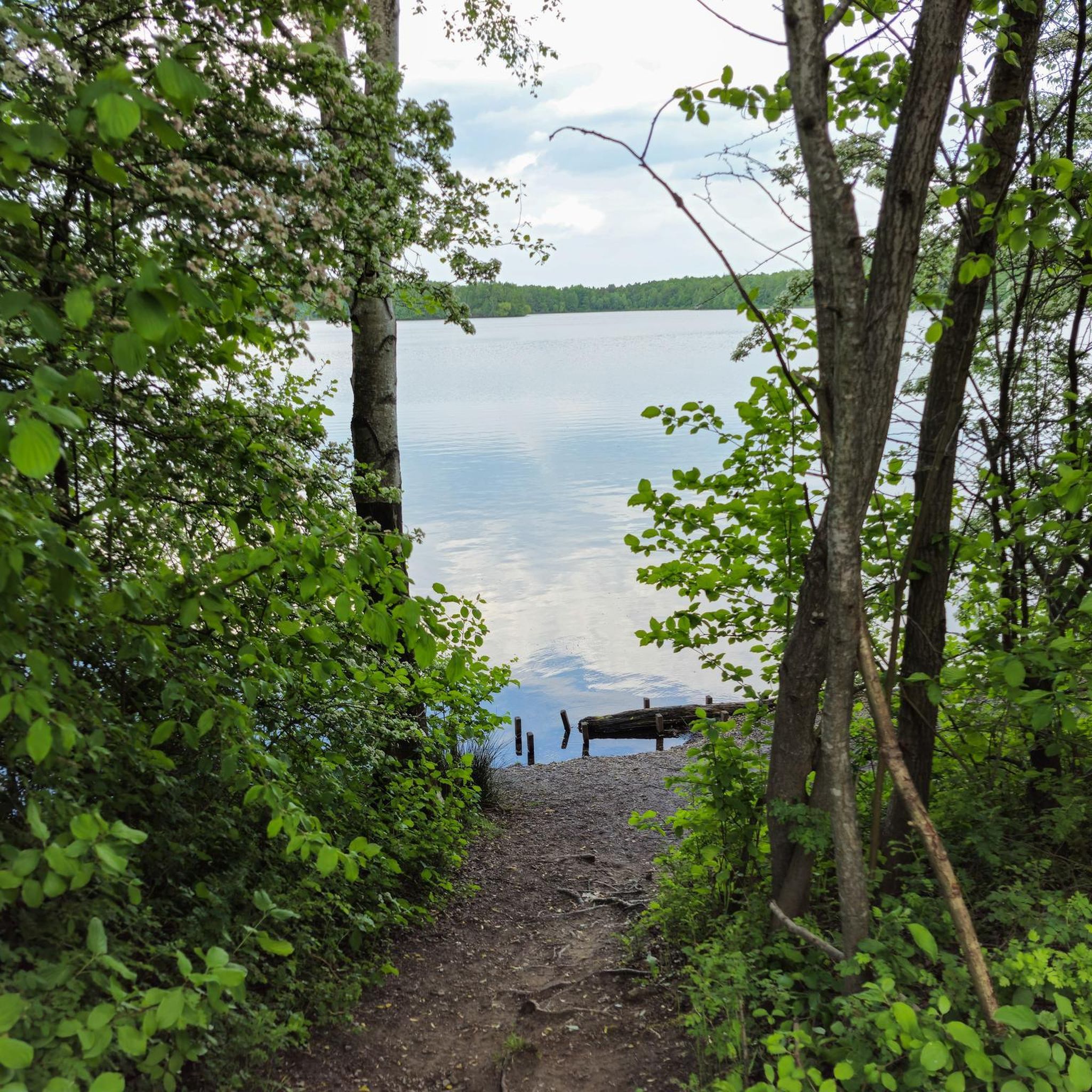
This view from the circular path onto the Goitzsche is always beautiful again.
1
0
Today, an developed network of cycle paths and hiking trails with viewing platforms and information boards on the formation of the landscape extends along the Neuhäuser See. The 120 km long Kohle-Dampf-Licht cycle path from Lutherstadt Wittenberg to Markkleeberg passes by the lake. Source https://de.wikipedia.org/wiki/Neuh%C3%A4user_See
1
0
In the mid-19th century, the first mining activities began in the southwest of Goitzsche, near the villages of Petersroda and Holzweißig.[3] Following the lignite seam, mining progressed from west to east. Favored by the opening of the current Magdeburg–Leipzig and Trebnitz–Leipzig railway lines, the sales market for lignite expanded to Halle and Leipzig, among other places. The increased demand for electrical energy and fossil fuels in the 19th and 20th centuries led in 1908 to the opening of the Leopold open-cast mine (from 1945 to 1962 Holzweißig–Ost) and in 1958 to the creation of the Holzweißig-West open-cast mine.[3] The Neuhäuser See originated from the former Holzweißig-West lignite open-cast mine. It is named after the Neuhaus estate, which was demolished in 1976 along with the village of Paupitzsch. The Holzweißig-West open-cast mine was operated from 1958 to 1980. Other sources report usage until 1991. The lake was flooded from 1993 to 2005.[1] Overflowing water is channeled via the Goitzsche into the Mulde. Since 1997, the area has been renatured and stable embankments have been created. Source https://de.wikipedia.org/wiki/Neuh%C3%A4user_See
1
0
The Neuhäuser See is located on the northwestern border of the Free State of Saxony with Saxony-Anhalt, at an altitude of about 78 m above sea level. NN. South of the lake is Benndorf, a district of the North Saxon district town of Delitzsch, and to the north is the unified municipality of Bitterfeld-Wolfen in Saxony-Anhalt. It is located in the Central German Lake District, south of the Großer Goitzschesee and the waters Ludwigsee and Paupitzscher See. Quelle https://de.wikipedia.org/wiki/Neuh%C3%A4user_See
1
0
The Neuhäuser See (also Neuhauser See) is an opencast mine residual lake of approximately 155 hectares, which was created by flooding the former Holzweißig-West opencast mine. The lake is located in the Central German Lake District, south of the Goitzsche nature reserve and north of the town of Delitzsch. Source https://de.wikipedia.org/wiki/Neuh%C3%A4user_See
1
0

Beautiful lake with a circular path. This circular path is quite wide and 3/4 asphalted. The lake and forest resort is recommendable 👍
1
0
The Pulverhäuschen is a historic building that was used in earlier times for storing explosives. The explosives stored there were used to remove ice jams or ice barriers on the Mulde. The building is made of irregular rubble masonry and is covered by a pointed barrel vault. The cornerstones at the building corners, the belt course at the base, the projecting eaves, and the two-rowed coverings are made of red bricks. The outer surface of the barrel vault is plastered. The Pulverhäuschen shows numerous damages, including defects in the masonry, damaged or improperly renewed joints, crumbling plaster on the barrel vault, and a clearly visible subsidence due to insufficient foundation. Source https://www.raguhn-jessnitz.de/de/pulverhaeuschen.html
2
0
Simply wonderful 👍
1
0
Frequently Asked Questions
How many traffic-free gravel bike routes are available around Muldestausee?
There are 8 dedicated traffic-free gravel bike routes around Muldestausee featured in this guide, offering a variety of experiences for cyclists looking to explore the region without vehicle interference.
What kind of terrain can I expect on the no-traffic gravel bike trails in Muldestausee?
The Muldestausee region, a transformed former industrial area, offers a diverse gravel biking experience. You can expect a mix of rolling hills, dense forests, and scenic lakeside paths. Many routes border the Dübener Heide Nature Park, providing natural, varied terrain suitable for gravel bikes.
What do other cyclists enjoy most about gravel biking in Muldestausee?
The komoot community highly rates the gravel biking experience around Muldestausee, with an average score of 4.7 stars from 15 ratings. Cyclists often praise the quiet, traffic-free paths, the unique transformed landscape, and the beautiful views of the lake and surrounding nature.
Are there easy, beginner-friendly gravel bike routes without traffic around Muldestausee?
Yes, this guide includes 2 easy routes perfect for beginners or those seeking a more relaxed ride. While all routes are traffic-free, these easier options provide a gentle introduction to gravel biking in the region. For example, the route Ferropolis Entrance – Großer Goitzschesee Gauge Tower loop from Mühlbeck is rated moderate but offers accessible sections.
What is the typical length and duration of the traffic-free gravel bike routes?
The traffic-free gravel bike routes around Muldestausee vary in length and duration. You can find routes ranging from approximately 41 km, taking around 2 hours and 20 minutes, up to 80 km, which might take over 4 hours to complete. This allows you to choose a ride that fits your available time and fitness level.
What natural features and landmarks can I see along the traffic-free gravel bike trails?
Many routes offer stunning views of the Muldestausee itself, which is the third-largest body of water in Saxony-Anhalt. You can also discover the unique post-industrial landscape, dense forests, and the rich biotope that supports diverse wildlife. Highlights include the View of the Mulde River and the Muldestausee from the Muldestausee Bridge and the impressive Muldestausee Dam and Hydroelectric Power Plant.
Are there any circular gravel bike routes without traffic around Muldestausee?
Yes, all the traffic-free gravel bike routes featured in this guide are designed as circular loops, allowing you to start and end your ride at the same point. This makes planning your trip convenient, especially if you're driving to the trailhead.
Are the traffic-free gravel bike routes around Muldestausee suitable for families?
While the guide features routes with varying difficulty, the transformed landscape with its mix of paths and forests can be enjoyable for families. We recommend checking the individual route details for elevation and distance to choose the most suitable option for your family's experience level. The easier routes are generally more family-friendly.
Where can I park my car when accessing the traffic-free gravel bike trails?
Many of the circular routes start from towns like Mühlbeck, Burgkemnitz, Bitterfeld, or Löbnitz, which typically offer public parking options. For instance, the route Oranienbaumer Heide – Lake in Wörlitzer Park loop from Burgkemnitz begins near Burgkemnitz, where you can often find suitable parking to start your ride.
Is public transport available to reach the trailheads for traffic-free gravel biking?
Muldestausee is accessible by public transport, particularly to towns like Bitterfeld or Burgkemnitz, which serve as starting points for several routes. We recommend checking local train and bus schedules to plan your journey, as services may vary. From these towns, you can often cycle directly to the trailheads.
What is the best time of year for gravel biking around Muldestausee?
The Muldestausee region is beautiful throughout the year, but spring and autumn often offer the most pleasant conditions for gravel biking. The weather is typically milder, and the natural scenery, especially the forests bordering the Dübener Heide Nature Park, is particularly vibrant or colorful. Summer can also be great, but be prepared for warmer temperatures.
Are there places to eat or get refreshments along the traffic-free gravel bike routes?
While the routes focus on traffic-free sections, many pass near or through small towns and villages where you can find cafes or restaurants. The Muldestausee area is also popular for recreation, so you might find establishments near the lake shores. It's always a good idea to check the route details and plan your stops in advance.
Most popular routes around Muldestausee
Most popular attractions around Muldestausee

Get inspired with the komoot mobile app


Explore more
Browse the best Gravel rides in other regions.
