The best hikes from bus stations around Vålådalen
4.7
(104)
941
hikers
13
hikes
Bus station hiking trails around Vålådalen are situated in the Jämtland region of Sweden, within the Vålådalen Nature Reserve. The area features a varied landscape, including ancient coniferous and mountain birch forests, expansive mountain plateaus, wetlands, and streams. Elevations range from 500m to 1600m above sea level, offering diverse terrain for hikers. The Vålån River winds through the reserve, contributing to the scenic views.
Best bus station hiking trails around Vålådalen
- The most popular bus station hiking route is Vålådalens…
Last updated: October 15, 2026
5.0
(9)
69
hikers
11.0km
03:59
660m
650m
Moderate hike. Good fitness required. Easily-accessible paths. Suitable for all skill levels.
4.4
(8)
42
hikers
8.20km
02:24
120m
110m
Moderate hike. Good fitness required. Mostly accessible paths. Sure-footedness required.

13
hikers
Easy hike. Great for any fitness level. Easily-accessible paths. Suitable for all skill levels.
5.0
(5)
18
hikers
15.3km
04:45
510m
520m
Moderate hike. Good fitness required. Easily-accessible paths. Suitable for all skill levels.
4.5
(2)
4
hikers
11.1km
03:12
160m
170m
Moderate hike. Good fitness required. Mostly accessible paths. Sure-footedness required.
Get access to more routes and recommendations from other explorers.
Already have an account?
Our route recommendations are based on thousands of hikes, rides, and runs completed by other people on komoot.
Start today with a free account
Your next adventure awaits.


Tips from the Community

From here, numerous hiking trails start in summer and a few cross-country ski trails in winter.
0
0
A cozy little lake with a nice long beach where you can easily keep your distance. There is a toilet and several barbecue or campfire sites available. From here, you can wonderfully set off on hikes or trail runs.
0
0

Vålådalen Mountain Station sits at the edge of the nature reserve where the high terrain gives way to forest and valley — a warm, well-equipped base with accommodation, restaurant, and bus connections onward to Undersåker and the train line.
0
0

Serene place at the end of the valley!
0
0

Once you reach the Ottfjäll, you’ll be rewarded with a breathtaking 360-degree view of Ottsjö, the Anaris Massif, the Lunndörr Pass, Lillstensdalsfjället and the Bunner Mountains, as well as Helags and Sylarna. On a truly clear day, you can even see all the way to Östersund.
0
0

The Swedish trainer, sports official and filmmaker Gösta Olander (1893-1972) is inextricably linked to Vålådalen's success as a tourist and sporting highlight. He used to measure the time on the "Zeitmessungskiefer" (tidtagartall) in competitions.
2
0

This great rest area is located above the Vålån and offers a beautiful view of the river and the mountains. There is even a barbecue area here and if it rains you can find shelter in the hut.
2
0
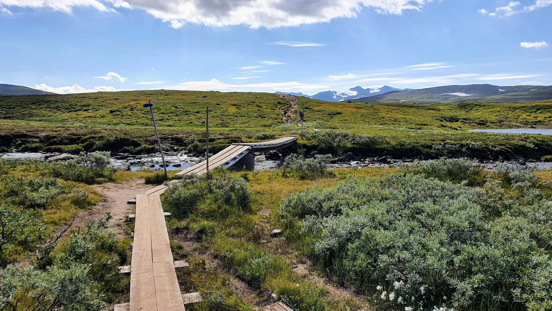
Impressive suspension bridge over the Vålån river.
1
0
Frequently Asked Questions
How many bus station hiking trails are available in Vålådalen?
There are 12 hiking routes accessible from bus stations in Vålådalen, offering a range of experiences from easy strolls to more challenging treks. This includes 5 easy, 6 moderate, and 1 difficult route.
What kind of landscapes can I expect on bus-accessible hikes in Vålådalen?
Vålådalen offers a diverse landscape, even on trails starting from bus stations. You can expect to hike through ancient coniferous and mountain birch forests, across open mountain plateaus, past wetlands and tarns, and alongside the scenic Vålån River. The region is also known for its unique glacial formations, such as the impressive gravel pyramids in Gröndalen.
Are there any easy, family-friendly hikes from the bus station?
Yes, Vålådalen has several easy routes perfect for families. A great option is the Vålådalens Fjällstation – View of the Vålån River loop from Vålådalen. This 3.4 km easy trail offers pleasant views and is suitable for most ages and fitness levels.
Can I find circular hiking routes that start and end at a bus station?
Many of the bus-accessible trails in Vålådalen are circular, allowing you to return to your starting point without needing additional transport. For example, the Vålådalens Fjällstation – Ottfjäll Creek Waterfall loop from Vålådalen is a moderate 11 km circular route that takes you past scenic waterfalls.
What interesting natural features or landmarks can I see along these trails?
Along the bus-accessible trails, you can discover several notable natural features. Keep an eye out for the impressive Suspension Bridge Over the Vålån, enjoy the turquoise waters of Östra Blanktjärnarna, or take in panoramic views from a View of the Vålån River. Some routes also lead to the beautiful Ingeborgfallet Waterfall.
Are there any routes that offer views of Ottfjället?
While the full ascent to Ottfjället Summit might be a longer endeavor, some routes provide excellent views of this prominent peak. The Vålådalens Fjällstation – Ottfjäll Creek Waterfall loop from Vålådalen offers glimpses of the surrounding mountain landscape, including Ottfjället.
What do other hikers enjoy most about hiking in Vålådalen?
The komoot community highly rates the hiking experiences in Vålådalen, with an average score of 4.6 stars from 92 ratings. Reviewers often praise the diverse and stunning natural features, the well-maintained trails, and the sense of wilderness, even on routes easily accessible by public transport.
Are there any longer, more challenging routes from a bus station?
Yes, for those seeking a greater challenge, the Vålådalens Fjällstation – Gösta Olander's Timekeeping Pine loop from Vålådalen is a difficult 19.7 km route. It features significant elevation changes and offers a more strenuous day out in the Vålådalen wilderness.
Can I find routes that pass by waterfalls?
Absolutely. The Ingeborgfallet Waterfall – Vålådalens Fjällstation loop from Vålådalen is a moderate 15.1 km route specifically designed to take you to the beautiful Ingeborgfallet Waterfall, a highlight of the region.
Are there any historical or cultural points of interest along the bus-accessible trails?
While Vålådalen is primarily known for its natural beauty, some routes touch upon local history. For instance, the Gösta Olander's Timekeeping Pine – Vålådalens Fjällstation loop from Vålådalen passes by Gösta Olander's Timekeeping Pine, a site with local significance related to the area's sporting heritage.
Most popular attractions around Vålådalen

Get inspired with the komoot mobile app


Explore more
Browse the best Hikes in other regions.
