The best hikes from bus stations around Setesdal Vesthei - Ryfylkeheiane landskapsvernområde
4.3
(1322)
5,684
hikers
49
hikes
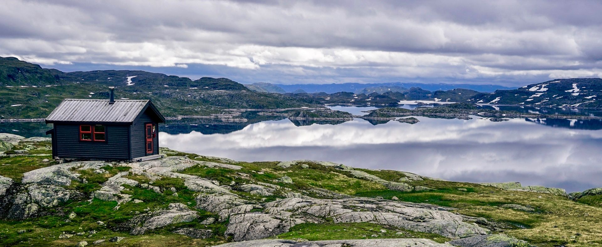
Bus station hiking trails around Setesdal Vesthei - Ryfylkeheiane landskapsvernområde traverse Norway's second-largest protected area, spanning 2,346 square kilometers. The landscape transitions from undulating highlands with birch forests and thousands of small lakes in the south to more rugged, alpine terrain with smooth bedrock and large boulders in the north, featuring peaks up to 1600m. Open heath areas, wide valleys, and untouched mountain sections are prevalent, with dramatic fjords like Lysefjorden on the western Ryfylke side. The region is characterized by countless lakes, tarns, and rivers, supporting diverse flora and fauna, including Europe's southernmost wild reindeer population.
Best bus station hiking trails around Setesdal Vesthei - Ryfylkeheiane landskapsvernområde
- The most popular bus station hiking route is Troll Cairns – Sloaros Cabin loop from Hovden kapell, a 16.1 miles (25.9 km) trail that takes 7 hours 43 minutes to complete. This difficult route offers an extensive wilderness experience through varied mountain terrain.
- Another top favourite among local hikers is View of Hovden and Hartevatnet – View from Hordalsnuten Summit loop from Hovden kapell, a moderate 4.5 miles (7.2 km) path. This trail provides views of Hovden and Hartevatnet from Hordalsnuten Summit.
- Local hikers also love the View from Hordalsnuten Summit – View of Hovden and Hartevatnet loop from Hovden fjellstoge, a 7.2 miles (11.5 km) trail leading through mountain landscapes, often completed in about 3 hours 24 minutes.
- Hiking around Setesdal Vesthei - Ryfylkeheiane landskapsvernområde is defined by extensive mountain plateaus, numerous lakes, and varied terrain from birch forests to alpine sections. The network offers options for easy, moderate, and difficult ability levels.
- The routes in Setesdal Vesthei - Ryfylkeheiane landskapsvernområde are highly rated by the komoot community with an average score of 4.4 stars from over 1000 reviews. More than 4000 hikers have used komoot to explore Setesdal Vesthei - Ryfylkeheiane landskapsvernområde's varied terrain.
Last updated: October 15, 2026
4.6
(14)
51
hikers
6.80km
01:53
120m
120m
Easy hike. Great for any fitness level. Easily-accessible paths. Suitable for all skill levels.
5.0
(3)
26
hikers
25.9km
07:43
790m
790m
Hard hike. Very good fitness required. Easily-accessible paths. Suitable for all skill levels.

14
hikers
7.35km
01:57
70m
80m
Easy hike. Great for any fitness level. Easily-accessible paths. Suitable for all skill levels.
5.0
(1)
6
hikers
8.28km
02:42
340m
340m
Moderate hike. Good fitness required. Easily-accessible paths. Suitable for all skill levels.
4.6
(16)
70
hikers
Moderate hike. Good fitness required. Easily-accessible paths. Suitable for all skill levels.
Get access to more routes and recommendations from other explorers.
Already have an account?
Our route recommendations are based on thousands of hikes, rides, and runs completed by other people on komoot.
Start today with a free account
Your next adventure awaits.
Popular around Setesdal Vesthei - Ryfylkeheiane landskapsvernområde
Other adventures around Setesdal Vesthei - Ryfylkeheiane landskapsvernområde

Tips from the Community

DNT's well-stocked cabin, always open, in a wonderful mountain and lake landscape. A truly fantastic location, and luxurious facilities with gas for cooking, two wood stoves, a well-stocked pantry, even electric light from a PV-powered battery! The drinking water is drawn from a nearby stream in buckets and tastes simply wonderful! The cabin is not locked and can be booked in advance most of the year, except for the hunting season in September. Hunters have priority then, but there is still room for individual hikers or couples. Payment is easy with the DNT's "Hyttebetaling" app. Wonderful starry sky, landscape all around, simply fantastic!
0
0

Nice place to take a break right on the lake shore.
1
0

Nice place to take a break and put your feet in the water.
0
0
Easily accessible, even with a stroller.
0
0
Shelter on the summit https://www.visitnorway.no/reisemal/sorlandet/setesdal/listings-setesdal/gapahuk-og-b%C3%A5lpanne-p%C3%A5-otros%C3%A5sen/206715/
0
0
Small shelter with fireplace, next to it a sandbox and swings.
0
0
Lt. Son are the “witch trees”. Nice shady clearing for a break.
0
0
Again with a map of the surrounding mountains for orientation.
0
0
Frequently Asked Questions
How many bus station hiking trails are available in Setesdal Vesthei - Ryfylkeheiane landskapsvernområde?
There are over 40 bus-accessible hiking trails in the Setesdal Vesthei - Ryfylkeheiane landskapsvernområde, offering a wide range of experiences from easy strolls to challenging multi-day treks. These routes allow you to explore Norway's second-largest protected area without needing a car.
What kind of terrain can I expect on bus-accessible hikes in this region?
The region offers remarkably diverse terrain. You can expect to find undulating highlands with birch forests and thousands of small lakes in the south, transitioning to more rugged, alpine landscapes with smooth bedrock, moraine ridges, and large boulders in the north. On the western Ryfylke side, trails often feature dramatic descents into narrow gorges and deep fjords, providing breathtaking scenic views.
Are there easy bus-accessible hikes suitable for beginners or families?
Yes, there are 21 easy bus-accessible routes perfect for beginners or families. An example is the Lakeside Rest Area – Shelter on Otrosåsen loop from Hovden kapell, which offers a gentle 7 km path with minimal elevation gain, allowing you to enjoy the scenery without strenuous effort.
Are there challenging bus-accessible hikes for experienced trekkers?
Absolutely. For experienced hikers, there are 4 difficult bus-accessible routes. A notable challenging option is the Troll Cairns – Sloaros Cabin loop from Hovden kapell. This demanding 25 km route involves significant elevation changes and offers a true wilderness experience, often leading to DNT cabins for overnight stays.
What natural features or landmarks can I see along bus-accessible routes?
Many bus-accessible routes lead to or pass by significant natural features. You can discover numerous lakes and tarns, and potentially spot the wild reindeer population. Highlights include the Island Chain in Setesdal Vesthei Ryfylkeheiane Landscape Protection Area and the panoramic vistas from Svarvarnuten Summit. The region also features old summer farming areas and cultural monuments.
Can I find circular bus-accessible routes in Setesdal Vesthei - Ryfylkeheiane?
Yes, many of the bus-accessible trails are designed as circular routes, allowing you to start and end your hike at the same bus stop without retracing your steps. For instance, the View of Hovden and Hartevatnet – View from Hordalsnuten Summit loop from Hovden kapell is a moderate 7 km circular hike offering great views.
What is the best time of year to hike these bus-accessible trails?
The best time for hiking in Setesdal Vesthei - Ryfylkeheiane is typically during the summer months, from late June to September, when the trails are clear of snow and the weather is most favorable. However, the area is also utilized for mountain skiing in winter, with marked trails available for colder months if you are prepared for winter conditions.
Are there any DNT cabins accessible from bus stops?
Yes, the region is well-equipped with DNT cabins, some of which are accessible from bus stops or serve as destinations on bus-accessible routes. These cabins, such as Bossbu Cabin by Botnsvatnet or Kringlevatn Cabin, offer convenient overnight stays and resupply points for longer treks, like the challenging Troll Cairns – Sloaros Cabin loop.
What do other hikers enjoy most about hiking in Setesdal Vesthei - Ryfylkeheiane landskapsvernområde?
The area is highly rated by the komoot community, with an average score of 4.4 stars. Reviewers often praise the genuine wilderness feel, the extensive network of well-marked trails, and the breathtaking panoramic views from various peaks. The opportunity for quiet, remote hikes and the presence of DNT cabins are also frequently highlighted.
Are there any bus-accessible routes that offer views of fjords?
While many bus-accessible routes focus on the high mountain plateau, the western Ryfylke side of the protected area dramatically plunges into narrow gorges and deep fjords like Lysefjorden, Jøsenfjorden, and Hylsfjorden. Some trails in this part of the region will offer expansive views over these dramatic fjord landscapes, though specific bus connections to these fjord-edge trailheads may require checking local transport schedules.
Can I bring my dog on these bus-accessible hiking trails?
Generally, dogs are welcome on hiking trails in Norway, but specific rules may apply in protected areas or on public transport. Always check local regulations regarding leash requirements, especially during nesting seasons for birds or in areas with wild reindeer. It's advisable to keep dogs on a leash to protect wildlife and ensure a pleasant experience for all hikers.
Most popular routes around Setesdal Vesthei - Ryfylkeheiane landskapsvernområde
Most popular attractions around Setesdal Vesthei - Ryfylkeheiane landskapsvernområde

Get inspired with the komoot mobile app


Explore more
Browse the best Hikes in other regions.
