The best dog-friendly hikes and walks around Setesdal Vesthei - Ryfylkeheiane landskapsvernområde
4.3
(1322)
5,684
hikers
4
hikes
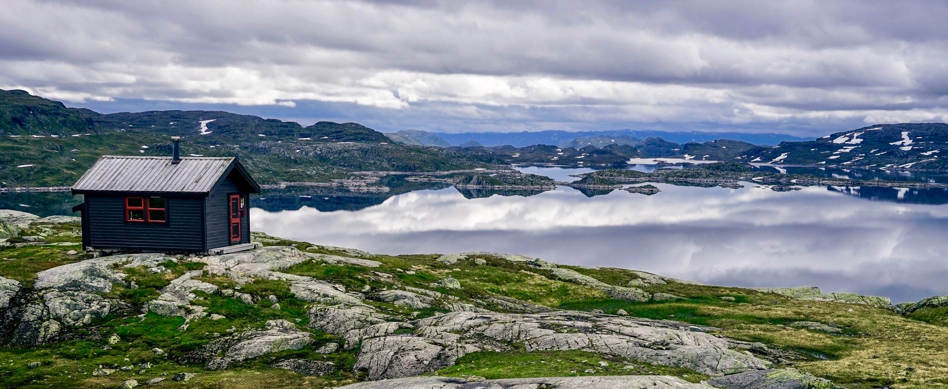
Dog friendly hiking trails around Setesdal Vesthei - Ryfylkeheiane landskapsvernområde traverse a diverse landscape of rolling moorlands, glaciated rock formations, and wide valleys. The region features mountain forests in its southern parts, transitioning to rougher terrain with moraine ridges and large boulders at higher elevations. Dramatic topography characterizes the western side, with land plunging towards fjords like Lysefjorden, offering views over the water and coastal islands. This protected area provides varied terrain for hikers and their dogs.
Best dog friendly…
Last updated: October 15, 2026
5.0
(2)
8
hikers
9.90km
02:45
170m
170m
Moderate hike. Good fitness required. Easily-accessible paths. Suitable for all skill levels.
5.0
(1)
6
hikers
8.28km
02:42
340m
340m
Moderate hike. Good fitness required. Easily-accessible paths. Suitable for all skill levels.

4.6
(34)
137
hikers
Easy hike. Great for any fitness level. Easily-accessible paths. Suitable for all skill levels.
4.3
(89)
190
hikers
8.69km
02:40
290m
290m
Moderate hike. Good fitness required. Easily-accessible paths. Suitable for all skill levels.
Our route recommendations are based on thousands of hikes, rides, and runs completed by other people on komoot.
Start today with a free account
Your next adventure awaits.
Popular around Setesdal Vesthei - Ryfylkeheiane landskapsvernområde
Other adventures around Setesdal Vesthei - Ryfylkeheiane landskapsvernområde

Tips from the Community

Is better suited for the afternoon.
0
0

Not an easy hike. Partly very steep, trails difficult to see due to lack of markings. Some trails are scree-covered. Hiking poles and sturdy footwear are required, as are some steep climbs.
1
0

Very beautiful waterfall, but often very slippery, so be careful!
0
0

We took the path above the shore. Even that was sometimes difficult to find
0
0
Rocky but beautiful climb
0
0
I'm not sure if the hut doesn't belong to the house
0
0
At the beginning it just goes up the rock
0
0
Beautiful lake, hardly any hikers around
0
0
Frequently Asked Questions
How many dog-friendly hiking trails are available in Setesdal Vesthei - Ryfylkeheiane landskapsvernområde?
There are 4 dog-friendly hiking trails in this guide for Setesdal Vesthei - Ryfylkeheiane landskapsvernområde. These include 1 easy route and 3 moderate routes, offering a good range of options for you and your canine companion.
What kind of terrain can I expect on dog-friendly hikes in Setesdal Vesthei - Ryfylkeheiane?
The terrain varies significantly across the region. In the southern parts, you'll find gently rolling moorlands with birch thickets and numerous small tarns and lakes. Moving northward, the landscape becomes rougher, featuring glaciated rock formations, moraine ridges, and large boulders. Expect open moorlands, wide valleys, and mountain forests. The western side, particularly Ryfylke, offers more dramatic topography with views over fjords.
Are there any easy dog-friendly hikes suitable for all fitness levels?
Yes, for an easier option, consider the View of Hovden and Hartevatnet – View from Hordalsnuten Summit loop from Hovden kapell. This 5.1 km route is rated as easy and offers pleasant views without significant elevation gain, making it suitable for a relaxed walk with your dog.
Can I find circular dog-friendly routes in the area?
Absolutely. All the dog-friendly routes featured in this guide are circular. For example, the Vatnedalsvatn Dam – Høydepunkt generated by Komoots dumme AI loop from Vatnedalsdammen is a moderate 9.9 km loop, and the Eikerapen Waterfall – Grill Cabin by the Lake loop from Eikerapen is an 8.7 km moderate loop.
What natural features or landmarks can I see on these dog-friendly trails?
The region is rich in natural beauty. You can encounter thousands of small tarns and lakes, dramatic fjords like Lysefjorden, and high peaks with panoramic vistas. Some routes offer views of large hydropower reservoirs such as Rosskreppfjorden and Blåsjø. You might also pass by cultural heritage sites like old summer farm areas. For specific points of interest, consider visiting the Bossbu Cabin by Botnsvatnet or exploring the scenic Lysevegen Road.
Are there any waterfalls on the dog-friendly routes?
Yes, the Eikerapen Waterfall – Grill Cabin by the Lake loop from Eikerapen specifically highlights a waterfall, making it a great option if you're looking to enjoy this natural feature with your dog.
What is the best time of year to hike with my dog in this region?
The best time for hiking in Setesdal Vesthei - Ryfylkeheiane is generally during the summer months, from late June to early September, when the trails are clear of snow and the weather is most favorable. Snowdrifts can persist on higher peaks throughout the summer. The area is also popular for winter cross-country skiing, but summer offers the most accessible hiking conditions for dogs.
What should I consider when hiking with my dog in Setesdal Vesthei - Ryfylkeheiane?
This is a protected area, home to the southernmost wild reindeer herd in Europe, as well as endangered bird species. Always keep your dog under control, preferably on a leash, to protect wildlife and respect local regulations. Be prepared for varied weather conditions, even in summer, and carry enough water for both yourself and your dog, as water sources might not always be readily available or safe to drink directly from.
Are there any less crowded dog-friendly options?
While the region is popular, its vastness allows for finding quieter spots. Generally, longer and more challenging routes tend to be less crowded. The View of Hardangervidda Plateau – Witch Trees loop from Hovden kapell, a moderate 8.1 km route, might offer a more secluded experience compared to shorter, more accessible trails, especially during off-peak hours.
What do other hikers say about the dog-friendly trails here?
The Setesdal Vesthei - Ryfylkeheiane landskapsvernområde is highly rated by the komoot community, with an average score of 4.4 stars from over 1000 ratings. Reviewers often praise the expansive wilderness, the sense of authentic nature, and the well-marked trails that make exploring with dogs enjoyable.
Where can I find parking for these dog-friendly trails?
Parking availability varies by trailhead. For routes starting near Hovden, such as the View of Hovden and Hartevatnet or View of Hardangervidda Plateau, you can typically find parking near Hovden kapell. For other routes like the Eikerapen Waterfall loop, parking would be available near Eikerapen. Always check the specific route details on Komoot for precise starting points and parking information.
Most popular routes around Setesdal Vesthei - Ryfylkeheiane landskapsvernområde
Most popular attractions around Setesdal Vesthei - Ryfylkeheiane landskapsvernområde

Get inspired with the komoot mobile app


