Wittenberge-Rühstädter Elbniederung
Wittenberge-Rühstädter Elbniederung
Top 5 Natural Monuments in Wittenberge-Rühstädter Elbniederung
Best natural monuments in Wittenberge-Rühstädter Elbniederung are found within a nature reserve spanning approximately 2124 hectares in the Prignitz district of Brandenburg, Germany. This area is characterized by its dynamic Elbe river landscape, featuring expansive floodplains, oxbow lakes, and diverse aquatic habitats. The region is recognized for its significant biodiversity, supporting over 1,300 plant species and more than 228 bird species. It offers opportunities to observe a variety of wildlife within a preserved river ecosystem.
Best natural monuments in Wittenberge-Rühstädter…
Last updated: July 5, 2026
Confluence of the Gnevsdorfer Vorfluter and the Elbe
Highlight • River
Translated by Google •
Tip by

Bridge Over the Karthane
Highlight • Bridge
Translated by Google •
Tip by

Sign up now to discover places like this
Get recommendations on the best single tracks, peaks, & plenty of other exciting outdoor places.
Sign up for free
Grumbkow Obelisk
Highlight • Monument
Translated by Google •
Tip by

Elbe Floodplain near Bälow
Highlight • Natural
Translated by Google •
Tip by
View of the Karthane
Highlight • River
Translated by Google •
Tip by

Start today with a free account
Your next adventure awaits.
Login or Signup
Popular around Wittenberge-Rühstädter Elbniederung
Road Cycling Routes in Wittenberge-Rühstädter Elbniederung
Hiking in Wittenberge-Rühstädter Elbniederung
Cycling in Wittenberge-Rühstädter Elbniederung
MTB Trails in Wittenberge-Rühstädter Elbniederung
Running Trails in Wittenberge-Rühstädter Elbniederung
Gravel biking in Wittenberge-Rühstädter Elbniederung
Tips from the Community

Very nice section with good bike path on top of the dike crown.
0
0

The Karthane is a left tributary of the Stepenitz. Your running length is 48 kilometers.
0
0

The Gnevsdorf drainage canal is an approximately eleven-kilometer-long, artificially constructed canal between the Havel and Elbe rivers, serving as an additional outlet into the Elbe. Its design aimed to shift the Elbe's backwater level downstream to a lower level, thus effectively relieving pressure on the Lower Havel during floods. Simultaneously, the canal improves the flow of Havel water to the Elbe, which has a steeper gradient. The Gnevsdorf drainage canal is part of a comprehensive flood control system that also includes several weirs and the Havelberg lock. A fantastic route along the Elbe Cycle Path, a relaxed tour with no significant difficulties. The scenery is beautiful, always by the water, pure nature. The old farmhouses are charming, and the route is very varied.
8
1
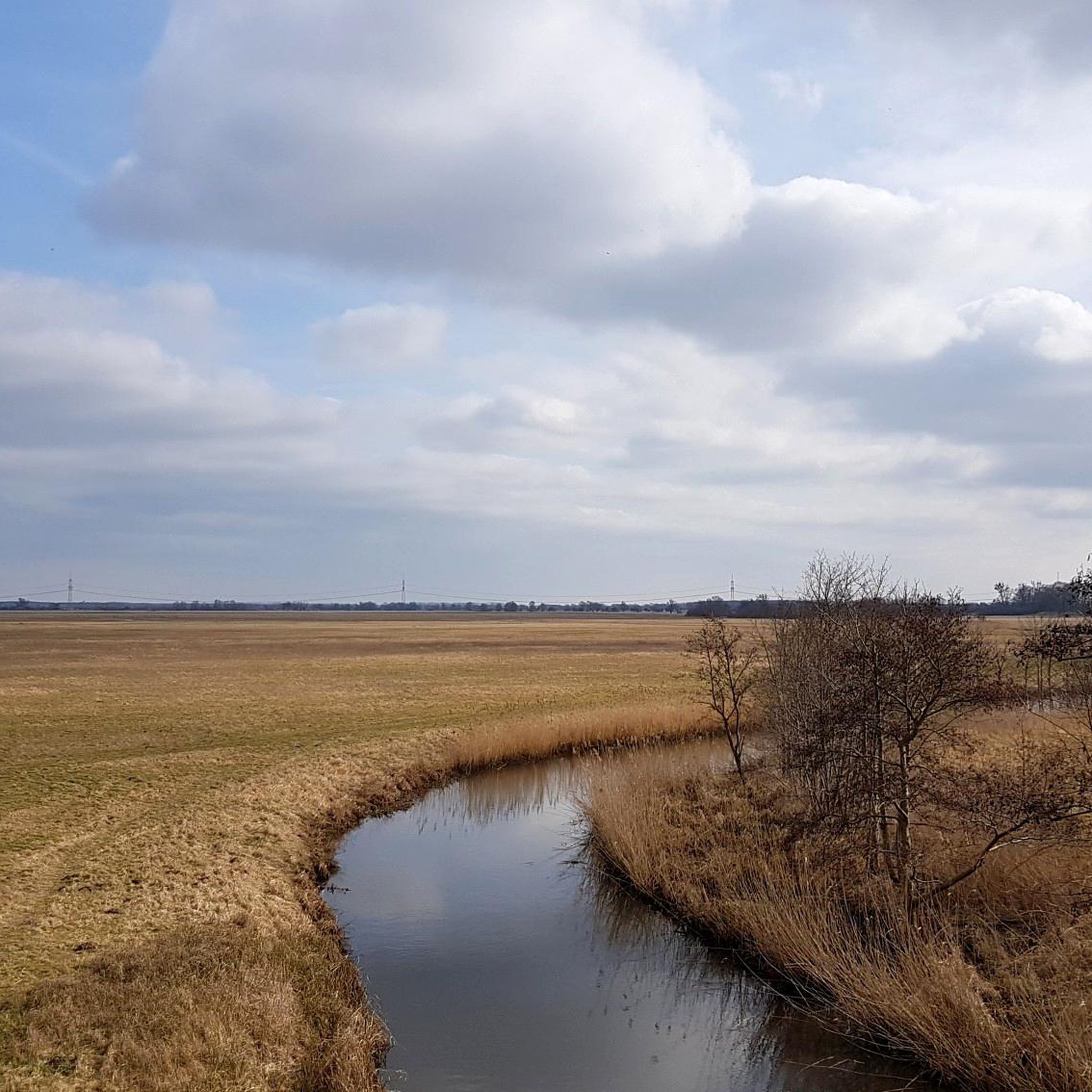
Not only sensible and useful, but also very nice to look at. The reflections in the water are a great photo opportunity. A short stop is worth it at this point, there are also many birds here, such as: B. Cranes can be observed in the meadows and on the Karthane.
6
0
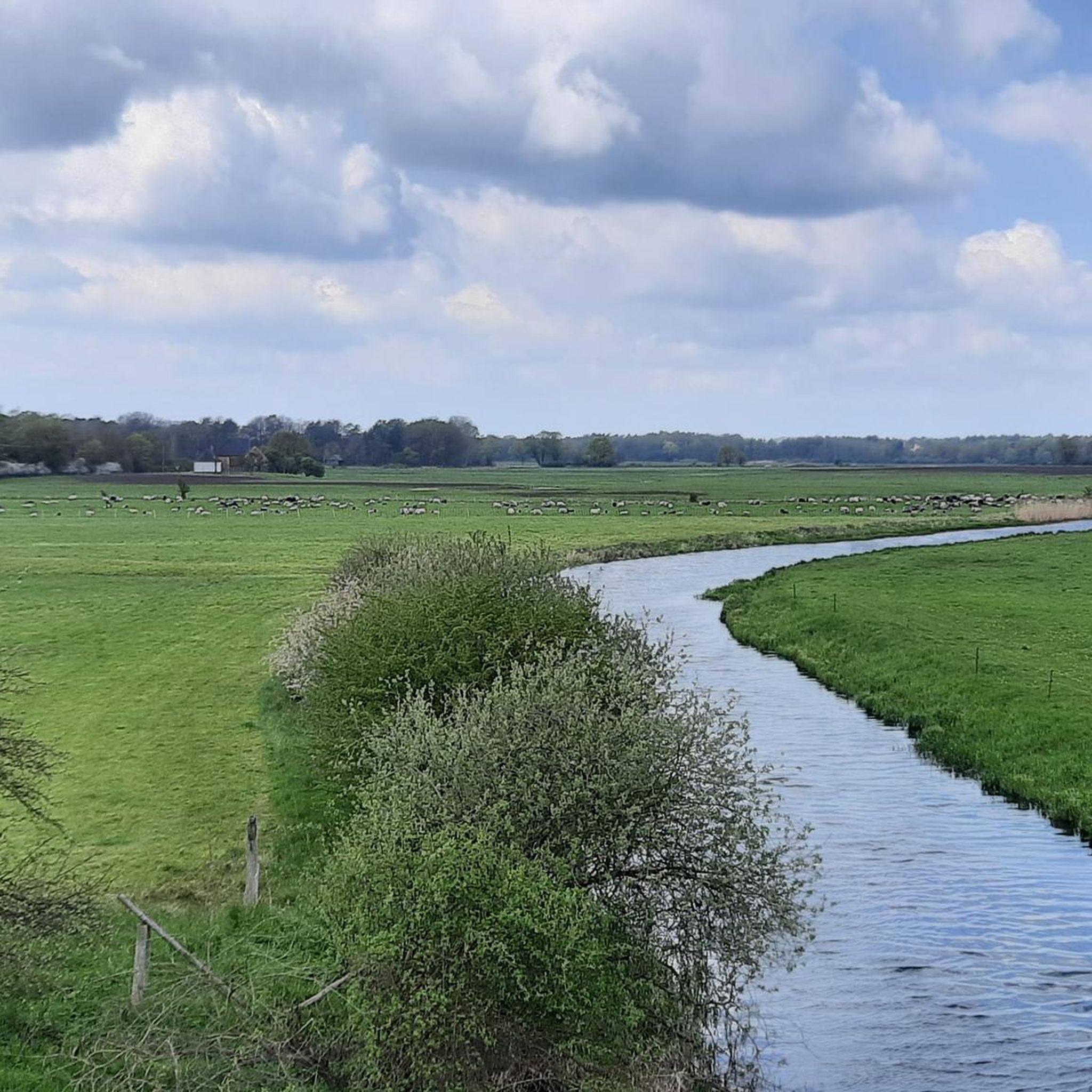
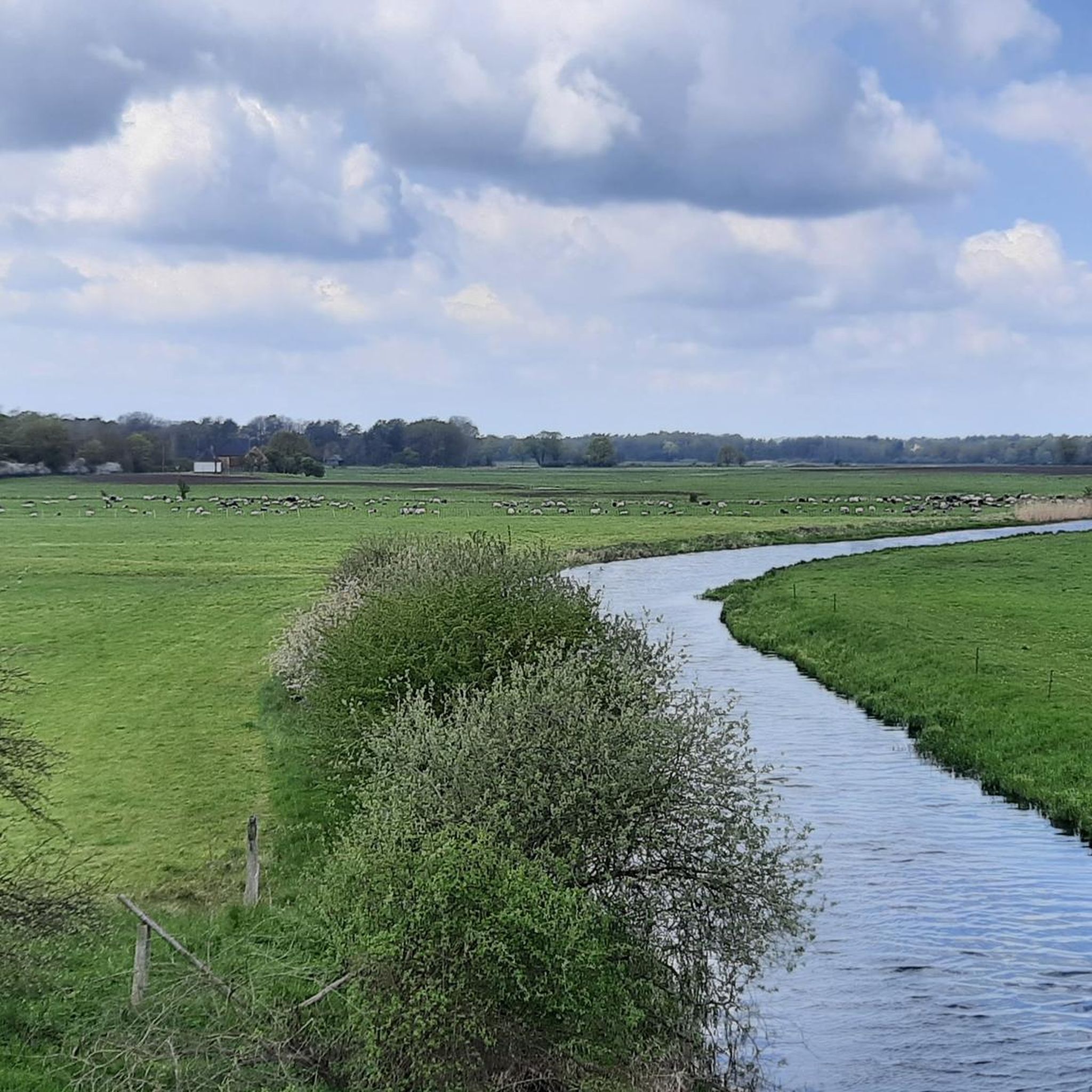
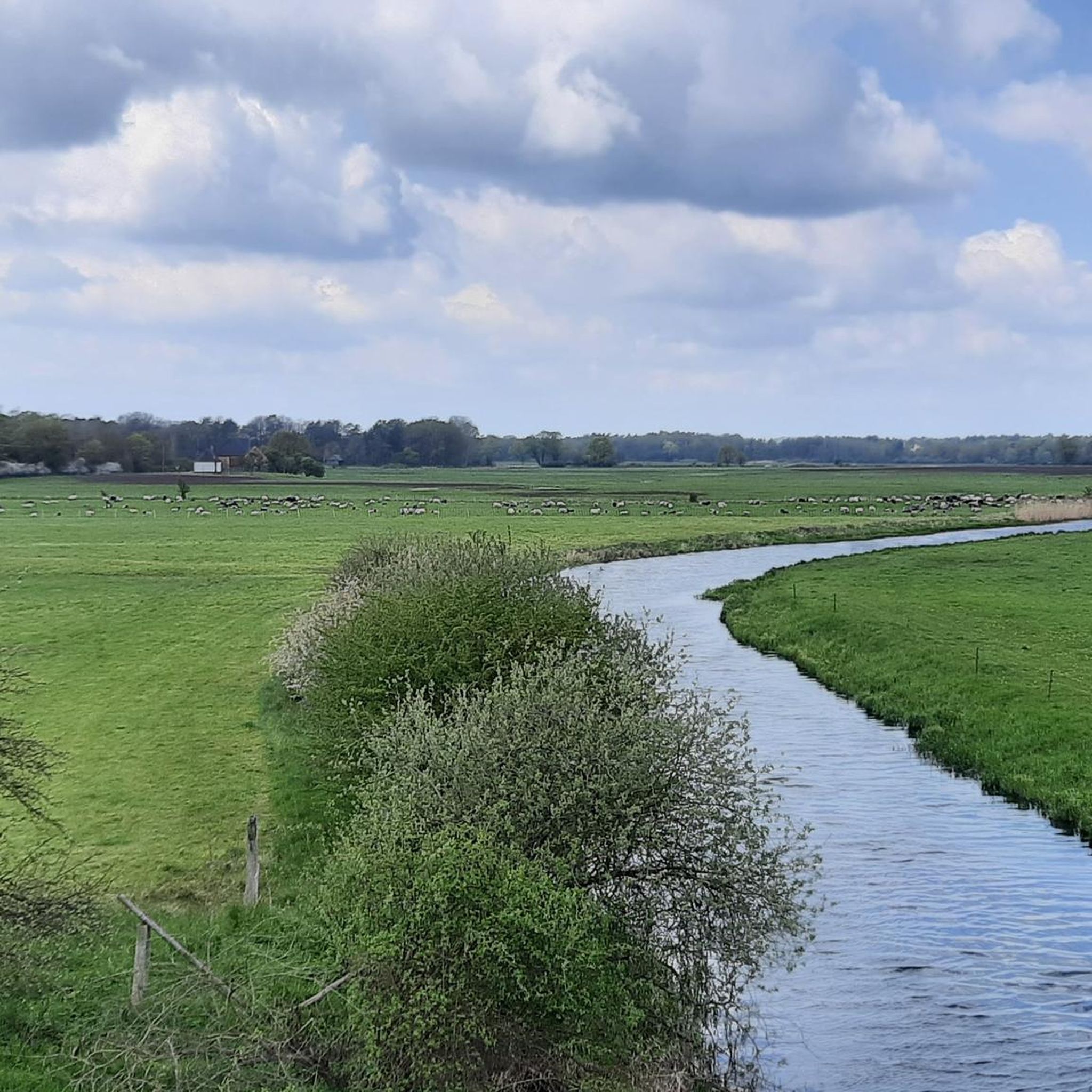
The cycle path leads over this bridge over the Karthane, which flows through a beautiful, wide landscape in this section. Very beautiful route and great sections on this route! Great! The Karthane is a left tributary of the Stepenitz in the Prignitz district. Its length is 48 kilometers, it has tributaries such as the Cederbach and a number of smaller streams and meadow ditches. The catchment area of the Karthane covers 436.8 km². The source area of the Karthane (Kehrberger Karthane) is in the area north of Klein Woltersdorf in the municipality of Groß Pankow, near the town of Seefeld between the 128 meter high Butterberg and the 120 meter high Wahrberg. https://de.wikipedia.org/wiki/Karthane
4
0

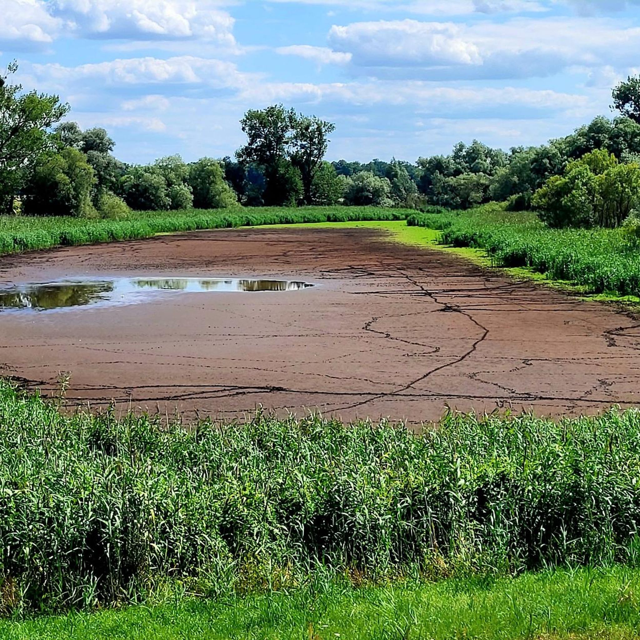
The top of the dyke offers attractive views of the Elbe meadows.
6
0
A visual axis (today an avenue of linden trees) leads from the castle through the park to the so-called white tower. This 10 m high sandstone obelisk was erected in 1719 by Friedrich Wilhelm von Grumbkow in gratitude for the feudal estate of Rühstädt and was extensively restored in 2006.
6
0

The confluence of the Gnevsdorf drainage ditch and the Elbe River is a significant hydraulic engineering project in Germany. The Gnevsdorf drainage ditch is an artificial canal that diverts the Elbe's backwater point, thus reducing the risk of flooding. The Gnevsdorf drainage ditch is an artificial channel that diverts the Elbe's backwater point, thereby reducing the risk of flooding. ...
13
1
Frequently Asked Questions
What unique natural features can I explore in Wittenberge-Rühstädter Elbniederung?
The Wittenberge-Rühstädter Elbniederung is defined by its expansive Elbe river landscape and dynamic floodplains. You can observe characteristic elements like temporary and permanent small bodies of water, oxbow lakes, and old river arms. A notable spot is the Elbe Floodplain near Bälow, where the top of the dyke offers attractive views of these unique Elbe meadows.
What kind of wildlife can I expect to see in the Wittenberge-Rühstädter Elbniederung?
The region is a haven for biodiversity. It's an internationally important area for birds, with over 228 species recorded, including thousands of migratory birds like taiga bean geese and whooper swans. You might also spot gray herons, cranes, white and black storks, ospreys, and sea eagles. Mammals such as the Elbe beaver and otter are present, particularly in the evenings or early mornings, alongside roe deer, red deer, wild boar, and foxes. Amphibians like the fire-bellied toad and reptiles such as the sand lizard also inhabit the area.
Are there family-friendly natural monuments or activities in the area?
Yes, several natural monuments are suitable for families. The Confluence of the Gnevsdorfer Vorfluter and the Elbe is family-friendly and offers well-paved cycle paths. The Bridge Over the Karthane is also family-friendly and wheelchair accessible, providing opportunities for birdwatching. Additionally, the Elbe Floodplain near Bälow and the View of the Karthane are great for nature observation with children.
What are the best opportunities for cycling near the natural monuments?
The Wittenberge-Rühstädter Elbniederung offers excellent cycling opportunities, especially along the Elbe Cycle Path and Havel Cycle Path. The Confluence of the Gnevsdorfer Vorfluter and the Elbe is a junction for multiple cycle paths. For more detailed routes, you can explore various options in the Cycling in Wittenberge-Rühstädter Elbniederung guide, which includes easy loops like the 'Farm café with garden – Havel Confluence With the Elbe loop from Rühstädt'.
Are there hiking trails available to explore the natural monuments?
Absolutely. The region features a network of hiking paths that allow you to experience the scenic beauty of the river landscape. For example, you can find routes like the 'Elbe Floodplain near Bälow – Grumbkow Obelisk loop from Wittenberge-Rühstädter Elbniederung' or the 'Havel Confluence With the Elbe – Stork Village Rühstädt loop from Rühstädt'. More hiking options are detailed in the Hiking in Wittenberge-Rühstädter Elbniederung guide.
What historical sites are located within or near the natural monuments?
While the region is primarily known for its natural beauty, you can also find historical elements. The Grumbkow Obelisk is a notable historical site, a 10-meter high sandstone monument erected in 1719. It was extensively restored in 2006 and is popularly known as the 'Grumbkow Pillar'.
What is the best time of year to visit the Wittenberge-Rühstädter Elbniederung for nature observation?
The Wittenberge-Rühstädter Elbniederung is particularly spectacular during migration seasons for birdwatching, typically in spring and autumn, when thousands of migratory birds utilize the area for resting. Spring also brings vibrant flora, while evenings and early mornings are best for spotting mammals like beavers and otters. The dynamic landscape changes throughout the year, offering unique experiences in every season.
Are there any viewpoints offering panoramic views of the Elbe landscape?
Yes, several spots provide excellent views. The top of the dyke near the Elbe Floodplain near Bälow offers attractive panoramic views of the Elbe meadows. The Confluence of the Gnevsdorfer Vorfluter and the Elbe and the Bridge Over the Karthane also serve as viewpoints, allowing you to appreciate the river and surrounding landscape.
What makes the Karthane River special in this region?
The Karthane is a significant left tributary of the Stepenitz, with a length of 48 kilometers. The View of the Karthane is known for its abundance of water lilies, creating a picturesque scene. The Bridge Over the Karthane offers views of the river flowing through a beautiful, wide landscape, where various birds, such as cranes, can often be observed.
What do visitors enjoy most about the natural monuments in Wittenberge-Rühstädter Elbniederung?
Visitors frequently praise the serene beauty and rich biodiversity of the area. Many enjoy the well-maintained cycle paths, especially along the Elbe, and the opportunities for birdwatching. The unique confluence of rivers and the expansive floodplains are often highlighted as particularly beautiful and peaceful. The chance to observe rare flora and fauna in a preserved river ecosystem is a major draw, as evidenced by over 1500 upvotes and 130 photos shared by the komoot community.
Are there options for mountain biking near the natural monuments?
Yes, the region offers trails suitable for mountain biking. You can find various routes, including those with moderate difficulty, such as the 'B107 Bridge over the Havel – View of Havelberg Cathedral loop from Rühstädt'. For a comprehensive list of trails, refer to the MTB Trails in Wittenberge-Rühstädter Elbniederung guide.
Can I bring my dog on the trails and to the natural monuments?
While specific regulations for dogs can vary, generally, dogs are welcome on trails in natural areas, often requiring them to be on a leash to protect wildlife. It's always recommended to check local signage or specific park rules for the exact area you plan to visit to ensure a pleasant experience for everyone and to protect the sensitive ecosystem.
Most popular routes in Wittenberge-Rühstädter Elbniederung
Most popular attractions in Wittenberge-Rühstädter Elbniederung

Get inspired with the komoot mobile app


Explore more
Extend your search for the best caves by checking out these guides of the top ones in Wittenberge-Rühstädter Elbniederung:
