The best walks and hikes in Gellibrand Point Nature Recreation Area
4.5
(3)
149
hikers
4
hikes
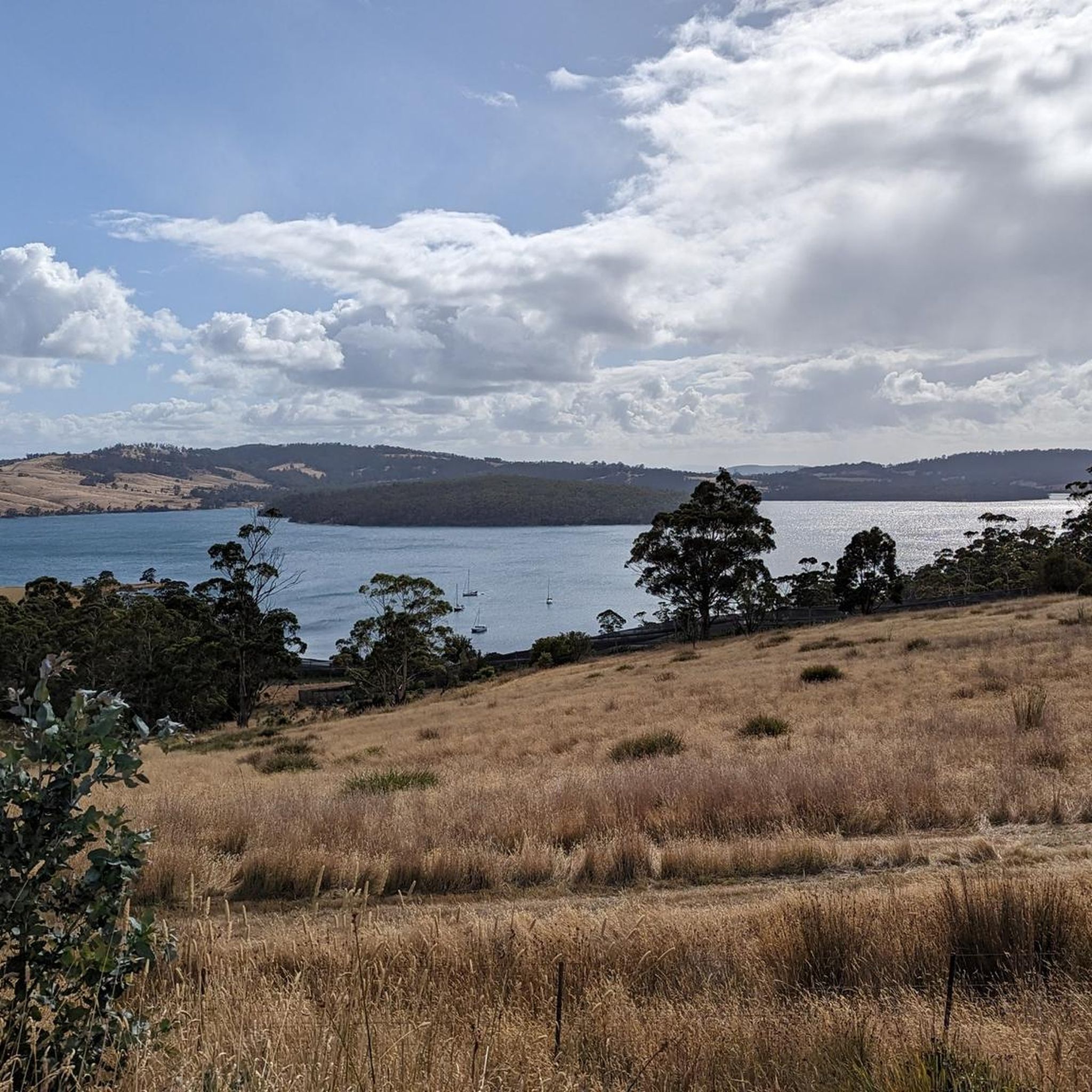
Hiking in Gellibrand Point Nature Recreation Area offers diverse landscapes, including coastal paths with views of cliffs and the sea, as well as inland forests and open grasslands. The terrain features picturesque bays and she-oak forests, providing varied environments for exploration. Hikers can experience panoramic vistas across the Derwent River towards Hobart and kunanyi/Mount Wellington. The area provides a range of walking experiences, from accessible paths to more moderate hikes.
Best hiking trails in Gellibrand Point Nature Recreation Area
- The…
Last updated: July 1, 2026
4.0
(1)
41
hikers
8.06km
02:21
220m
220m
Moderate hike. Good fitness required. Easily-accessible paths. Suitable for all skill levels.
28
hikers
5.74km
01:40
160m
160m
Easy hike. Great for any fitness level. Easily-accessible paths. Suitable for all skill levels.

Sign up for free
30
hikers
5.24km
01:26
80m
80m
Easy hike. Great for any fitness level. Easily-accessible paths. Suitable for all skill levels.
9
hikers
6.72km
01:44
30m
30m
Easy hike. Great for any fitness level. Easily-accessible paths. Suitable for all skill levels.
21
hikers
6.28km
01:36
10m
10m
Easy hike. Great for any fitness level. Easily-accessible paths. Suitable for all skill levels.
Our route recommendations are based on thousands of hikes, rides, and runs completed by other people on komoot.
Start today with a free account
Your next adventure awaits.
Login or Signup


Tips from the Community

This small beach in Sandy Bay is a great place to spot bird and marine life. You'll also have great views across the water to Hobart and beyond.
0
0

Alum Cliffs Lookout is a breathtaking viewpoint from the top of Alum Cliffs, looking 30 metres down onto bright blue waters below. There's a bench to take a break on and a fence to stay behind, as the cliffs can be unstable. The cliffs' geological makeup is of prehistoric Permian mudstone, and they are 3.5 kilometres in length.
1
0
Alum Cliffs Track connects Kingston Beach to the neighborhoods of Hinsby Beach via the Alum Cliffs, with wonderful views over Bonnet Point, Tyndal Beach and Taronga. The track is easy to follow and well-marked, with open views of the sea between lengths of walking thought forests of coastal blue gum forest with tall silver banksias. The climbs are short and rolling, tracing the coastline.
0
0
The Shot Tower Historic Site is one of the tallest buildings in Tasmania, a circular sandstone tower standing 58 metres high that was once used for producing lead shot. Today, anyone can ascend the 259 steps to the top for amazing views over the River Derwent and Hobart. There is also a café, tearoom, parking and toilets on site. It's free to climb the tower from 10:00 am to 5:00 pm.
0
0

Bellerive Beach is a beautiful stretch of sand with long views across the Derwent. Backed by open lawns and close to Bellerive’s village centre, the beach is an easy place to linger and watch sailboats and ferries moving across the river.
0
0
Wentworth Park is a spacious waterfront reserve with open green lawns and views across the River Derwent toward Hobart. There are picnic shelters, barbecues, toilets, and a playground, making it an ideal place to spend time by the water. Its foreshore setting, shaded areas, and easy access to the shoreline make it a popular spot for families and a relaxing break along the trail.
0
0
Clarence Foreshore Trail follows the eastern shoreline of the River Derwent, connecting beaches, reserves, wetlands, and waterfront suburbs with beautiful views across the water toward Hobart and kunanyi / Mount Wellington in the distance on a clear day. As you walk, the trail passes through a mix of coastal scenery, from sandy bays and rocky foreshore to open parkland, with opportunities to spot seabirds and enjoy quieter waterside sections. It's mostly gentle terrain makes it an easy and scenic way to experience Hobart’s eastern shore.
0
0
This beach forms part of the Errol Flynn Reserve, named after the "Golden Age of Holloywood" actor who was born and raised in Battery Point. It is said that the actor first pursued sailing and other nautical adventures here, skills that would go on to inspire his daring lifestyle both on and off screen.
0
0
Frequently Asked Questions
What kind of landscapes can I expect to see while hiking in Gellibrand Point Nature Recreation Area?
Hikers in Gellibrand Point Nature Recreation Area will encounter a diverse range of landscapes. These include stunning coastal paths with dramatic cliffs and sea views, tranquil inland forests, picturesque bays, and expansive open grasslands. You can also find she-oak forests and secluded beaches like Mitchells Beach and Mary Ann Bay.
Are there any easy hiking trails suitable for beginners or families in Gellibrand Point Nature Recreation Area?
Yes, Gellibrand Point Nature Recreation Area offers several easy trails perfect for beginners or families. An excellent option is the Sandy Bay Beach loop from Lower Sandy Bay, an easy 6.6 km path that provides a pleasant walk along the coastline, passing by sandy beaches. Another easy choice is the View of Cliffs and Sea loop from Kingston Beach, a 5.2 km trail through coastal scenery.
What are some notable landmarks or points of interest along the trails?
Beyond natural beauty, the area features several points of interest. You can discover public art installations like 'Seals and Penguins' and 'The Bernacchi Tribute,' which includes a statue of Antarctic explorer Louis Bernacchi. Historically, the Gellibrand Vault, the burial site of an early landowner, is accessible via the trails. The area also holds significant Aboriginal heritage.
Are there any circular hiking routes available?
Yes, many of the trails in Gellibrand Point Nature Recreation Area are designed as loops, offering circular routes. For example, the View of Cliffs and Sea loop from Taronga is a moderate 8.4 km circular trail with varied terrain and coastal views. The View of Cliffs and Sea loop from Bonnet Hill is another easy circular option, covering 4.5 km.
Can I bring my dog on the hiking trails?
The specific rules regarding dogs can vary within nature recreation areas. While some areas may permit dogs on leash, it's always best to check with the Tasmanian Parks and Wildlife Service or local signage for the most current regulations to ensure compliance and protect local wildlife.
What kind of wildlife might I see while hiking?
Gellibrand Point Nature Recreation Area is a good spot for wildlife observation, particularly for birdwatchers. The reserve is home to various bird species, including majestic wedge-tailed eagles. Visitors should be mindful of sensitive bird breeding habitats, especially on spits, and avoid disturbing them.
What are the typical trail conditions and surfaces?
The paths in Gellibrand Point Nature Recreation Area vary, catering to different hiking experiences. You'll find wide concrete sections in some areas, while others consist of narrower gravel tracks. The terrain can include coastal paths, forest trails, and open grasslands, offering a mix of surfaces.
What do other hikers say about the trails in Gellibrand Point Nature Recreation Area?
The routes in Gellibrand Point Nature Recreation Area are highly rated by the komoot community, with an average score of 4.5 stars. Hikers often praise the varied terrain, stunning coastal views, and the opportunity to explore both natural beauty and interesting historical features.
Are there good viewpoints for panoramic scenery?
Absolutely. A major highlight for many hikers is the panoramic vista across the Derwent River, offering spectacular views towards Hobart and the iconic kunanyi/Mount Wellington. Coastal paths also provide expansive views of cliffs and the sea.
Is there information available about the Aboriginal heritage of the area?
Yes, Gellibrand Point Nature Recreation Area holds deep Aboriginal heritage, having been part of the traditional lands of the Mumirimina people. While specific interpretive signage may vary, the historical significance of the area to its original custodians is an important aspect of its cultural landscape.
Where can I find more information about the Arm End Circuit mentioned in the region research?
For more detailed information about the Arm End Circuit, including its length and elevation, you can refer to the Clarence City Council's facility page: ccc.tas.gov.au/facility/arm-end-circuit/.
Most popular routes in Gellibrand Point Nature Recreation Area

Get inspired with the komoot mobile app


Explore more
Browse the best Hikes in other regions.
