The best cycling routes in Gellibrand Point Nature Recreation Area
4.4
(25)
682
riders
25
rides
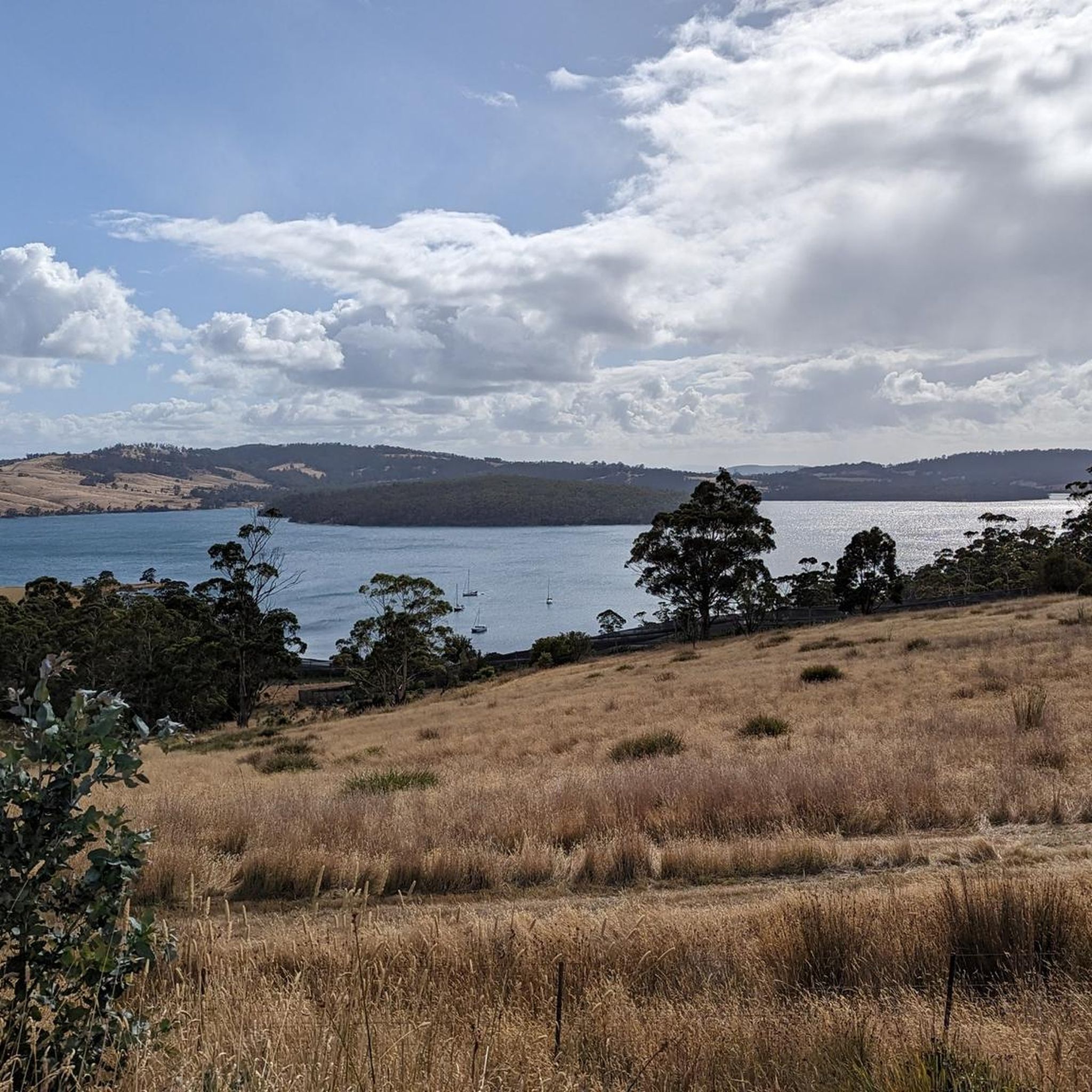
Touring cycling in Gellibrand Point Nature Recreation Area features routes along coastal areas and through natural park landscapes. The terrain is generally characterized by gentle elevations and scenic waterfront paths, offering views of bays and bridges. This region provides a mix of paved and unpaved surfaces suitable for touring bicycles. The area's geography supports a variety of routes, from shorter, easy rides to longer, moderate excursions.
Best touring cycling routes in Gellibrand Point Nature Recreation Area
- The most popular touring…
Last updated: July 1, 2026
3.0
(1)
8
riders
38.7km
02:22
320m
320m
Moderate bike ride. Good fitness required. Mostly paved surfaces. Suitable for all skill levels.
4.9
(8)
47
riders
30.1km
01:58
270m
270m
Moderate bike ride. Good fitness required. Mostly paved surfaces. Suitable for all skill levels.

Sign up for free
32
riders
22.2km
01:21
180m
180m
Moderate bike ride. Good fitness required. Mostly paved surfaces. Suitable for all skill levels.
11
riders
31.8km
02:11
550m
550m
Hard bike ride. Very good fitness required. Mostly paved surfaces. Suitable for all skill levels.
3.0
(1)
5
riders
37.8km
02:43
340m
340m
Moderate bike ride. Good fitness required. Mostly paved surfaces. Suitable for all skill levels.
Get access to more routes and recommendations from other explorers.
Sign up for free
Already have an account?
Our route recommendations are based on thousands of hikes, rides, and runs completed by other people on komoot.
Start today with a free account
Your next adventure awaits.
Login or Signup



Tips from the Community

The Shot Tower Historic Site is one of the tallest buildings in Tasmania, a circular sandstone tower standing 58 metres high that was once used for producing lead shot. Today, anyone can ascend the 259 steps to the top for amazing views over the River Derwent and Hobart. There is also a café, tearoom, parking and toilets on site. It's free to climb the tower from 10:00 am to 5:00 pm.
0
0

Tasman Bridge is the city’s main link between the eastern and western shores. Opened in 1965, the bridge includes pedestrian walkways on both sides running directly beside traffic lanes. Walking across feels exposed and noisy, but the elevation gives wide views over the river, Hobart skyline, and surrounding hills. The bridge is also closely tied to Hobart’s history following the 1975 Tasman Bridge disaster, when a cargo ship collision caused part of the bridge to collapse and temporarily split the city in two.
0
0

Ryan was super helpful. Easy to book online. The gravel bike was an awesome bike. located a short walk from the dock. https://www.hobartbikehire.com.au/
0
0

Nice views of the Derwent river, Mt. Wellington, Hobart, Bruny Island etc
0
0

Hotel where famed arctic explorer Roald Amundsen stayed when he returned to Hobart. Also frequented by Errol Flynn.
0
0
From this spot you can see 6 different outdoor stores, ranging from hardcore mountaineering suppliers to more casual clothing stores. Kathmandu, Macpac, Paddy Pallin and the local hero; Mountain Creek Outdoors are all within mere metres of this intersection, meaning that you can easily repair or replace any of your camping gear in this spot. A real boon for the bikepacker or bike tourer!
0
0
In 2003, the city council of Hobart, Tasmania, named a small park in the city’s affluent Sandy Bay suburb Errol Flynn Reserve, laying claim to the nautical landscape that likely influenced Flynn’s seafaring endeavors and iconic roles. The Battery Point Sculpture Trail cuts through the reserve; the bold, white-painted steel numerals 1909 adorn the green space, a tribute to both Flynn’s birth year and the famous Hollywood sign.
0
0
A beautiful monument to the Heroic Age of Antarctic Exploration, the Mawson’s Huts Replica Museum is, as its name implies, an exact reconstruction of the main research hut built in 1911 on Cape Dension by members of the Australasian Antarctic Expedition, lead by famed Australian geologist, explorer, and academic, Sir Douglas Mawson. The expedition – made up of Mawson, Lieutenant Belgrave Edward Ninnis, and Xavier Mertz – met with disaster on December 14, 1912, during a survey of the largely uncharted Victoria Land when Ninnis' sledge plunged through a crevasse, never to be recovered. With most of the expedition’s supplies, as well as its strongest sled dogs, lost, and over 300 miles away from base camp, Mawson and Mertz rationed their meager supplies and headed back, resorting to eating the remaining sled dogs as they went. Mertz ultimately succumbed to starvation, dysentery, and frostbite, forcing Mawson to carry on alone. On February 8, 1913, Mawson – near-death, skin literally peeling off of his body – stumbled into base camp. Only six hours before, the ship Aurora had departed Cape Denison after failing to locate Mawson and his team. A relief party of six men stayed behind and nursed Mawson back to health, and the weary explorer was forced to spend another winter on the cape.
1
0
Frequently Asked Questions
How many touring cycling routes are available in Gellibrand Point Nature Recreation Area?
Gellibrand Point Nature Recreation Area offers a diverse network of over 30 touring cycling routes. These routes vary in difficulty and length, providing options for different skill levels and preferences.
What is the typical length and duration of touring cycling routes in Gellibrand Point Nature Recreation Area?
Route lengths vary significantly. You can find shorter, easy rides like the Howrah Beach loop from Derwent Shores, which is about 13.5 km and takes under an hour. Longer, moderate excursions, such as the Ralph's Bay loop from South Arm, can be around 38.7 km and take over two hours to complete.
Are there easy touring cycling routes suitable for beginners or families?
Yes, Gellibrand Point Nature Recreation Area has several easy touring cycling routes perfect for beginners or families. The Howrah Beach – Tranmere Coastal Reserve loop from Tranmere is a great option, offering a gentle 15.3 km ride along scenic coastal paths.
What kind of terrain can I expect on touring cycling routes in this region?
The terrain in Gellibrand Point Nature Recreation Area is characterized by gentle elevations and scenic waterfront paths. You'll encounter a mix of paved and unpaved surfaces, with routes often following coastal areas and winding through natural park landscapes. Expect beautiful views of bays and bridges.
Are there any circular touring cycling routes in Gellibrand Point Nature Recreation Area?
Many of the touring cycling routes in the area are designed as loops, allowing you to start and finish at the same point. Examples include the Tasman Bridge loop from Tranmere and the Mawson's Huts Replica Museum – Hobart Bike Hire loop from Taroona.
What are the best times of year for touring cycling in Gellibrand Point Nature Recreation Area?
Given its coastal location, touring cycling in Gellibrand Point Nature Recreation Area is generally pleasant during spring, summer, and autumn. These seasons typically offer milder weather and less rainfall, making for more enjoyable rides along the waterfront and through natural areas.
What do other touring cyclists enjoy most about the routes here?
The area is highly rated by the komoot community, with an average score of 4.6 stars from over 30 reviews. Cyclists often praise the scenic coastal views, the variety of terrain, and the accessibility of routes that cater to different ability levels.
Are there any specific landmarks or points of interest to look out for while cycling?
While cycling, you'll often encounter stunning coastal vistas and views of significant structures like the Tasman Bridge. Routes like the Mawson's Huts Replica Museum – Hobart Bike Hire loop from Taroona also pass by cultural landmarks, offering opportunities to explore beyond just the ride.
What should I wear for touring cycling in Gellibrand Point Nature Recreation Area?
Given the coastal environment, it's advisable to wear layers that can be adjusted for changing weather conditions. A windproof or waterproof outer layer is recommended, especially near the water, along with comfortable cycling attire suitable for the season.
Are there options for more challenging touring cycling routes?
Yes, while there are many easy and moderate routes, Gellibrand Point Nature Recreation Area also offers more challenging options. Out of the 30 available routes, 16 are classified as difficult, providing longer distances and more significant elevation changes for experienced touring cyclists.
Is it possible to combine touring cycling with exploring nearby towns or attractions?
Absolutely. Many routes are designed to pass through or near urban sections and coastal towns, allowing you to easily stop for refreshments or explore local attractions. The region's routes often connect scenic natural areas with accessible community hubs.
Most popular routes in Gellibrand Point Nature Recreation Area

Get inspired with the komoot mobile app


Explore more
Browse the best Cycling routes in other regions.
