The best waterfall hikes and walks around Aspangberg-St.Peter
4.6
(855)
5,211
hikers
7
hikes
Waterfall hiking trails around Aspangberg-St.Peter are found in a picturesque municipality nestled in Lower Austria, at the foot of the Wechselgebirge mountains. The region is characterized by a diverse landscape of rolling hills, lush forests, and expansive meadows. Numerous streams, including the Pittental stream, contribute to the area's natural beauty, featuring several waterfalls that are accessible via hiking paths.
Best waterfall hiking trails around Aspangberg-St.Peter
- The most popular waterfall hiking route is Wechselgraben Waterfall – Marienseer Schwaig loop from Katastralgemeinde…
Last updated: July 9, 2026
4.9
(73)
408
hikers
Moderate hike. Good fitness required. Mostly accessible paths. Sure-footedness required.
4.9
(54)
292
hikers
16.8km
06:28
920m
920m
Hard hike. Very good fitness required. Mostly accessible paths. Sure-footedness required.

Sign up for free
4.6
(25)
110
hikers
Easy hike. Great for any fitness level. Easily-accessible paths. Suitable for all skill levels.
4.8
(10)
35
hikers
Moderate hike. Great for any fitness level. Mostly accessible paths. Sure-footedness required.
4.7
(3)
20
hikers
11.5km
03:37
440m
440m
Moderate hike. Good fitness required. Mostly accessible paths. Sure-footedness required.
Get access to more routes and recommendations from other explorers.
Sign up for free
Already have an account?
Our route recommendations are based on thousands of hikes, rides, and runs completed by other people on komoot.
Start today with a free account
Your next adventure awaits.
Login or Signup



Tips from the Community

Wonderful nature experience - an easy, exciting way to the waterfall.
0
0

The mountain ridge of the Wechsel stretches for over 15 km - the eastern Austrian low mountain range on the border between Lower Austria and Styria 🌲 Its three most lofty peaks each rise over 1,700 m ⛰️ Thanks to its mountain landscapes, which range from lovely to challenging, the Wechsel is considered a hiking destination for families on the one hand - and a local recreation area for experienced hikers and climbers on the other 🥾 The Hochwechsel, as the highest peak, offers particularly worthwhile views: the panoramic view stretches from Semmering and Rax to the Schneeberg 🌄 In good weather, even Burgenland, Styria, Hungary and Slovenia can be seen 😎 From mid-May to mid-November, a wonderful rest in the Wetterkoglerhaus is also tempting 🧃 www.wieneralpen.at/ausflugsziel-in-den-wiener-alpen-entdecken/a-hochwechsel-im-wechselgebirge
10
0
Border stone between Lower Austria and Styria 🧱
7
0
The Hochwechsel summit not only offers an impressive panoramic view of the surrounding landscape of Styria and Lower Austria, but is also known for its picturesque chapel, which invites visitors to reflect and relax 🌄 Inside, the chapel surprises with colorful paintings, coats of arms and inscriptions that are painted directly onto the wood of the dome and reach all the way to the top ⛪ Source www.steiermark.com/de/Oststeiermark/Urlaub-planen/Ausflugsziele/Hochwechsel-Gipfel_isd_42403458
9
0
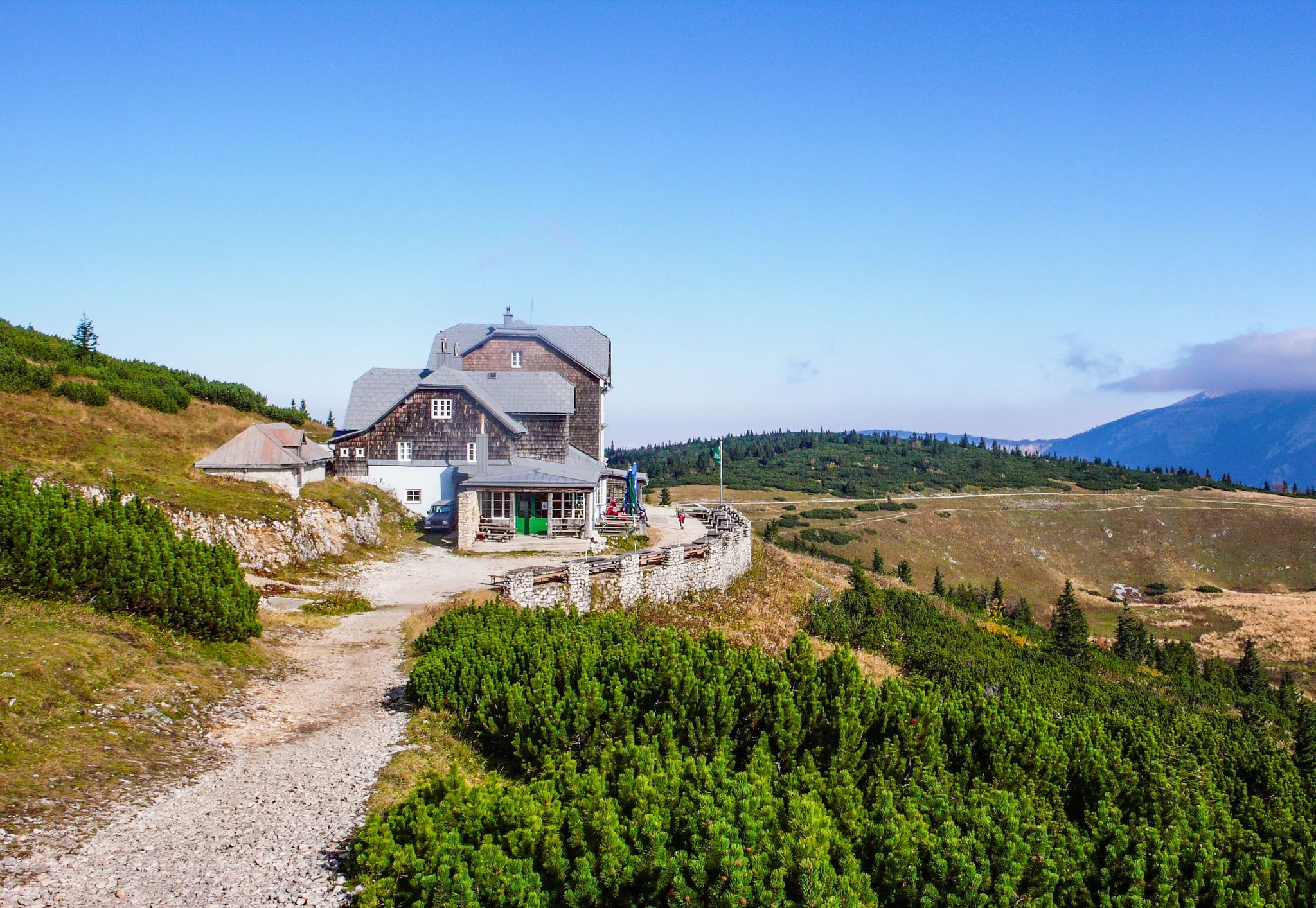
Altitude 📕 1743 m Rooms/beds 📗 9 Mattresses 📘 26 Winter room 📙 The winter room is not locked (3 places, heated). 3 places, electric fan heater with coin slot, no cooking facilities. Emergency room 📓 The emergency room is unlocked. Is the same as the winter room. www.alpenverein.at/wetterkoglerhaus
8
0
The mountain ridge of the Wechsel stretches for over 15 km - the eastern Austrian low mountain range on the border between Lower Austria and Styria 🌲 Its three most lofty peaks each rise over 1,700 m ⛰️ Thanks to its mountain landscapes, which range from lovely to challenging, the Wechsel is considered a hiking destination for families on the one hand - and a local recreation area for experienced hikers and climbers on the other 🥾 The Hochwechsel, as the highest peak, offers particularly worthwhile views: the panoramic view stretches from Semmering and Rax to the Schneeberg 🌄 In good weather, even Burgenland, Styria, Hungary and Slovenia can be seen 😎 From mid-May to mid-November, a wonderful rest in the Wetterkoglerhaus is also tempting 🧃 www.wieneralpen.at/ausflugsziel-in-den-wiener-alpen-entdecken/a-hochwechsel-im-wechselgebirge
9
0
The mountain ridge of the Wechsel stretches for over 15 km - the eastern Austrian low mountain range on the border between Lower Austria and Styria 🌲 Its three most lofty peaks each rise over 1,700 m ⛰️ Thanks to its mountain landscapes, which range from lovely to challenging, the Wechsel is considered a hiking destination for families on the one hand - and a local recreation area for experienced hikers and climbers on the other 🥾 The Hochwechsel, as the highest peak, offers particularly worthwhile views: the panoramic view stretches from Semmering and Rax to the Schneeberg 🌄 In good weather, even Burgenland, Styria, Hungary and Slovenia can be seen 😎 From mid-May to mid-November, a wonderful rest in the Wetterkoglerhaus is also tempting 🧃 https://www.wieneralpen.at/ausflugsziel-in-den-wiener-alpen-entdecken/a-hochwechsel-im-wechselgebirge
8
0
Altitude 📕 1743 m Rooms/beds 📗 9 Mattresses 📘 26 Winter room 📙 The winter room is not locked (3 places, heated). 3 places, electric fan heater with coin slot, no cooking facilities. Emergency room 📓 The emergency room is unlocked. Is the same as the winter room. www.alpenverein.at/wetterkoglerhaus
8
0
Frequently Asked Questions
How many waterfall hiking trails are available in Aspangberg-St. Peter?
There are 7 dedicated waterfall hiking trails around Aspangberg-St. Peter, offering a range of experiences from easy walks to more challenging routes. These trails are highly rated by the komoot community, with an average score of 4.6 stars.
What makes waterfall hiking in Aspangberg-St. Peter unique?
The region's unique charm comes from its location at the foot of the Wechselgebirge mountains, offering a diverse landscape of rolling hills, lush forests, and expansive meadows. The Pittental stream and its tributaries create picturesque waterfalls, providing refreshing natural sights amidst clean mountain air.
Are there easy waterfall hikes suitable for beginners or families?
Yes, there are easy options. For instance, the Marienseer Waterfall – Wechselgraben Waterfall loop from Katastralgemeinde Neustift am Alpenwald is an easy 3.7-mile (6.0 km) trail that takes about 2 hours to complete, leading through forested areas and along streams.
Are there any challenging waterfall routes for experienced hikers?
Absolutely. For those seeking a more demanding adventure, the Marienseer Schwaig – Wechselgraben Waterfall loop from Aspangberg-St. Peter is a difficult 10.5-mile (16.8 km) path. This challenging route offers extensive views and passes through the scenic Wechselgebirge foothills, with significant elevation gain.
Are there circular waterfall walks in the area?
Yes, many of the waterfall trails are designed as circular routes, allowing you to experience varied scenery without retracing your steps. An example is the Wechselgraben Waterfall – Marienseer Schwaig loop from Katastralgemeinde Neustift am Alpenwald, a moderate 8.1-mile (13.1 km) trail.
What is the best time of year to visit the waterfall trails?
Waterfall trails are beautiful year-round. Spring, after snowmelt or heavy rains, often sees the waterfalls at their most powerful. Summer offers lush greenery and refreshing spray, while autumn brings vibrant foliage. Even in winter, frozen waterfalls can offer a unique, serene experience.
What nearby attractions can I explore in addition to the waterfalls?
Beyond the waterfalls, the region offers several points of interest. You can find cozy resting spots at various huts and cabins, such as the Pollereshütte or Wetterkogler House. There are also picturesque lakes like Sparkassenteich or Bärenlacke Pond, perfect for extending your outdoor adventure.
Are there any waterfall trails that offer panoramic viewpoints?
Many trails in the Aspangberg-St. Peter region, especially those ascending into the Wechselgebirge mountains, provide stunning panoramic views. The Hochwechsel, the highest peak in the region, offers breathtaking vistas that can stretch across Semmering, Rax, Schneeberg, and even into neighboring countries on clear days.
What do other hikers enjoy most about the waterfall trails in Aspangberg-St. Peter?
The trails are highly rated by the komoot community, with an average score of 4.6 stars from over 800 reviews. Hikers frequently praise the diverse landscapes, from rolling hills and dense forests to the refreshing presence of the waterfalls. The well-maintained paths and the variety of routes for different skill levels are also often highlighted.
Is there a moderate waterfall hike that offers a good balance of challenge and scenery?
Yes, the Marienseer Waterfall loop from Aspangberg-St. Peter is a moderate 7.1-mile (11.5 km) route. It offers a good balance of distance and elevation gain, allowing you to enjoy the natural beauty of the waterfalls and surrounding forests without being overly strenuous.
Are there options for less crowded waterfall hikes?
While some popular routes can see more visitors, exploring trails during off-peak hours (early mornings or late afternoons) or on weekdays can offer a more tranquil experience. The region's extensive network of paths means you can often find quieter sections, especially on longer routes that venture deeper into the forests and mountains.
Most popular routes around Aspangberg-St.Peter
Most popular attractions around Aspangberg-St.Peter

Get inspired with the komoot mobile app


Explore more
Browse the best Hikes in other regions.
