The best road cycling routes in Underhill State Park
44
riders
3
rides
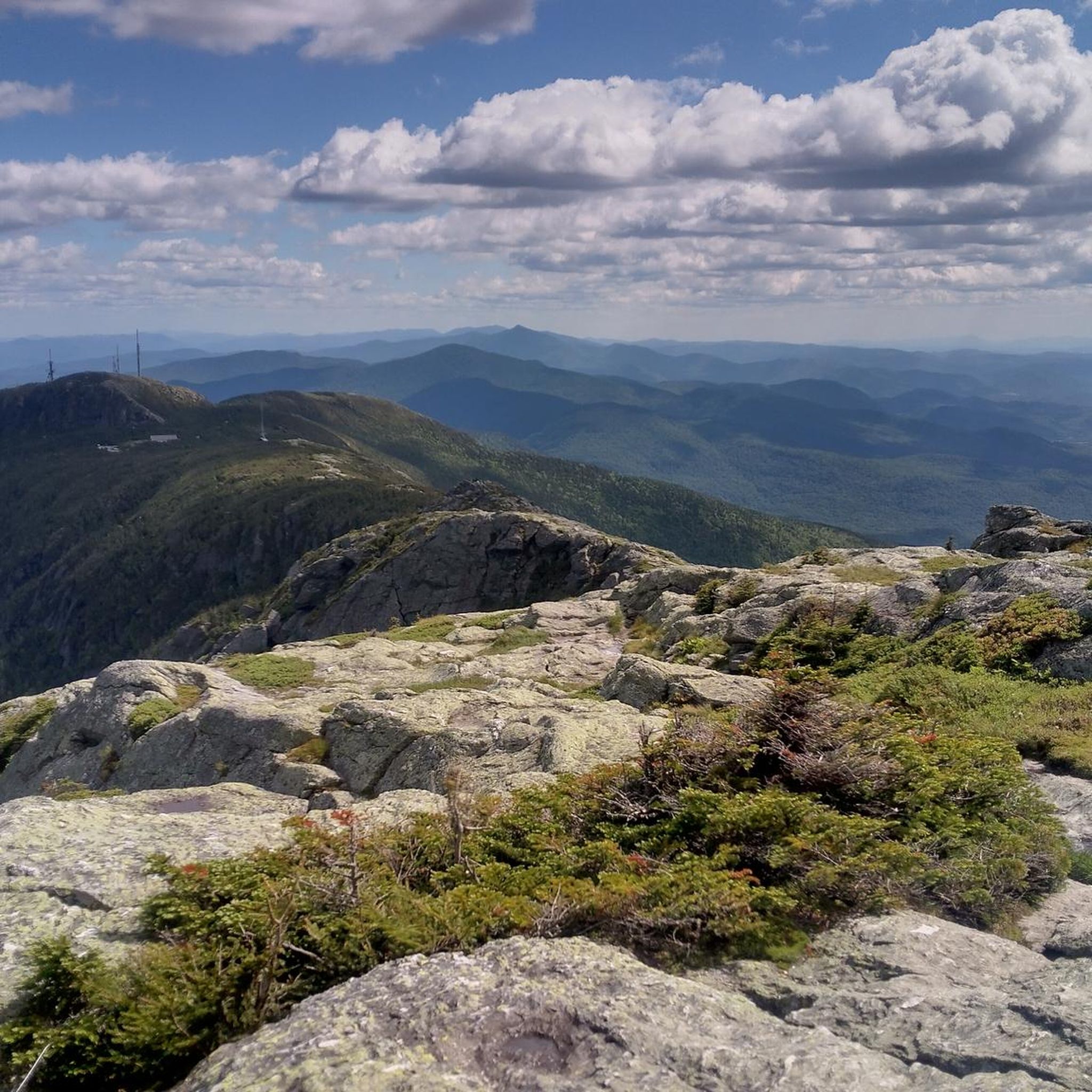
Road cycling routes in Underhill State Park are situated on the western slope of Mount Mansfield, Vermont's highest peak, within the expansive Mt. Mansfield State Forest. The terrain features significant elevation changes, with roads ascending through dense mixed hardwood and spruce-fir forests, offering views of rugged cliffs and rocky outcrops. Cyclists can expect challenging ascents and descents on paved roads leading to and around the park, providing a vigorous workout amidst scenic beauty. The area also includes historic infrastructure built…
Last updated: October 14, 2026
8
riders
33.9km
01:55
770m
770m
Moderate road ride. Good fitness required. Some segments of this route may be unpaved and difficult to ride.
12
riders
32.7km
01:35
400m
400m
Moderate road ride. Good fitness required. Mostly well-paved surfaces and easy to ride.

4
riders
39.5km
01:43
280m
280m
Moderate road ride. Great for any fitness level. Some segments of this route may be unpaved and difficult to ride.
Our route recommendations are based on thousands of hikes, rides, and runs completed by other people on komoot.
Start today with a free account
Your next adventure awaits.
Popular around Underhill State Park


Tips from the Community

Great way to get up the Notch and avoid most of Route 107
0
0

The Stowe Recreation Path is a 5.3 mile fully paved trail from Stowe Village to Top Notch Resort. It is a beautiful path to walk that is free from car traffic.
0
0

The Grist Mill Covered Bridge, which is also known as the Scott Covered Bridge, the Bryant Covered Bridge, or the Canyon Covered Bridge, spans the Brewster River near the beautiful Brewster River Gorge and falls. This bridge is one of a small number of surviving Burr arch truss bridges in the state and was built in the 19th century. In 1974 it was listed on the National Register of Historic Places. There is a nice overlook for the Brewster Falls not far from here, down a short trail if you wanted to leave your bikes and go on a short walk.
0
0
A coffee shop and a brewery right across the street from each other! What more can you ask for on a relaxing ride around Stowe? Idletyme Brewing and PK Coffee are two great spots to grab a burger and beer or coffee and pastry depending on your mood (and time of day). Both of these local-favorite spots are right off of the Stowe Recreational Path, making them convenient to stop at and refuel as you explore the area.
0
0
From the main parking area, you must walk back on the road and through the Grist Mill Covered Bridge. Also known as the Scott Covered Bridge, the Bryant Covered Bridge,or the Canyon Covered Bridge, this bridge is one of a small number of surviving Burr arch truss bridges in the state and was built in the 19th century. In 1974 it was listed on the National Register of Historic Places.
0
0

Thompson Park is home to a parking area, picnic tables, and trailhead for the paved Stowe Recreational Path. The trail leaving from here is wide, smooth, and easy for any skill level.
0
0
Great view from the road of the surrounding area. Smugglers' Notch is between Vermont's highest peak (Mount Mansfield), Spruce Peak and Sterling Ridge.
1
0
Chase Park is a great little local park near downtown Stowe. It is a common access point for the Stowe Recreation Path, a popular 5.3-mile paved multi-use trail that runs through the town of Stowe. There is parking available here for the Recreation Path as well as a bike repair station for those who might need it.
0
0
Frequently Asked Questions
What kind of terrain can I expect on road cycling routes around Underhill State Park?
The road cycling routes in and around Underhill State Park feature significant elevation changes as they ascend towards Mount Mansfield. You'll experience challenging ascents and descents on paved roads, winding through dense mixed hardwood and spruce-fir forests, with occasional views of rugged cliffs and rocky outcrops. The area also includes historic infrastructure built by the Civilian Conservation Corps, adding a cultural dimension to your rides.
Are there routes suitable for experienced road cyclists seeking a challenge?
Yes, for experienced road cyclists looking for a significant challenge, the region offers routes with extensive paved surfaces and substantial elevation gain. For example, the Stowe Recreation Path – Idletyme Brewing & PK Coffee loop from Mount Mansfield State Forest is a difficult 104.1 km (64.7 miles) route with over 1250 meters of elevation gain, showcasing the region's diverse ecosystems and providing a vigorous workout.
What natural features or landmarks can I see while road cycling in the area?
While cycling, you'll be treated to constant views of Vermont's highest peak, Mount Mansfield, which dominates the landscape. The routes traverse diverse ecosystems, including dense forests and offer glimpses of the Brown's River headwaters. You might also encounter historic infrastructure built by the Civilian Conservation Corps in the 1930s, which are listed on the National Register of Historic Places.
Are there any family-friendly road cycling options near Underhill State Park?
While many routes in the immediate vicinity of Underhill State Park involve significant elevation, the broader 'Underhill Flats' area and routes like the Stowe Recreation Path – Idletyme Brewing & PK Coffee loop from Adams Camp, which is 26.0 km (16.1 miles) and moderate, offer varied terrain that can be enjoyed by families with some cycling experience. These routes often feature mostly paved surfaces and manageable climbs.
What is the best time of year for road cycling in Underhill State Park?
The best time for road cycling in Underhill State Park is typically from late spring through early autumn. During these months, the weather is generally favorable, and the scenic beauty of the forests and mountain views are at their peak. Fall offers spectacular foliage, making it a particularly popular time for scenic rides.
Are there loop trails available for road cyclists?
Yes, several loop trails are available for road cyclists. For instance, the Main Street loop from Smuggler's Notch State Park is a moderate 29.4 km (18.3 miles) route that takes you through forested landscapes. Another option is the Roadbike loop from Underhill, a moderate 39.5 km (24.5 miles) ride.
What do other road cyclists say about the routes in Underhill State Park?
Over 50 road cyclists have used komoot to explore Underhill State Park's varied terrain. They often praise the challenging ascents towards Mount Mansfield, the scenic roads through dense forests, and the unique experience of cycling past historic infrastructure. The network is appreciated for offering options for different ability levels, from moderate loops to difficult, long-distance rides.
Are there any specific routes that offer great viewpoints of Mount Mansfield?
Many of the routes leading to and around Underhill State Park offer constant views of Mount Mansfield. As you cycle on roads like Mountain Road and Pleasant Valley Road, you'll experience challenging ascents and descents with breathtaking scenery of the mountain and the surrounding Green Mountains. The Stowe Recreation Path – Sunset Rock Trailhead loop from Adams Camp, a moderate 32.9 km (20.4 miles) route, also provides excellent views of the peak.
What is the general difficulty level of road cycling routes in this region?
The road cycling routes in the Underhill State Park area range from moderate to difficult. You'll find several moderate routes that involve climbs through forested landscapes, as well as more challenging options with significant elevation gain and longer distances, catering to a wide range of fitness levels.
Are dogs allowed on the road cycling routes?
While Underhill State Park itself has specific policies regarding dogs on trails, the paved roads in the surrounding area are generally public. However, it's always best to check local regulations for specific road segments or any private land you might traverse. For detailed information on park policies, you can visit the official Vermont State Parks website: vtstateparks-visit.com.
Where can I find parking for road cycling routes near Underhill State Park?
Parking is typically available at designated trailheads or public access points leading to the road cycling routes. For routes that start from state parks or forests, such as those originating from Smuggler's Notch State Park or Mount Mansfield State Forest, parking facilities are usually provided. Always check specific route details for recommended starting points and parking information.
Most popular routes in Underhill State Park

Get inspired with the komoot mobile app


Explore more
Browse the best Road cycling routes in other regions.
