The best cycling routes in Underhill State Park
4.8
(4)
53
riders
5
rides
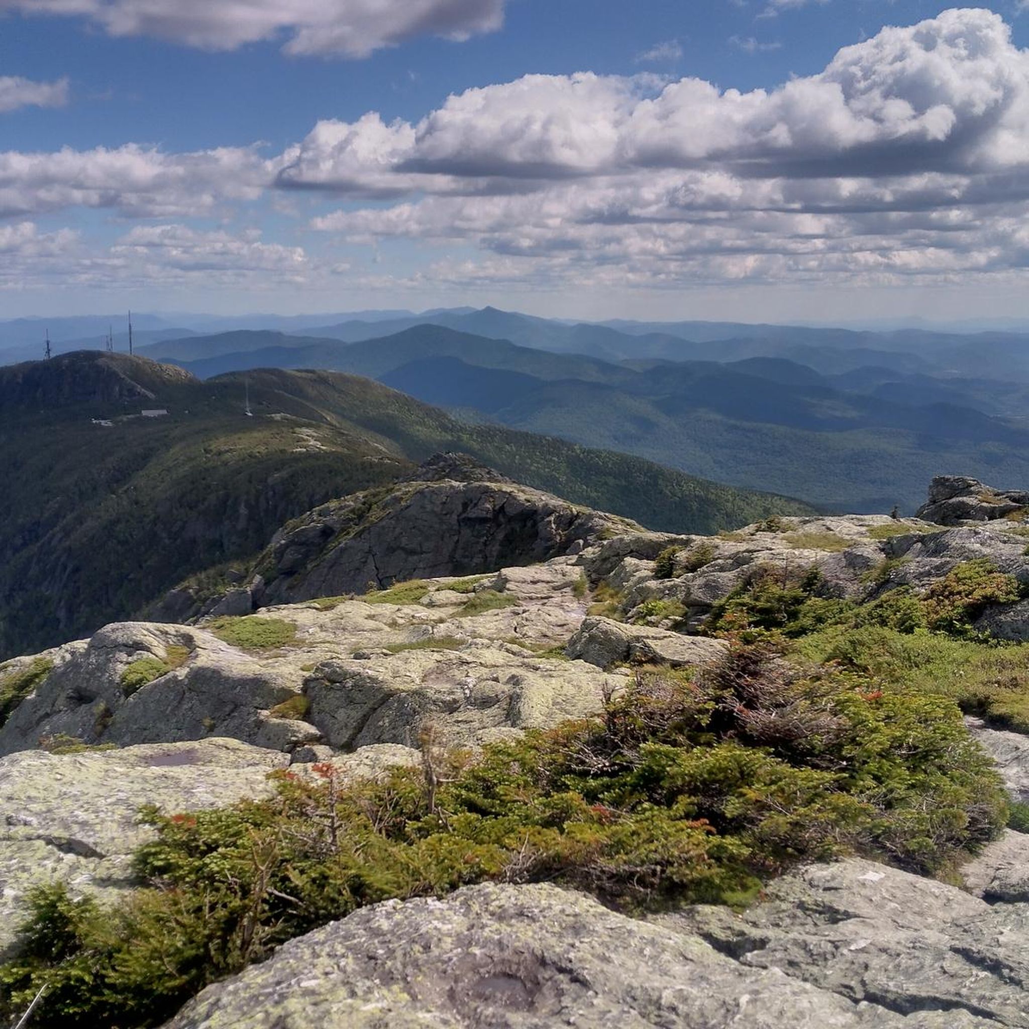
Touring cycling in Underhill State Park is characterized by its location on the western slopes of Mount Mansfield, Vermont's highest peak. The region features mixed hardwood and spruce-fir forests, with routes often including significant elevation gain. Cyclists can expect varied terrain, from paved roads to unpaved segments, offering views of the Champlain Valley. The area provides a challenging and rewarding experience for those seeking mountain views and climbs.
Best touring cycling routes in Underhill State Park
- The most popular touring…
Last updated: June 28, 2026
7
riders
64.2km
03:55
550m
550m
Hard bike ride. Very good fitness required. Mostly paved surfaces. Suitable for all skill levels.
5
riders
27.1km
02:24
410m
410m
Moderate bike ride. Good fitness required. Mostly paved surfaces. Suitable for all skill levels.

Sign up for free
4.5
(2)
6
riders
Moderate bike ride. Good fitness required. Mostly paved surfaces. Suitable for all skill levels.
5
riders
Hard bike ride. Very good fitness required. Mostly paved surfaces. Suitable for all skill levels.
2
riders
32.9km
02:18
320m
330m
Moderate bike ride. Good fitness required. Mostly paved surfaces. Suitable for all skill levels.
Our route recommendations are based on thousands of hikes, rides, and runs completed by other people on komoot.
Start today with a free account
Your next adventure awaits.
Login or Signup


Tips from the Community

Every day, I get in the queue To get on the bus that takes me to you I'm so nervous, I just sit and smile Your house is only another mile Thank you, driver, for getting me here You'll be an inspector, have no fear I don't wanna cause no fuss But can I buy your Magic Bus? I don't care how much I'll pay I wanna drive my bus to my baby each day I want it, I want it, I want it, I want it I want it, I want it, I want it (You can't have it!) I want it, I want it, I want it, I want it Thruppence and sixpence every day Just to drive to my baby Thruppence and sixpence each day 'Cause I drive my baby every way Magic Bus, Magic Bus (Magic Bus) Magic Bus, Magic Bus (All aboard! All aboard!) Magic Bus, Magic Bus (I want the Magic Bus) Magic Bus (I want the Magic Bus) Magic Bus (I want the Magic Bus) Magic Bus (I want the Magic Bus) Magic Bus, Magic Bus (I want the Magic Bus) I said, now I've got my Magic Bus I said, now I've got my Magic Bus I drive my baby every way Each time, I go a different way I want it, I want it (Magic Bus) I want it, I want it (Magic Bus) I want it, I want it (Magic Bus) I want it, yeah, I want it (Magic Bus) Every day, you'll see the dust As I drive my baby in my Magic Bus
0
0

Randolph Road is a relatively flat road that connects Stowe to Morrisville, past the local airport. This road has great views of the mountains pretty much the entire way as you ride.
0
0
Morrisville, Vermont, is a charming village in Lamoille County, just north-northeast of Stowe. The main street is lined with 19th and early 20th-century buildings that host a variety of locally-owned shops, including boutiques, and antique stores, as well as cozy cafes and family-owned restaurants that emphasize local ingredients. Main Street also features nearby green spaces with easy access to the Lamoille River and the Lamoille Valley Rail Trail, the longest rail trail in New England!
0
0
Main Street in Stowe, Vermont, is a charming, quintessentially New England small mountain town. Lined with historic buildings, boutique shops, cozy cafes, and a variety of restaurants, it is a great spot to spend the afternoon exploring after a morning in the mountains skiing, hiking, or biking. The street is a popular destination for both locals and tourists, featuring attractions like the Vermont Ski and Snowboard Museum and the Stowe Community Church.
0
0
Lintilhac Park is a lovely little park behind the Stowe Community Church and is a common access point for the southern end of the Stowe Recreation Path, just north of Main Street, Stowe. The Stowe Recreation Path is a popular, scenic, 5.3-mile paved trail that is open for bikers and walkers, and is groomed in the winter for cross-country skiers. This fantastic trail crosses Little River several times via wooden bridges, has multiple spots for swimming, and offers direct access to many restaurants and shops in Stowe. There is a bike repair station at Lintilhac Park for those who might need it, in addition to parking for the Recreation Path.
0
0
A coffee shop and a brewery right across the street from each other! What more can you ask for on a relaxing ride around Stowe? Idletyme Brewing and PK Coffee are two great spots to grab a burger and beer or coffee and pastry depending on your mood (and time of day). Both of these local-favorite spots are right off of the Stowe Recreational Path, making them convenient to stop at and refuel as you explore the area.
0
0

The Stowe Recreation Path is a 5.3 mile fully paved trail from Stowe Village to Top Notch Resort. It is a beautiful path to ride that is free from car traffic.
0
0
The West Farm Trail is located within the Brewster Uplands and loops through the woods northeast of the gorge, past farmlands that are still in use. There are several trails that connect to The Alden Bryan Trail, which parallels the river, and the Brewster Pond Loop, allowing you to lengthen your hike if you choose. Please note that two farms and associated fields on the property are not open to public recreation; they are working farms so please be respectful as you hike around here.
0
0
Frequently Asked Questions
How many touring cycling routes are available in Underhill State Park?
There are several touring cycling routes available in the Underhill State Park area, with komoot featuring over 4 distinct tours. These routes offer a variety of experiences, from moderate rides to more challenging climbs.
What kind of terrain can I expect on touring cycling routes around Underhill State Park?
The terrain around Underhill State Park is characterized by its location on the western slopes of Mount Mansfield, Vermont's highest peak. Cyclists can expect significant elevation gain, offering a challenging and rewarding experience with mountain views. Routes may include both paved roads and unpaved segments, winding through mixed hardwood and spruce-fir forests.
Are there any family-friendly touring cycling routes in the area?
While the immediate park area is known for challenging hikes, the surrounding region offers touring cycling routes that can be enjoyed by families. Routes like the Stowe Recreation Path and Trapp Family Lodge Loop, a moderate 12.7-mile path, provide a scenic experience with less extreme elevation changes, making them suitable for a wider range of abilities.
Can I find circular touring cycling routes near Underhill State Park?
Yes, many of the touring cycling routes in the area are designed as loops. For example, the West Farm Trail loop from Valley Dream Farm is a moderate 16.8-mile path that winds through rural settings with rolling hills, offering a complete circular journey.
What are some scenic touring cycling routes with good views?
Given the region's location on Mount Mansfield, many routes offer stunning views of the Champlain Valley. The Main Street – Stowe Recreation Path loop from Smuggler's Notch State Park, a difficult 39.9-mile route, provides extensive riding through varied and scenic landscapes. The overall area is known for its picturesque forests and mountain backdrops.
Are there options for less experienced touring cyclists?
Yes, while some routes involve significant climbs, there are moderate options available. The West Farm Trail loop from Valley Dream Farm is a moderate 16.8-mile path, and the Stowe Recreation Path – Idletyme Brewing & PK Coffee loop from Stowe, a 26.2-mile moderate trail, are good choices for those seeking a less strenuous ride while still enjoying the scenery.
What do other cyclists say about touring cycling in Underhill State Park?
The touring cycling routes in the Underhill State Park area are highly rated by the komoot community, with an average score of 4.7 stars from over 4 reviews. More than 50 touring cyclists have used komoot to explore the varied terrain, often praising the challenging climbs and rewarding mountain views.
Is it possible to bring my dog on touring cycling routes?
While Underhill State Park itself is known for hiking, specific regulations for dogs on touring cycling routes outside the immediate park trails can vary. It's generally advisable to check local ordinances for any specific route you plan to take, especially concerning paved roads versus unpaved paths, to ensure a dog-friendly experience.
What is the best time of year to go touring cycling in Underhill State Park?
The best time for touring cycling in the Underhill State Park region is generally from Memorial Day Weekend through the second Monday in October. This period offers favorable weather conditions for cycling, allowing riders to fully enjoy the scenic beauty of the mixed hardwood and spruce-fir forests and the views of the Champlain Valley.
Are there places to eat or stay near the touring cycling routes?
The region surrounding Underhill State Park, particularly areas like Stowe, offers various amenities including cafes, pubs, and accommodation options. While the park itself is more focused on primitive camping, nearby towns provide services for cyclists looking for places to refuel and stay overnight after their rides.
What are the parking options for touring cyclists visiting the area?
Parking availability can vary depending on the specific starting point of your touring cycling route. For Underhill State Park itself, visitors are encouraged to carpool due to limited parking, especially during peak times, and to arrive early. When planning your route, it's advisable to check parking facilities at your chosen trailhead or starting location.
Are there any challenging routes for experienced touring cyclists?
Absolutely. The region's location on the western slopes of Mount Mansfield means that many routes feature significant elevation gain, providing a challenging experience. The Main Street – Stowe Recreation Path loop from Smuggler's Notch State Park is classified as a difficult 39.9-mile trail, perfect for experienced cyclists seeking a demanding ride.
What unique natural features might I encounter while cycling?
While cycling in the Underhill State Park area, you'll be surrounded by the unique landscape of Mount Mansfield, Vermont's highest peak. The routes traverse mixed hardwood and spruce-fir forests, and you'll often be treated to stunning views of the Champlain Valley. The high elevation contributes to a diverse environment, though specific alpine tundra features are typically found at the summit, which is primarily a hiking destination.
Most popular routes in Underhill State Park

Get inspired with the komoot mobile app


Explore more
Browse the best Cycling routes in other regions.
