The best mountain hikes around Licciana Nardi
5.0
(4)
46
hikers
7
hikes
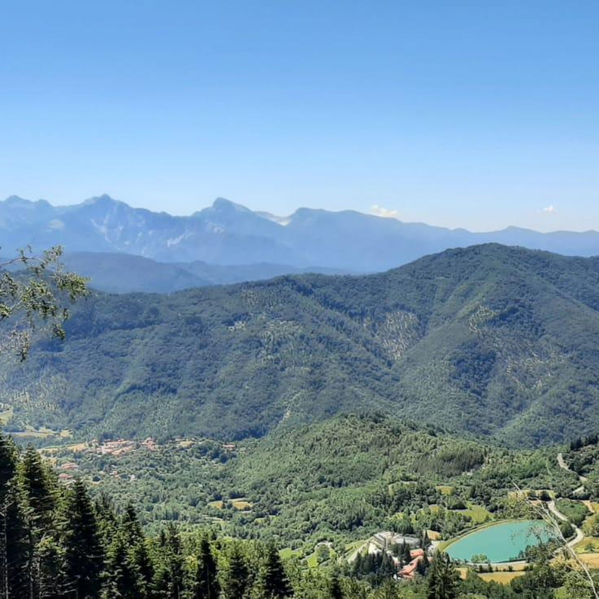
Mountaineering routes around Licciana Nardi are situated within the mountainous terrain of Massa-Carrara, characterized by significant elevation changes and diverse landscapes. The region features prominent peaks and high-altitude passes, offering challenging ascents and panoramic views. Alpine lakes and dense woodlands are also common elements along these routes, providing varied environments for exploration.
Best mountaineering routes around Licciana Nardi
- The most popular mountaineering route is Alpe di Succiso – Il Torrione loop from Succiso Nuovo, a 6.9 miles (11.1 km)…
Last updated: July 4, 2026
5.0
(1)
13
hikers
11.1km
04:55
960m
960m
Hard mountaineering route. Very good fitness required. Mostly accessible paths. Sure-footedness required.
10
hikers
Moderate mountaineering route. Good fitness required. Mostly accessible paths. Sure-footedness required.

Sign up for free
2
hikers
Hard mountaineering route. Good fitness required. Sure-footedness, sturdy shoes and alpine experience required.
6
hikers
10.6km
04:39
970m
970m
Hard mountaineering route. Very good fitness required. Mostly accessible paths. Sure-footedness required.
4
hikers
9.47km
04:15
620m
620m
Hard mountaineering route. Good fitness required. Sure-footedness, sturdy shoes and alpine experience required.
Get access to more routes and recommendations from other explorers.
Sign up for free
Already have an account?
Our route recommendations are based on thousands of hikes, rides, and runs completed by other people on komoot.
Start today with a free account
Your next adventure awaits.
Login or Signup

Tips from the Community

The Diga del Lagastrello (officially called Diga di Lago Paduli) is an artificial dam located in the Tuscan-Emilian Apennines, at an altitude of about 1,157 meters in the municipality of Comano (Massa-Carrara), very close to the Passo del Lagastrello which separates Tuscany from Emilia-Romagna. Built between 1906 and 1910 for hydroelectric purposes by damming the Enza stream, it creates the Lago Paduli, an artificial basin that collects over 3 million cubic meters of water. From an engineering point of view, it is a notable example of an earth-fill dam with a central impermeable clay core. In December 1909, during the final stages of its construction, it suffered a partial and disastrous collapse that devastated the underlying Val Cedra, fortunately without causing any casualties.
0
0
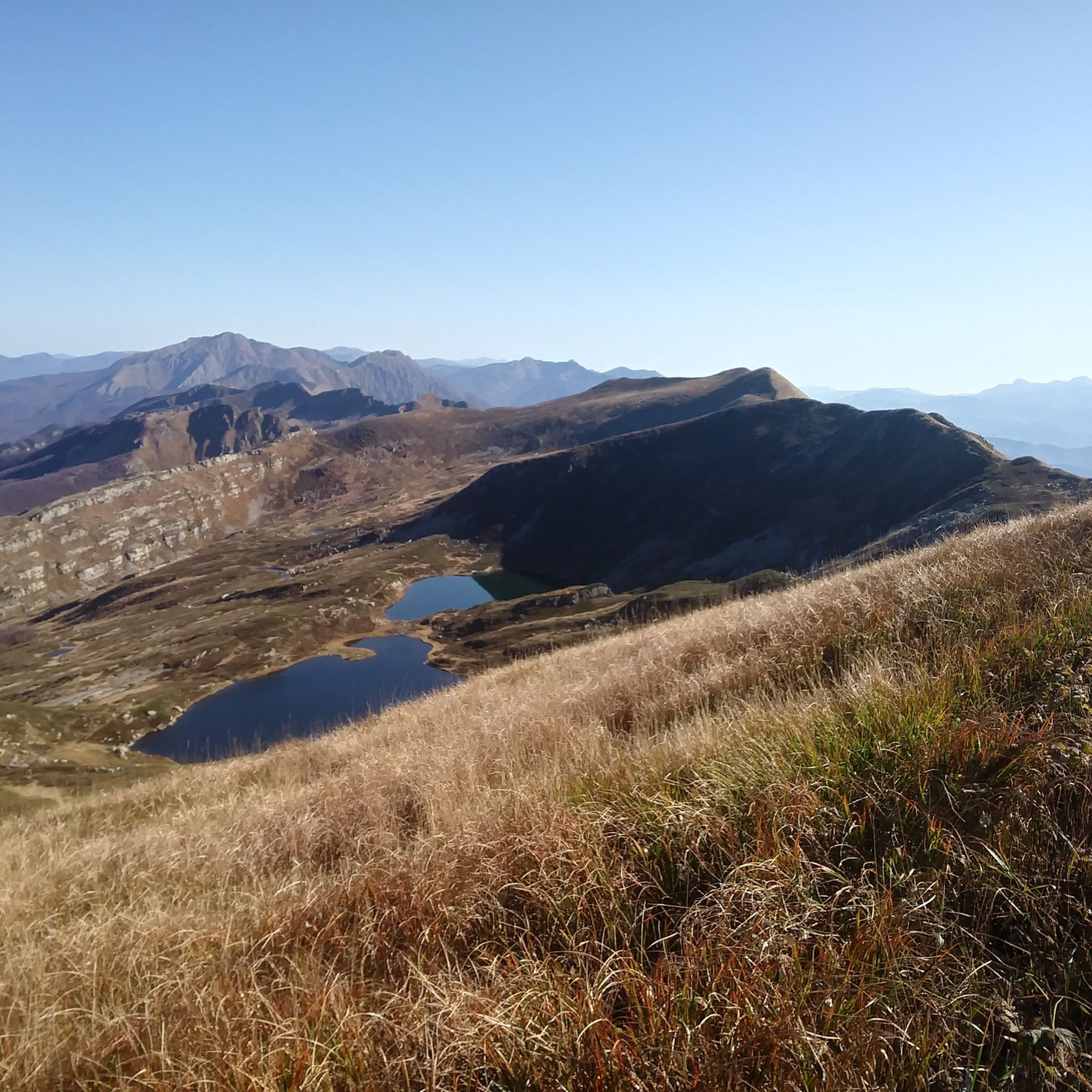
The Lago Santo Parmense is the largest glacial lake in Emilia-Romagna and the largest natural body of water in the entire northern Apennines. Located at an altitude of 1,507 meters in the municipality of Corniglio, it covers an area of over 81,000 square meters and reaches a maximum depth of 22.5 meters. It is located within the Tuscan-Emilian Apennine National Park (also known as the Park of the Hundred Lakes) and is dominated by the walls of Monte Marmagna.
0
0
Lago Santo Parmense is the largest glacial lake in Emilia-Romagna and the largest natural body of water in the entire northern Apennines. Located at an altitude of 1,507 meters in the municipality of Corniglio, it covers an area of over 81,000 square meters and reaches a maximum depth of 22.5 meters. It is located within the Tuscan-Emilian Apennine National Park (also known as Parco dei Cento Laghi) and is dominated by the walls of Monte Marmagna.
0
0

The Rifugio is closed (June 2026)
0
0
The Passo del Cerreto is an important pass in the Tuscan-Emilian Apennines, located at an altitude of 1,261 meters. It separates Tuscany from Emilia-Romagna, connecting the province of Massa-Carrara (municipality of Fivizzano) with that of Reggio Emilia (municipality of Ventasso). The pass is entirely crossed by the State Road 63 (SS 63).
0
0

Beautiful route, with a stunning summit panorama
1
0


Nice panoramic point at the foot of M. Marmagna
0
0
Frequently Asked Questions
Are there any beginner-friendly mountaineering routes around Licciana Nardi?
While many routes in the region are challenging, there are options suitable for those with some experience looking for a moderate ascent. For example, the Lake Santo Parmense – Sella del Marmagna loop from Riserva Naturale Orientata Guadine-Pradaccio is a moderate 4.5-mile (7.3 km) path that takes you through a nature reserve. Another good choice is the Lago di Monte Acuto loop from Passo del Lagastrello, a 5.6-mile (9.1 km) trail leading through mountain passes and past alpine lakes.
What are some challenging mountaineering routes in the Licciana Nardi area?
For experienced mountaineers seeking a challenge, the region offers several demanding routes. The Alpe di Succiso – Il Torrione loop from Succiso Nuovo is a difficult 6.9-mile (11.1 km) trail with substantial elevation gain. Another strenuous option is the Monte Aquila – Bocchetta del Tavola loop from I Cancelli Demaniali, which spans 9 miles (14.6 km) and features significant ascents. You could also consider the Alpe di Succiso Summit loop from Succiso for a rewarding summit experience.
How long do mountaineering routes around Licciana Nardi typically take?
The duration of mountaineering routes in this area varies significantly based on difficulty and distance. Moderate trails like the Lake Santo Parmense loop can take around 3 hours 30 minutes, while more difficult routes such as the Alpe di Succiso – Il Torrione loop often require closer to 5 hours to complete. Longer, more challenging ascents can extend to 6 hours or more.
Are there any circular mountaineering routes available?
Yes, many of the mountaineering routes around Licciana Nardi are designed as loops, allowing you to start and end at the same point. Examples include the popular Alpe di Succiso – Il Torrione loop from Succiso Nuovo, the Lake Santo Parmense – Sella del Marmagna loop, and the Lago di Monte Acuto loop from Passo del Lagastrello.
What kind of natural landmarks can I expect to see along these routes?
The mountaineering routes around Licciana Nardi are rich in natural beauty. You'll encounter stunning alpine lakes like Lake Santo Parmense and Lago di Monte Acuto, as well as prominent peaks such as Mount Sillara. The region is characterized by high mountain passes, dense woodlands, and diverse landscapes typical of the Apennine range.
What is the best time of year for mountaineering in Licciana Nardi?
The best time for mountaineering in Licciana Nardi is typically from late spring through early autumn (May to October). During these months, the weather is generally more stable, and trails are free of snow at lower to mid-altitudes. Summer offers the warmest temperatures, while spring and autumn provide cooler conditions and vibrant foliage. Always check local weather forecasts before heading out, especially for higher elevations.
Are there any mountain huts or refuges along the trails?
Yes, you can find mountain huts in the area that provide shelter and sometimes refreshments. A notable one is the Giovanni Mariotti Mountain Hut at Lago Santo, which is a great stop for those exploring routes around Lake Santo Parmense.
What do other mountaineers enjoy most about the routes in Licciana Nardi?
The mountaineering routes in Licciana Nardi are highly rated by the komoot community, with an average score of 4.75 stars. Reviewers often praise the challenging ascents, the panoramic views from high-altitude passes, and the serene beauty of the alpine lakes and dense woodlands. The varied terrain offers a rewarding experience for those seeking adventure in the Apennines.
Are there any historical or cultural points of interest near the mountaineering trails?
Beyond the natural landscapes, the region also features some interesting historical and cultural sites. You might encounter the Sanctuary of Madonna del Gaggio or the Lagastrello Dam, which are points of interest that add another dimension to your exploration of the area.
How many mountaineering routes are there in the Licciana Nardi area?
There are over 9 distinct mountaineering routes around Licciana Nardi documented on komoot, offering a range of difficulties from moderate to difficult. This provides ample choice for various skill levels and preferences within the mountainous terrain of Massa-Carrara.
What should I wear for mountaineering in Licciana Nardi during winter?
For winter mountaineering in the Apennines around Licciana Nardi, it's crucial to dress in layers. Essential gear includes waterproof and windproof outer shells, insulated mid-layers (fleece or down), thermal base layers, waterproof mountaineering boots, gaiters, warm gloves, a hat, and sunglasses. Depending on snow conditions and altitude, crampons and an ice axe may also be necessary. Always check weather and snow reports before your trip.
Are there any hidden gem routes or less-trafficked trails?
While specific 'hidden gems' are often discovered through local knowledge, exploring routes that venture deeper into the Apennine wilderness, away from the most popular starting points, can lead to quieter experiences. Look for trails that traverse less-known passes or connect smaller villages, as these often offer solitude and untouched natural beauty.
Most popular routes around Licciana Nardi
Most popular attractions around Licciana Nardi

Get inspired with the komoot mobile app


Explore more
Browse the best Mountain Hikes & Routes in other regions.
