The best gravel rides in Burns Bog Ecological Conservancy Area
4.4
(8)
111
riders
3
rides
Gravel biking in Burns Bog Ecological Conservancy Area is primarily confined to the Delta Nature Reserve, a portion on the eastern side of the bog, which features wide gravel paths suitable for casual cycling. The broader region, while known for its unique raised peat bog ecosystem, has highly restricted public access for recreational activities like gravel biking to designated trails. The accessible areas offer flat to gently rolling terrain, often bordering the bog's lagg zone or connecting to nearby coastal…
Last updated: July 3, 2026
26
riders
67.4km
03:17
140m
150m
Moderate gravel ride. Good fitness required. Mostly paved surfaces. Suitable for all skill levels.
4.9
(7)
64
riders
52.0km
02:36
130m
130m
Moderate gravel ride. Good fitness required. Mostly paved surfaces. Suitable for all skill levels.

Sign up for free
10
riders
Easy gravel ride. Great for any fitness level. Mostly paved surfaces. Suitable for all skill levels.
Our route recommendations are based on thousands of hikes, rides, and runs completed by other people on komoot.
Start today with a free account
Your next adventure awaits.
Login or Signup
Popular around Burns Bog Ecological Conservancy Area

Tips from the Community

So need to use a gravel bike ? Would it be too challenge with road bike?
0
0

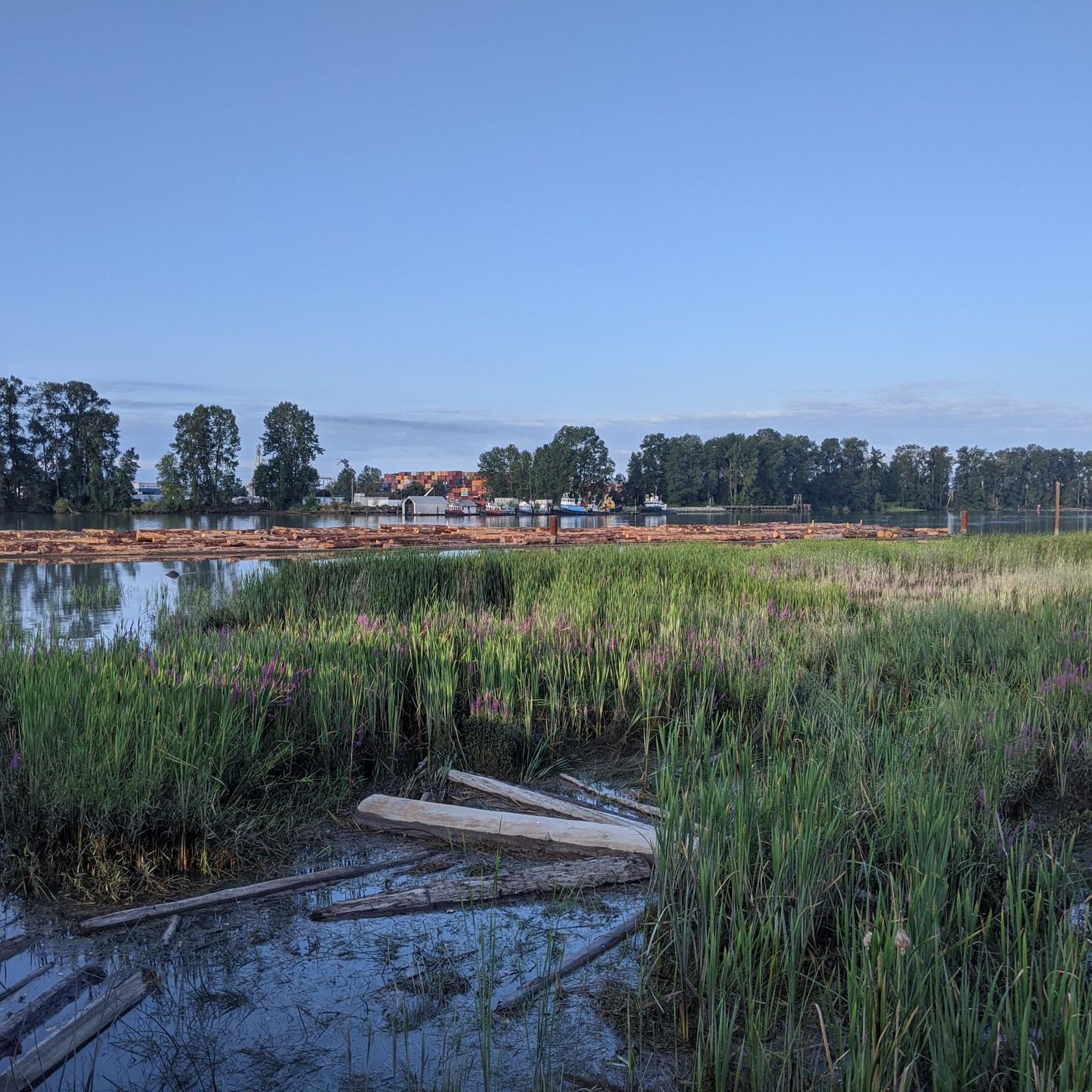
Boundary Bay Wildlife Management Area protects a vast stretch of intertidal mudflats, salt marsh, and eelgrass habitat along Boundary Bay. The area supports large numbers of migratory shorebirds and waterfowl, making it one of the most important bird habitats on Canada’s Pacific coast. Its accessible trails, consistent bird activity, and ever-changing tidal scenery make it an especially rewarding place to explore on foot or by bike.
0
0
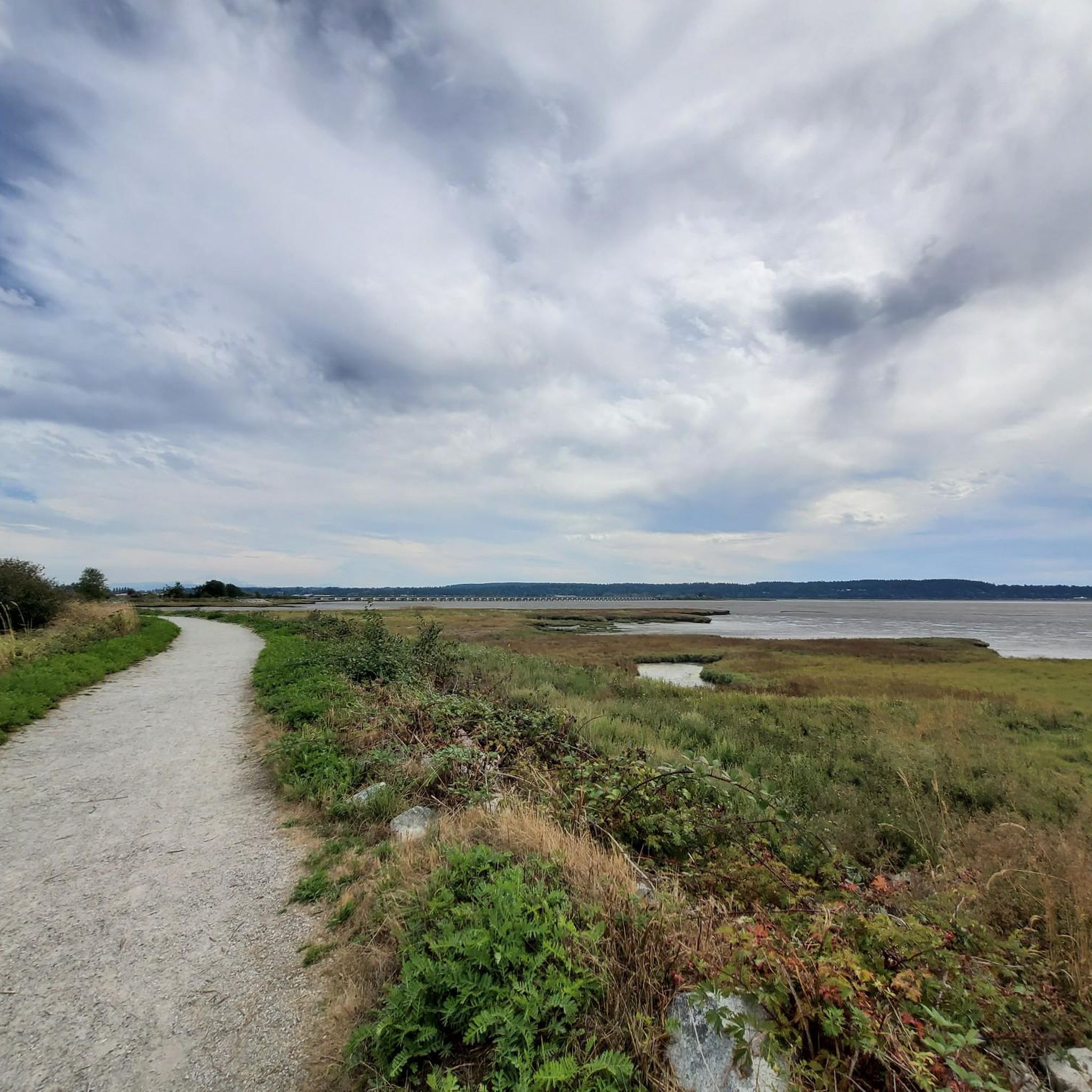
Boundary Bay Dyke Trail is a long, flat route along the shoreline, with uninterrupted views across mudflats and the open water. Its wide gravel surface is ideal for walking and cycling, with plenty of benches and access points along the way. Set along a major migratory route, the trail is especially known for birdlife and beautiful, expansive coastal scenery.
1
0

Smooth gravel. Beautiful views of Boundary Bay and Mount Baker.
0
0
Check the wind forecast and plan your ride accordingly.
0
0

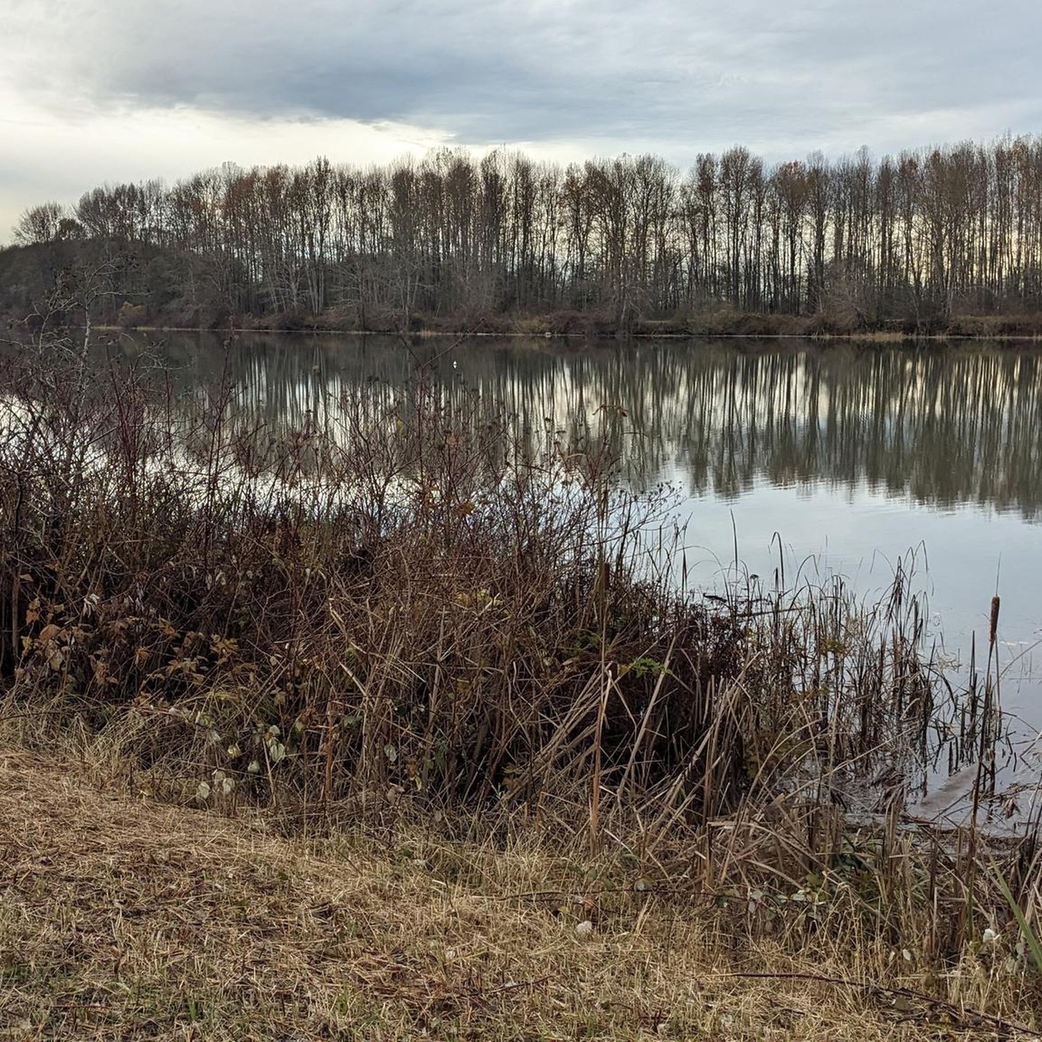
Deas Island Regional Park is a tranquil 300-acre green space situated along the Fraser River in Delta, BC. Located at 6090 Deas Island Road, the park is easily accessible from Vancouver via Highway 99 and the George Massey Tunnel. It offers approximately 7.6 km (4.7 miles) of easy, flat trails suitable for walking, cycling, and horseback riding. Popular trails include the Tinmaker’s Walk, Riverside Walk, and Island Tip Trail, which provide scenic views of the river and surrounding nature. The park is open daily from 7 a.m. to 10 p.m. during the summer months, with varying closing times in winter. Dogs are welcome on-leash. Vancouver Trails +2
1
0
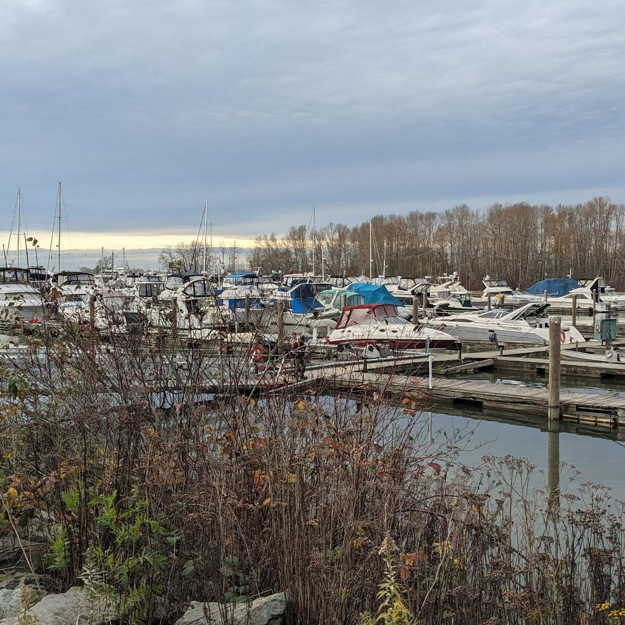
Early Industry: Oyster harvesting and shucking have been part of BC's coastal history since the late 19th century, initially focusing on the native Olympia oyster. Pacific Oyster Introduction: The introduction of the larger Pacific oyster in the early 20th century spurred the growth of the industry, leading to the establishment of dedicated shucking plants. Delta Example: One early significant plant was the BC Packers Limited shucking plant in Delta, operating from 1941 until its closure due to pollution in 1963. This plant processed both local and oysters from other BC farms. Hand Shucking: Traditionally, oyster shucking in BC was done entirely by hand, a labor-intensive process under strict sanitary regulations.
0
0
Frequently Asked Questions
Are gravel bikes allowed in Burns Bog Ecological Conservancy Area?
Public access for recreational activities like gravel biking within the Burns Bog Ecological Conservancy Area is highly restricted due to its delicate ecosystem and conservation priorities. Gravel biking is primarily confined to the Delta Nature Reserve, a portion on the eastern side of the bog, which features wide gravel paths suitable for casual cycling. The vast majority of the bog is closed to protect its sensitive environment.
What kind of terrain can I expect on gravel bike trails near Burns Bog?
The available gravel bike routes in the vicinity of Burns Bog offer flat to gently rolling terrain, often bordering the bog's lagg zone or connecting to nearby coastal gravel paths. You'll find wide, well-maintained gravel surfaces, ideal for consistent riding with minimal elevation changes.
How many gravel bike trails are available in the Burns Bog area?
There are several gravel bike routes available in the Burns Bog area, with komoot featuring 5 distinct tours. These routes are generally of moderate difficulty, focusing on distance rather than significant elevation.
What is the longest gravel bike route near Burns Bog?
The longest gravel bike route in the area is the Mud Bay Park – Boundary Bay Gravel Path loop from Alex Fraser Bridge, which spans 42.5 miles (68.3 km) and typically takes around 3 hours and 20 minutes to complete.
Are there any family-friendly gravel biking options?
The gravel paths within the Delta Nature Reserve and the coastal routes nearby are generally flat and wide, making them suitable for families and beginners. Routes like the Stewart Farmhouse – Crescent Beach loop from Crescent Beach, at 23.0 miles (37.0 km), offer a manageable distance for a family outing.
What are the best times of year for gravel biking in this region?
The region's gravel paths are generally accessible year-round. However, for the most comfortable experience, spring and fall offer milder temperatures. Winter riding is possible, but conditions can be wet, so appropriate gear is recommended.
What do other gravel bikers enjoy most about the trails near Burns Bog?
The routes in the Burns Bog area are highly rated by the komoot community, with an average score of 4.9 stars from over 10 reviews. Riders often praise the extensive, well-maintained gravel paths, the flat coastal sections, and the unique natural surroundings that offer a peaceful riding experience.
Are there any loop routes for gravel biking?
Yes, many of the gravel biking routes in the area are designed as loops. For example, the Mud Bay Park – Boundary Bay Gravel Path loop from Watershed Park is a popular 32.3-mile (52.0 km) loop that provides a consistent surface for extended rides.
Where can I park when visiting for gravel biking?
Parking is typically available at the starting points of the routes, such as Mud Bay Park, Watershed Park, or Joe Brown Park Equestrian Trailhead, which provide access to the Boundary Bay Gravel Path system. For the Delta Nature Reserve, designated parking areas are available for visitors.
Can I spot wildlife while gravel biking near Burns Bog?
Burns Bog is a significant biodiversity hotspot, home to over 300 plant and animal species and 175 bird species. While gravel biking is restricted to designated paths, particularly in the Delta Nature Reserve, you may encounter various bird species, including migratory birds, and other local wildlife in the surrounding areas.
Are there any advanced gravel biking routes in the Burns Bog area?
The gravel biking routes in the immediate Burns Bog area are generally classified as moderate, focusing on distance and consistent surfaces rather than technical difficulty or significant elevation gain. There are no routes specifically designated as 'difficult' or 'advanced' within the provided data for this region.
What is the shortest gravel bike route available?
The shortest route listed is the Stewart Farmhouse – Crescent Beach loop from Crescent Beach, which covers 23.0 miles (37.0 km) and can be completed in about 1 hour and 52 minutes.
Most popular routes in Burns Bog Ecological Conservancy Area

Get inspired with the komoot mobile app


Explore more
Browse the best Gravel rides in other regions.
