The best road cycling routes in Yellomundee Regional Park
5.0
(2)
325
riders
20
rides
Road cycling in Yellomundee Regional Park offers access to routes in the lower Blue Mountains and Penrith area, situated on the eastern escarpment of the Blue Mountains. The region features largely natural bushland, protecting diverse plant communities and riverine ecosystems along the Nepean River. While the park itself does not contain dedicated paved road cycling paths, its proximity to urban areas provides connections to scenic roads and cycleways. Road cyclists can explore routes that offer views of the bushland and…
Last updated: October 18, 2026
41
riders
41.0km
02:11
450m
450m
Moderate road ride. Good fitness required. Mostly well-paved surfaces and easy to ride.
18
riders
30.1km
01:44
370m
370m
Moderate road ride. Good fitness required. Mostly well-paved surfaces and easy to ride.

5.0
(2)
8
riders
91.6km
04:34
630m
630m
Moderate road ride. Good fitness required. Mostly well-paved surfaces and easy to ride.
7
riders
110km
05:33
910m
910m
Hard road ride. Very good fitness required. Mostly well-paved surfaces and easy to ride.
4
riders
Moderate road ride. Good fitness required. Mostly well-paved surfaces and easy to ride.
Get access to more routes and recommendations from other explorers.
Already have an account?
Our route recommendations are based on thousands of hikes, rides, and runs completed by other people on komoot.
Start today with a free account
Your next adventure awaits.
Tips from the Community

Westlands Reserve is a lovely riverside parkland situated along the Nepean River. There are open grassy fields, picnic areas, playgrounds, and access to the Nepean River Cycleway, making it a popular spot for walking, cycling, and family outings. With its mix of river views and recreational spaces, it’s an ideal place to spend a relaxing afternoon close to the town centre.
1
0

This looped track circles the lake within Harrington Park Lake, following the shoreline through open parkland. The path is mostly paved, making it suitable for walking and cycling, with consistent views across the water throughout. It’s largely exposed with limited shade, and can be busier at peak times. After rain, grass edges beside the path may become soft underfoot.
0
0
Set within Harrington Park, this suburban lake is surrounded by open grass, scattered trees, and sections of reed-lined shoreline. The water is usually calm, with birdlife often present around the edges. It’s a maintained reserve rather than a bush setting, with clear sightlines across the lake and nearby residential areas. Ground conditions are generally firm, though softer sections can develop closer to the water after rain.
0
0

Green Parade is a road that is often paired with the Valley Heights Fire Trail to create a complete loop. Green Parade has a sidewalk for most of the way, but there are also just grassy and dirt areas to walk on the side of the road. Green Parade is not very busy, but still be careful when walking near traffic.
0
0
The Valley Heights Rail Museum has tours, a cafe, and steam tram rides, along with its museum. It's a charming museum full of information and with lots of realistic miniature working trains to enjoy.
0
0


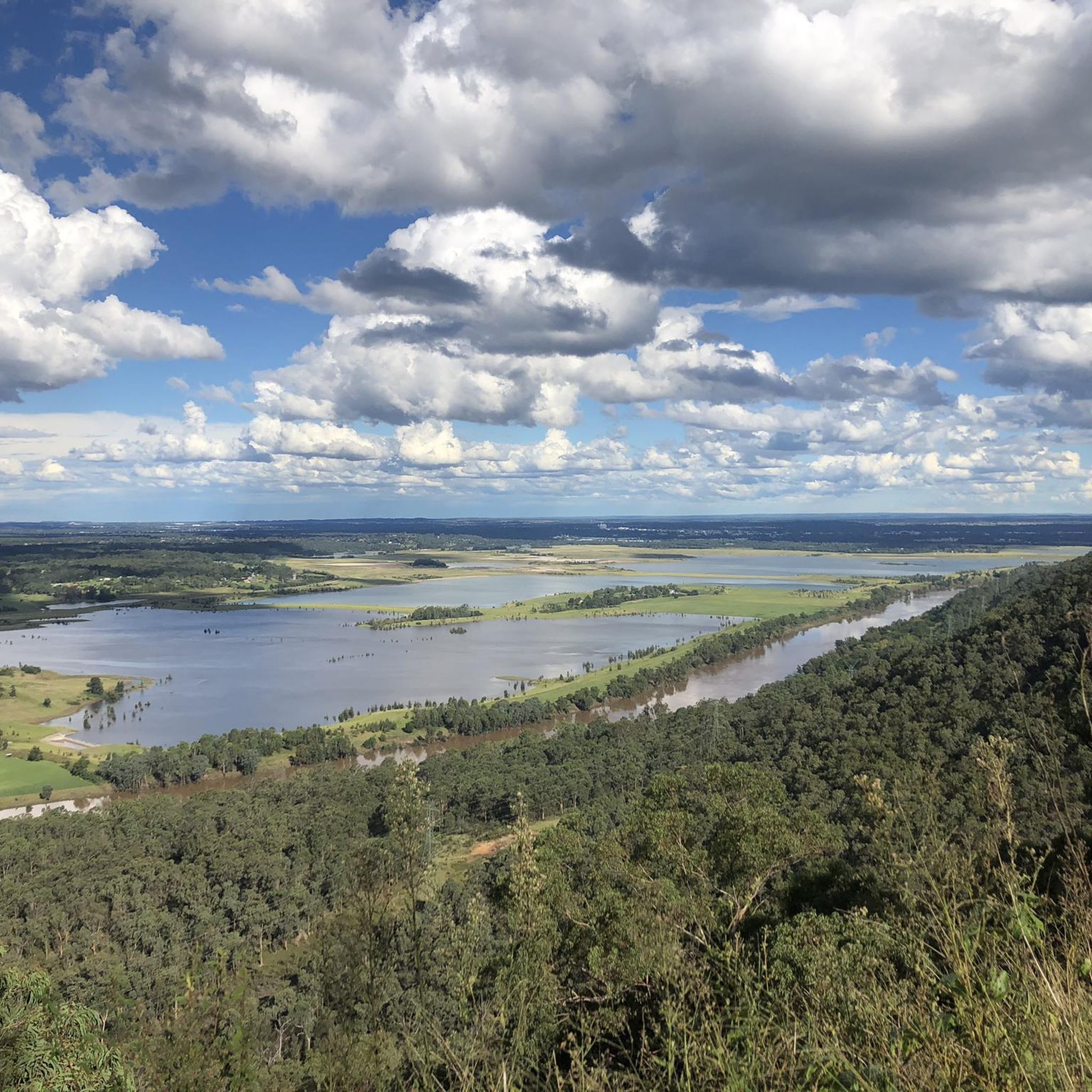
The Nepean River, known as Yandhai in the local Dharug language, is the main tributary of the Hawkesbury River that flows into the Tasman Sea at Broken Bay. An important water source for the region the river is also an attraction for hikers, cyclists, canoers, and kayakers.
0
0
Spanning 258 meters across the Nepean River, the Yandhai Nepean Crossing is the single span footbridge in Australia.
0
0
Frequently Asked Questions
How many road cycling routes are available in the Yellomundee Regional Park area?
There are over 25 road cycling routes in the area surrounding Yellomundee Regional Park, catering to various skill levels. You'll find 5 easy, 14 moderate, and 7 difficult routes to explore.
What kind of terrain can I expect on road cycling routes near Yellomundee Regional Park?
The routes in this area often feature varied terrain, including sections with elevation changes as they traverse the eastern escarpment of the Blue Mountains. You can expect a mix of bushland views and riverine landscapes, with some routes incorporating cycleways like the M7. For example, the Huntington Reserve – Railway Reserve loop from Blaxland offers moderate terrain with over 430 meters of elevation gain.
Are there any road cycling routes that offer scenic views or landmarks?
Yes, several routes provide scenic vistas. The Hawkesbury Lookout loop from Warrimoo leads through bushland and offers views from Hawkesbury Lookout. From lookouts like Yellow Rock and Hawkesbury, you can enjoy expansive views over the Nepean River and Western Sydney. These lookouts also provide picnic facilities.
What do other road cyclists enjoy most about cycling in the Yellomundee Regional Park area?
The routes in the Yellomundee Regional Park area are highly rated by the komoot community, with an average score of 5.0 stars. Cyclists often praise the diverse bushland and riverine landscapes, as well as the variety of routes available for different abilities.
Are there any long-distance road cycling options in the region?
For those seeking longer rides, routes like the McDonald's Camden Valley Way – M7 Cycleway Water Bubbler loop from Emu Plains cover over 90 kilometers and include sections of the M7 Cycleway. Another challenging option is the Silverdale Road loop from Emu Plains, which is over 100 kilometers with significant elevation.
Can I find loop routes for road cycling near Yellomundee Regional Park?
Yes, many road cycling routes in the area are designed as loops, allowing you to start and finish at the same point. Examples include the Huntington Reserve – Railway Reserve loop from Blaxland and the Glenbrook Lagoon Reserve – Mt Sion Park loop from Winmalee High School.
Is Yellomundee Regional Park itself suitable for road cycling?
Yellomundee Regional Park is primarily known for mountain biking, bushwalking, and horse riding, with extensive networks of trails. While the park itself does not feature dedicated paved road cycling paths, its proximity to Penrith and the lower Blue Mountains provides access to scenic road cycling routes in the surrounding region.
What are the best times of year for road cycling in this region?
The region generally offers good cycling conditions for much of the year. Spring and autumn typically provide milder temperatures, making them ideal for longer rides. Summer can be warm, so early morning or late afternoon rides are often preferred, while winter offers crisp, clear days.
Are there options for family-friendly road cycling in the area?
While Yellomundee Regional Park's immediate vicinity might be more challenging, the broader Penrith area offers cycleways, such as the Glenmore Park to Penrith cycleway, which can be integrated into longer, potentially more family-friendly rides. Look for routes designated as 'easy' on komoot for less strenuous options.
Where can I find parking for road cycling routes near Yellomundee Regional Park?
Parking is generally available at the starting points of many routes in the surrounding towns and suburbs, such as Blaxland, Emu Plains, Warrimoo, or Winmalee. Specific parking details are often provided within individual komoot Tour descriptions.
Are there any cafes or amenities along the road cycling routes?
The routes often pass through or near towns in the lower Blue Mountains and Penrith area, where you can find cafes, pubs, and other amenities. It's advisable to check the specific route details on komoot to plan your stops for refreshments and supplies.
Can I combine road cycling with other activities in the Yellomundee Regional Park area?
Absolutely. After your road ride, you could explore Yellomundee Regional Park itself for bushwalking or enjoy the Nepean River for canoeing or fishing. The park also protects significant Aboriginal sites, offering a chance to connect with the region's cultural heritage. More information about the park can be found on the NSW National Parks website.
Most popular routes in Yellomundee Regional Park

Get inspired with the komoot mobile app


Explore more
Browse the best Road cycling routes in other regions.
