The best MTB trails in Yellomundee Regional Park
4.7
(5)
225
riders
7
rides
Mountain biking in Yellomundee Regional Park offers diverse terrain on the eastern escarpment of the Blue Mountains, just west of Sydney. The park features a mix of native bushland, single-track trails, and views over the Nepean River. Its landscape includes geological formations and connects the flat Sydney basin to the Blue Mountains.
Best mountain bike trails in Yellomundee Regional Park
- The most popular mountain bike trail is Nepean River Lookout loop from Blaxland, a 24.5 miles (39.4 km) moderate…
Last updated: October 20, 2026
5.0
(2)
46
riders
39.4km
03:03
620m
620m
Moderate mountain bike ride. Good fitness required. Suitable for all skill levels.
34
riders
9.34km
00:51
120m
120m
Easy mountain bike ride. Great for any fitness level. Suitable for all skill levels.

36
riders
21.9km
01:49
290m
290m
Moderate mountain bike ride. Great for any fitness level. Advanced riding skills necessary.
14
riders
50.3km
03:45
820m
820m
Moderate mountain bike ride. Good fitness required. Suitable for all skill levels.
5.0
(1)
42
riders
69.1km
05:37
1,300m
1,300m
Hard mountain bike ride. Very good fitness required. Suitable for all skill levels.
Get access to more routes and recommendations from other explorers.
Already have an account?
Our route recommendations are based on thousands of hikes, rides, and runs completed by other people on komoot.
Start today with a free account
Your next adventure awaits.

Tips from the Community

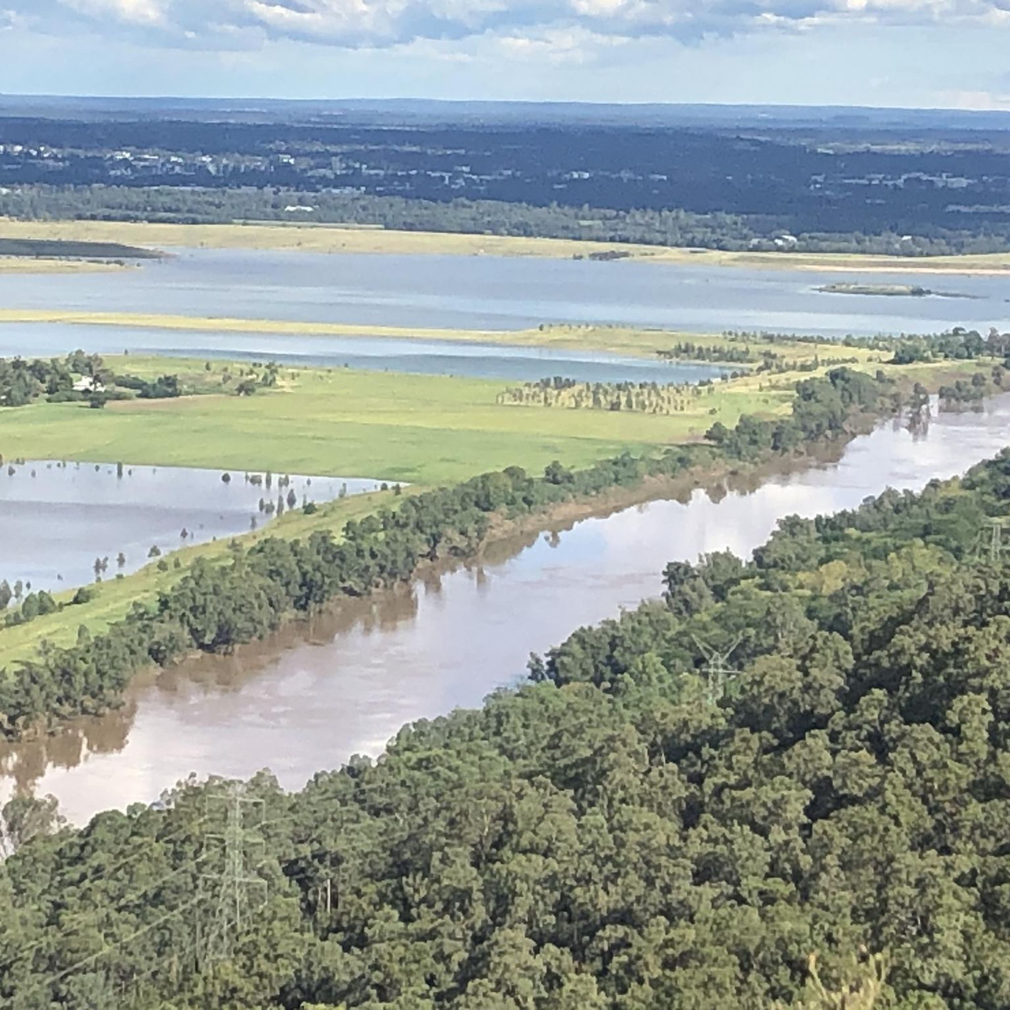
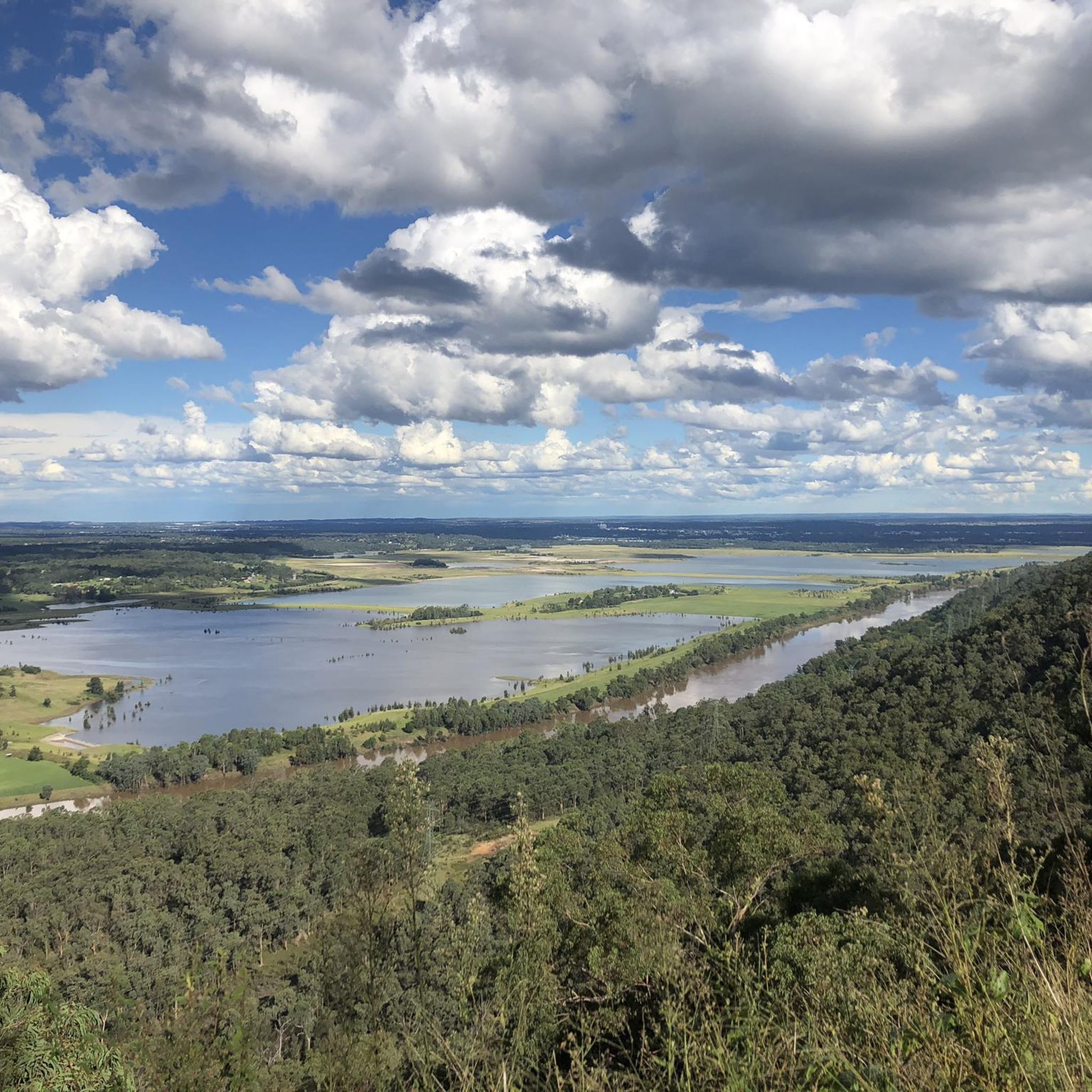
Elizabeth Lookout is a dirt outcrop with metal handrails near a break in the trees with wide panoramic views looking out over the Penrith Valley and toward the distant Sydney skyline. Just behind the viewpoint are two picnic benches with a large shade structure.
0
0

This crossing is a concrete causeway where Glenbrook Creek flows gently across the trail. Depending on water levels, you may need to walk or ride through a shallow sheet of flowing water, so take extra care as you cross, as the surface can be slippery. After heavy rain, the crossing may become impassable or be closed, so be sure to check recent weather conditions before you plan to explore this part of the trail.
0
0
Bennetts Ridge Day Use Area is a lovely spot with plenty of open green space, picnic tables, a car park, and easy access to Bennetts Ridge Trail and the surrounding fire track network. Set among the eucalypts, it’s a great starting point for exploring the park, and if you’re passing by, a perfect place to rest for a while before continuing your walk.
0
0
Bennetts Ridge Trail is a wide fire track that climbs gradually along the ridgeline under a canopy of eucalypts. Popular with walkers, trail runners, and mountain bikers, it’s a great way to explore this corner of the park where you can occasionally catch a peek across the surrounding valleys through breaks in the trees.
0
0
Red Wire Saddle is sometimes referred to as Red Wire Saddle Cliffs, and sticks out above the forests to reveal a nice view of the lower Blue Mountains bushland and rolling hills. The saddle sits alongside sandstone cliffs. The name comes from utility workers and fire workers who put up basic telephone and emergency communication lines, and in order to stand up to harsh elements, bushfires, and rusting, the wires were copper-coated which aged into a distinct rusty red hue.
0
0
Woodford – Oaks trail is a wide fire management road that passes though eucalyptus forests and past streams, watering holes, reservoirs, campsites, picnic areas, and archaeological sites like Bora Ground. The entire trail stretches from Woodford to Glenbrook spanning almost 28 kilometres in total. The trail can be taken as an out and back or, for ambitious bushwalkers and bikers, an end-to-end adventure. The trail starts and ends very close to Woodford and Glenbrook train stations. This area can get hot in summer. During severe heatwaves, temperatures can occasionally soar past 40° C, so plan accordingly.
0
0
The Woodford – Oaks trail is an unsealed fire management road, not a public driving road. Just south of the Wheel Firefighting Reservoir spur trail, the Woodford – Oaks trail opens up to a large dirt car park for designated vehicles.
0
0
Green Parade is a road that is often paired with the Valley Heights Fire Trail to create a complete loop. Green Parade has a sidewalk for most of the way, but there are also just grassy and dirt areas to walk on the side of the road. Green Parade is not very busy, but still be careful when walking near traffic.
0
0
Frequently Asked Questions
How many mountain bike trails are available in Yellomundee Regional Park?
Yellomundee Regional Park offers a network of over 10 mountain bike trails, catering to various skill levels from easy to difficult. The park is known for its diverse single-track trails and scenic views.
What types of terrain can I expect on the mountain bike trails in Yellomundee Regional Park?
The trails in Yellomundee Regional Park feature diverse terrain, including flowing single-track, switchbacks, and sections with significant elevation gain. You'll ride through native bushland, along the Blue Mountains escarpment, and enjoy views over the Nepean River. Both green and blue difficulty singletracks are available.
Are there any easy or beginner-friendly mountain bike trails in Yellomundee Regional Park?
Yes, Yellomundee Regional Park has trails suitable for beginners. For an easier ride, consider the Knapsack Reserve loop from Glenbrook, which is rated as easy and covers about 9.3 km.
What are some scenic viewpoints or landmarks to look out for while mountain biking?
The park offers spectacular views from lookouts such as Hawkesbury Lookout and Yellow Rock Lookout, providing sweeping vistas over the Nepean River and Western Sydney. The trails also pass through significant native bushland and along the Blue Mountains escarpment, offering impressive geological formations. The park also protects special Aboriginal sites, reflecting its deep cultural significance.
Is Yellomundee Regional Park suitable for family mountain biking?
Yes, Yellomundee Regional Park is considered a family-friendly destination. Beyond mountain biking, the park offers picnic tables and sheltered areas, and some trails are suitable for easier rides, making it enjoyable for families.
Are dogs allowed on the mountain bike trails in Yellomundee Regional Park?
Dogs are permitted in Yellomundee Regional Park, but they must be kept on-lead and in designated areas. Always check the latest park regulations on the NSW National Parks website for specific rules regarding pets on trails.
Do I need a permit or pay an entry fee to mountain bike in Yellomundee Regional Park?
Generally, individual mountain bikers do not require a permit or pay an entry fee for general access to Yellomundee Regional Park. However, it's always advisable to check the official NSW National Parks website for any updates or specific requirements, especially for organised events or commercial activities. You can find more information on the NSW National Parks visitor info page.
Where can I park my car when visiting Yellomundee Regional Park for mountain biking?
Parking is available at various points around Yellomundee Regional Park, often near trailheads or popular access points. Specific parking areas can be found by checking detailed park maps or visitor information on the NSW National Parks website.
What do other mountain bikers enjoy most about Yellomundee Regional Park?
The mountain bike trails in Yellomundee Regional Park are highly rated by the komoot community, with an average score of 4.8 stars. Reviewers often praise the diverse single-track trails, the scenic views over the Nepean River, and the engaging ride experience provided by the 'figure 8' trail layout with plenty of switchbacks.
Are there any mountain bike trails that offer a good challenge for experienced riders?
Yes, for experienced riders seeking a challenge, Yellomundee Regional Park offers several difficult trails. The park features significant elevation gains and technical single-track sections. For example, the The Helipad loop from Blaxland is a moderate route with substantial elevation gain through varied bushland, providing a good test for skilled riders.
Can I access Yellomundee Regional Park using public transport?
While Yellomundee Regional Park is minutes from Western Sydney, direct public transport access to the trailheads can be limited. It is generally more convenient to access the park by car. However, you can research public transport options to nearby towns like Blaxland or Glenbrook and then consider a short ride or taxi to the park's entry points.
Are there any cafes or pubs near Yellomundee Regional Park?
Yellomundee Regional Park is located near Western Sydney, with towns like Penrith and Springwood offering various amenities. You can find cafes, pubs, and accommodation options in these nearby areas for refreshments or overnight stays after your ride.
Most popular routes in Yellomundee Regional Park

Get inspired with the komoot mobile app


Explore more
Browse the best MTB trails in other regions.
