The best walks and hikes in Sperrins Aonb
4.5
(160)
1,369
hikers
64
hikes
Hikes in Sperrins AONB explore a landscape of rolling hills, heather-clad moorlands, and quiet valleys. The region is characterized by a spine of peaks with broad, rounded ridges and dense forests covering a significant portion of the area. The trail network follows rivers and ascends to summits such as Sawel Mountain and Mullaghcarn, offering a range of hiking experiences.
Best hiking trails in Sperrins Aonb
- The most popular hiking route is Gortin Glen Forest Park via Mullaghcarn — Sperrins, a 5.6 mile (9.0 km) trail that takes around 2 hours 45 minutes to complete. The route leads through Gortin Glen Forest Park to the summit of Mullaghcarn.
- Another top favourite among local hiking enthusiasts is Sawel Mountain — Sperrins, a moderate 2.8 mile (4.6 km) path. This route involves an ascent to the highest peak in the Sperrin Mountains.
- Local hiking enthusiasts also love the Lough Fea loop — Sperrins, a 2.6 mile (4.1 km) trail leading around the perimeter of the lake, often completed in about 1 hour.
- Hiking in Sperrins Aonb is defined by its rolling hills, deep valleys, and expansive forests. The network of trails offers options for different ability levels, from gentle lakeside walks to more demanding mountain ascents.
- The routes in Sperrins Aonb are highly rated by the komoot community with an average score of 4.7 stars from over 90 reviews. More than 900 hikers have used komoot to explore Sperrins Aonb's varied terrain.
Last updated: October 10, 2026
4.6
(12)
67
hikers
13.3km
03:45
280m
280m
Embark on the Banagher Glen Forest Trail, a moderate hike that spans 8.2 miles (13.3 km) with an elevation gain of 923 feet (281 metres). This route guides you through one of Ireland's oldest ancient oak woodlands, following the soothing Banagher Stream. You will eventually reach the impressive Altnaheglish Reservoir and Banagher Dam, offering panoramic views of the Sperrin Mountains from higher points. Expect to spend around 3 hours and 44 minutes exploring this diverse landscape. The trail features varied terrain, including surfaced roads and forest tracks, with some very steep sections leading to the dam. Sturdy footwear is highly recommended due to rocky and uneven paths you may encounter. While specific parking details are not provided, the trailhead is accessible for you to begin your adventure. This trail is notable for its rich natural environment, as it is a designated Special Area of Conservation. The steep glens are home to mature trees like oak and ash, along with an understory of rowan, hazel, and holly. You can also catch glimpses of Donegal in the distance from certain vantage points, adding to the scenic appeal of the area.
5.0
(6)
47
hikers
9.27km
02:53
370m
370m
Embark on the Slieve Gallion NE Top via Iniscarn Forest trail, a moderate hike spanning 5.8 miles (9.3 km) with an elevation gain of 1212 feet (369 metres). This route typically takes around 2 hours and 53 minutes to complete, guiding you through the atmospheric Iniscarn Forest on uneven forest roads before ascending to the mountain's north-eastern top. As you climb out of the woodland, the views dramatically open up, offering incredible panoramic vistas of the Sperrins mountain range and Lough Neagh from the summit. Be prepared for potentially boggy ground, especially after rain, so sturdy walking boots are a must.
Access to the trail is convenient, with a car park and playpark available on-site, making it a good option for families. While some parts of the trail are easily accessible, the ascent to the summit requires good fitness and sure-footedness. Remember that the land around the summit is privately owned, and you might encounter free-roaming sheep, so keep dogs on a lead. This trail is popular among both hikers and mountain bikers, so you can expect to share the path with others.
Slieve Gallion is situated at the edge of the Sperrins Area of Outstanding Natural Beauty, recognized for its "High Scenic Value." Historically, the mountain was a significant site for Lughnasadh festival gatherings for centuries. Keep an eye out for local wildlife such as Irish hare, curlew, and red grouse as you explore this area. Annual races to the top of the mountain also highlight its enduring appeal and challenge.

5.0
(1)
57
hikers
4.12km
01:03
20m
20m
Embark on the Lough Fea Walk, an easy hiking route that guides you through a peaceful forest and along the tranquil shores of Lough Fea. This well-maintained path offers panoramic views across the calm water, with the wild mountainous landscape of the Sperrin Mountains forming a dramatic backdrop, particularly from the eastern side. The entire loop covers 2.6 miles (4.1 km) with a gentle elevation gain of just 57 feet (17 metres), making it a relaxed outing. You can comfortably complete this hike in about 1 hour and 3 minutes, enjoying the unspoiled scenery. It's especially beautiful during autumn, or for early morning and late evening strolls when you might catch a sunset or spot some birds.
Planning your visit to Lough Fea is straightforward, as the route is a clearly marked circular path. You'll be pleased to know that a recently reopened footbridge ensures the full loop is accessible for everyone. The area provides convenient on-site facilities, including dedicated picnic areas where you can relax, public toilets, and even a children's play area. This makes the Lough Fea Walk an excellent choice if you are looking for a family-friendly destination.
This trail stands out within the Sperrins Area of Outstanding Natural Beauty for its serene lakeside environment. The unspoiled landscape around Lough Fea offers a quiet escape, perfect for those seeking a moment of calm away from busier trails. Keep an eye out for local birdlife, especially during the quieter times of day, adding another layer to your outdoor experience.
4.2
(6)
25
hikers
8.99km
02:47
350m
350m
Embark on a moderate hike through Gortin Glen Forest Park via Mullaghcarn, a rewarding journey spanning 5.6 miles (9.0 km) with an elevation gain of 1156 feet (352 metres). This route typically takes around 2 hours and 47 minutes to complete, guiding you from serene forest roads alongside the Pollan Burn stream to steeper, more rugged terrain as you ascend. As you climb, the path emerges onto heather-covered hillsides, leading you towards the summit of Mullaghcarn, where you will find expansive views. Be prepared for varied surfaces, including gravel, grass, and exposed rock, with potentially slippery sections when wet, so proper walking boots are recommended.
Planning your visit to Gortin Glen Forest Park is straightforward, as it offers excellent accessibility for hikers. You will find a well-maintained visitor car park, complete with information boards and toilets, making it convenient to start your adventure. The park also features a play park, which is a nice addition if you are visiting with family. Remember that while the park has many trails, the Mullaghcarn section involves physically demanding climbs, so ensure you are adequately prepared for the challenge.
This trail stands out for its unique features and stunning vistas, particularly from the summit of Mullaghcarn. Here, you can greet Darach, the Guardian of the Sperrins, a majestic giant sculpture that offers a fantastic photo opportunity and marks the peak. From this vantage point, you are treated to spectacular 360-degree panoramic views across the Glenelly valley, the Sperrins, and even into County Donegal on clear days. The park itself is a haven for wildlife, boasting a dedicated wildlife area and a deer enclosure, providing opportunities to spot red squirrels and deer.
3.7
(3)
36
hikers
4.56km
01:43
320m
320m
Hiking Sawel Mountain offers a rugged and rewarding experience, leading you to the highest point in the Sperrin Mountains. The 2.8-mile (4.6 km) trail involves a moderate climb of 1036 feet (316 metres), taking about 1 hour and 42 minutes to complete. You'll navigate steep, often boggy terrain, especially after rain, so proper walking boots are essential. From the summit, you'll be treated to sweeping panoramic views across the wild, untouched landscape of the Sperrins, potentially seeing as far as the Foyle Estuary and the Mourne Mountains on a clear day. The montane heathland around you features heather and bilberries, adding to the remote feel of the hike.
Be prepared for challenging conditions on Sawel Mountain; the trail often lacks clear markers, so you might need to follow fence lines for navigation, especially if visibility is low. The terrain is frequently boggy, making proper walking boots and gaiters highly recommended to keep your feet dry. The best time to hike this route is between March and September, when conditions are generally more favorable. Always check the weather forecast before you set out, as the mountain environment can change quickly.
Sawel Mountain stands as the highest peak in the Sperrins, offering unparalleled vistas that make the demanding ascent worthwhile. The Sperrin Mountains are known for their wild, untouched beauty, providing a sense of solitude amidst diverse habitats like bog, moorland, and woodland. You might spot wildlife such as kestrels, buzzards, or hares during your journey. This trail is a popular choice for those seeking a strenuous walk in a truly natural and beautiful setting.
Get access to more routes and recommendations from other explorers.
Already have an account?
Our route recommendations are based on thousands of hikes, rides, and runs completed by other people on komoot.
Start today with a free account
Your next adventure awaits.
Tips from the Community

Wear waterproof shoes/boots because even on the longest day of the year it's still wet underfoot
0
0

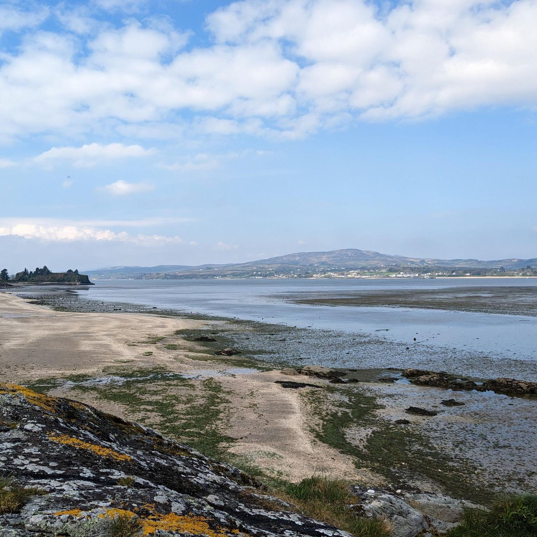
Slieve Gallion NE Top is a mountain summit in the region in the county of Mid-Ulster, Ireland. It stands at 496m and provides sensational views across the Sperrins mountain range and lough neagh.
2
0
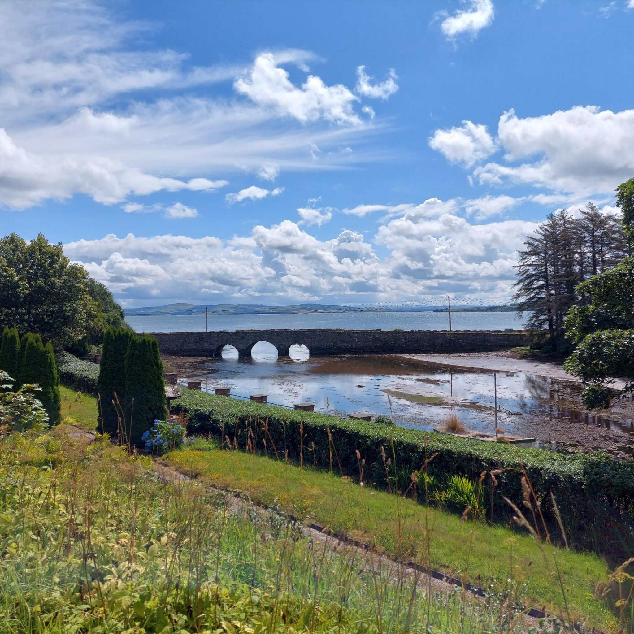
Enjoy some peace and serenity as you jog along the shores of the beautiful and calm Altnaheglish Reservoir, situated in the Sperring Area of Natural Beauty. The reservoir is located in the Banagher Forest, which is home to some of the oldest ancient oak woodlands in Ireland. It's a true place of beauty!
1
0
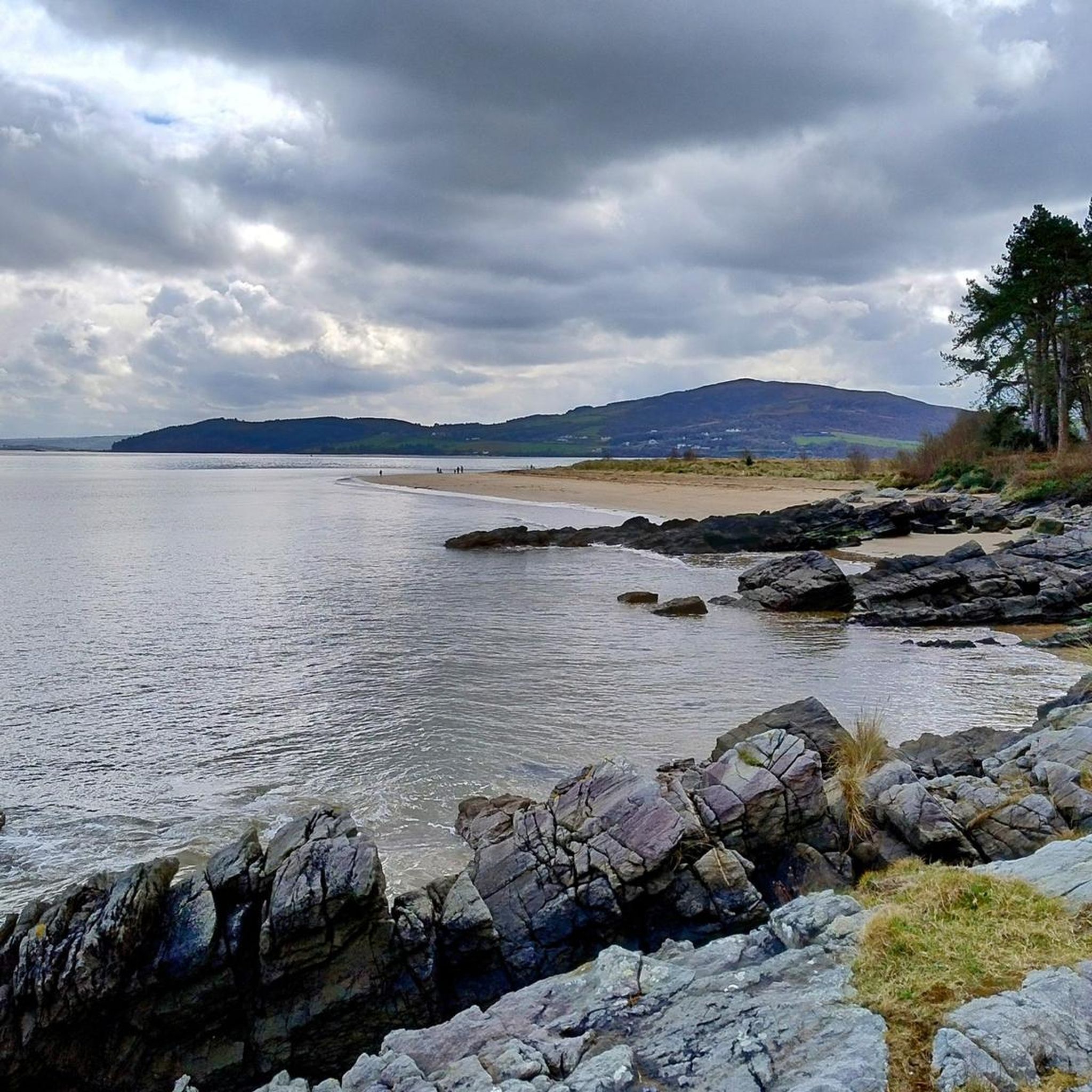
An enjoyable 4km walking track leads you around the serene Lough Fea in the eastern Sperrins in Northern Ireland. The scenery is mountainous and panoramic, and the calm waters bring many anglers and are home to a number of fascinating bird species, often seen flitting along the lake. The walk is lovely and flat and features a children's play area, toilets, and plenty of rain shelters in case of unpredictable weather.
4
0
Sawel Mountain stands at 678m and is the highest peak in the Sperrins range, and the 8th highest in Northern Ireland. The vegetation around the summit consists of montane heathland, featuring a medley of plant life including heather, bilberries and cowberries. From the summit, you can enjoy uninterrupted views across the countryside of County Londonderry and Tyrone. It's all downhill from this point on, so you can enjoy a scenic descent back to the carpark.
1
0
Turn off here to visit a hidden waterfall deep in the Gortin Glen Forest Park.
2
0
Sawel Mountain stands at 678m and is the highest peak in the Sperrins range, and the 8th highest in Northern Ireland. The vegetation around the summit consists of montane heathland, featuring a medley of plant life including heather, bilberries and cowberries. From the summit, you can enjoy uninterrupted views across the countryside of County Londonderry and Tyrone.
4
0

Great climb and view of the sperins and lough neagh
1
1
Frequently Asked Questions
Are there any easy, family-friendly walks in the Sperrins?
Yes, the Sperrins offer several gentle walks perfect for families. A great option is the Lough Fea loop, a flat 2.6-mile (4.1 km) path around a picturesque lake. Gortin Glen Forest Park is also highly regarded by families, offering accessible trails and a children's play area.
Can I bring my dog on hikes in the Sperrins?
Dogs are generally welcome in many parts of the Sperrins, but they should be kept on a lead, especially on farmland where livestock may be present. Forest parks like Gortin Glen are popular spots for dog walkers. Always check local signage at trailheads for specific rules.
Where are the main parking areas for hikers?
Key trailheads have dedicated parking. Popular starting points with car parks include Gortin Glen Forest Park, which serves as a gateway to many trails, and Davagh Forest, known for its walking and biking paths. You will also find parking at the start of the Lough Fea walk.
What kind of wildlife might I see in the Sperrins?
The Sperrins' wild landscape is home to a variety of wildlife. Keep an eye out for Irish hares and red grouse on the open moorlands. In forested areas like Banagher Glen, you might spot red squirrels and various woodland birds. The region's rivers are also important habitats for otters and salmon.
Are there any circular walks in the Sperrins?
Yes, there are many excellent circular routes. For a challenging loop with rewarding views, consider the Slieve Gallion NE Top via Iniscarn Forest trail. This moderate hike takes you through woodland and up to the summit for panoramic vistas before returning to your starting point.
What is the best way to get to the Sperrins AONB?
The most convenient way to access the various trailheads throughout the Sperrins is by car. The AONB is spread across counties Tyrone and Derry, and main roads like the A6 and A5 provide good access to the region. From there, smaller rural roads lead to specific parks and trailheads.
Are there any historical or archaeological sites to see while hiking?
Absolutely. The Sperrins are rich in history. A must-visit is the Beaghmore Stone Circles, an ancient Bronze Age complex. Many trails pass by historical features, offering a glimpse into the region's deep archaeological past as you walk.
What makes the Sperrins a good place for stargazing?
The Sperrins have very low light pollution, making the night sky exceptionally clear. The area around Davagh Forest is an official Dark Sky Park, recognized as one of the best places for stargazing. The OM Dark Sky Park and Observatory is located here, offering visitors a chance to explore the cosmos.
How many hiking trails are in the Sperrins AONB?
There are over 60 waymarked hiking routes to explore in the Sperrins AONB. These range from easy, short walks to difficult mountain climbs, offering something for every fitness level.
What do other hikers enjoy most about the Sperrins?
The komoot community rates hikes in the Sperrins very highly. Reviewers often praise the wild, untouched beauty and the sense of solitude. The well-maintained trails in places like Gortin Glen Forest Park and the stunning panoramic views from summits are frequently mentioned as highlights.
Are there any challenging hikes for experienced walkers?
Yes, experienced hikers can tackle the region's highest peaks. The ascent of Sawel Mountain, the highest point in the Sperrins at 678 meters, offers a rewarding challenge with incredible views from its heathery summit.
What is the terrain like in the Sperrins?
The landscape is defined by its rolling hills, broad rounded ridges, and deep, quiet valleys. You'll find a mix of open heather-clad moorland on the higher slopes and dense, ancient woodland in the glens, such as the Banagher Glen Forest Trail.
Most popular routes in Sperrins Aonb
Most popular attractions in Sperrins Aonb

Get inspired with the komoot mobile app


Explore more
Browse the best Hikes in other regions.
