The best walks and hikes in Kahikinui Forest Reserve
4.8
(172)
1,988
hikers
24
hikes
Hiking trails in Kahikinui Forest Reserve are primarily managed for natural resource conservation, with public access for hiking currently very limited within its boundaries. The reserve, spanning approximately 2,916 acres, focuses on watershed values and native tree species like koa and māmane. While the reserve itself lacks improved public trails, the komoot routes listed for this region are located in the nearby Haleakalā National Park. These trails offer diverse landscapes, including volcanic terrain and native shrubland, on the leeward slopes of Haleakalā.
Best hiking trails in Kahikinui Forest Reserve
- The most popular hiking route is Pā Ka’oao Overlook and Keonehe’ehe’e (Shifting Sands) Trail – Haleakalā National Park, a 4.6 miles (7.4 km) trail that takes 2 hours 28 minutes to complete. This moderate route offers panoramic views of the volcanic landscape.
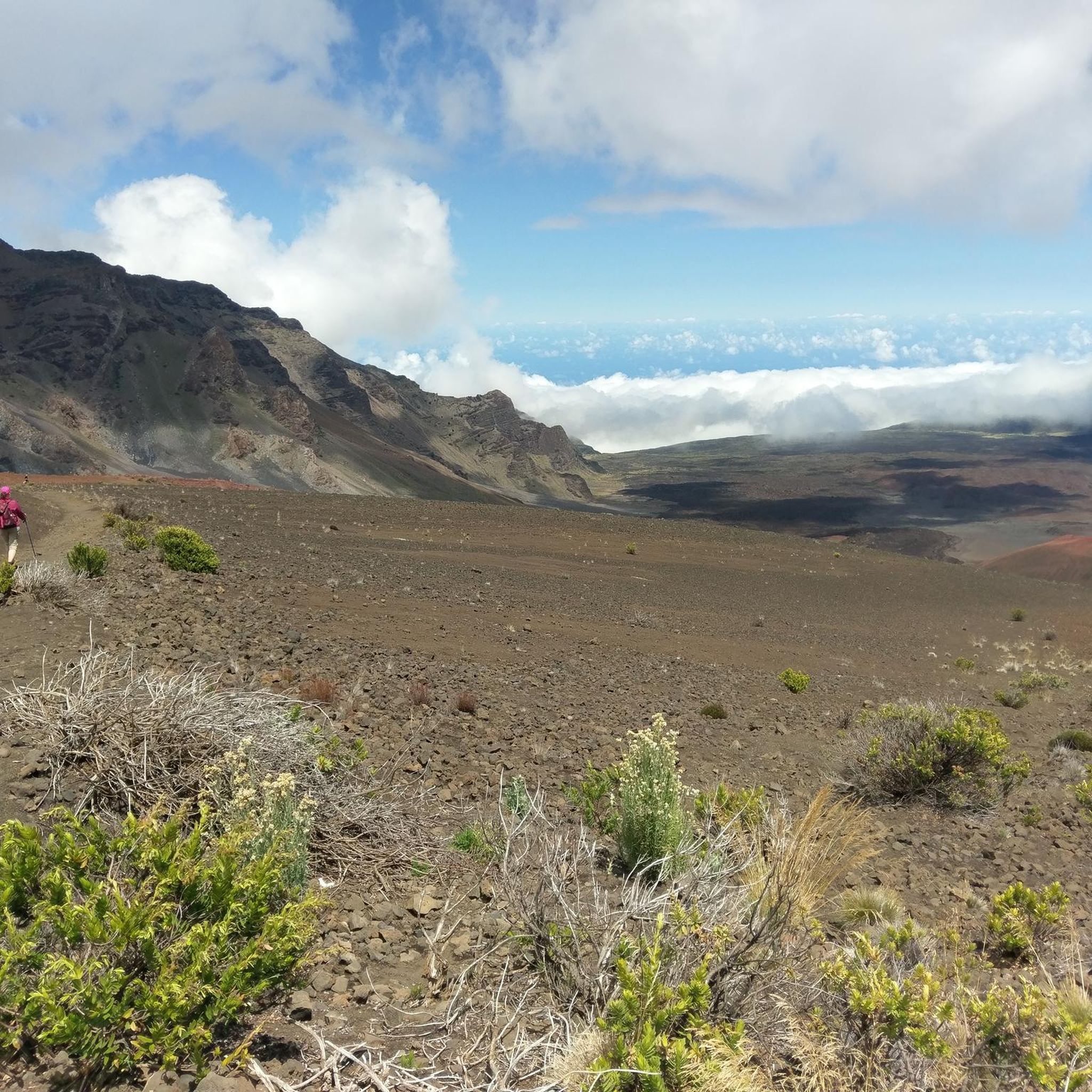
- Another top favourite among local hikers is Keonehe‘ehe‘e (Sliding Sands) Trail to Split Rock — Haleakalā National Park, a moderate 4.3 miles (6.9 km) path. This trail explores the unique volcanic terrain and cinder deserts.
- Local hikers also love the Keonehe‘ehe‘e (Sliding Sands) Trail Loop to Bottomless Pit — Haleakalā National Park, a 14.2 miles (22.8 km) trail leading through challenging volcanic landscapes, often completed in about 7 hours 13 minutes.
- Hiking in Kahikinui Forest Reserve is defined by its focus on natural resource conservation, native tree species, and watershed protection. The nearby Haleakalā National Park offers routes through volcanic terrain, native shrubland, and cinder deserts, providing options for various ability levels.
- The routes in Kahikinui Forest Reserve are highly rated by the komoot community with an average score of 4.7 stars from over 125 reviews. More than 1400 hikers have used komoot to explore Kahikinui Forest Reserve's varied terrain.
Last updated: September 1, 2026
4.9
(36)
363
hikers
Moderate hike. Good fitness required. Easily-accessible paths. Suitable for all skill levels.
4.9
(37)
350
hikers
6.86km
02:22
380m
380m
If you're looking for Haleakala Crater hiking trails that transport you to another world, the Sliding Sands Trail is a must-do. This 4.3-mile (6.9 km) out-and-back route plunges you into the heart of a volcanic crater, offering sweeping lunar-like vistas of colorful cinder cones and unique volcanic rock formations. You'll navigate loose volcanic sand and ash, feeling like you're walking on Mars, with the chance to spot the rare Haleakalā Silversword plant.
Planning your visit requires preparation for the unique challenge of this trail. It's rated moderate, but don't let the downhill start fool you; the 1254 feet (382 metres) of elevation gain on the return climb is strenuous, especially at nearly 10,000 feet of altitude. The estimated time is 2 hours and 21 minutes, but allow extra time for the uphill slog. There's no shade or water on the trail, so carry plenty, and be ready for rapid weather changes and strong winds.
What makes the Sliding Sands Trail truly notable is its unparalleled access to the Haleakalā crater floor and its otherworldly landscape. It's considered the premier access point for exploring the interior of the crater, offering a unique geological experience found nowhere else. Many hikers combine this with a sunrise viewing, making it a truly unforgettable adventure in Haleakala National Park.

Sign up for free
5.0
(18)
128
hikers
22.8km
07:13
910m
910m
The Sliding Sands and Halemau'u Trail Loop offers an unparalleled journey through Haleakalā National Park's volcanic heart, starting with a descent into the crater that feels like stepping onto another planet. You'll navigate a landscape of vibrant cinder cones and ancient lava flows, spotting the unique silversword plants before climbing out past features like the Bottomless Pit (Kawilinau). This difficult 14.2-mile (22.8 km) hike, with 2986 feet (910 metres) of elevation gain, typically takes around 7 hours and 13 minutes, making it a full-day commitment for experienced hikers.
Planning for this point-to-point route requires arranging a shuttle or ride between the two trailheads. Starting at nearly 10,000 feet, you'll need to be prepared for high altitude, intense sun, and potentially cold, windy conditions, so pack plenty of water, sun protection, and layers. The most common approach is to descend via Sliding Sands and ascend via Halemau'u, which is generally considered less strenuous overall.
What truly sets this loop apart is its immersive, otherworldly scenery, often compared to Mars, combined with the unique opportunity to see the endangered Haleakalā silversword in its natural habitat. It's a challenging but incredibly rewarding experience that showcases the raw geological power of Maui's dormant volcano, offering panoramic views that change dramatically as you traverse the crater floor and climb back to the rim.
5.0
(1)
5
hikers
14.8km
04:30
530m
530m
If you're seeking a quintessential Mount Rainier experience, the Skyline Trail delivers with its stunning alpine scenery and diverse terrain. This moderate 9.2-mile (14.8 km) hiking loop takes you through vibrant subalpine meadows, past cascading waterfalls, and offers close-up views of Mount Rainier's glaciers. You'll encounter everything from paved sections to rocky paths and stone steps, with the reward of panoramic vistas from Panorama Point.
Plan your visit between late July and September, with late July to mid-August being ideal for catching the wildflower bloom. The trail involves a significant 1731 feet (528 metres) of elevation gain and takes approximately 4 hours and 30 minutes, so bring plenty of water and sun protection as shade is minimal. Snow patches can linger at higher elevations even into August, so be prepared for varied conditions.
The Skyline Trail is renowned for showcasing nearly all of Mount Rainier National Park's natural wonders in a single hike, making it an iconic choice for visitors. Beyond the main loop, you have options to extend your adventure towards Camp Muir for an even more alpine experience, or take alternative routes like the Golden Gate Trail for a steeper but quicker ascent.
4.9
(17)
205
hikers
14.5km
04:58
780m
780m
Moderate hike. Good fitness required. Easily-accessible paths. Suitable for all skill levels.
Get access to more routes and recommendations from other explorers.
Sign up for free
Already have an account?
Our route recommendations are based on thousands of hikes, rides, and runs completed by other people on komoot.
Start today with a free account
Your next adventure awaits.
Login or Signup
Popular around Kahikinui Forest Reserve
Tips from the Community

Actually a hiking trail, but it shouldn't stop you...start as early as possible!
1
0

This is a wonderful drive on an excellent road up to 3060 m altitude. We drove partly through clouds and short before the summit it cleared up and we got awarded with an outstanding view around the island.
0
0

This volcanic rock road/trail takes you to the majestic peak and offers uninterrupted views the entire way! Being that you are on a ridge line, you can see almost the entirety of Maui at different point as you climb the volcano.
0
0

This trail leads into the crater of Haleakalā Volcano, also known as Keonehe'ehe'e. This most stunning route section offers panoramic views that defy the imagination. As you continue your run down the trail, be aware of the loose gravel, as it can cause loose rocks and sand to find their way into your shoes. The descent can also be deceiving, so watch your energy for the challenge back to the trailhead.
0
0
Split Rock is a large rock cut in half, and the Keonehe'ehe'e trail passes between the two parts. Here, the endangered Haleakala silverswords grow, and it's crucial to avoid touching them. These delicate 'ahinahina live for 3-90 years, producing a stunning flowering stalk before scattering their seeds. Park staff protect them by fencing out silversword-munching ungulates, removing non-native plants, and educating visitors to stay on trails and avoid stepping on fragile seedlings.
0
0
The Visitor Center is open daily, with outside accessible restrooms available 24 hours daily. Inside, there are panoramic orientation tables of the landscape and knowledgeable staff that can provide information on the history of Haleakalā, which means house of the sun, and its importance to the indigenous peoples. The view from here is stunning, and if you plan early, this is an excellent spot to watch the sunrise, which has been a visitor attraction since the late 1800s.
0
0

The Skyline Trail is a picturesque hiking trail on the island of Maui, that mostly leads through volcanic terrain and offers breathtaking views of the surrounding volcanos.
0
0
Fascinating colors of the earth...
1
0
Frequently Asked Questions
Are there designated hiking trails within Kahikinui Forest Reserve?
Kahikinui Forest Reserve is primarily managed for natural resource conservation, and there are currently no improved public trails within its boundaries. Legal public access through adjacent lands is also not available. However, the nearby Haleakalā National Park offers extensive and well-known hiking opportunities.
Where can I find hiking routes in the vicinity of Kahikinui Forest Reserve?
While direct hiking within Kahikinui Forest Reserve is restricted, komoot offers 19 routes in the nearby Haleakalā National Park. These trails provide diverse landscapes, including volcanic terrain and native shrubland, on the leeward slopes of Haleakalā.
What are the typical difficulty levels for hikes in the Haleakalā National Park area?
The hiking routes in Haleakalā National Park cater to various fitness levels. You can find 7 easy routes, 8 moderate routes, and 4 difficult routes, offering options for different abilities and experiences.
Are permits or fees required to hike in Haleakalā National Park?
Yes, an entrance fee is required to access Haleakalā National Park. Additionally, if you plan to visit for sunrise, a reservation is mandatory. For detailed information on fees and reservations, please visit the official National Park Service website: nps.gov/hale.
What kind of terrain and natural features can I expect on hikes near Kahikinui Forest Reserve?
Hikes in the adjacent Haleakalā National Park feature unique volcanic terrain, including vast cinder deserts and native shrubland. Trails like the Keonehe‘ehe‘e (Sliding Sands) Trail explore these distinctive landscapes, offering panoramic views and a chance to experience the geological history of the volcano.
Are there any family-friendly hiking options in the area?
Yes, Haleakalā National Park offers several routes suitable for families. For example, the Summit Building – Haleakalā Visitor Center loop is an easy option that provides accessible views and a shorter distance, making it ideal for families with children.
Can I bring my dog on the hiking trails near Kahikinui Forest Reserve?
Within Haleakalā National Park, pets are generally not permitted on hiking trails to protect the fragile ecosystem and wildlife. They are typically allowed only in parking lots and on paved roads. Always check the latest regulations on the National Park Service website before your visit.
What do other hikers say about the routes in this region?
The routes in the Haleakalā National Park area are highly rated by the komoot community, with an average score of 4.7 stars from over 125 reviews. Hikers often praise the unique volcanic landscapes, the panoramic views, and the opportunity to explore diverse terrain.
Are there any loop trails available in Haleakalā National Park?
Yes, there are loop options for hikers seeking a circular experience. A notable example is the challenging Keonehe‘ehe‘e (Sliding Sands) Trail Loop to Bottomless Pit, which offers an extensive journey through the volcanic crater.
What is the best time of year to hike in Haleakalā National Park?
Haleakalā National Park can be visited year-round, but conditions vary. The summit area can be cold and windy at any time of year, especially at sunrise. The leeward slopes generally experience drier weather. It's always advisable to check the weather forecast before heading out and to dress in layers.
Is public transport available to reach the hiking areas?
Public transport options directly to the trailheads within Haleakalā National Park are very limited. Most visitors access the park by private vehicle. There are no direct public bus services that go into the park's summit or crater areas.
What should I wear for hiking in Haleakalā National Park?
Due to significant elevation changes and varying weather conditions, it's recommended to dress in layers. Even on sunny days, temperatures at the summit can be cool, especially in the early morning or late afternoon. Bring sun protection, sturdy hiking shoes, and plenty of water.
Most popular routes in Kahikinui Forest Reserve

Get inspired with the komoot mobile app


Explore more
Browse the best Hikes in other regions.
