The best cycling routes in Columbia National Wildlife Area
5.0
(4)
87
riders
8
rides
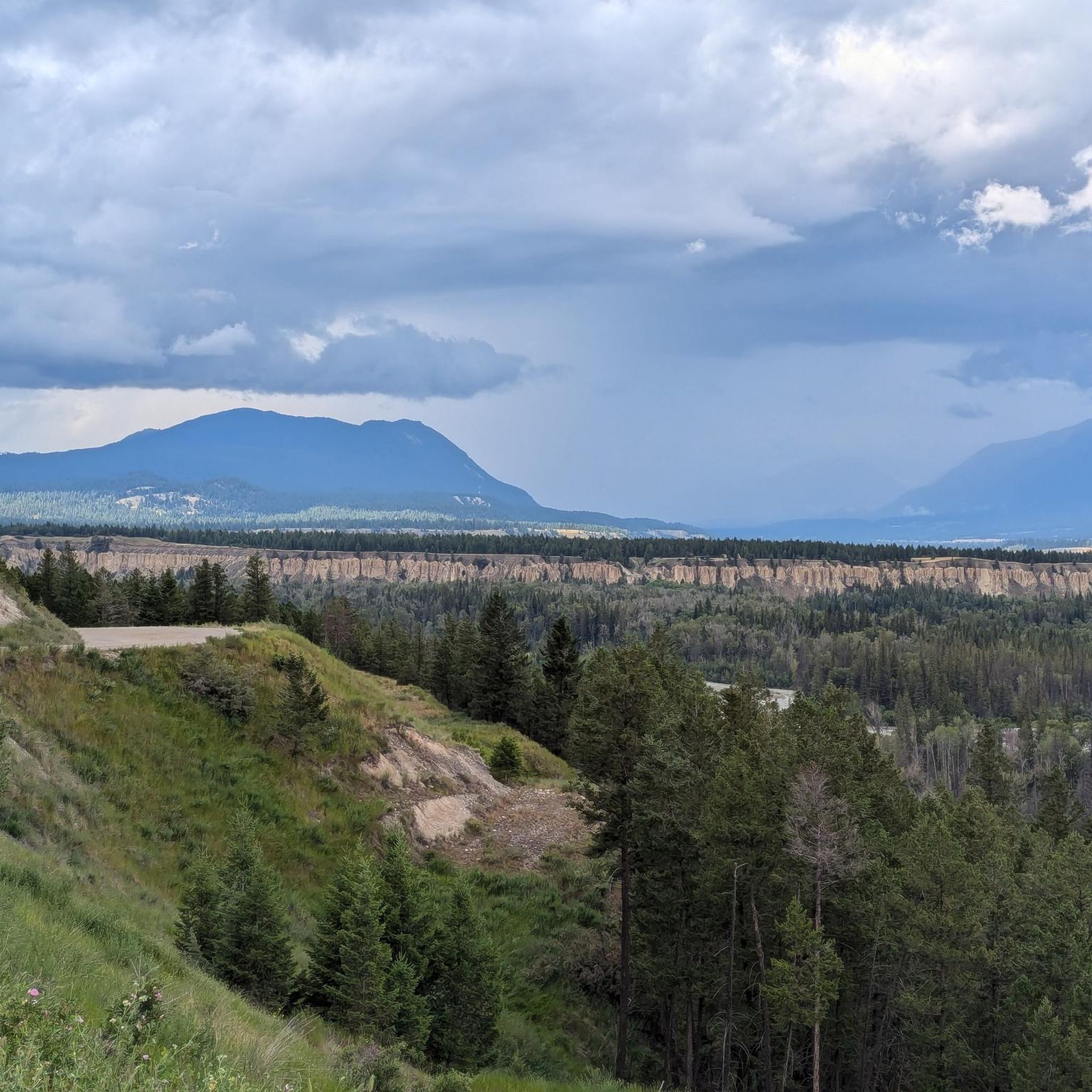
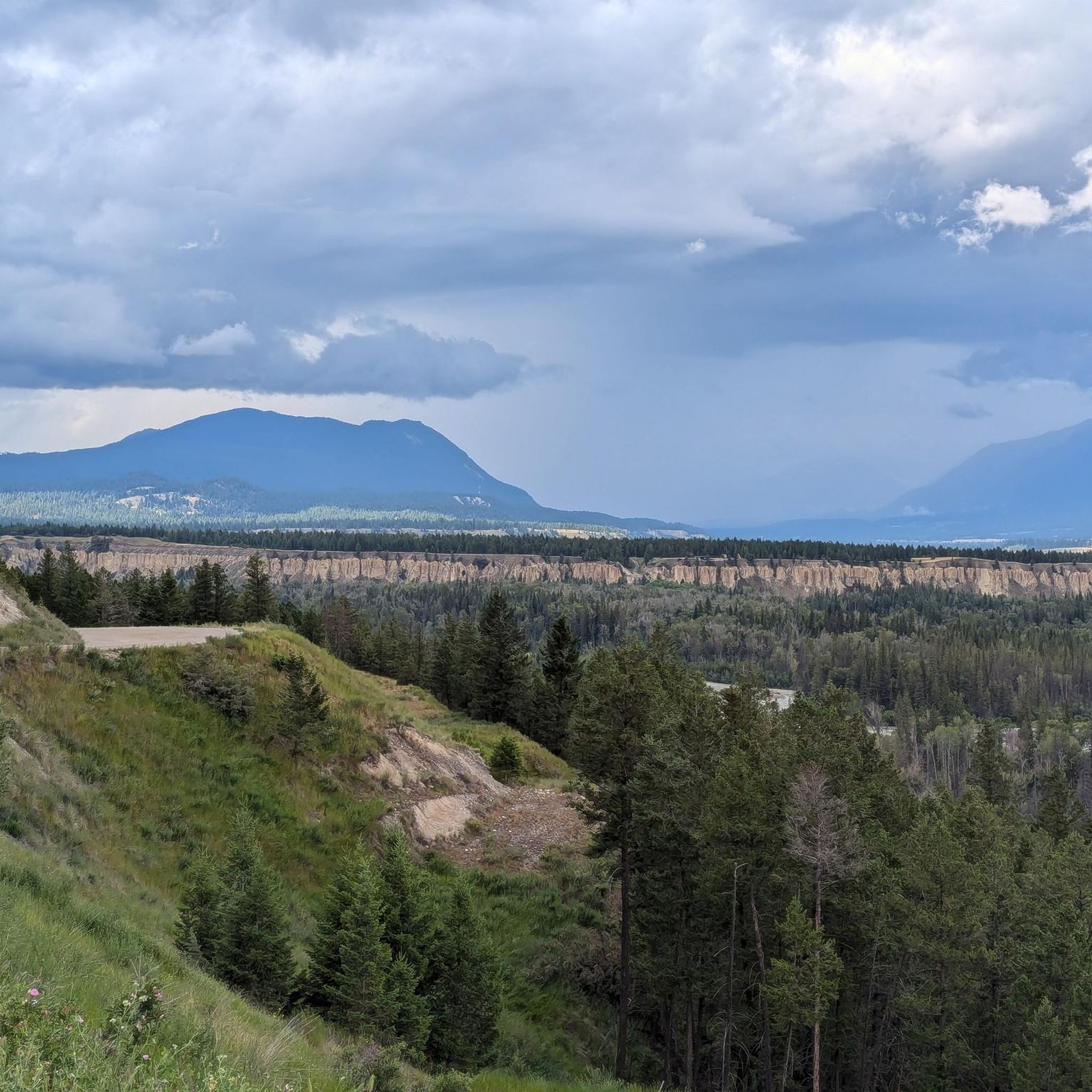
Touring cycling routes in Columbia National Wildlife Area navigate the scenic Columbia Valley in British Columbia, Canada. This region is characterized by its expansive valley floor, flanked by mountain ranges, and the presence of the Columbia River. The terrain offers a mix of paved and unpaved roads, suitable for touring cyclists seeking routes through forested areas and alongside water bodies. Elevation changes are present, providing varied cycling experiences.
Best touring cycling routes in Columbia National Wildlife Area
- The most popular…
Last updated: July 14, 2026
5.0
(1)
16
riders
Moderate bike ride. Good fitness required. Mostly paved surfaces. Suitable for all skill levels.
2
riders
43.6km
03:34
570m
560m
Hard bike ride. Very good fitness required. Mostly paved surfaces. Suitable for all skill levels.

Sign up for free
3
riders
52.4km
04:08
700m
700m
Hard bike ride. Very good fitness required. Mostly paved surfaces. Suitable for all skill levels.
29
riders
42.2km
02:41
530m
530m
Hard bike ride. Very good fitness required. Mostly paved surfaces. Suitable for all skill levels.
5.0
(2)
21
riders
19.6km
01:19
260m
260m
Moderate bike ride. Good fitness required. Mostly paved surfaces. Suitable for all skill levels.
Get access to more routes and recommendations from other explorers.
Sign up for free
Already have an account?
Our route recommendations are based on thousands of hikes, rides, and runs completed by other people on komoot.
Start today with a free account
Your next adventure awaits.
Login or Signup
Popular around Columbia National Wildlife Area
Tips from the Community

This dirt path over Sinclair Creek has some beautiful floral paintings that spruce up the concrete blocks that keep it in place and some nice views of the creek from above.
0
0

The Markin-MacPhail Westside Legacy Trail is a 25 kilometer multi-use trail linking the towns of Invemere and Fairmont. The trail is dotted with a number of picnic area, viewpoint, benches, and information kiosks making it a great place for the family to get out and enjoy the scenery.
0
0
This multi-use trail traces the ledges overlooking the Columbia River Valley. You'll have great views along the way but keep an eye out for mountain bikers as well, especially around blind corners.
0
0
On a trail with many great viewpoints, this is one of the best. If the weather is clear you'll have a wide open look across the river and valley to the mountains on the other side.
0
0

This easy out-and-back trail leads to a viewpoint overlooking the expansive Columbia Wetlands — one of North America’s largest intact wetlands. Along the route you’ll pass forested sections and open ridge spots where you can pause and watch for birds, wildlife and sweeping valley views.
0
0

Even on hot summer days it is pleasantly cool here.
2
1

Beautiful, pleasantly fresh even on hot days. But there are a lot of mosquitoes.
2
0

Frequently Asked Questions
How many touring cycling routes are available in Columbia National Wildlife Area?
There are 9 touring cycling routes available in the Columbia National Wildlife Area, offering a variety of experiences for cyclists.
What kind of terrain can I expect on touring cycling routes in Columbia National Wildlife Area?
The routes in Columbia National Wildlife Area navigate the scenic Columbia Valley in British Columbia, Canada. You can expect a mix of paved and unpaved roads, with sections winding through forested areas and alongside the Columbia River. The terrain includes elevation changes, providing varied cycling experiences.
What are the difficulty levels of touring cycling routes in Columbia National Wildlife Area?
The routes in this area cater to different ability levels. There are 4 moderate routes and 5 difficult routes, ensuring options for both intermediate and experienced touring cyclists.
What do other cyclists say about touring cycling in Columbia National Wildlife Area?
The touring cycling routes in Columbia National Wildlife Area are highly rated by the komoot community, with an average score of 5.0 stars from over 3 reviews. Cyclists often praise the valley views, forested sections, and routes near the Columbia River.
Are there any loop routes for touring cyclists in Columbia National Wildlife Area?
Yes, there are several loop routes available. For example, you can try the Deja View Trail – View of Columbia Valley loop from Dry Gulch Provincial Park, which offers scenic views, or the more challenging Fairy Garden loop from James Chabot Provincial Park.
What are some of the longer touring cycling routes in the area?
One of the longer and more challenging routes is the Fairy Garden loop from James Chabot Provincial Park, which spans 26.2 miles (42.2 km) and involves significant elevation gain.
Are there any shorter touring cycling routes suitable for a quicker ride?
Yes, for a shorter ride, consider the Deja View Trail – View of Columbia Valley loop from Dry Gulch Provincial Park. This route is 7.7 miles (12.5 km) long and typically takes about 1 hour 15 minutes to complete.
What kind of wildlife can I expect to see while touring cycling in the Columbia National Wildlife Area?
The Columbia National Wildlife Area in British Columbia focuses on wetlands and migratory bird habitat. While cycling, you may have opportunities to observe various bird species, especially during migration periods, as well as other wetland-dependent wildlife.
Are there any specific regulations for biking in the Columbia National Wildlife Area?
Specific regulations for biking, including areas where it's permitted or restricted, are typically managed by the local authorities. It's always advisable to check the official website of the Columbia National Wildlife Area or local park authorities for the most current guidelines before your ride.
What should I wear for touring cycling in Columbia National Wildlife Area?
Given the varied terrain and potential for elevation changes, it's recommended to wear comfortable cycling attire suitable for mixed conditions. Layers are always a good idea, as weather can change. Ensure you have appropriate footwear for cycling and consider bringing rain gear, especially during shoulder seasons.
Where can I find parking for touring cycling routes in Columbia National Wildlife Area?
Many routes start from provincial parks, such as Dry Gulch Provincial Park or James Chabot Provincial Park. These parks typically offer designated parking areas for visitors, which can serve as convenient starting points for your touring cycling adventures.
Is the Columbia National Wildlife Area suitable for family-friendly touring cycling?
While the guide features routes with moderate to difficult ratings, the presence of varied terrain and unpaved sections means that routes might be more suitable for families with older children or those experienced in touring cycling. Always check the specific route details for distance and elevation to determine suitability for your family.
Most popular routes in Columbia National Wildlife Area

Get inspired with the komoot mobile app


Explore more
Browse the best Cycling routes in other regions.
