Gorobel Mendilerroa Bbe/Zepa Sierra Sálvada
Gorobel Mendilerroa Bbe/Zepa Sierra Sálvada
The best road cycling routes in Gorobel Mendilerroa Bbe/Zepa Sierra Sálvada
4.5
(37)
2,061
riders
89
rides
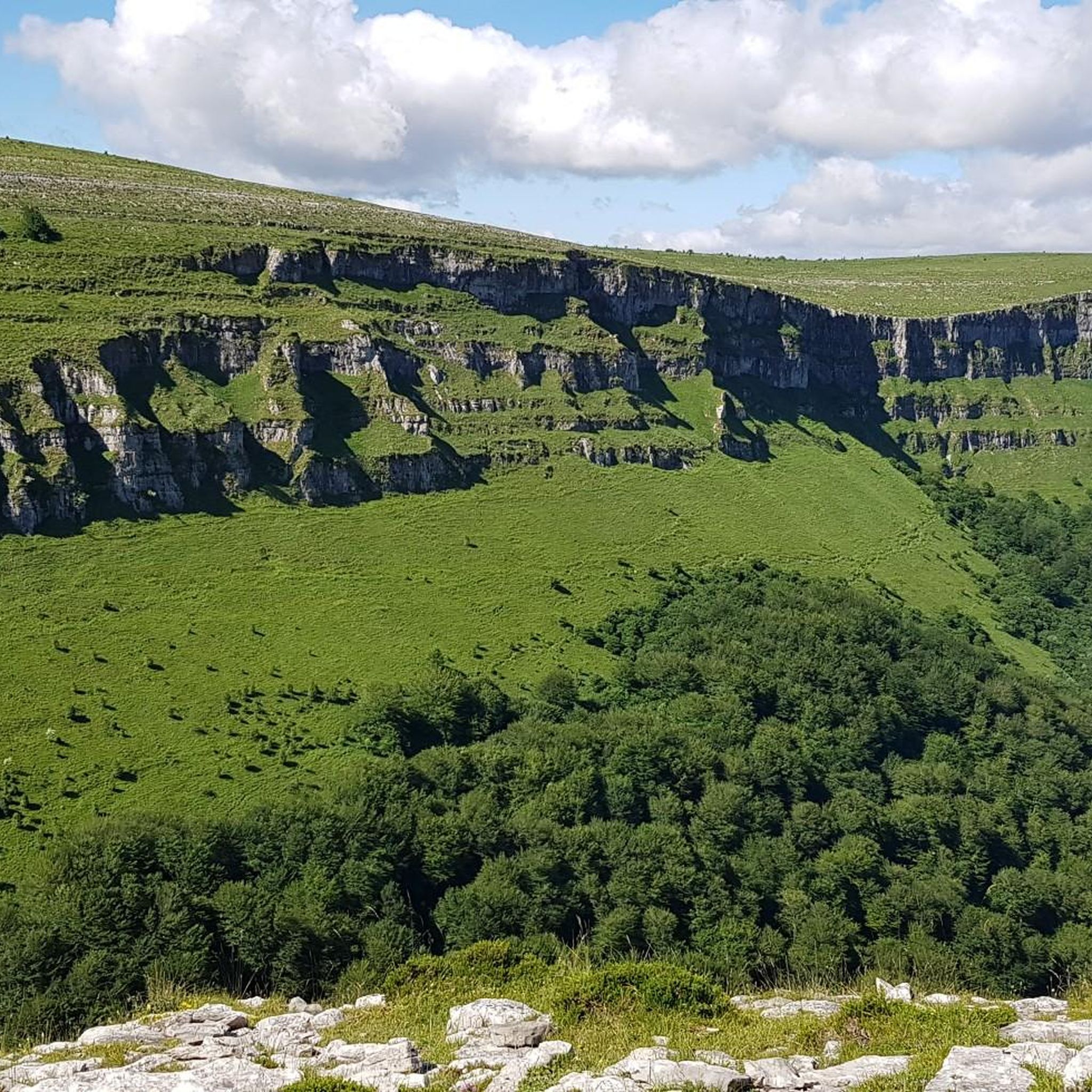
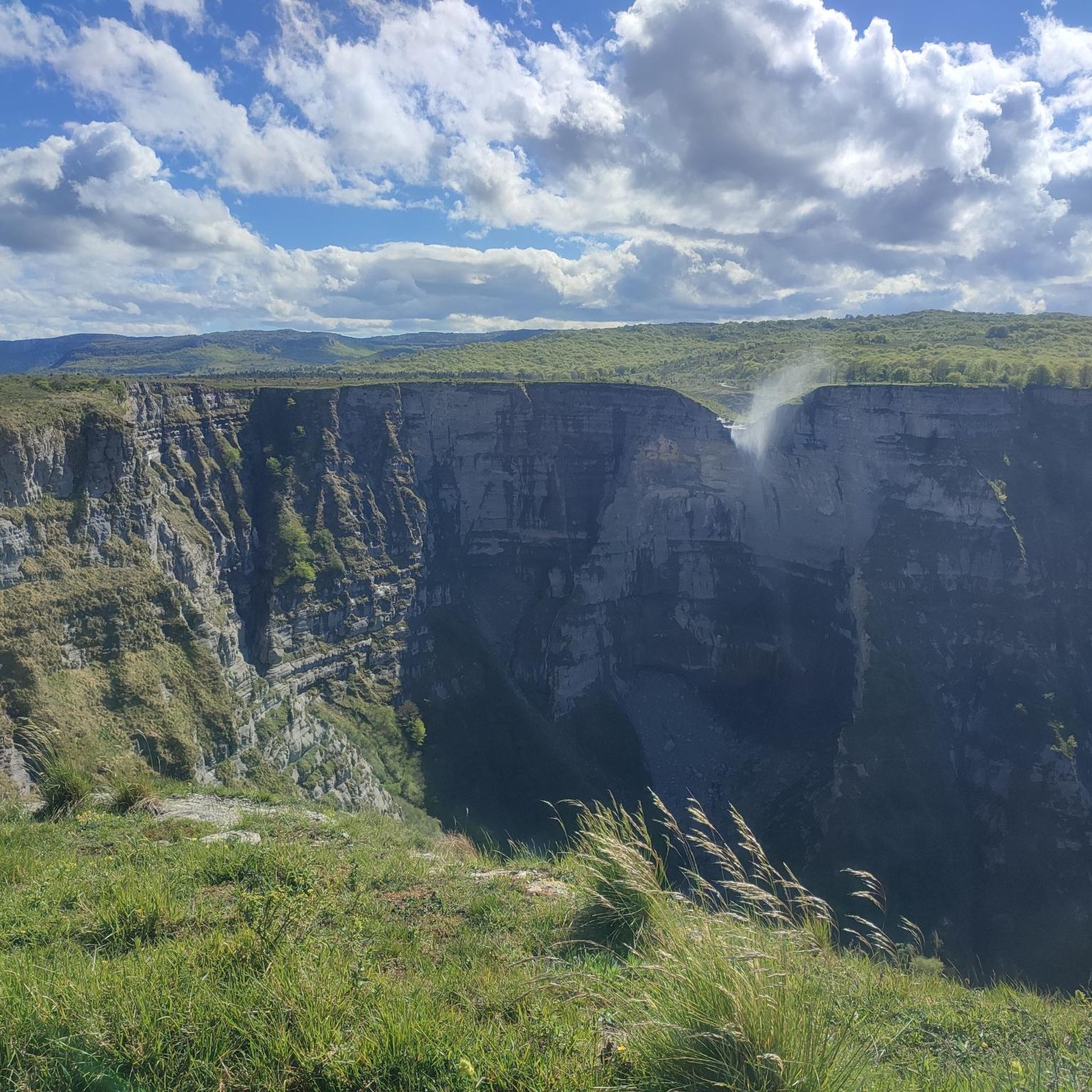
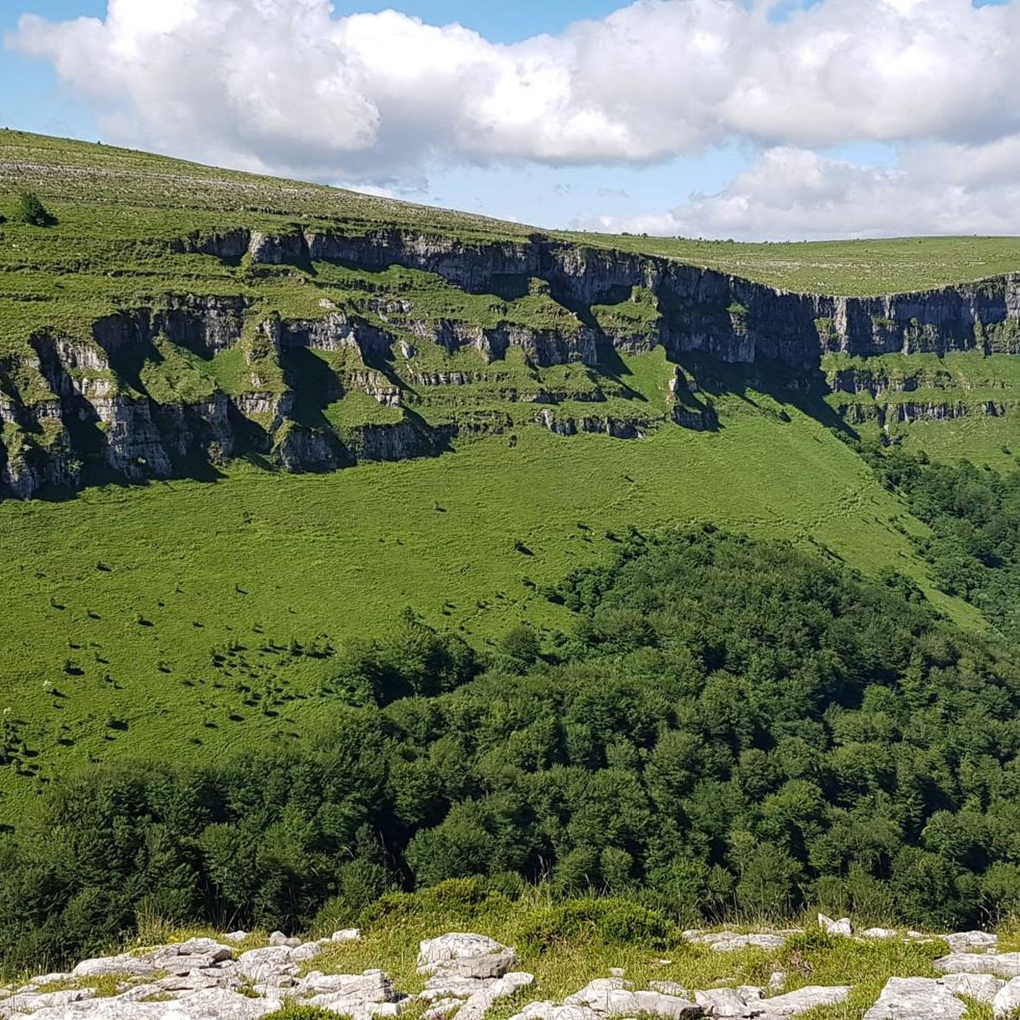
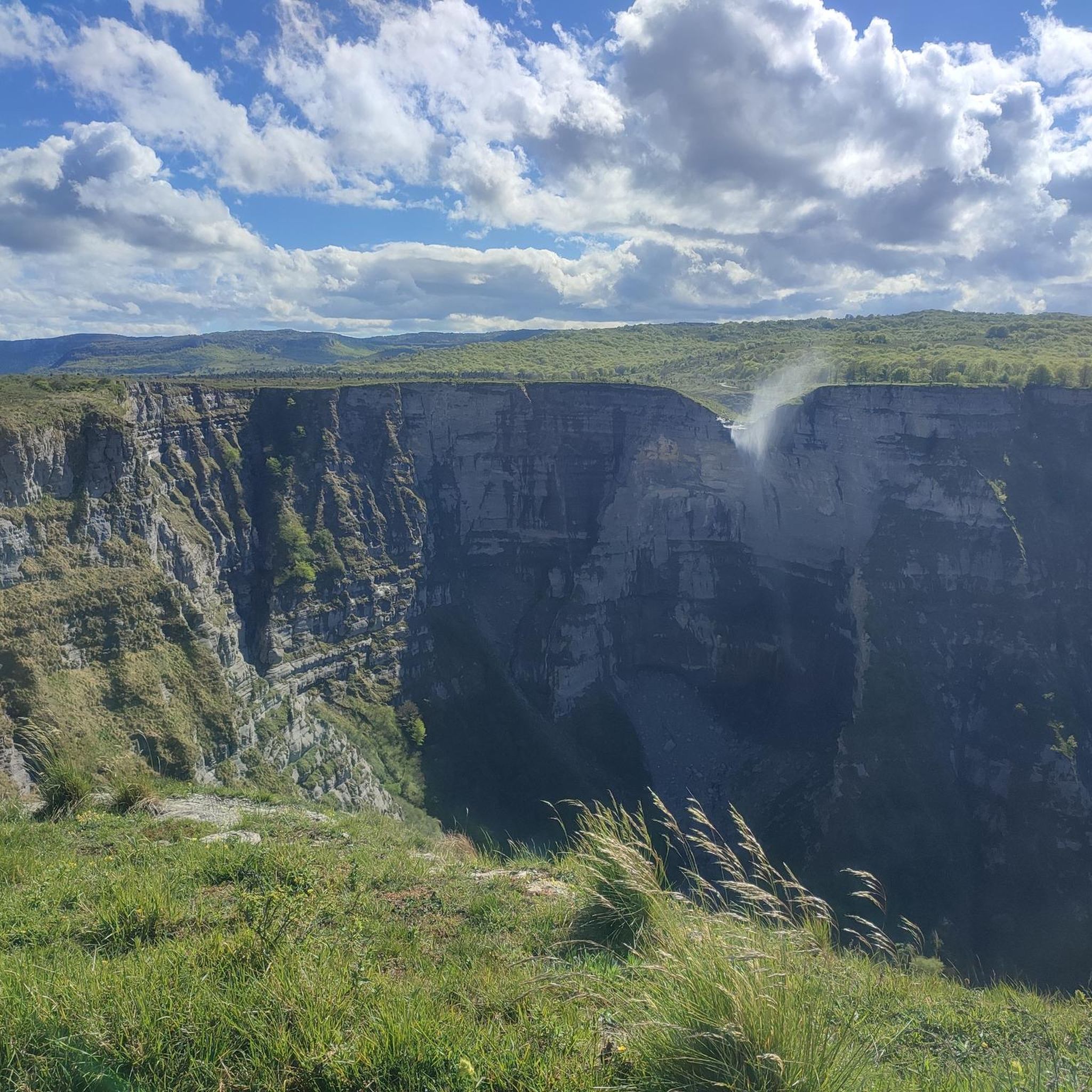
Road cycling in Gorobel Mendilerroa Bbe/Zepa Sierra Sálvada offers routes through a landscape characterized by a 25 km long steep northern slope, numerous mountain peaks, and extensive beech forests. The region features significant elevation changes, including challenging ascents and descents, making it suitable for varied road cycling experiences. Notable natural features include the Nervión Waterfall and the Delika Gorge, which contribute to the area's dramatic visual impact. The limestone composition of the area also influences the terrain, providing a diverse…
Last updated: September 5, 2026
106
riders
38.9km
01:57
530m
530m
Moderate road ride. Good fitness required. Mostly well-paved surfaces and easy to ride.
12
riders
14.5km
00:42
150m
150m
Easy road ride. Great for any fitness level. Mostly well-paved surfaces and easy to ride.

Sign up for free
6
riders
Moderate road ride. Good fitness required. Some segments of this route may be unpaved and difficult to ride.
5.0
(3)
82
riders
69.5km
03:38
1,260m
1,260m
This difficult 43.2-mile (69.5 km) circular road cycling route from Orduña features challenging climbs over Puerto de Orduña and La Barreril
79
riders
94.5km
04:43
1,440m
1,440m
Hard road ride. Very good fitness required. Mostly well-paved surfaces and easy to ride.
Get access to more routes and recommendations from other explorers.
Sign up for free
Already have an account?
Our route recommendations are based on thousands of hikes, rides, and runs completed by other people on komoot.
Start today with a free account
Your next adventure awaits.
Login or Signup
Popular around Gorobel Mendilerroa Bbe/Zepa Sierra Sálvada

Tips from the Community

Mikel Landa's training ground. The climb to La Barrerilla from Orduña is beautiful, offering a natural view of the Orduña Valley.
0
0

Some fantastic views of the valley floor and mountain in the background, small car park so take some photos enjoy the view for 10 or 15 mins then go
0
0

Located on a plain in Álava to the south of the municipality, on the left bank of the Nervión River, Orduña is known for its impressive mountainous landscape and its Basque cultural heritage. If you make a stop in the town, I recommend visiting the parish church of Nuestra Señora de la Asunción, the Sanctuary of Nuestra Señora de la Antigua and the walls of Tras Santiago.
1
0

Anyone looking at this small town from the heights that flank it will agree that it appears to have been built to guard the southern entrance to the valley. In fact, the Badaia and Arkamo mountain ranges, east and south walls that surround Kuartango, get closer until leaving no exit other than the narrow Tetxa Pass, and there, a few hundred meters before, Aprikano stands.
0
0
It is located at an altitude of 654 metres, on a low-lying plain on the edge of the wide Omecillo valley, on its left bank, between holm oaks, at the foot of the Arcamo and Guibijo mountains. It is located 35 km west of the city of Vitoria.
0
0
This municipality has several singularities that make it unique. The first, being from Bizkaia, is in Álava, on the border with Burgos, and on the road from Castilla to the sea. The second, which is the only town in the province with the title of city. And the third, which was declared a historical-monumental complex in 1997
0
0
The Peña Angulo is 18.2 km long, has its highest point at 727 m and rises over a distance of about 18.2 km. The average slope of Peña Angulo is 2.9%.
0
0
The Llanteno schools, in Ayala (Álava, Spain), were built in 1897 thanks to the generosity of several people who made it possible!
0
0
Frequently Asked Questions
How many road cycling routes are available in Gorobel Mendilerroa Bbe/Zepa Sierra Sálvada?
There are over 60 road cycling routes in Gorobel Mendilerroa Bbe/Zepa Sierra Sálvada, offering a wide range of experiences for cyclists. These routes vary in difficulty, from easy loops to challenging climbs over mountain passes.
What is the general difficulty level of road cycling in this region?
The region offers a diverse range of difficulties. You'll find about 10 easy routes, 37 moderate routes, and 21 difficult routes. The terrain is characterized by dramatic steep northern slopes and significant elevation changes, including challenging ascents and descents, especially over mountain passes like Orduña and La Barrerilla.
What kind of natural attractions or viewpoints can I expect along the road cycling routes?
Road cycling routes in Gorobel Mendilerroa Bbe/Zepa Sierra Sálvada often feature stunning natural landmarks. You can encounter breathtaking views of the Pico del Fraile, the spectacular Nervión Waterfall, and the dramatic Delika Gorge. Other notable peaks like Txarlazo and Tologorri also offer panoramic vistas.
When is the best time to go road cycling in Gorobel Mendilerroa Bbe/Zepa Sierra Sálvada?
The region's weather conditions can vary. Generally, spring and autumn offer pleasant temperatures for cycling, with spring showcasing vibrant flora in the beech forests. During heavy rains or thaw, the Nervión Waterfall is particularly spectacular. It's always advisable to check local weather forecasts before heading out, especially given the significant elevation changes.
Are there any family-friendly road cycling routes in the area?
Yes, there are several easier routes suitable for families. For instance, the Fountain in Orduña – Orduña Historic Town Center loop from Orduña is an easy 36.8 km route that offers a more relaxed cycling experience, allowing families to enjoy the scenery without overly strenuous climbs.
What do other road cyclists enjoy most about road cycling in Gorobel Mendilerroa Bbe/Zepa Sierra Sálvada?
The area is highly rated by the komoot community, with an average score of 4.6 stars from over 30 reviews. Cyclists often praise the dramatic landscapes, the challenge of the mountain passes, and the serene beauty of the extensive beech forests. The combination of significant elevation changes and stunning scenery provides a rewarding experience.
What kind of terrain and natural environment will I encounter while cycling?
You will encounter a varied landscape defined by a 25 km long steep northern slope, numerous mountain peaks, and extensive beech forests, particularly at the base of the northern slopes. The region's limestone composition also influences the terrain, contributing to its unique character and biodiversity. It's recognized as a Special Protection Area (SPA) for birds, adding to its ecological richness.
Are there options for parking near the road cycling routes?
Yes, the region is generally accessible. Well-signposted entrances to natural monuments like Monte Santiago often include car parks, which can serve as convenient starting points for your road cycling adventures. It's recommended to check specific route details for parking availability at the trailhead.
Is public transport available to access the Gorobel Mendilerroa Bbe/Zepa Sierra Sálvada region for cyclists?
While specific public transport options directly catering to cyclists with bikes can vary, the region is generally accessible. For detailed information on public transport routes and bike carriage policies, it's best to consult local transport authorities or regional tourism websites.
Are there places to stay or eat near the cycling routes, particularly around Orduña?
The historic town of Orduña, often a central point for many routes, provides amenities for cyclists. You can find cafes, pubs, and accommodation options in and around Orduña, making it a convenient base for exploring the region's road cycling routes. These establishments cater to visitors and can offer a welcome break after a ride.
Can I bring my dog on these road cycling routes?
Road cycling routes typically follow paved roads, which are generally suitable for cyclists but not always ideal for dogs, especially for longer distances or in high-traffic areas. While some areas might have quieter sections, it's important to prioritize your dog's safety and comfort. For off-road or trail cycling with dogs, specific regulations and trail conditions should be checked.
Which routes offer challenging climbs and significant elevation?
For cyclists seeking strenuous routes, the region offers several challenging options. The Orduña and La Barrerilla Passes Loop is a difficult 69.5 km path with significant climbs. Another demanding route is the Puerto de Orduña – Alto de Peña Angulo loop from Orduña, a 95.5 km trail leading through mountain passes and elevated terrain.
Most popular routes in Gorobel Mendilerroa Bbe/Zepa Sierra Sálvada
Most popular attractions in Gorobel Mendilerroa Bbe/Zepa Sierra Sálvada

Get inspired with the komoot mobile app


Explore more
Browse the best Road cycling routes in other regions.
