The best running trails in Laurel Creek Conservation Area
5.0
(3)
785
runners
111
runs
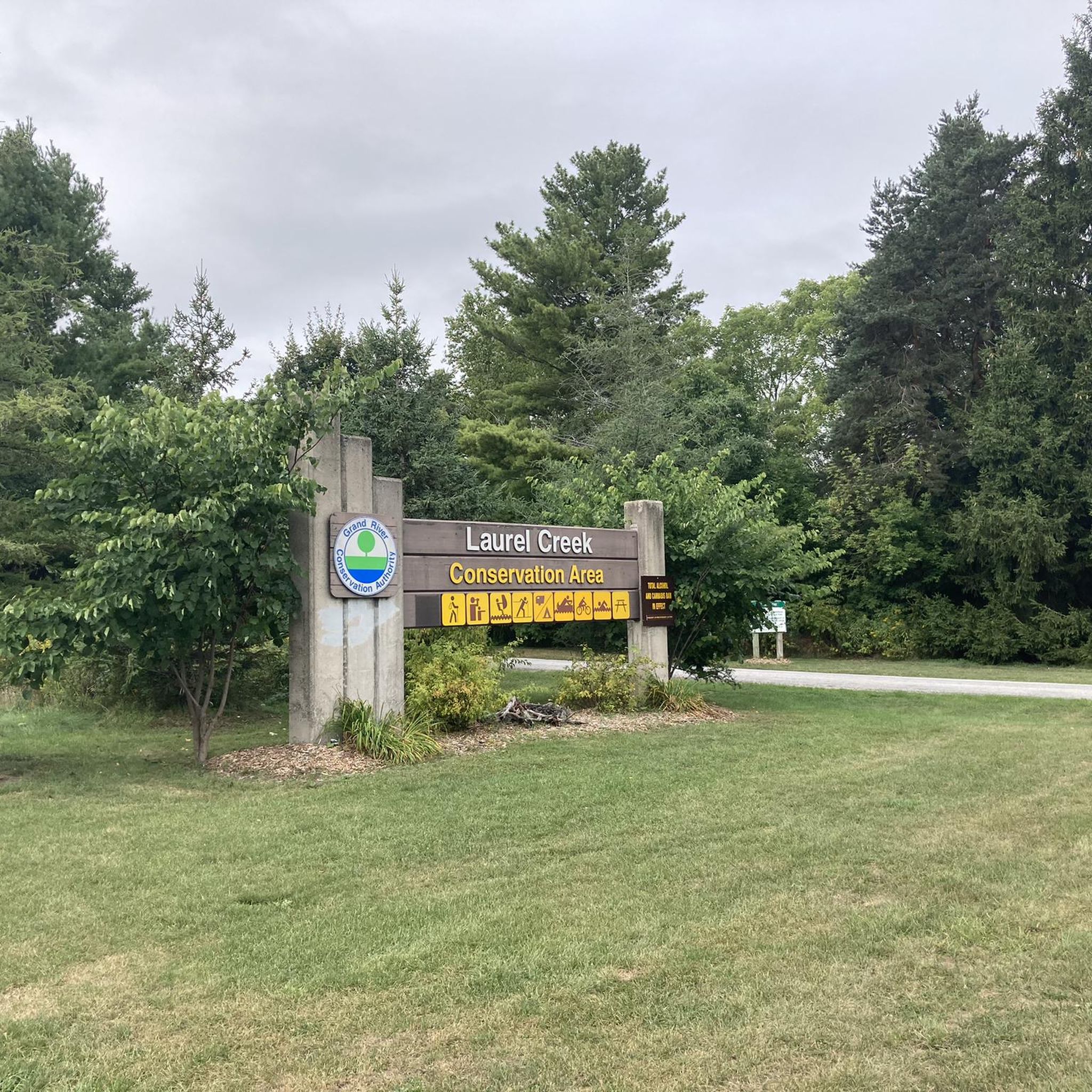
Jogging in Laurel Creek Conservation Area offers diverse landscapes across 300 hectares, featuring a mix of mature hardwood and pine forests, coniferous plantations, and grassy meadows. A central reservoir, formed by a dam on Laurel Creek, provides a scenic backdrop for running. The area also includes wetlands and open fields, contributing to varied natural scenery. Its multi-use trails are groomed and suitable for running, winding through these varied environments.
Best jogging routes in Laurel Creek Conservation Area
- The most popular jogging route is Laurelwood Park loop from Laurel Creek Conservation Area, a 3.6 miles (5.8 km) trail that takes about 35 minutes to complete, winding through varied forests and meadows.
- Another top favourite among local runners is Clair Lake – Environmental Reserve loop from Laurel Creek Conservation Area, a moderate 5.5 miles (8.8 km) path. This route features the scenic reservoir and diverse natural scenery.
- Local runners also love the Running loop from Waterloo, a 2.2 miles (3.5 km) trail leading through hardwood and pine forests, often completed in about 20 minutes.
- Jogging in Laurel Creek Conservation Area is defined by hardwood and pine forests, grassy meadows, and the central reservoir. The network offers options for different ability levels, from easy loops to moderate trails.
- The routes in Laurel Creek Conservation Area are highly rated by the komoot community with an average score of 5.0 stars from 2 reviews. More than 800 runners have used komoot to explore Laurel Creek Conservation Area's varied terrain.
Last updated: June 29, 2026
9
runners
5.81km
00:37
40m
40m
Moderate run. Good fitness required. Mostly paved surfaces. Suitable for all skill levels.
5
runners
Moderate run. Good fitness required. Mostly paved surfaces. Suitable for all skill levels.

Sign up for free
5
runners
11.2km
01:11
50m
50m
Moderate run. Good fitness required. Mostly paved surfaces. Suitable for all skill levels.
5
runners
3.53km
00:22
10m
10m
Easy run. Great for any fitness level. Mostly paved surfaces. Suitable for all skill levels.
3
runners
6.34km
00:43
40m
40m
Moderate run. Good fitness required. Mostly paved surfaces. Suitable for all skill levels.
Get access to more routes and recommendations from other explorers.
Sign up for free
Already have an account?
Our route recommendations are based on thousands of hikes, rides, and runs completed by other people on komoot.
Start today with a free account
Your next adventure awaits.
Login or Signup


Tips from the Community

Laurel Creek runs quietly alongside much of the trail. In most sections, it’s wide like a small river, with reeds, grasses, and low vegetation lining the banks. The water level can vary depending on rainfall, and in drier periods it can look quite low. It’s not used for recreation, but it adds a consistent natural element to the route, especially through the less developed stretches.
0
0
Laurel Trail runs for about eight kilometres alongside Laurel Creek, connecting Uptown Waterloo with the University of Waterloo and down to Columbia Lake. It’s a multi-use route with a mix of paved and gravel sections, so you’ll be sharing it with cyclists in places. The terrain is mostly level, following the creek through a mix of urban green space and more natural stretches. It’s easy to dip in and out of, but also works well as a continuous route if you follow it end to end.
0
0
Columbia Lake is a shallow, man-made lake designed as part of a stormwater and wetland system on the University of Waterloo campus. The water is generally still, with large sections of reeds and marsh around the edges rather than open shoreline. It’s not used for swimming or boating, but it attracts plenty of birdlife, especially around the quieter sections. The level can fluctuate depending on rainfall, so it can look different throughout the year.
0
0
Frequently Asked Questions
How many running routes are available in Laurel Creek Conservation Area?
Laurel Creek Conservation Area offers a wide selection of running routes, with over 120 options available. These routes cater to various preferences, ranging from easy strolls to more challenging runs.
What kind of terrain can I expect on the jogging trails in Laurel Creek Conservation Area?
The jogging trails in Laurel Creek Conservation Area feature diverse landscapes, including mature hardwood and pine forests, coniferous plantations, and grassy meadows. The central reservoir also provides scenic views, and the area includes wetlands and open fields, offering a varied natural experience.
Are there any easy running routes suitable for beginners or a relaxed jog?
Yes, there are several easy running routes. For instance, the Running loop from Waterloo is an easy 2.2-mile (3.5 km) trail that takes about 20 minutes to complete, winding through hardwood and pine forests.
Can I bring my dog on the running trails in Laurel Creek Conservation Area?
Laurel Creek Conservation Area is generally dog-friendly, allowing leashed dogs on its multi-use trails. It's always a good idea to check local regulations or signage upon arrival for any specific restrictions or designated off-leash areas.
Are the running routes in Laurel Creek Conservation Area suitable for families?
Yes, the conservation area's diverse and well-maintained trails, including easy loops, make it suitable for families. The varied scenery and amenities like picnic areas contribute to a pleasant family outing. The Laurelwood Park loop from Laurel Creek Conservation Area is a moderate 3.6-mile (5.8 km) option that families might enjoy.
What are the options for parking when visiting Laurel Creek Conservation Area for a run?
Laurel Creek Conservation Area provides parking facilities for visitors. The main entrance at 625 Westmount Road North in Waterloo typically offers convenient access to trailheads. A permit or entrance fee may be required, so it's advisable to check the conservation area's official website for current details.
Is public transport available to reach Laurel Creek Conservation Area?
Yes, public transport is an option. The Grand River Transit (GRT) serves the Waterloo area. You can look for GRT bus stops near the Laurelwood / Brookmill intersection, which is within walking distance of the conservation area's entrance at 625 Westmount Road North.
What natural features or landmarks can I see while running in the area?
While running, you'll encounter a central reservoir created by a dam on Laurel Creek, offering tranquil views. The trails also wind through mature hardwood and pine forests, coniferous plantations, and open grassy meadows, providing a rich natural backdrop. The Clair Lake – Environmental Reserve loop from Laurel Creek Conservation Area specifically features the scenic reservoir.
Are there any loop trails for running in Laurel Creek Conservation Area?
Yes, many of the running routes in Laurel Creek Conservation Area are designed as loops, offering a continuous and engaging experience without retracing your steps. Examples include the Laurelwood Park loop from Laurel Creek Conservation Area and the Clair Lake – Environmental Reserve loop from Laurel Creek Conservation Area.
What do other runners say about the trails in Laurel Creek Conservation Area?
The running routes in Laurel Creek Conservation Area are highly rated by the komoot community, with an average score of 5.0 stars from 2 reviews. Over 800 runners have used komoot to explore the varied terrain, often praising the diverse landscapes and well-maintained trails.
Are there any longer running routes for endurance training?
For longer runs, you can explore options like the Laurel Lake – Stormwater Retention Pond loop from Waterloo, which is a moderate 7-mile (11.2 km) route. Additionally, the conservation area's trails connect to regional networks such as the Walter Bean Grand River Trail, expanding options for extended runs.
What amenities are available near Laurel Creek Conservation Area for runners?
Beyond the conservation area's facilities like picnic areas, the surrounding Waterloo region offers various amenities. You can find cafes, pubs, and accommodation options within a reasonable distance, providing places to refuel or relax after your run.
Most popular routes in Laurel Creek Conservation Area

Get inspired with the komoot mobile app


Explore more
Browse the best Running Trails & Routes in other regions.
