The best MTB trails in Laurel Creek Conservation Area
4.7
(15)
321
riders
5
rides
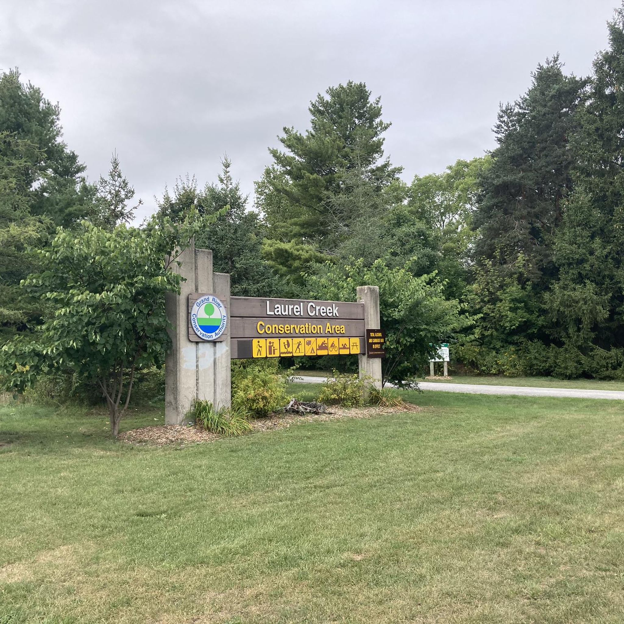
Mountain biking in Laurel Creek Conservation Area offers a network of multi-use trails within a 300-hectare natural space in Waterloo, Ontario. The area features diverse landscapes including mature hardwoods, coniferous plantations, and tall grass meadows, with the Laurel Creek reservoir at its heart. Trails within the conservation area span approximately 6 to 8 kilometers, connecting to regional routes like the Walter Bean Grand River Trail. While not known for extreme elevation changes, some trails provide varied terrain for riders.
Best…
Last updated: June 28, 2026
5.0
(1)
9
riders
14.6km
01:13
160m
160m
Moderate mountain bike ride. Great for any fitness level. Advanced riding skills necessary.
4.5
(12)
220
riders
19.0km
01:40
180m
180m
Hard mountain bike ride. Great for any fitness level. Advanced riding skills necessary. Some portions of the route may require you to push your bike.

Sign up for free
4.5
(2)
67
riders
9.70km
00:52
110m
110m
Hard mountain bike ride. Great for any fitness level. Advanced riding skills necessary. Some portions of the route may require you to push your bike.
7
riders
28.4km
01:56
210m
210m
Easy mountain bike ride. Great for any fitness level. Suitable for all skill levels.
8
riders
36.3km
02:33
250m
250m
Hard mountain bike ride. Good fitness required. Advanced riding skills necessary. Some portions of the route may require you to push your bike.
Our route recommendations are based on thousands of hikes, rides, and runs completed by other people on komoot.
Start today with a free account
Your next adventure awaits.
Login or Signup



Tips from the Community

Officially named Otis Little Lake but known by locals simply as the lake at Victoria Park, this man-made gem has been a community hub since 1896.
0
0
Built back in 1896, this rare, iron-and-steel cantilever truss bridge is one of the oldest of its kind in Canada.
1
0
This lovely urban park is famous for its dense, mature trees that make you feel like you are deep in a grand forest. A gentle creek winds its way through the woods, and you can listen to the soothing sound of bubbling water as you cross over small wooden footbridges.
0
0
This trail features a lovely loop that is roughly two kilometers long. It consists of flat, well-maintained gravel paths, making it a perfect destination for a relaxing morning stroll, a quick jog, or an easy bike ride.
1
0
As you walk, you will follow white blazes marked on the trees, which guide you through rolling hills and quiet, shaded pathways. The woods are filled with a mix of hardwoods like maple and oak, which create a beautiful canopy overhead. In the spring, you can see colorful wildflowers blooming on the forest floor, and in the autumn, the leaves turn into a sea of bright yellow and orange.
0
0
The river here is a great place for you to watch for local wildlife. If you stay quiet, you might spot a blue heron standing still in the shallow water or see a bald eagle soaring above the trees. For those who like being on the water, this section is popular for canoeing and kayaking because the current is usually gentle.
0
0

From here you'll have access to a multitude of trail like Upper Ities, Downtown, The 4 Ities, and A-Line. The are all multi-use trail with some features built for mountain bikers, so keep an eye out for your fellow trail users.
0
0
The Columbia Forest is a wonderful natural escape on the outer edge of Waterloo. There is a robust trail network through the woods that allows hikers, runners, and mountain bikers access to a variety of terrain.
0
0
Frequently Asked Questions
How many mountain bike trails are there in Laurel Creek Conservation Area?
There are 5 mountain bike trails available in Laurel Creek Conservation Area, catering to various skill levels from easy to difficult. These trails offer diverse landscapes for riders to explore.
What kind of terrain can I expect on the mountain bike trails in Laurel Creek Conservation Area?
The trails wind through diverse natural environments, including mature hardwoods, coniferous plantations, and tall grass meadows. While not known for extreme elevation changes, some routes offer varied terrain, such as the Wetland Trail with up to 84 feet of elevation gain, providing a dynamic riding experience.
Are there any family-friendly mountain bike trails in Laurel Creek Conservation Area?
Yes, there are trails suitable for families. For instance, the Grand River – Grand Valley Trail loop from Frederick is rated as easy, making it a good option for those looking for a less challenging ride. The area generally offers trails considered easy to moderate.
Are dogs allowed on the mountain bike trails in Laurel Creek Conservation Area?
Laurel Creek Conservation Area is generally dog-friendly, but it's always best to check the specific rules and regulations of the Grand River Conservation Authority (GRCA) regarding pets on trails to ensure compliance and a pleasant experience for everyone.
What are the entry fees and bike access rules for Laurel Creek Conservation Area?
Laurel Creek Conservation Area typically has an entry fee, which contributes to the maintenance of its facilities and trails. Mountain bikes are generally permitted on the multi-use trails and conservation area roads. For the most current information on fees and specific bike access rules, it is recommended to check the official Grand River Conservation Authority website.
Are there any circular mountain bike routes in Laurel Creek Conservation Area?
Yes, many of the trails in Laurel Creek Conservation Area are designed as loops, allowing for continuous riding without retracing your steps. An example is the Columbia Forest – Sundew Stormwater Pond loop from Schneider's Bush, which is a moderate 14.6 km route.
What do other mountain bikers enjoy most about riding in Laurel Creek Conservation Area?
The trails in Laurel Creek Conservation Area are highly rated by the komoot community, with an average score of 4.75 stars from over 16 reviews. Riders often praise the diverse landscapes, including mature hardwoods and meadows, and the well-maintained multi-use trails that connect to wider regional networks.
Can I find parking for mountain biking at Laurel Creek Conservation Area?
Yes, Laurel Creek Conservation Area provides designated parking areas for visitors. These facilities are typically located near the main entrances, offering convenient access to the trail network.
Are there any challenging mountain bike trails for experienced riders?
Yes, for experienced riders seeking a challenge, there are several difficult routes. The Mountainbike loop from Kitchener is a difficult 34.3 km trail, and the Mountainbike loop from Westmeadow Park Natural Area is another difficult 19.0 km option that navigates through varied terrain.
What natural features or scenic spots can I see while mountain biking?
While riding, you'll encounter a rich tapestry of natural environments, including mature hardwoods, coniferous plantations, and tall grass meadows. The Laurel Creek reservoir is a significant natural feature, offering peaceful water views and a serene backdrop for your ride. The varied scenery provides a constantly changing and immersive natural experience.
Are there any trails that connect to wider regional networks?
Yes, the trails within Laurel Creek Conservation Area extend beyond its borders, connecting to other regional trails like the Walter Bean Grand River Trail. This connectivity allows for longer and more varied rides, expanding your options beyond the conservation area itself.
What are the typical trail lengths for mountain biking in Laurel Creek Conservation Area?
Trail lengths vary, with routes ranging from approximately 9.7 km, such as the difficult Mountainbike loop from Petersburg Regional Forest, up to 34.3 km for more extensive rides like the difficult Mountainbike loop from Kitchener.
Most popular routes in Laurel Creek Conservation Area

Get inspired with the komoot mobile app


Explore more
Browse the best MTB trails in other regions.
