The best road cycling routes in Truper Blänken
4.5
(1370)
19,097
riders
417
rides
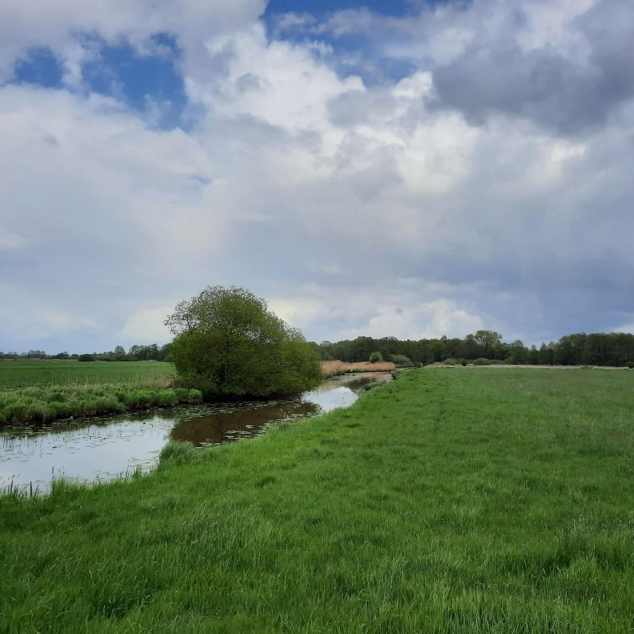
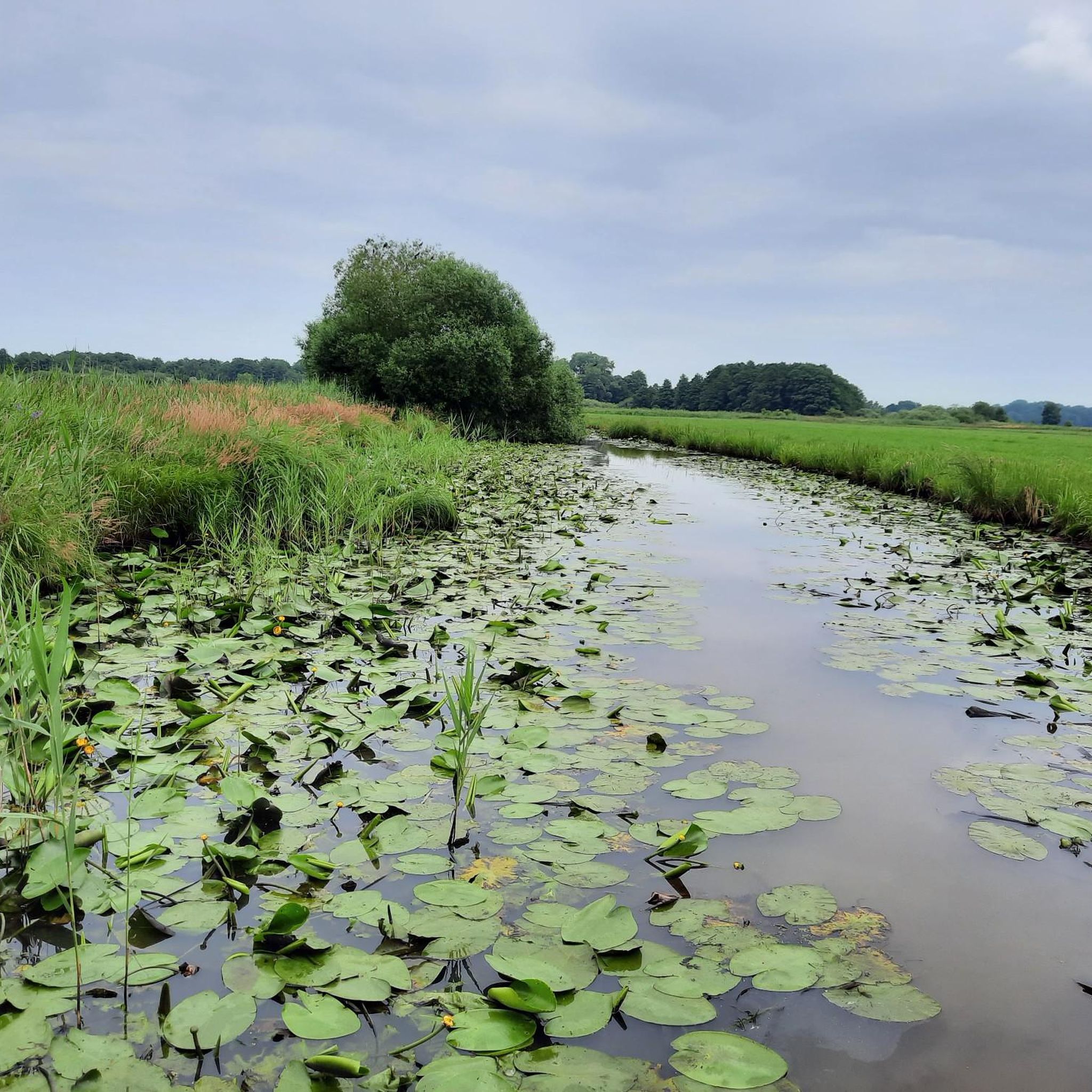
Road cycling in Truper Blänken offers a flat and gently undulating landscape ideal for smooth rides. The region, located in Lilienthal, Lower Saxony, is characterized by extensive grasslands, numerous ditches, and small waterways known as "Fleete." Road cycling routes here feature predominantly paved surfaces and dedicated cycleways, with minimal elevation changes, often less than 50 meters of ascent. This lowland scenery provides wide-open views and long stretches of flat terrain, suitable for various cycling paces.
Best road cycling routes in…
Last updated: July 5, 2026
4.8
(40)
219
riders
24.4km
00:56
30m
30m
Easy road ride. Great for any fitness level. Mostly well-paved surfaces and easy to ride.
4.0
(4)
105
riders
20.2km
00:47
20m
20m
Easy road ride. Great for any fitness level. Mostly well-paved surfaces and easy to ride.

Sign up for free
5.0
(1)
39
riders
62.7km
03:05
140m
140m
Moderate road ride. Good fitness required. Some segments of this route may be unpaved and difficult to ride.
4.8
(4)
45
riders
Easy road ride. Great for any fitness level. Mostly well-paved surfaces and easy to ride.
4.8
(4)
40
riders
30.1km
01:11
40m
40m
Easy road ride. Great for any fitness level. Mostly well-paved surfaces and easy to ride.
Get access to more routes and recommendations from other explorers.
Sign up for free
Already have an account?
Our route recommendations are based on thousands of hikes, rides, and runs completed by other people on komoot.
Start today with a free account
Your next adventure awaits.
Login or Signup

Tips from the Community

Very nice village center with church, local history museum, art association, inns, cafes and many interesting shops.
0
0

A charming, idyllic little village with cafes, perfect for a break. In the center, the Evangelical Lutheran Church of Our Lady, a listed historical monument, invites visitors to explore its interior. Further information: https://de.wikipedia.org/wiki/Liebfrauenkirche_(Fischerhude)
0
0

Very beautiful when there are so many birds there! It's definitely worth a visit!
0
0

The beautiful, smooth surface invites you to drive quickly. Be careful and considerate of other road users.
0
0

A nice spot to drive, but sometimes there are also a lot of other road users. Tractors also like to drive quickly around the bends here. Watch out for horses!
1
0

Great library! Also a great children's area
0
0
Great village. A little further on there is a great coffee shop
0
0
Frequently Asked Questions
What is the typical terrain for road cycling in Truper Blänken?
The Truper Blänken region is characterized by a flat and gently undulating lowland landscape. You'll find predominantly paved surfaces and dedicated cycleways, with minimal elevation changes, often less than 50 meters of ascent. This makes it ideal for smooth, relaxed rides and speed-oriented cycling alike.
Are there many road cycling routes available in Truper Blänken?
Yes, Truper Blänken offers a wide selection for road cyclists. There are over 400 road cycling routes in the area, catering to various preferences and skill levels, from easy loops to more moderate, longer rides.
What kind of natural features can I expect to see while cycling in Truper Blänken?
Road cycling routes in Truper Blänken often pass through expansive grasslands, alongside numerous ditches and small waterways known as "Fleete." You'll also encounter patches of alder swamp forests and moorland, contributing to a diverse visual experience with wide-open views and picturesque wetland ecosystems. The area is a nature reserve, preserving a unique lowland landscape.
What is the best time of year for road cycling in Truper Blänken?
The flat terrain of Truper Blänken makes it enjoyable for road cycling across many seasons. Spring and autumn offer pleasant temperatures and beautiful scenery. Summer is also great, though some shaded sections in alder swamp forests can provide a welcome contrast during longer rides. Winter cycling is possible, but conditions may vary.
Are there family-friendly road cycling options in Truper Blänken?
Absolutely. The minimal elevation changes and predominantly paved, dedicated cycle paths make Truper Blänken an excellent destination for family-friendly road cycling. Many routes are easy and suitable for cyclists of all ages, allowing for relaxed exploration of the lowland scenery.
Can I bring my dog on road cycling routes in Truper Blänken?
While Truper Blänken is a nature reserve, specific rules for dogs on cycling routes can vary. Generally, dogs should be kept on a leash, especially in protected areas, to protect local wildlife. It's always best to check local signage or regulations for the specific route you plan to ride to ensure a pleasant experience for everyone.
Where can I find parking for road cycling in Truper Blänken?
The municipality of Lilienthal, where Truper Blänken is located, is well-equipped for cyclists. You can typically find parking in and around Lilienthal, often near the starting points of popular routes. Look for designated parking areas in towns or villages adjacent to the nature reserve.
How can I access Truper Blänken by public transport for cycling?
Lilienthal, the main town bordering Truper Blänken, is accessible by public transport. You can often reach Lilienthal via tram or bus connections from larger cities like Bremen. From there, many cycling routes are easily accessible, allowing you to start your ride directly.
Are there any circular road cycling routes in Truper Blänken?
Yes, many of the road cycling routes in Truper Blänken are designed as loops, offering convenient circular tours. For example, the Wümme Meadows – Moordamm Asphalt Path loop from Lilienthal is a popular easy circular route, and the Müller's Inn and Lounge – Fischerhude Village Center loop from Lilienthal also offers a great circular experience.
What is the difficulty level of road cycling routes in Truper Blänken?
The majority of road cycling routes in Truper Blänken are considered easy to moderate. With over 95 easy routes and 291 moderate routes, the area is very accessible. Routes like the Höftdeich Pumping Station – St. Jürgen Church loop from Lilienthal are easy, while longer options like the Fischerhude Village Center – Moordamm Asphalt Path loop from Lilienthal are moderate, offering a bit more distance without significant climbs.
Are there cafes or restaurants near the road cycling routes in Truper Blänken?
Yes, the towns and villages surrounding Truper Blänken, such as Lilienthal and nearby Worpswede, offer various cafes and restaurants where you can take a break and refuel. Many are cyclist-friendly, providing a good opportunity to experience local hospitality.
What do other road cyclists say about their experience in Truper Blänken?
The road cycling experience in Truper Blänken is highly rated by the komoot community, with an average score of 4.5 stars from over 1400 reviews. Cyclists often praise the flat, well-maintained paths, the serene lowland scenery, and the extensive network of routes that cater to all abilities.
Most popular routes in Truper Blänken

Get inspired with the komoot mobile app


Explore more
Browse the best Road cycling routes in other regions.
