The best cycling routes in Oicatá
4.7
(120)
900
riders
86
rides
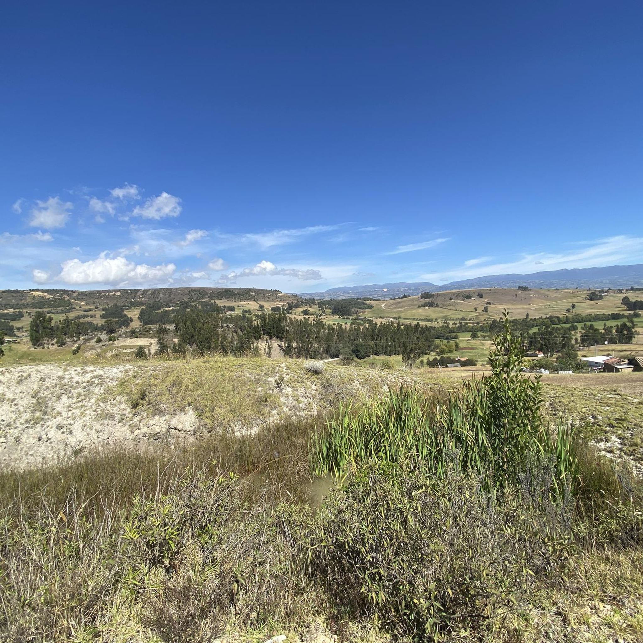
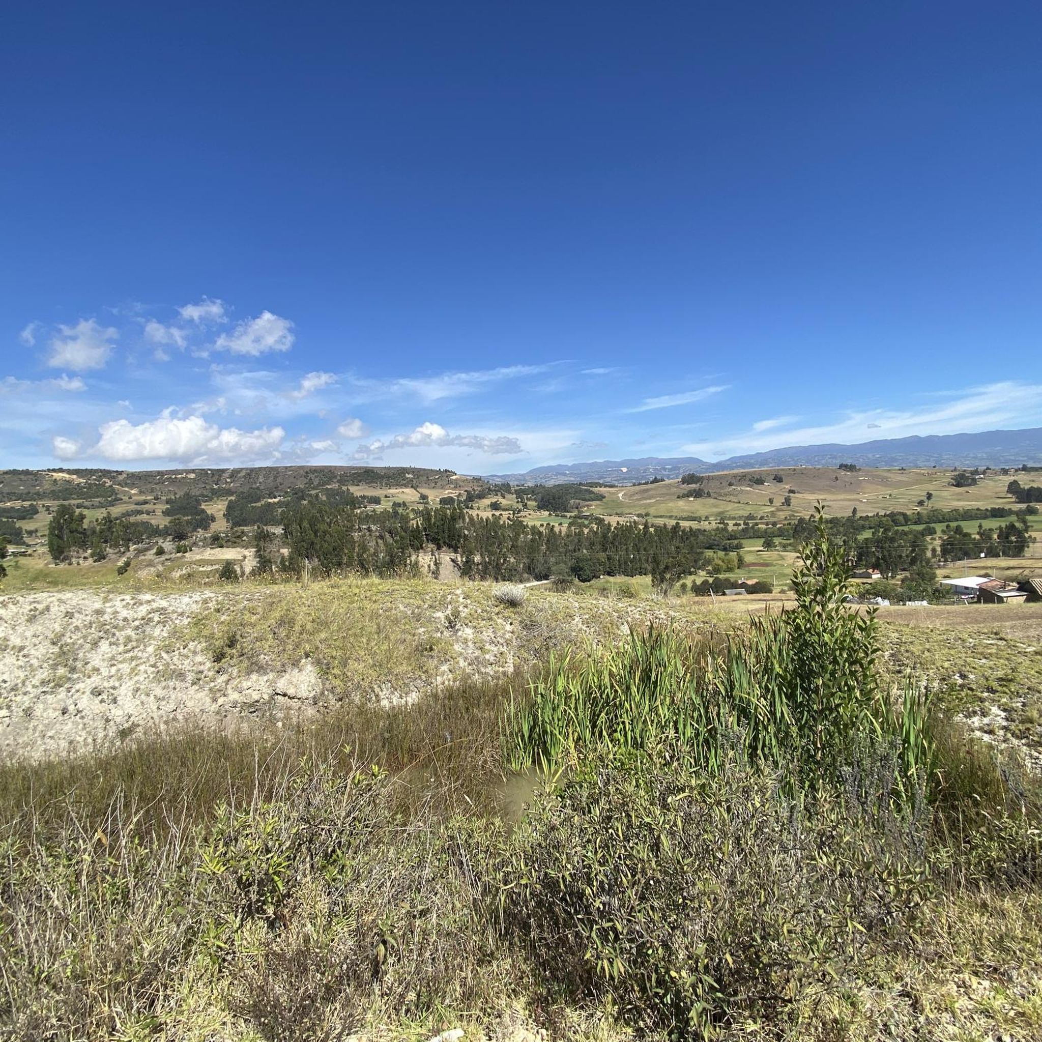
Touring cycling routes in Oicatá traverse mountainous terrain within the Altiplano Cundiboyacense, situated at an altitude of 2,815 meters (9,236 ft). The region features a "rollercoaster of hills," offering both challenging climbs and exhilarating descents. Cyclists encounter diverse landscapes, including green hillside landscapes, valleys, and forests, alongside rural roads and ecological trails. This environment provides a varied and engaging experience for touring cyclists.
Best touring cycling routes in Oicatá
- The most popular touring cycling route is Work loop from Oicatá…
Last updated: July 15, 2026
4.5
(4)
40
riders
33.2km
02:25
530m
530m
Hard bike ride. Very good fitness required. Mostly paved surfaces. Suitable for all skill levels.
4.8
(5)
30
riders
41.3km
03:17
920m
920m
Hard bike ride. Very good fitness required. Mostly paved surfaces. Suitable for all skill levels.

Sign up for free
4.0
(1)
19
riders
40.9km
02:44
640m
640m
Hard bike ride. Very good fitness required. Mostly paved surfaces. Suitable for all skill levels.
5.0
(1)
11
riders
51.2km
03:54
1,010m
1,010m
Hard bike ride. Very good fitness required. Mostly paved surfaces. Suitable for all skill levels.
7
riders
23.2km
02:04
590m
590m
Hard bike ride. Very good fitness required. Mostly paved surfaces. Suitable for all skill levels.
Get access to more routes and recommendations from other explorers.
Sign up for free
Already have an account?
Our route recommendations are based on thousands of hikes, rides, and runs completed by other people on komoot.
Start today with a free account
Your next adventure awaits.
Login or Signup


Tips from the Community

House of Nairo Quintana. Emblematic meeting point for cyclists where you can find food from the region and souvenirs from Nairo.
0
0

Nairo Quintana's parents' house, at 3110 meters above sea level, welcomes all lovers of this beautiful sport, to rest for a while and have a snack from Monique, with cheeses from the region.
0
0

Small road side cafe and home to Nairo Quintana where his mother still lives. She often comes to say hello to groups of cyclist.
0
0
This is the place where Nairo Quintanas mother lives. There is a small cafe with coffee, snacks and some killer Arepas. If you're lucky Nairos mom will even come out and say hello!
0
0
Frequently Asked Questions
How many touring cycling routes are available in Oicatá?
Oicatá offers a wide selection of touring cycling routes, with over 90 different options available on komoot. These routes cater to various skill levels, ranging from easy to difficult, ensuring there's a suitable adventure for every cyclist.
What is the general difficulty level of touring cycling in Oicatá?
Touring cycling in Oicatá is characterized by its mountainous terrain and high altitude, making many routes quite challenging. While there are 3 easy routes and 18 moderate routes, the majority (70) are classified as difficult, featuring significant elevation gains and descents. Good fitness is often recommended for longer or more demanding tours.
What kind of terrain can I expect on Oicatá's cycling routes?
Cyclists in Oicatá will encounter a diverse landscape, including a 'rollercoaster of hills' with both demanding climbs and exhilarating descents. Routes traverse extensive green hillside landscapes, valleys, and forests. You'll find a mix of rural roads and ecological trails, with some seldom-used dirt tracks offering a more rugged bikepacking experience.
When is the best time of year to go touring cycling in Oicatá?
The climate in Oicatá, influenced by its high altitude, offers stable temperatures throughout the year. However, the distinct dry season from December to March is generally considered ideal for planning touring cycling adventures, as it provides more favorable weather conditions.
Are there any notable landmarks or cultural sites to see while cycling in Oicatá?
Yes, Oicatá is rich in colonial heritage. Many routes pass through or near the town center, where you can admire well-preserved colonial architecture and cobblestone streets. Key landmarks include the 16th-century Church of San Francisco de Asís, a National Monument, and other religious sites like the Chapel of the Virgen del Rosario and the Chapel of San Antonio de Padua. The broader Boyacá region also features charming colonial villages.
What are some of the scenic viewpoints along Oicatá's cycling routes?
Due to Oicatá's elevated position in the Andes, many cycling routes offer breathtaking panoramic views of Boyacá's natural beauty. For example, the difficult route Chivatá Viewpoint – Work loop from Cómbita is known for its scenic vistas. You'll often find extensive green hillside landscapes, valleys, and forests providing stunning backdrops.
Are there any circular touring cycling routes in Oicatá?
Yes, many of Oicatá's touring cycling routes are designed as loops, offering convenient starting and ending points. Examples include the popular Work loop from Oicatá, the challenging Work – San Lázaro Church loop from La Colorada, and the scenic Christ's Rock – Nairo Quintana's House loop from La Colorada.
What do other touring cyclists enjoy most about cycling in Oicatá?
The touring cycling routes in Oicatá are highly rated by the komoot community, with an average score of 4.7 stars from nearly 100 reviews. Cyclists often praise the challenging yet rewarding mountainous terrain, the stunning panoramic views of the Boyacá department, and the opportunity to experience the region's diverse landscapes and cultural heritage.
Are there family-friendly touring cycling options in Oicatá?
While many routes in Oicatá are challenging due to the mountainous terrain, there are a few easier options suitable for families or those seeking a less strenuous ride. For instance, the Bike loop from Pirgua is an easy 12 km route with minimal elevation gain, perfect for a relaxed family outing.
What food and drink can I enjoy after a ride in Oicatá?
Oicatá is known for its typical gastronomy, offering delicious local dishes to refuel after your ride. You can savor traditional Colombian fare such as cuchuco de trigo, mute santandereano, arepas boyacenses, and tamales, along with various traditional sweets. The charming villages in the region provide opportunities to experience local cuisine and interact with friendly locals.
Is there parking available near the cycling routes in Oicatá?
While specific parking facilities for each trailhead are not detailed, Oicatá is a municipality with a town center and rural areas. It is generally possible to find parking in or near the main town areas or at the start of more popular routes, especially in less congested rural settings. It's advisable to check local signage or inquire locally upon arrival.
Are there any natural parks or larger natural attractions near Oicatá that I can combine with a cycling trip?
Yes, for those looking to extend their exploration, the Parque Nacional Natural Iguaque is approximately 15 kilometers from Oicatá, offering rich flora and fauna. Further afield, the scenic Lago de Tota is another significant natural highlight in the broader Boyacá region, known for its beauty and outdoor activities. These areas provide additional opportunities for nature immersion beyond cycling.

Get inspired with the komoot mobile app


Explore more
Browse the best Cycling routes in other regions.
