The best road cycling routes around Flörsheim
3.9
(107)
1,150
riders
17
rides
Road cycling around Flörsheim offers diverse landscapes along the Main River in Hesse, Germany. The region features a mix of flat riverbanks, rolling hills, expansive fields, and picturesque vineyards. Cyclists can explore routes that traverse open terrain, providing views of the Taunus mountains and the wider Rhine-Main plain. The area also includes charming sections like "Flörsheimer Schweiz," characterized by gentle hills and stream floodplains.
Best road cycling routes around Flörsheim
- The most popular road cycling route is KelsterBar on the…
Last updated: July 5, 2026
4.6
(37)
324
riders
42.4km
01:48
100m
100m
Easy road ride. Great for any fitness level. Mostly well-paved surfaces and easy to ride.
4.7
(56)
497
riders
Moderate road ride. Great for any fitness level. Some segments of this route may be unpaved and difficult to ride.

Sign up for free
4.3
(4)
82
riders
22.0km
00:57
40m
40m
Easy road ride. Great for any fitness level. Mostly well-paved surfaces and easy to ride.
46
riders
80.3km
03:10
110m
110m
Moderate road ride. Good fitness required. Mostly well-paved surfaces and easy to ride.
4.0
(3)
57
riders
42.4km
02:10
630m
630m
Moderate road ride. Good fitness required. Mostly well-paved surfaces and easy to ride.
Get access to more routes and recommendations from other explorers.
Sign up for free
Already have an account?
Our route recommendations are based on thousands of hikes, rides, and runs completed by other people on komoot.
Start today with a free account
Your next adventure awaits.
Login or Signup



Tips from the Community

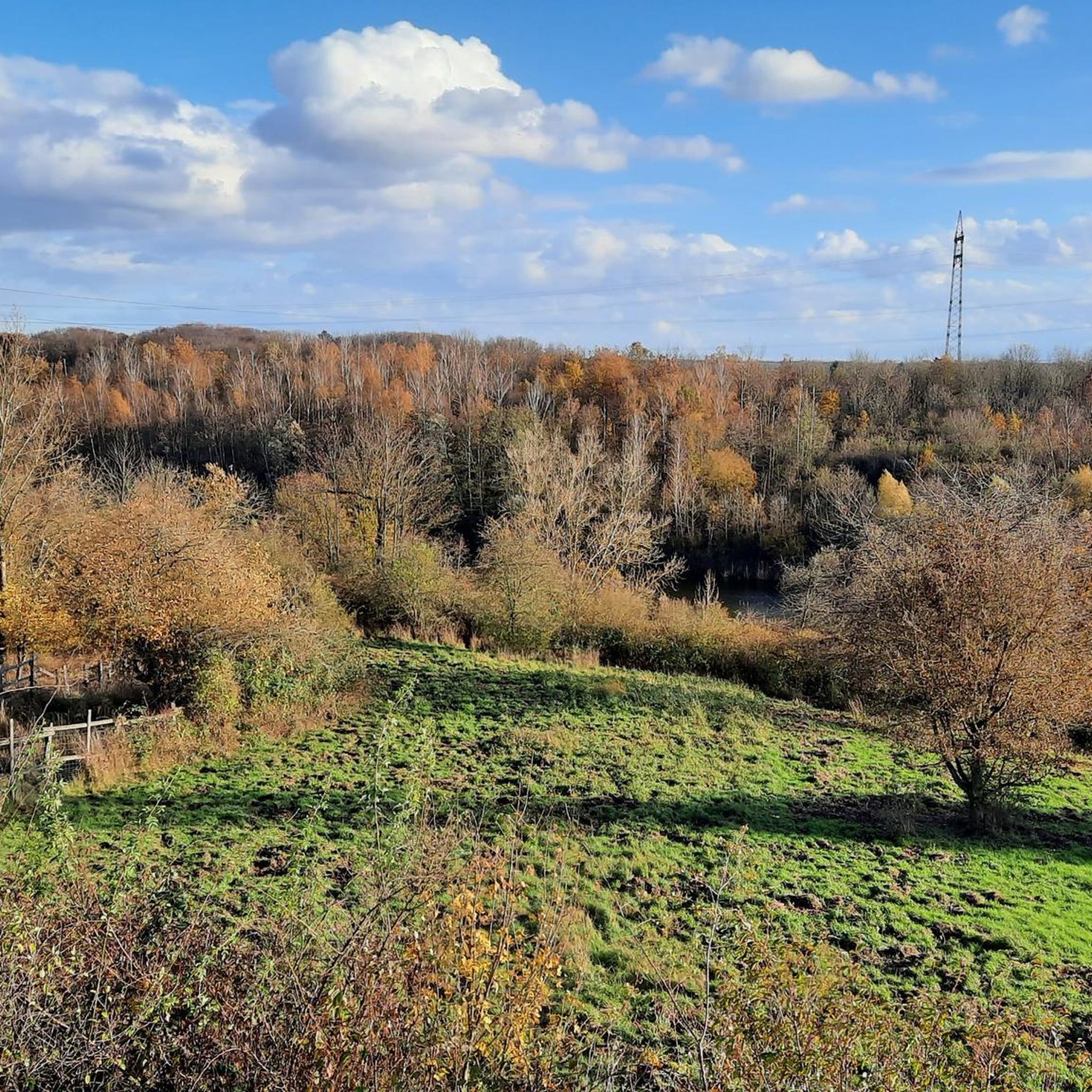
Right next to the motorway is the small viewing hill. From its "platform" you have beautiful clear panoramic views, great.
2
0

The industrial site is the so-called Phrix-Werke (cellulose and paper mill). This factory turned the rather rural and small Okriftel into an industrial location with over 1,000 jobs in this plant alone. Founded in 1884/1885, the founders - the Offenheimer family - had to emigrate to the USA during the Third Reich. In 1970, the plant was closed (after being transferred back to the founding family, sold (among others to BASF)). Parts of this complex are listed as historical monuments and have been converted into condominiums, lofts, and shops for several years.
0
0
The path on the (northern) bank of the Main estuary is already beautiful, but those who like it a bit nicer will find the detour to the Mainspitze (southern bank) even better.
0
0

Historical Age: The bridge was built around 1877 (twelve years after the harbor opened) and is today considered one of the oldest still preserved swing bridges in all of Germany. For this reason, the steel truss construction is an important cultural monument under strict heritage protection. Technical Dimensions & Function: The structure has a length of 37.50 meters, a width of 4.50 meters, and weighs around 54 tons. The original mechanical rotation mechanism ensured for decades that the bridge could be swung to the side at any water level to allow larger ships to pass into the harbor basin. Modernization: After the historical rotation mechanism was irreparably damaged and jammed in 1996, the bridge was fundamentally reconstructed in 2009. The historical appearance of the top chords was preserved, while the outdated mechanics were replaced by a state-of-the-art hydraulic rotation system. Location & Significance: It connects the Stresemann-Ufer (Old Town side near the Hyatt Hotel) directly with the Victor-Hugo-Ufer on the upstream mole. Today, it serves exclusively as an important, highly frequented connection for pedestrians and cyclists and is an integral part of recreational routes such as the popular Mainzer Drei-Brücken-Weg.
7
0
With a total length of around 1,233 kilometers, the Rhine is one of the longest, most historically significant, and economically important rivers in Europe. The river originates in the Swiss Alps, where it is formed from the two headwaters, the Vorder- and Hinterrhein. After flowing through Lake Constance, it plunges down at the Rhine Falls near Schaffhausen and then, as the High Rhine, forms the border between Switzerland and Germany. Further on, as the Upper Rhine, it flows through the Upper Rhine Plain past major cities such as Karlsruhe and Ludwigshafen, as well as directly past the region of Mainz and Wiesbaden. In this area, the river makes a sharp turn west at the so-called "Rhine Knee" (Rheinknie) before reaching the spectacular Middle Rhine. This section between Bingen and Koblenz – known as the Upper Middle Rhine Valley (Obere Mittelrheintal) – has been protected as a UNESCO World Heritage site since 2002 due to its density of castles, historic vineyards, and the legend of the Loreley rock. Via the Lower Rhine (Niederrhein) and the metropolitan regions of Cologne and Düsseldorf, the Rhine finally continues into the Netherlands. There it divides into a widely branched delta and finally flows into the North Sea near Rotterdam. As an international waterway, the Rhine is the logistical backbone of Western Europe. It connects major industrial centers and seaports directly with the hinterland, and is used annually by tens of thousands of cargo ships for the transport of coal, ores, containers, and chemical goods. In addition to its industrial function, the Rhine Valley serves as a lifeline for tourism, as a rich source of energy through hydropower plants, and as a valuable natural and recreational area for millions of people.
8
0
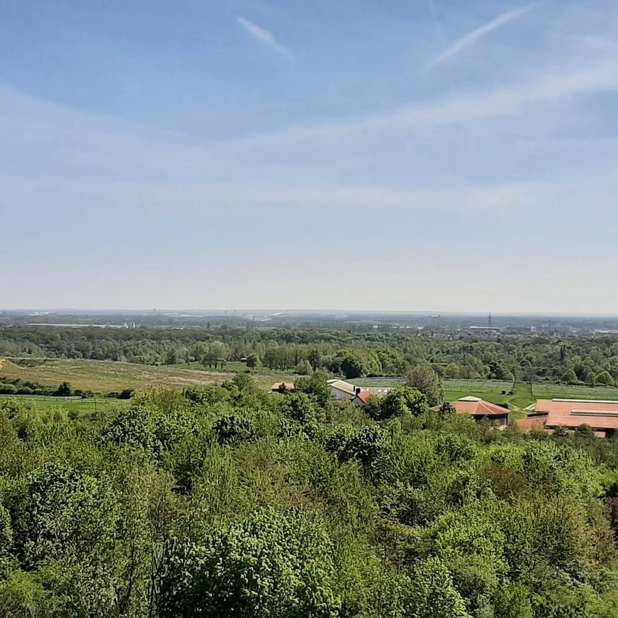
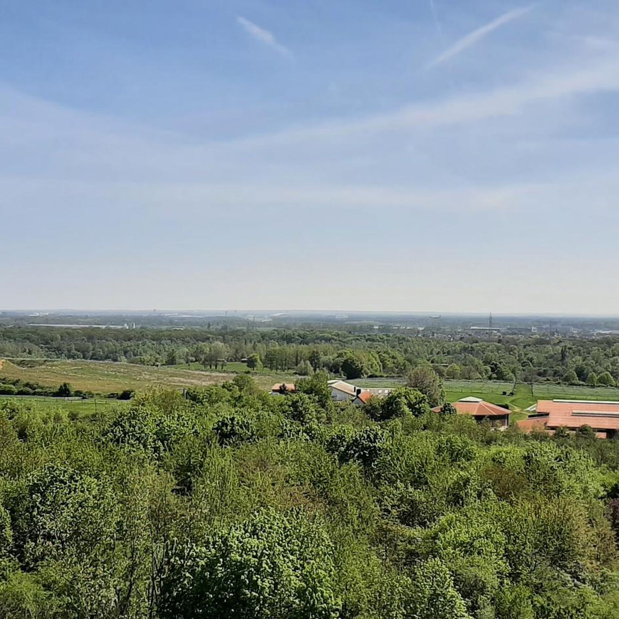
The viewing bastion shows the Rhein-Main region with all its contrasts, its charming and its edgy aspects. The view sweeps over fields and meadows to the nearby low mountain ranges. In contrast, the A 3 motorway, with seven lanes, roars directly at the foot of the "observation post", and on the high-speed rail line next to it, ICE trains speed back and forth between Frankfurt and Cologne – and above them, jets circle. LANDSCAPE OF EXCITING CONTRASTS No one from the region would want to talk up Rhein-Main as being more beautiful than it is. Nor does anyone need to. Because here people are so self-confident that they not only accept the ambivalent appearance but even present it with the greatest conviction. The viewing bastion on the A 3 is an outstanding example of this. Anyone who, for example, looks out in spring over the blooming meadows and budding trees towards the slowly greening heights of the Odenwald or Taunus will hardly be able to avoid calling it idyllic. The path to the small hill itself is a feast for the eyes: since planting in 2003, the 1.5-kilometer-long avenue with a succession of oak, cherry, and sycamore trees has developed splendidly. To enjoy the idyll, one "only" has to block out the roar on the region's lifelines, the transport routes to the trading and banking city. However, the more than lively flow of goods and the constant coming and going of people have been part of the pulsating metropolitan region for centuries. This all-encompassing mobility underscores the location of Frankfurt Rhein Main in the heart of Europe. Anyone who has climbed the winding cobblestone spiral to the small platform of the artificial hill on the A 3 will certainly marvel at the nobly rusted Corten steel plates. These "sights" direct the gaze to the most striking points in the landscape. The Melibokus, at 517 m and with its very regular cone shape, clearly stands out from the Odenwald ridge. The Frankfurt Airport Tower appears just as clearly as the characteristic Frankfurt skyline. The elevations in the Taunus range present themselves as an impressive ensemble: Altkönig (798 m), Großer Feldberg (879 m), the nearby Kleine Feldberg (825 m above sea level), and – very close by – Kapellenberg (292 m) near Hofheim.
10
0
The Okriftel cellulose factory was founded in 1884/85. After its "Aryanization" in 1938, the Offenheimer family fled to the USA. In 1949, the factory was returned to the family and subsequently sold to Phrix-Werke. By 1951, the expanded production employed over 1,000 workers. BASF took over the plant in 1967. It closed three years later. Today, parts of the factory are used as workshops, offices, and artists' studios. The architect Georg Metzendorf designed the villa, the former administration building on Kirchgrabenstraße, which is a listed historical monument. In May 2008, a production hall and the acid tower along Rheinstraße were demolished to make way for a new supermarket. In the coming years, the site of the former factory is slated for development – primarily residential, but also commercial units – with the aim of preserving as many of the existing buildings as possible.
12
0
Frequently Asked Questions
How many road cycling routes are available around Flörsheim?
There are over 15 road cycling routes around Flörsheim, offering diverse experiences for cyclists. These include a mix of easy, moderate, and some more challenging options.
What kind of terrain can I expect on road cycling routes near Flörsheim?
You can expect varied terrain. Many routes follow the flat, paved Main Riverbanks, ideal for leisurely rides. Other routes venture into rolling hills, expansive fields, and picturesque vineyards, especially south of Hochheim, offering views towards the Taunus mountains and the wider Rhine-Main plain. The area also features unique sections like "Flörsheimer Schweiz" with gentle hills and stream floodplains.
Are there easy, beginner-friendly road cycling routes in Flörsheim?
Yes, Flörsheim is directly on the Mainradweg (Main Cycle Path), which offers mostly flat and well-paved sections perfect for beginners or those seeking a relaxed ride. Routes like the Main River Cycle Path – Mönchhof Chapel loop from Flörsheim(Main) are considered easy and follow the riverbanks.
Are there challenging road cycling routes with significant elevation gain?
While many routes are relatively flat, some options do offer more significant elevation gain. For instance, the Descent to Lorsbach – Climb to Langenhain loop from Flörsheim(Main) includes over 600 meters of elevation gain, providing a more demanding experience for cyclists looking for a challenge.
What scenic views or natural features can I expect along the routes?
Road cycling routes in Flörsheim offer diverse scenic views. You'll frequently ride along the picturesque Main Riverbanks, through vineyards, and past orchards that are particularly beautiful in spring. The region also includes nature reserves like the "Flörsheim-Wicker Nature Park" and "Krifteler Wiesen," excellent for observing local flora and fauna. You'll also encounter open terrain with distant views of the Taunus mountains.
Are there any notable landmarks or viewpoints along the road cycling routes?
Yes, several routes pass by interesting landmarks and offer panoramic views. You might encounter the Main estuary, the Mainz Railway Bridge, or the Ölhafen Bridge Raunheim. For elevated perspectives, the Flörsheimer Warte tower in Wicker and the artificial "Eisenbaum" west of downtown offer panoramic views of the surrounding landscape.
Are there circular road cycling routes available?
Many of the road cycling routes around Flörsheim are designed as loops, allowing you to start and end at the same point. Examples include the KelsterBar on the banks of the Main – Mönchbruch Hunting Lodge loop from Flörsheim(Main) and The Main River at Kostheim – View of Mainz loop from Flörsheim(Main).
What is 'Flörsheimer Schweiz' and can I cycle there?
"Flörsheimer Schweiz" is a charming local area between Wicker and the Main River, characterized by gentle hills, sheep pastures, and stream floodplains. While not mountainous, it offers unique and diverse landscapes for cycling, providing a different experience from the flat river paths.
What is the best time for road cycling in Flörsheim?
The spring and summer months are particularly appealing for road cycling in Flörsheim, when the vineyards and orchards are in bloom. The weather is generally favorable, making it ideal for enjoying the scenic landscapes along the Main River and through the fields.
How accessible are the cycling routes by public transport?
Flörsheim am Main is well-connected, making its cycling routes accessible by public transport. The town's location on the Main River and within the Rhine-Main region means that train and bus services can often bring you close to starting points for various routes, including the Mainradweg.
Can I find places to eat or stay near the cycling routes?
Yes, the town of Flörsheim itself has a renovated old town and riverfront promenade with options. Nearby villages like Wicker, known as the "Gateway to the Rheingau," offer traditional wine taverns ("Straußwirtschaften") and other establishments where you can find refreshments and local cuisine. The Waldgasthof Gundelhard is also a notable spot.
What do other cyclists say about the road cycling experience in Flörsheim?
The road cycling routes around Flörsheim are highly rated by the komoot community, with an average score of 3.95 stars from over 100 reviews. Cyclists often praise the varied terrain, the scenic river views, and the well-maintained paths that cater to different ability levels.
Most popular routes around Flörsheim
Most popular attractions around Flörsheim

Get inspired with the komoot mobile app


Explore more
Browse the best Road cycling routes in other regions.
