The best cycling routes around Clarkson Valley
4.7
(28)
561
riders
44
rides
Touring cycling around Clarkson Valley features a landscape primarily defined by riverine paths and extensive greenways. The region offers a mix of flat, long-distance routes along former rail lines and levee systems, alongside routes that traverse parklands. This area is characterized by its accessible terrain, making it suitable for various cycling abilities.
Best touring cycling routes around Clarkson Valley
- The most popular touring cycling route is Monarch-Chesterfield Levee and Babler Park Loop, a 38.9 miles (62.6 km) trail that…
Last updated: October 18, 2026
3
riders
62.6km
03:47
320m
320m
This 38.9-mile touring cycling loop combines the flat Monarch-Chesterfield Levee with the wooded hills of Babler State Park, offering divers
34
riders
Moderate bike ride. Good fitness required. Mostly paved surfaces. Suitable for all skill levels.

18
riders
Moderate bike ride. Good fitness required. Mostly paved surfaces. Suitable for all skill levels.
4.9
(8)
14
riders
19.6km
01:06
20m
20m
Easy bike ride. Great for any fitness level. Mostly paved surfaces. Suitable for all skill levels.
11
riders
Moderate bike ride. Good fitness required. Mostly paved surfaces. Suitable for all skill levels.
Get access to more routes and recommendations from other explorers.
Already have an account?
Our route recommendations are based on thousands of hikes, rides, and runs completed by other people on komoot.
Start today with a free account
Your next adventure awaits.



Tips from the Community

Tricky to get to but a great access to the KATY Trail.
0
0

take the time to stop and enjoy the view while crossing the bridge
1
0
One of 3 major highway bridges over the Missouri between Weldon and St Charles, MO. The KATY trail through here is as smooth as concrete and the scenery is beautiful!
1
0

Fantastic bike path over the Daniel Boone Bridge. Great views of the Missouri.
1
0

The Mononame 207 Reservoir is a 22-acre lake off the side of the Busch Greenway. It's popular for fishing and has a pretty cool looking backdrop of trees. There's a spot with a bench on the north side of the lake where you can take a break and take in the view
0
0

Here you will reach a historic iron bridge that spans over Femme Osage Creek just before entering Defiance. This is a particularly significant part of the Katy Trail, adding to its historical charm.
0
0
This section of the Katy Trail extends from Greens Bottom Road to Missouri Research Trail. Here, you'll discover a shady, compact gravel road with views of the Missouri River.
1
0
The Hamburg Trail connects the Katy Trail with the August A. Busch Memorial Conservation Area. It's a vital 6-mile trail that connects to both the Mound and Lost Valley areas.
1
0
Frequently Asked Questions
How many touring cycling routes are available in Clarkson Valley?
There are over 45 touring cycling routes around Clarkson Valley, offering a diverse range of experiences for different skill levels.
Are there easy touring cycling routes suitable for beginners or families in Clarkson Valley?
Yes, Clarkson Valley features 17 easy touring cycling routes. A great option for a relaxed ride is the Chesterfield Settlers Cemetery – Monarch Levee Trail loop from Chesterfield Airport at Chesterfield Commons, which is 15.7 miles long and primarily follows levee systems, offering accessible terrain.
What kind of terrain can I expect on touring cycling routes in Clarkson Valley?
The routes in Clarkson Valley are primarily defined by riverine paths, extensive greenways, and former rail lines. You'll find a mix of flat, long-distance levee systems and routes that traverse parklands, making the terrain generally accessible.
Are there any long-distance touring cycling routes in the area?
Clarkson Valley offers several long-distance options. The Katy Trail – Katy Trail loop from Chesterfield is a challenging 66.6-mile path that follows a historic rail-trail, providing extensive views and a significant distance for experienced touring cyclists.
What can I see along the touring cycling routes in Clarkson Valley?
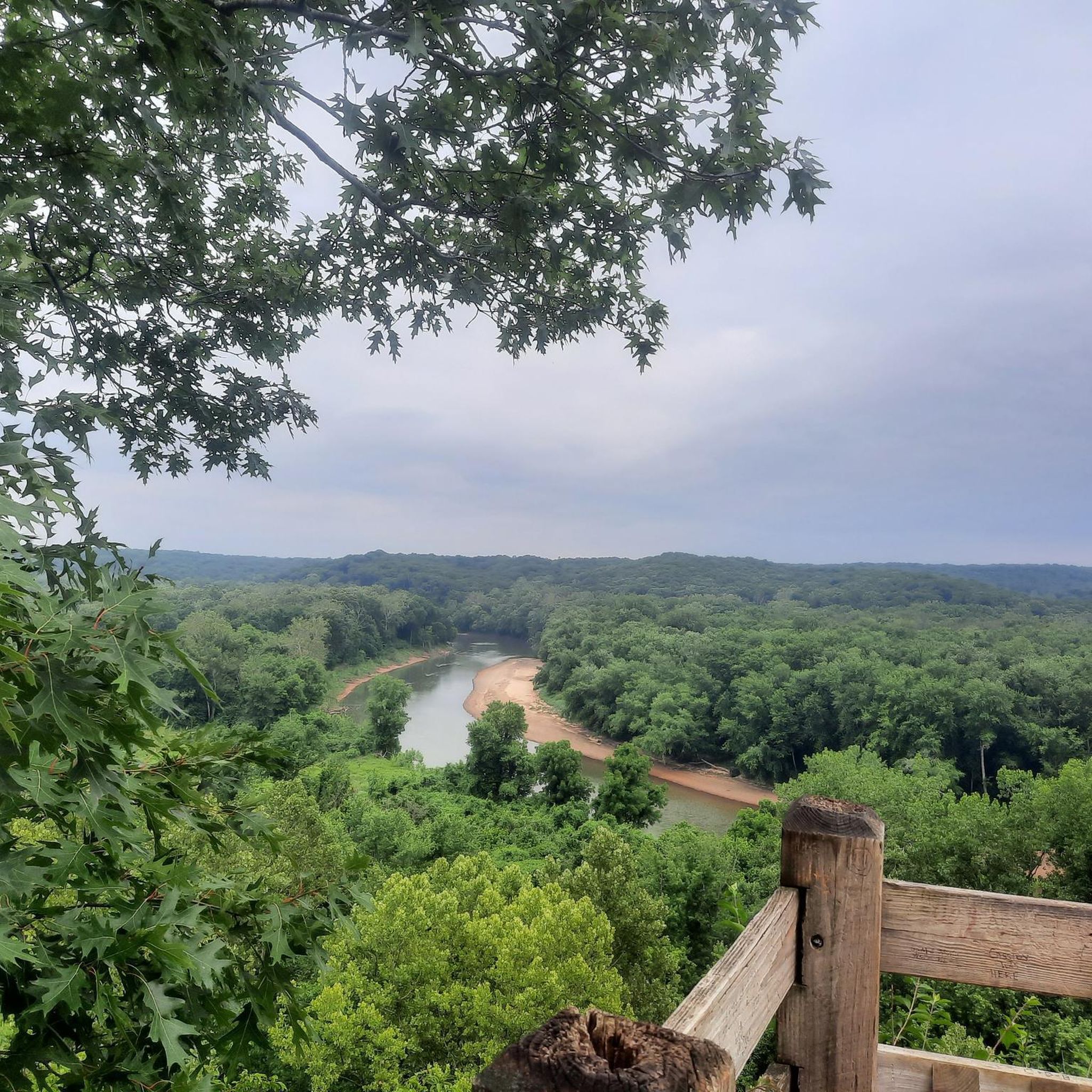
Many routes offer scenic views, especially along the Missouri River. You can find viewpoints like the Missouri River Overlook and the View of the Missouri River from Katy Trail State Park. The Katy Trail itself is a prominent feature, offering a chance to experience the region's natural beauty.
Are there circular touring cycling routes available?
Yes, many routes in Clarkson Valley are designed as loops. For example, the Monarch-Chesterfield Levee and Babler Park Loop is a moderate 38.9-mile circular route that combines levee riding with parkland exploration.
What do other touring cyclists enjoy most about cycling in Clarkson Valley?
The area is highly rated by the komoot community, with an average score of 4.6 stars from over 10 reviews. Reviewers often praise the accessible terrain, the well-maintained levee trails, and the variety of routes that cater to different abilities, from easy greenways to challenging long-distance paths.
Is it possible to cycle in Clarkson Valley during winter?
While many trails remain open, winter cycling in Clarkson Valley can be affected by weather conditions. It's advisable to check local forecasts for ice or snow and ensure your bike is equipped for colder temperatures and potentially slick surfaces. Some unpaved sections might be less suitable after heavy precipitation.
Are there any routes that offer a mix of levee riding and parkland exploration?
Absolutely. The Monarch-Chesterfield Levee and Babler Park Loop is a prime example, offering a balanced experience of riding along the levee systems and exploring the natural beauty of Babler Park.
What is the best time of year for touring cycling in Clarkson Valley?
Spring and fall generally offer the most pleasant conditions for touring cycling in Clarkson Valley, with mild temperatures and vibrant scenery. Summer can be warm and humid, while winter may bring colder temperatures and potential for snow or ice on trails.
Are there any routes that follow the historic Katy Trail?
Yes, the Katy Trail – Weldon Spring Site loop from Chesterfield is a moderate 28.3-mile route that incorporates sections of the historic Katy Trail, allowing you to experience this renowned rail-trail.
Are there any easy routes that connect to the Katy Trail?
Yes, the Busch Greenway Trail – Katy Trail loop from Chesterfield Airport at Chesterfield Commons is an easy 15.3-mile route that connects the Busch Greenway with sections of the Katy Trail, providing a gentle introduction to the area's trail network.
Most popular attractions around Clarkson Valley

Get inspired with the komoot mobile app


Explore more
Browse the best Cycling routes in other regions.
