The best running trails around San Mar
5.0
(1)
48
runners
5
runs
Jogging around San Mar offers a unique experience within a microstate characterized by its mountainous terrain. The region is dominated by Mount Titano, a UNESCO World Heritage site, featuring limestone slopes, dense woods, and natural grasslands. Running routes often involve elevation changes, providing panoramic views of the surrounding countryside. Streams, valleys, and ravines further diversify the natural landscape for runners.
Best jogging routes around San Mar
- The most popular jogging route is Annapolis Rock via Appalachian Trail, a 5.0…
Last updated: October 15, 2026
19
runners
8.10km
01:05
220m
220m
Hard run. Good fitness required. Sure-footedness, sturdy shoes and alpine experience required.
10
runners
11.1km
01:26
250m
250m
Moderate run. Good fitness required. Mostly paved surfaces. Suitable for all skill levels.

5.0
(1)
7
runners
8.22km
00:55
190m
190m
Moderate run. Good fitness required. Mostly paved surfaces. Suitable for all skill levels.
7
runners
11.5km
01:37
360m
360m
Hard run. Very good fitness required. Sure-footedness, sturdy shoes and alpine experience required.
5
runners
16.5km
02:09
400m
400m
Hard run. Very good fitness required. Mostly paved surfaces. Suitable for all skill levels.
Our route recommendations are based on thousands of hikes, rides, and runs completed by other people on komoot.

Tips from the Community

At an elevation of 1,800 feet, the cliffs of Black Rock reach up roughly 1,200 feet above the valley floor. Many people looking for a day hike will hike out and back to the cliffs and viewpoints on Annapolis Rock. If you want a few more miles and like to have the trail to yourself, add on this unique overlook situated along the Appalachian Trail overlooking the Shenandoah Valley. As you make your way further north along the trail, you start to encounter a bunch of backcountry campsites where it's common to come across thru-hikers and people camping overnight along the path.
1
0

This is a beautiful yet challenging ascent/descent (depending on direction you're travelling) along the Appalachian Trail. You'll either be heading toward or away from Annapolis and Black Rock, so you'll be rewarded with scenic viewpoints and somewhere to catch your breath.
1
0
Black Rock is a scenic lookout that provides exceptional views across the Shenandoah Valley, Massanutten Mountain, and beyond. It's a tough route up here, but the views make it all worthwhile.
0
0
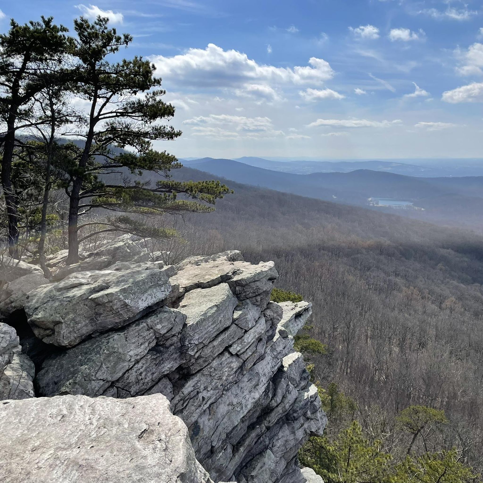
Annapolis Rock is perched atop South Mountain in Maryland. There are plenty of smaller rocks to sit down and enjoy the breathtaking west-facing views across the Cumberland Valley. The final bit of path to the lookout is very rocky, so mind your footing, but the views as you arrive make it all worthwhile. There is a water fountain in the campground neaby.
1
0
This section of the Appalachian Trail weaves up and down the landscape of the South Mountain State Park. It's a challenging trail run with plenty of inclines and declines throughout, and travels through beautiful forestry. The path can get rocky underfoot and tends to collect ice in the winter, so it would be best done in the summer months.
0
0

Located at 1,535 feet in the Washington Monument State Park, Monument Knob is a peak with great views of the surrounding landscape. The mountain is situated along the Appalachian National Scenic Trail, so make sure to visit while hiking along the popular trail.
0
0
Greenbrier State Park is nestled in the picturesque Catoctin Mountains of Maryland. It offers a pristine lake, lush forests, and scenic hiking/running trails, and a range of outdoor activities from swimming and fishing to picnicking and camping.
0
0
Black Rock is a scenic lookout that provides exceptional views across the Shenandoah Valley, Massanutten Mountain, and beyond.
0
0
Frequently Asked Questions
What kind of terrain can I expect on running routes in San Mar?
Jogging routes in San Mar are characterized by mountainous terrain, with many paths winding through dense woods, natural grasslands, and limestone slopes. You can expect varied elevation changes, from challenging uphill climbs to more moderate sections, often rewarding your effort with panoramic views of the surrounding countryside, including the Romagna Riviera and, on clear days, the Adriatic Sea.
Are there any challenging running trails for experienced runners in San Mar?
Yes, San Mar offers several challenging routes. For instance, the Annapolis Rock via Appalachian Trail is a difficult 8.1 km (5.0 miles) route with significant elevation gain. Another demanding option is the Appalachian Trail: Greenbrier to Washington Monument, which spans 11.5 km (7.1 miles) and features substantial climbs. For an even longer challenge, consider the Appalachian Trail – Washington Monument loop from Washington Monument, a difficult 27.9 km (17.3 miles) route with over 900 meters of elevation gain.
Are there any moderate running options for those looking for a less strenuous experience?
Absolutely. While San Mar is known for its mountainous terrain, there are moderate options available. The Appalachian Trail to Annapolis Rock and Black Rock is a moderate 11.1 km (6.9 miles) path offering a good workout with moderate climbs and scenic viewpoints. Another great choice is the Big Red Trail, a moderate 8.2 km (5.1 miles) route through natural landscapes.
What kind of scenic views or landmarks can I expect to see while running in San Mar?
Running in San Mar offers a blend of natural beauty and historical sights. Many routes provide panoramic views of the surrounding countryside from Mount Titano. You might encounter viewpoints like the View from Annapolis Rock or the View from Black Rock Cliff. Some trails also lead past historical landmarks, such as the Three Towers or the medieval beauty of the capital, San Marino City. You could also pass by natural features like Greenbrier Lake or the Washington Monument State Park.
Are there any loop running trails in San Mar?
Yes, San Mar features several loop trails. The Appalachian Trail – Washington Monument loop from Washington Monument is a significant difficult loop covering 27.9 km (17.3 miles). The historic 'Sentiero della Rupe' (Cliff Trail) also forms a loop around Mount Titano, offering incredible views and glimpses of the landscape, though some parts can be steep. For a truly comprehensive experience, the 'Cammino del Titano' is a 43 km loop that circumnavigates the entire country.
What do other runners say about the trails in San Mar?
The running routes in San Mar are highly regarded by the komoot community, with an average score of 5.0 stars. Runners often praise the varied terrain, the challenging climbs, and the rewarding panoramic views from Mount Titano. The blend of natural landscapes and historical elements also makes for a unique and enjoyable running experience.
What is the typical length of running routes in San Mar?
The running routes in San Mar vary significantly in length to suit different preferences and fitness levels. You can find shorter loops like 'Il parco di Monte Cerreto' at 1.5 km, or the 'Sentiero della Rupe' at around 3.95 km. Moderate routes like the Big Red Trail are about 8.2 km (5.1 miles), while longer, more challenging options such as the Appalachian Trail – Washington Monument loop from Washington Monument can extend to nearly 28 km (17.3 miles). The 'Cammino del Titano' is an extensive 43 km loop for those seeking a multi-day adventure.
Are there any specific trails that follow old railway lines?
Yes, for a unique running experience, you can explore trails that incorporate parts of old railway lines. The 'Cammino del Titano' includes sections along old railway lines as it traverses the country. Additionally, the 'Ausa - Laiala - Railway Path' is a 7.3 km trail specifically designed to follow parts of an old railway line, offering a relatively flat and distinct running environment.
What are the best times of year for jogging in San Mar?
San Mar offers good jogging conditions for much of the year. Spring and autumn generally provide pleasant temperatures and beautiful scenery, with lush greenery in spring and vibrant colors in autumn. Summer can be warm, especially at midday, so early morning or late afternoon runs are recommended. While winter can bring colder temperatures, the trails remain accessible, though some higher or more exposed sections might require extra caution due to potential ice or snow.
Are there any organized running events in San Mar?
Yes, San Marino hosts the annual Tour of Mount Titano, a popular 7-kilometer footrace. This event circles Mount Titano, starting and finishing at an iconic city gate and winding through the old town and roads at the base of the rock. It has a history spanning over forty years and also includes a non-competitive walk, making it a great community event for runners and walkers alike.
Can I find trails that lead to historical ruins or castles?
Yes, San Mar's rich history is integrated into its outdoor trails. The 'Castellaccio trail' leads to Mount Seghizzo and the ruins of Fiorentino castle, offering a chance to combine your run with historical exploration. Many routes also pass by or offer views of the iconic Three Towers and the medieval architecture of San Marino's historic center.
Most popular routes around San Mar
Most popular attractions around San Mar

Get inspired with the komoot mobile app


Explore more
Browse the best Running Trails & Routes in other regions.
