The best road cycling routes around San Mar
27
riders
3
rides
Road cycling routes around San Mar are defined by varied terrain, including challenging climbs and descents. The region features continuous "ups and downs" with well-maintained roads. Cyclists can expect to traverse landscapes with vineyards and olive groves, offering diverse scenery. The area provides a range of itineraries for different fitness levels.
Best road cycling routes around San Mar
- The most popular road cycling route is Catoctin Mountain Park loop from Myersville, a 44.0 miles (70.9 km) trail that takes…
Last updated: October 16, 2026
3
riders
36.5km
01:42
320m
320m
Moderate road ride. Good fitness required. Mostly well-paved surfaces and easy to ride.
4
riders
59.8km
04:20
780m
780m
Moderate road ride. Good fitness required. Some segments of this route may be unpaved and difficult to ride.

3
riders
79.8km
04:03
1,230m
1,230m
Hard road ride. Very good fitness required. Mostly well-paved surfaces and easy to ride.
4
riders
114km
05:43
1,220m
1,220m
Hard road ride. Very good fitness required. Some segments of this route may be unpaved and difficult to ride.
3
riders
90.2km
05:43
1,850m
1,850m
Hard road ride. Very good fitness required. Some segments of this route may be unpaved and difficult to ride.
Our route recommendations are based on thousands of hikes, rides, and runs completed by other people on komoot.
Tips from the Community

This portion of the route is gravel. I had no trouble on a wet day with tires.
0
0

The Antietam Aqueduct was built in 1834 to carry canal boats over Antietam Creek. It is over 140 feet long and is one of many such aqueducts along the C&O Canal.
0
0

The Antietam Aqueduct, located at mile 69.4 of the C&O Canal Towpath, is a three-arch stone aqueduct that once carried the canal over Antietam Creek. Built in 1834, it is constructed from limestone quarried nearby and remains one of the best-preserved aqueducts along the canal. During the Civil War, it was near the site of Confederate troop movements before and after the Battle of Antietam in 1862. Though it suffered some damage over the years, it has been fully restored and now serves as a scenic and historic stop along the towpath, offering great river views and picnic spots.
0
0
Shepherdstown, West Virginia, is the oldest town in the state (founded in 1762) and has a fun, vibrant college-town atmosphere. Located along the Potomac River at mile 72 of the C&O Canal Towpath, it is home to Shepherd University, giving it a lively college-town vibe with great cafés, restaurants, and shops. Rich in Civil War history, it played a role in the aftermath of the Battle of Antietam, as wounded soldiers were treated here. With its historic district, riverside views, and plenty of accommodations, Shepherdstown is a perfect overnight stop for cyclists C&O Canal Towpath or to just visit when exploring the area.
0
0

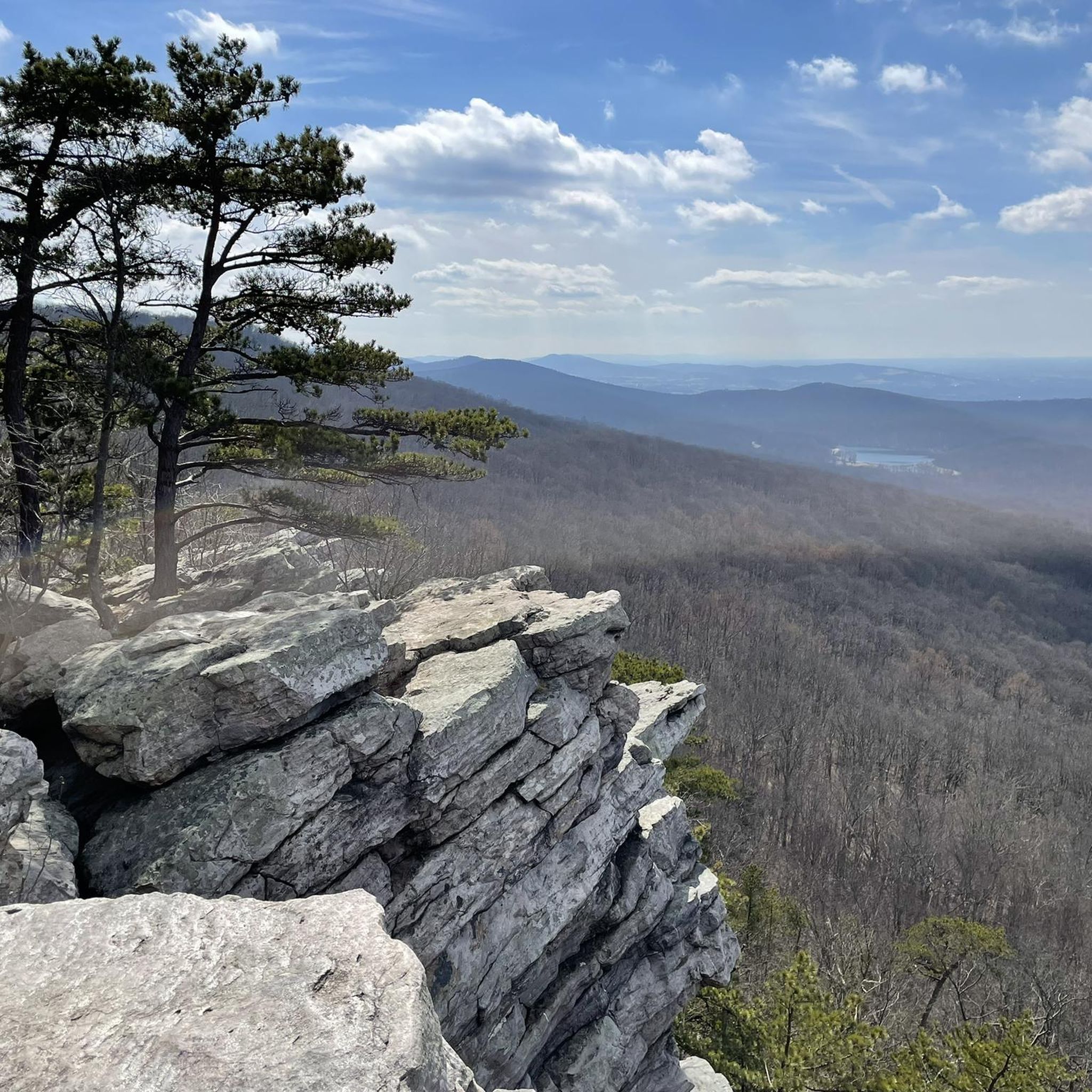
High Rock is a park and overlook about an hour and a half outside of Baltimore and just off of the Appalachian Trail. There is a large graffitied rock (and surrounding rocks) with a great vantage point on the surrounding foothills. If you have the time, fill up a bag of trash because this local spot could use some love.
0
0

Catoctin Creek is a 28-mile tributary of the Potomac River. The creek is named after the nearby Catoctin Mountains and features eleven stone aqueducts that span the creek before it empties into the Potomac near Brunswick
0
0
Catoctin Mountain Park is a 5,120-acre national park that is also home to the Presidential retreat, Camp David. The park, with its scenic vistas of the Blue Ridge Mountains, offers 25 miles of hiking trails, fishing streams, camping, and horseback riding.
0
0

Beautiful park and nature center known for its abundant wildlife, network of family-friendly walking trails, verdant nature and educational facilities.
1
0
Frequently Asked Questions
When is the best time of year for road cycling in San Mar?
The spring and fall months are ideal for road cycling in San Mar. During these seasons, you'll experience mild temperatures and fewer crowds, making for a more enjoyable ride through the region's diverse landscapes.
What kind of terrain can I expect on road cycling routes in San Mar?
San Mar is characterized by its hilly terrain and winding roads, offering continuous 'ups and downs' that provide varied and fun itineraries. You'll traverse picturesque landscapes featuring vineyards, olive groves, and forests, with some routes offering views of the Marecchia River and the Adriatic Sea in the distance.
Are there road cycling routes suitable for beginners in San Mar?
While San Mar is known for its challenging climbs, there are also routes suitable for those with good fitness levels. For a more accessible ride with less elevation, consider the Roadbike loop from East Hagerstown Park & Ride, which is a moderate 22.6 miles (36.5 km) path.
What are some challenging road cycling routes for experienced cyclists in San Mar?
Experienced cyclists looking for a challenge will find several difficult routes. The Catoctin Mountain Park loop from Myersville is a difficult 44.0 miles (70.9 km) trail with significant elevation gain. Another demanding option is the Catoctin Mountain Park – High Rock loop from Myersville, spanning 90.2 miles (145.2 km) with substantial climbing.
Are the road cycling routes in San Mar circular?
Yes, many of the road cycling routes in San Mar are designed as loops, allowing you to start and finish at the same point. Examples include the Catoctin Mountain Park loop from Myersville and the Catoctin Creek loop from Myersville.
What scenic viewpoints or attractions can I expect along the road cycling routes?
Road cycling routes in San Mar offer stunning panoramic views, especially around Mount Titano, which provides breathtaking vistas of the surrounding countryside and the Adriatic Sea. You can also find highlights like the View from Annapolis Rock and the View from Black Rock Cliff. Historical sites such as the Three Towers (Guaita, Cesta, Montale) and the Palazzo Pubblico are also prominent features of the region.
What is the typical length and duration of road cycling routes in San Mar?
The routes vary significantly in length and duration to suit different preferences. You can find shorter rides like the Roadbike loop from East Hagerstown Park & Ride, which is 22.6 miles (36.5 km) and takes about 2 hours, up to longer, more challenging routes such as the Shepherdstown – Antietam Aqueduct loop from Myersville, which covers 71.0 miles (114.2 km) and can take over 5 hours.
Are there family-friendly road cycling routes in San Mar?
While San Mar's terrain is generally hilly, making many routes more suitable for experienced cyclists, some moderate options might be manageable for families with older children who are comfortable with varied terrain. However, routes specifically designed as 'family-friendly' with minimal elevation are less common for road cycling in this region.
Where can I find parking for road cycling routes in San Mar?
Many routes start from convenient locations that may offer parking. For example, routes like the Catoctin Mountain Park loop and Catoctin Creek loop begin from Myersville, and the Roadbike loop from East Hagerstown Park & Ride indicates a starting point with parking facilities.
What do other road cyclists enjoy most about road cycling in San Mar?
The area is highly rated by the komoot community, with an average score of 5.0 stars. Reviewers often praise the varied terrain, the continuous 'ups and downs,' and the well-maintained roads that cater to different fitness levels. The scenic beauty, including vineyards, olive groves, and panoramic views, is also frequently highlighted.
Can I access road cycling routes in San Mar using public transport?
San Marino City serves as a popular starting point for many routes, and while specific public transport options for carrying bikes directly to trailheads are not detailed, the city itself is generally accessible. It's advisable to check local public transport regulations regarding bicycle carriage if you plan to use it to reach your starting point.
Are road cycling routes in San Mar dog-friendly?
Road cycling routes, especially those on public roads with traffic, are generally not considered suitable or safe for cycling with dogs. For activities with dogs, you might consider exploring hiking or walking trails in more natural, traffic-free environments within the region.
Most popular routes around San Mar
Most popular attractions around San Mar

Get inspired with the komoot mobile app


Explore more
Browse the best Road cycling routes in other regions.
