The best cycling routes around Sierra Madre
4.6
(49)
891
riders
64
rides
Touring cycling routes around Sierra Madre traverse a diverse landscape characterized by extensive mountain ranges, lush forests, and numerous hills. The region offers significant elevation changes, providing both challenging climbs and exhilarating descents for cyclists. Routes often follow winding roads through valleys and ascend to higher elevations, with some trails tracing rivers and passing by natural water features. The terrain includes a mix of paved and unpaved surfaces, catering to various cycling preferences.
Best touring cycling routes around Sierra Madre
…Last updated: October 16, 2026
44
riders
73.9km
05:17
1,500m
1,500m
Hard bike ride. Very good fitness required. Mostly paved surfaces. Suitable for all skill levels.
4.8
(6)
50
riders
39.0km
02:22
200m
200m
Moderate bike ride. Good fitness required. Mostly paved surfaces. Suitable for all skill levels.

5.0
(1)
36
riders
37.6km
02:30
510m
510m
Hard bike ride. Very good fitness required. Mostly paved surfaces. Suitable for all skill levels.
5.0
(1)
30
riders
Moderate bike ride. Good fitness required. Mostly paved surfaces. Suitable for all skill levels.
21
riders
44.7km
02:55
570m
570m
Hard bike ride. Very good fitness required. Mostly paved surfaces. Suitable for all skill levels.
Get access to more routes and recommendations from other explorers.
Already have an account?
Our route recommendations are based on thousands of hikes, rides, and runs completed by other people on komoot.
Start today with a free account
Your next adventure awaits.

Tips from the Community

Nice bike path. not much roads to cross. some are hilly but doable for newbies. It's our first time and we had a good time. just some areas are with a lot of homeless people, esp. the tunnels.
0
0

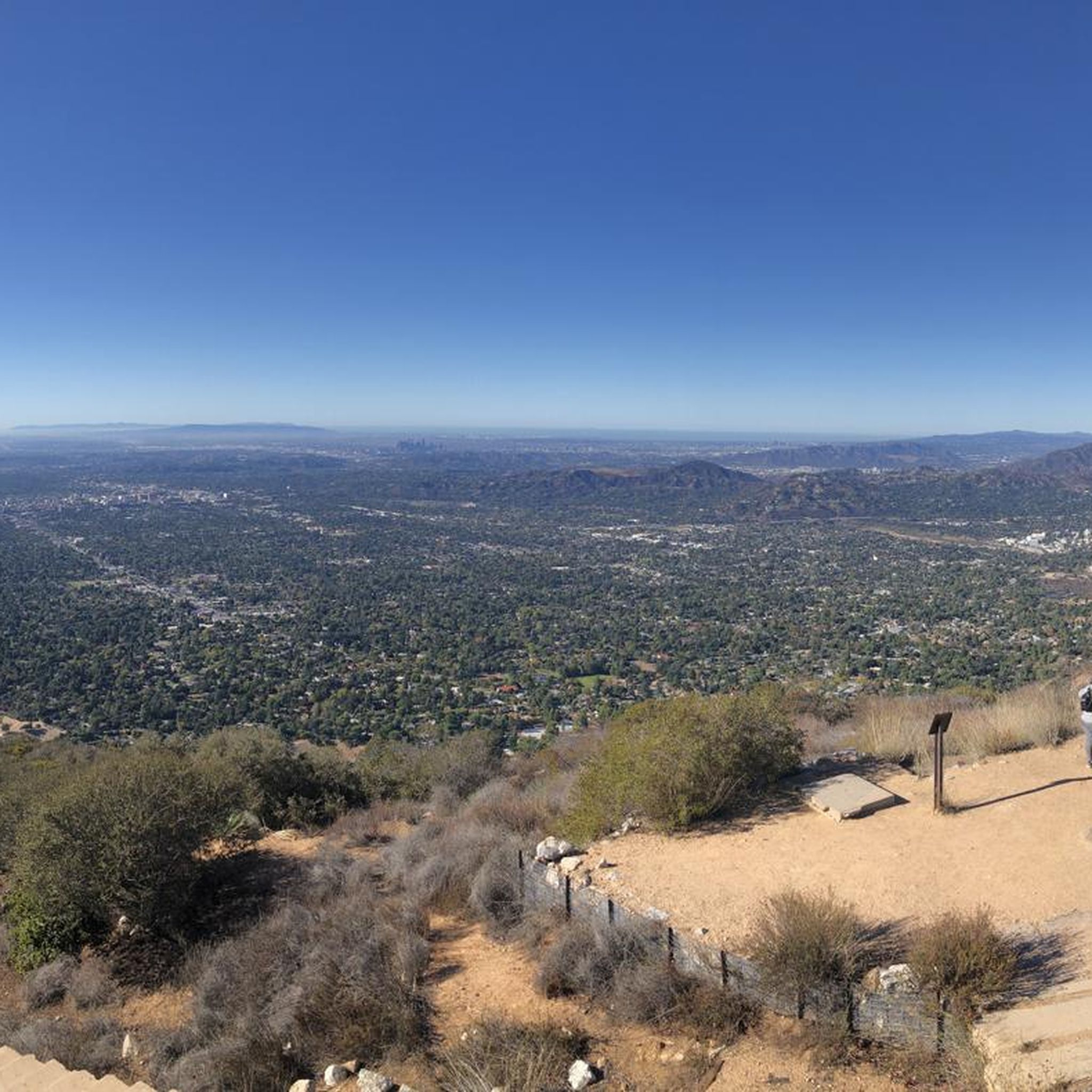
Great view from the cycle path of the San Gabriel Mountains in the distance.
0
0

One of the best dedicated bike trails in the LA area, leading from the San Gabriel mountains north of Azuza along a car free paved river route all the way to Seal beach
2
0
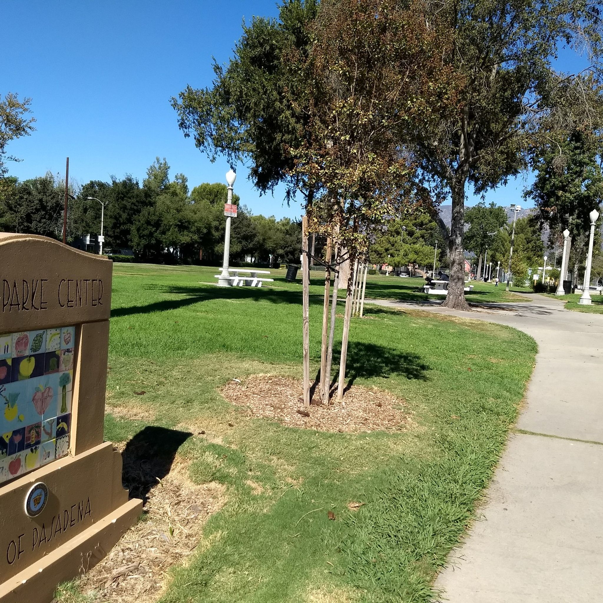
Leafy park with lawns and shaded seating, restrooms, drinking water fountains, and a bike repair station. Great for a break or as trailhead to ride west along the dedicated Duarte Bike Trail, a multi-purpose trail that was founded in 1977. It stretches 1.6 miles from Royal Oaks Park at Vineyard Avenue to Buena Vista Avenue. Next to the paved cycling path runs a dirt jogging and equestrian trail shaded by oak trees. The gently sloped trail follows the historic Pacific Electric Railway route, passing an arched bridge that once carried Red Trolley Cars to Los Angeles.
1
0

The Club House is a vibrant bike shop offering bike sales and service, apparel, gear, and cacti. What began with a red VW bus and online sales in 2017 transitioned to an old service station turned plant store. A small, fun-loving team runs the shop, sharing their love of cycling. Stop by for events like the annual Bike & Car Show, a lazy Sunday ride, the Wednesday night Basket Ride, or just to grab coffee at their mobile espresso bar.
1
0
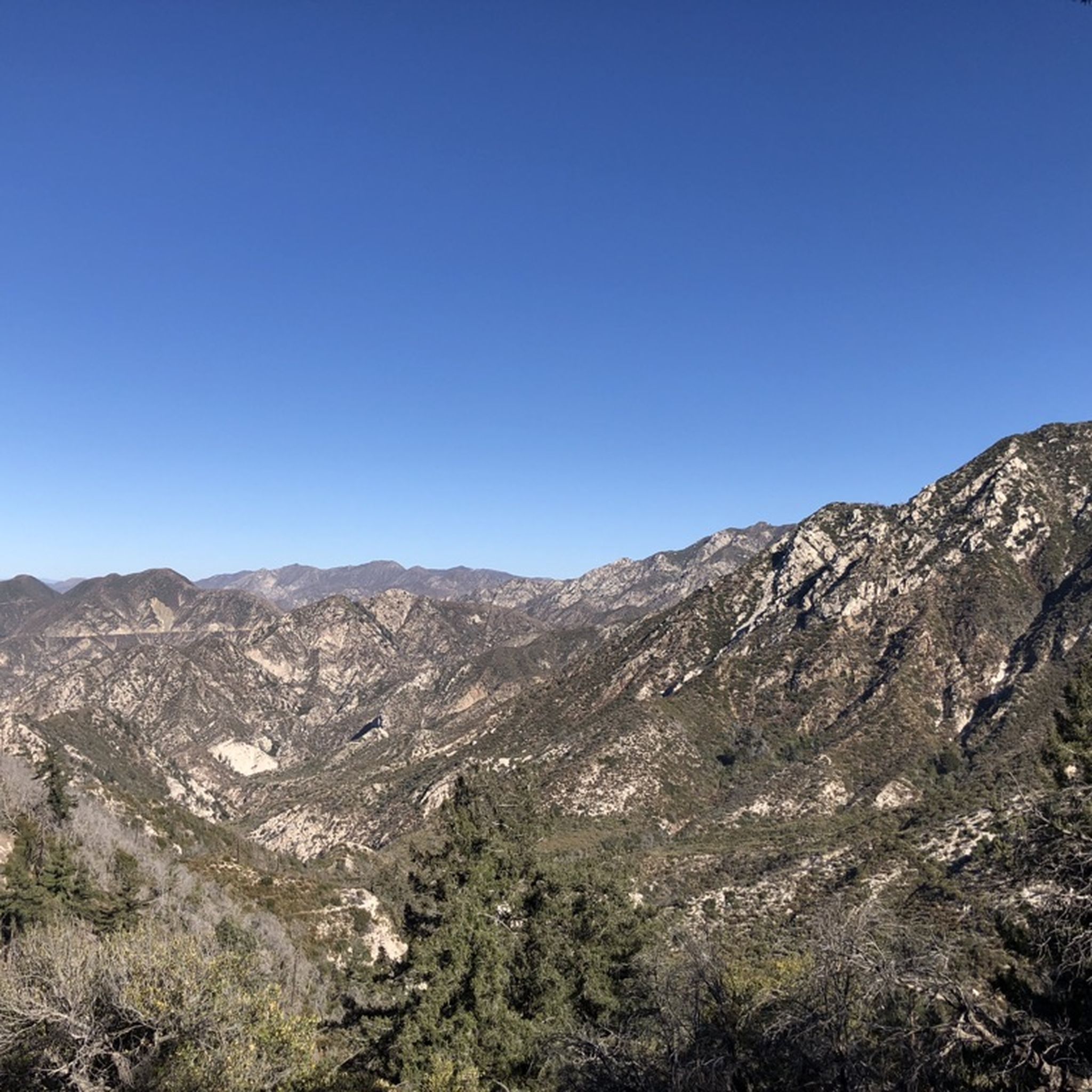
Red Box Gap, located below Lawlor Peak, offers great views and an ideal spot for a break. A 3.5-mile trail from here leads to Strawberry Peak, which comes into view before reaching the saddle. Popular with hikers and bikers, Red Box has a trailhead parking area, the Haramokngna American Indian Cultural Center, and a natural stone viewpoint. The center typically opened on weekends and holidays from 10 a.m. to 6 p.m.
0
0
Brookside Park has several miles of bike trails that cut through the wood land. There are also benches and a playground.
1
0
Brookside Park is Pasadena's largest fully maintained park at 61.1 acres. It sits south of Rose Bowl Stadium with tons of parking off Arroyo Boulevard. The park features a lighted baseball diamond, two softball diamonds, and a large, lighted, multi-purpose field for soccer and flag football. There is also a speaker's platform with permanent seating, numerous picnic tables, barbecue pits, a play area, restrooms, and drinking fountains.
0
0
Frequently Asked Questions
How many touring cycling routes are available in Sierra Madre?
There are over 75 touring cycling routes available in Sierra Madre, offering a wide range of options for different skill levels and preferences.
What kind of terrain can I expect when touring cycling in Sierra Madre?
Sierra Madre offers a diverse landscape characterized by extensive mountain ranges, lush forests, and numerous hills. Cyclists can expect significant elevation changes, providing both challenging climbs and exhilarating descents. Routes often follow winding roads through valleys and ascend to higher elevations, with some trails tracing rivers and passing by natural water features. The terrain includes a mix of paved and unpaved surfaces, such as dirt paths and cobble, catering to various cycling preferences.
What do other cyclists say about touring cycling in Sierra Madre?
The touring cycling routes in Sierra Madre are highly rated by the komoot community, with an average score of 4.7 stars from more than 40 reviews. Over 800 touring cyclists have used komoot to explore the region, often praising the varied terrain and scenic beauty.
Are there touring cycling routes suitable for beginners or families in Sierra Madre?
Yes, Sierra Madre offers routes suitable for various ability levels. For a more gentle experience, consider the Duarte Bike Trail – Duarte Recreational Trail loop from Monrovia, which is a moderate 15.9-mile (25.6 km) path with moderate elevation changes. There are 28 easy and 29 moderate routes in total, providing plenty of options for less experienced riders or families.
Are there challenging touring cycling routes for experienced riders?
Absolutely. The region is known for its significant elevation gains and descents. An excellent option for experienced riders is the Mount Wilson Summit Viewpoint – Mount Lowe Summit loop from Allen, a difficult 29.4-mile (47.4 km) trail featuring substantial elevation gain through mountainous terrain. There are 20 difficult routes available for those seeking a greater challenge.
Can I find circular touring cycling routes in Sierra Madre?
Yes, many touring cycling routes in Sierra Madre are designed as loops, allowing you to start and end at the same point. Examples include the Arroyo Seco Bike Trail – Red Car Bridge loop from Allen and the Brookside Park – Arroyo Seco Bike Trail loop from Arcadia. These circular routes provide convenient options for exploring the area.
Are there any waterfalls I can visit along touring cycling routes in Sierra Madre?
Yes, the Sierra Madre region features several beautiful waterfalls that can be incorporated into your cycling adventures. Notable waterfalls include Eaton Canyon Waterfall, Monrovia Canyon Falls, and Sturtevant Falls. Some routes may pass near these natural attractions, offering a refreshing stop.
What are some notable viewpoints or natural landmarks accessible by touring bike?
The Sierra Madre offers numerous panoramic viewpoints and natural landmarks. You can cycle towards Inspiration Point for stunning vistas, or explore routes that lead to summits like San Gabriel Peak, Mount Disappointment, and Clamshell Peak. The Pililla Wind Farm area also offers panoramic mountain views.
Are there historical sites or unique attractions to see while cycling?
Yes, beyond natural beauty, you can discover historical sites. The Mount Lowe Railway Ruins offer a glimpse into the region's past. Additionally, some cycling tours can incorporate visits to charming traditional mountain towns and local ranches, providing a cultural dimension to your outdoor adventure.
Is public transport available to access touring cycling routes in Sierra Madre?
Access to specific trailheads via public transport can vary. While some areas might have limited bus services, it's generally recommended to check local public transport schedules and routes in advance, especially for more remote starting points. Many cyclists opt for personal vehicles to reach their desired starting locations.
Are there specific permits required for touring cycling on trails in Sierra Madre?
Generally, permits are not required for touring cycling on most public trails in the Sierra Madre. However, it's always advisable to check with local park authorities or land management agencies for any specific regulations or permit requirements, especially if you plan to cycle through protected areas or private lands.
What is the best time of year for touring cycling in Sierra Madre?
The Sierra Madre region can be enjoyed for touring cycling during various seasons, but spring and fall often offer the most pleasant weather with milder temperatures. Summers can be hot, especially at lower elevations, while winters may bring cooler temperatures and occasional rain or snow at higher altitudes. Always check the local weather forecast before heading out.
Are there dog-friendly touring cycling routes in Sierra Madre?
While many outdoor areas in Sierra Madre are dog-friendly, specific regulations for cycling routes can vary. It's best to check the rules for individual trails or parks regarding dogs, especially concerning leash requirements and waste disposal. Always ensure your dog is well-behaved and can handle the terrain and distance of your chosen route.
Most popular attractions around Sierra Madre

Get inspired with the komoot mobile app


Explore more
Browse the best Cycling routes in other regions.
